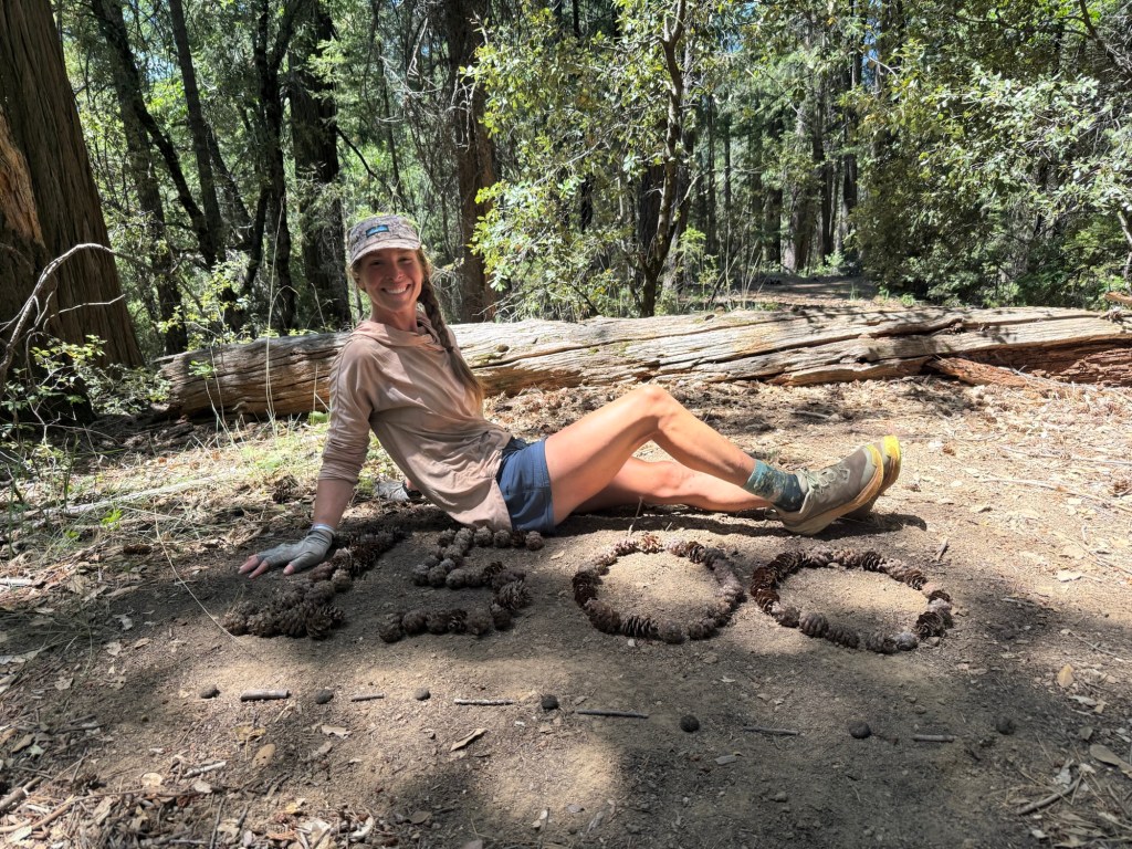
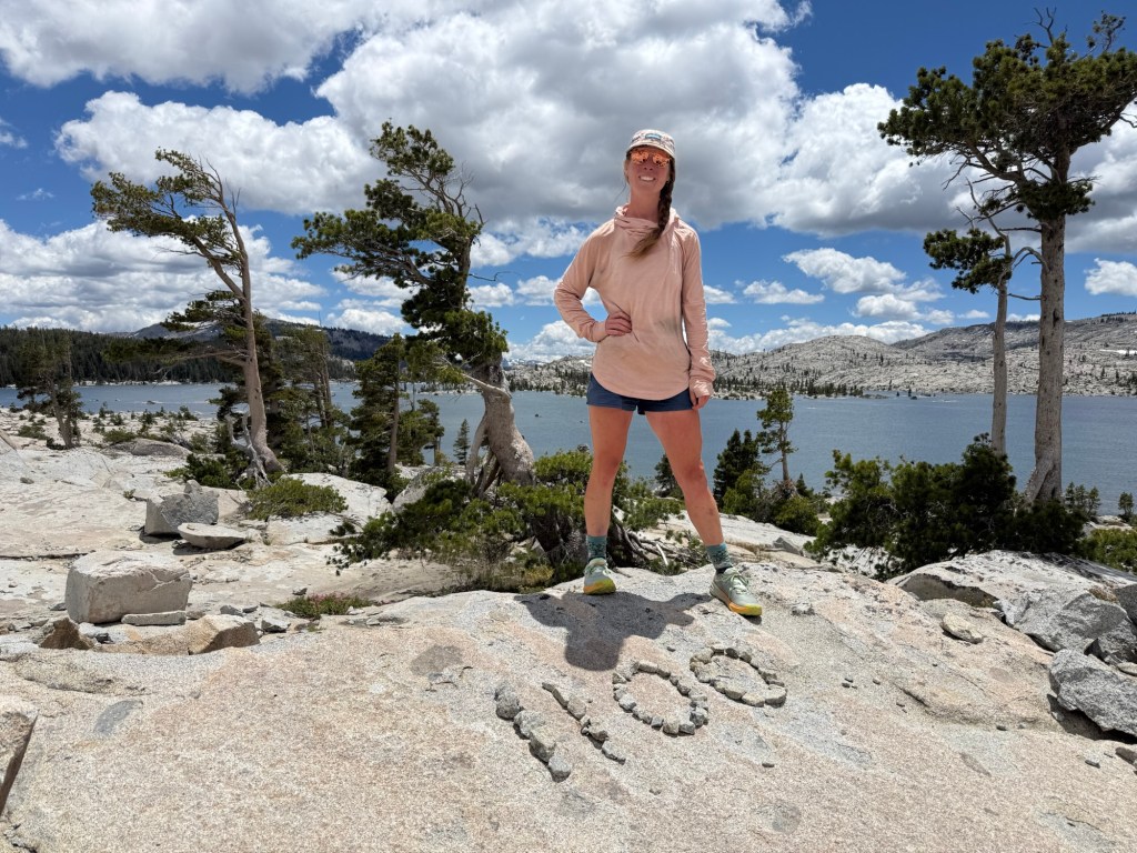
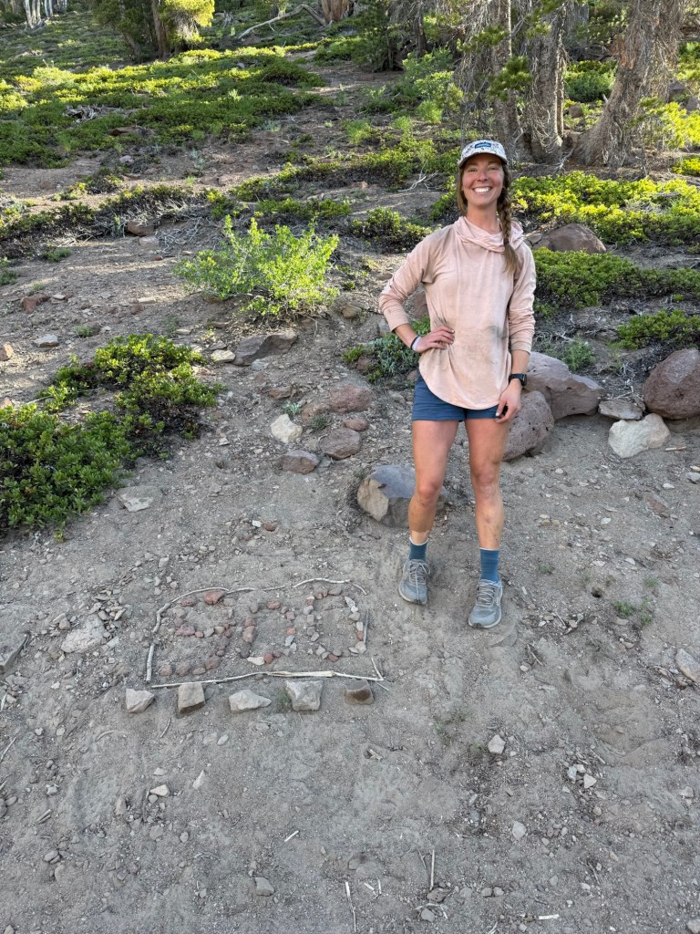
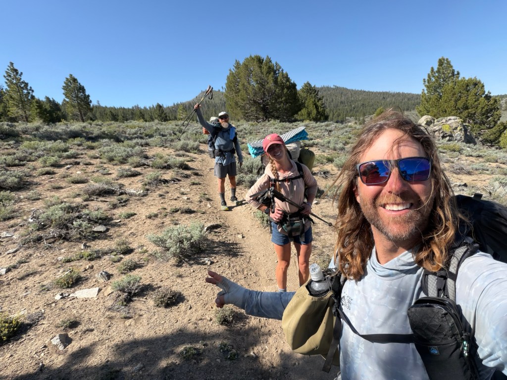
Woke up to three months on the PCT! I can’t believe I’ve been out here this long, but at the same time it feels like forever. When planning I always hoped I’d make it this far, but never really certain. Now I’m confident I’ll go the distance.
It wasn’t the greatest nights sleep at the KOA, a train came through hourly blasting its horn that earplugs just couldn’t stand a chance against. Nancy picked us up at 9am and even treated us to coffee and homemade cookies. She’s one of those rare kind people who really makes an impact. She said if we ever do the Arizona Trail she’ll be happy to be our own personal trail angel! I can’t guarantee I’ll ever want to do another long trail after this, but who knows. Probably two years from now I’ll be ready to go!
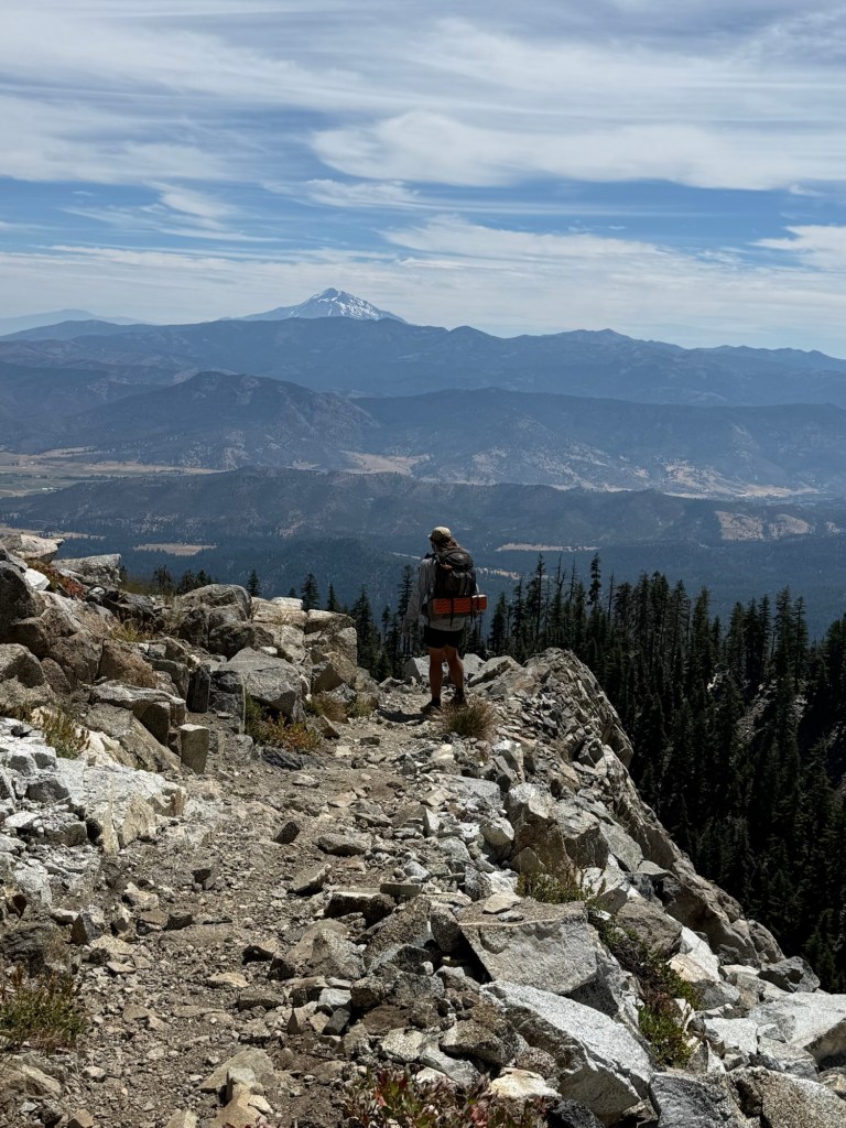
At 10am we were off, knowing it’d be a big climbing day it wasn’t great having a late start, but it was what it was. Already hot, I was just praying the climbs would at least be shaded. Well, they weren’t. It was sunny and bright, great for spotting the abundant bear scat. I have never seen so much on trail in all 3 months. Must be all the manzanita and blackberry bushes. Though plenty of evidence of their existence, none were spotted.
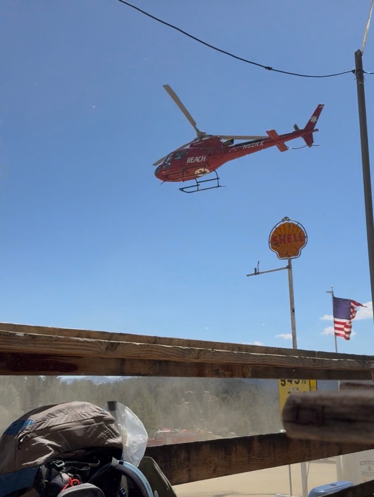
Most of the climbing was with big views of Castle Crags, which made it at least scenic. Another big distraction was watching a helicopter land far off in the distance, right by where we knew the trail passed. We hoped it’d still be there by the time we did so we could check it out. The whole walk to it we theorized that it was definitely parked there to deliver trail magic. Why else would a helicopter land right on trail?? After the 4.5 mile walk to it, we realized it was actually a few hundred yards off trail separated by a large ravine. Darn, looks like the mystery won’t be solved… just yet.
The last few miles to camp were interrupted by a plane flying in circles over head. What was with these aircrafts today?? Round and round it went, with no real noticeable purpose. I figured it was a training exercise, maybe for the military or for SAR. Either way we were heading right for it.
When we got to camp Batona was not far behind. “Did you hear what’s going on??”, he asked. How could we have? We haven’t had service all day! But I love trail gossip so I was a very active listener, especially with such a juicy opening line. “There’s an active armed hostage situation at Gumboot Lake, that’s why all the planes and helicopters are flying around”. Well, I certainly wasn’t expecting that. Gumboot was only 4 trail miles away. Certainly not close to be overly concerned, but definitely close enough to be concerned about how this could affect our ability to hike tomorrow. But of course, the main concern was for the safety of those being held hostage. Without any more information, it was hard to make sense why someone would choose a backcountry off the grid lake to perform such a violent act. Only time would tell.
The planes are still circling around, I’m sure sleep won’t be easy but I just pray everything ends peacefully without anyone getting hurt.
Also, when looking back at the day, I realized we did 5859’ of elevation gain! That is our biggest day yet, I’m fairly certain. While it was no means easy, I was shocked by the high number. Sure it was climbing all day, but I felt not only up for the challenge, but strong the whole time. Maybe I finally have my trail legs, only took 3 months!
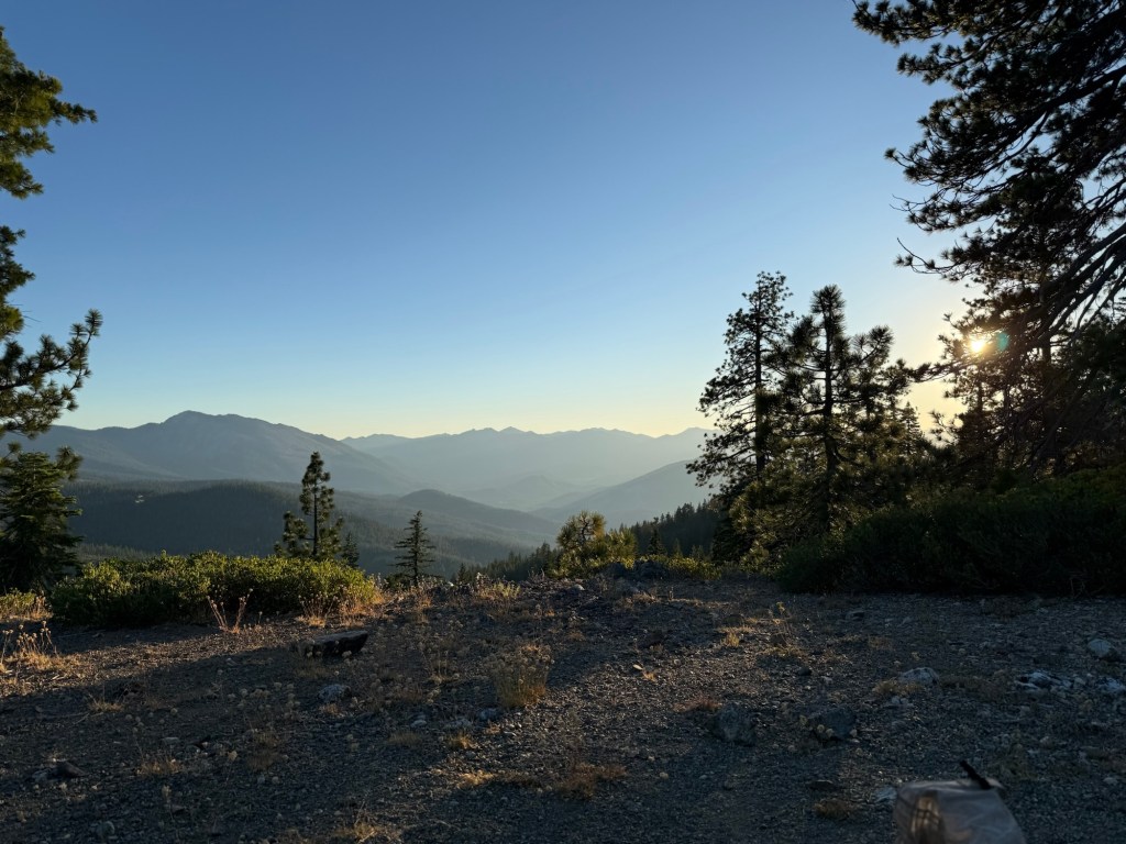
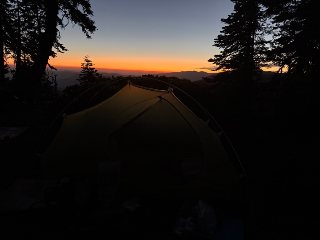
The day ended with a beautiful sunset with 360 degree views. It might be the best sunset on trail yet.
Day 93: July 17; 30.5 miles
After falling asleep to the sweet sound of planes whirring around, I was abruptly awoken at 1:45am by a sound that was not an aircraft. There was something big clomping around a little too close to comfort. And when I say clomping, I mean it. It sounded like a legit horse was milling around camp. Thinking it was just a large deer and not a bear, I put my earplugs in and drifted off to sleep until 3am when I woke up again to silence. And not because of the earplugs. The planes were gone. The hostage situation had clearly been resolved, hopefully without any fatalities or injuries. I enjoyed the silence for a bit as I stared at the abundant stars and Milky Way. I will never get over how dazzling the night sky is out here.
I woke up in a panic at 5:30am, fully aware that I slept through my alarm. It’s amazing how that panic can motivate quick disassembly of camp. I was still ready to get a start to the day by 6:30am.
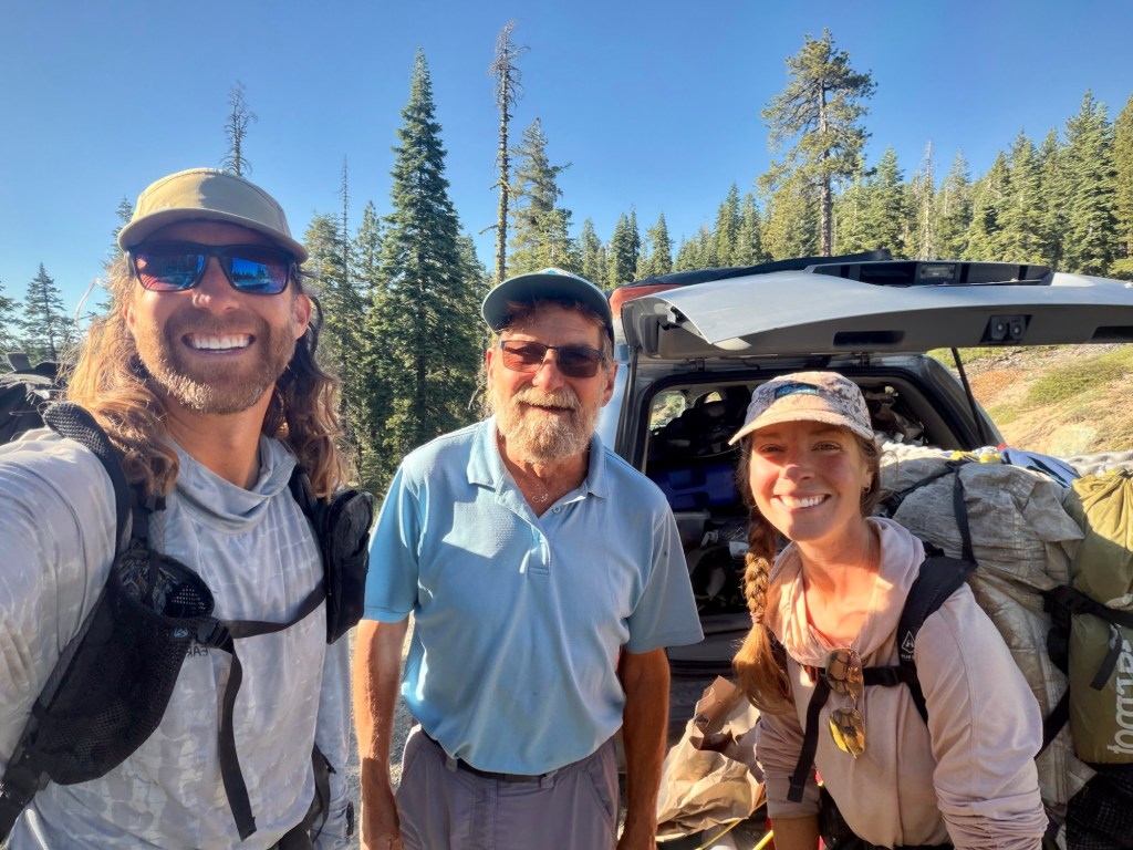
We only saw one helicopter hovering over Gumboot briefly, likely a news helicopter. We weren’t sure what to expect when we got there, we just hoped to not come across a crime scene. The 4 miles went quickly and when we got to Gumboot, you wouldn’t know anything happened! It was open and no vehicles outside of those of day hikers were to be found. We did find, however, Grizzly Gramps there with his trusty dog Nevada. We first met Gramps at Horseshoe Meadows campground back in the beginning of the Sierra. He’s a trail angel who follows the “bubble” providing trail magic and rides to needy hikers.
Grizzly Gramps
He had all the scoop on the hostage situation, mainly because he had a first row seat. Apparently two NFS employees were held hostage by two captures. Because they are federal employees, they sent the FBI from Quantico to negotiate and safely end the hold up. They even jammed all cell towers to prevent any information leaking. At 2:21am they flash banged the area and got the hostages out and arrested the perpetrators. It all ended peacefully and by 2:45am the scene was cleared of all personnel, like nothing ever happened. As he was telling us this, I couldn’t help but notice there was a cooler full of water and Gatorade right next to him. He said as the FBI left they gave him all the leftover drinks they had, encouraging him to give them to needy hikers. Can’t ever say I’d ever get trail magic courtesy of the FBI, but given that the situation was handled safely and peacefully, I was happy to accept!
Obviously, the hostage situation was talk of the trail. We talked to some folks who were right by the action. They heard the planes, flash bangs, and megaphone communications. One guy even claimed that the flash bangs were so loud that baby bears started crying shortly after. I’m sure they’re not used to that type of noise in such remote wilderness.
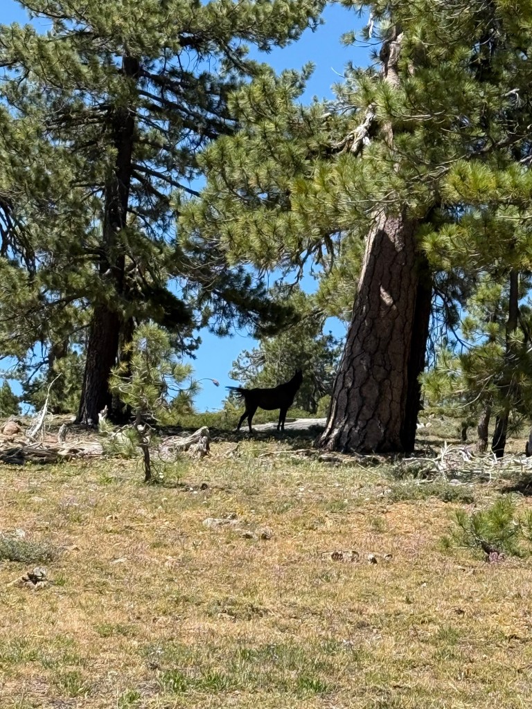
Onward we went. I couldn’t help but notice how much horse poop and tracks were on the trail. Sure, some people hike with their horses. I know we’re close to a woman doing as much of the trail as possible by horse. But this is way more than just one horse. The tracks were going in both directions too. Maybe it indeed was a horse I heard last night, I just couldn’t imagine how one would be passing by so late off trail. Another mystery!
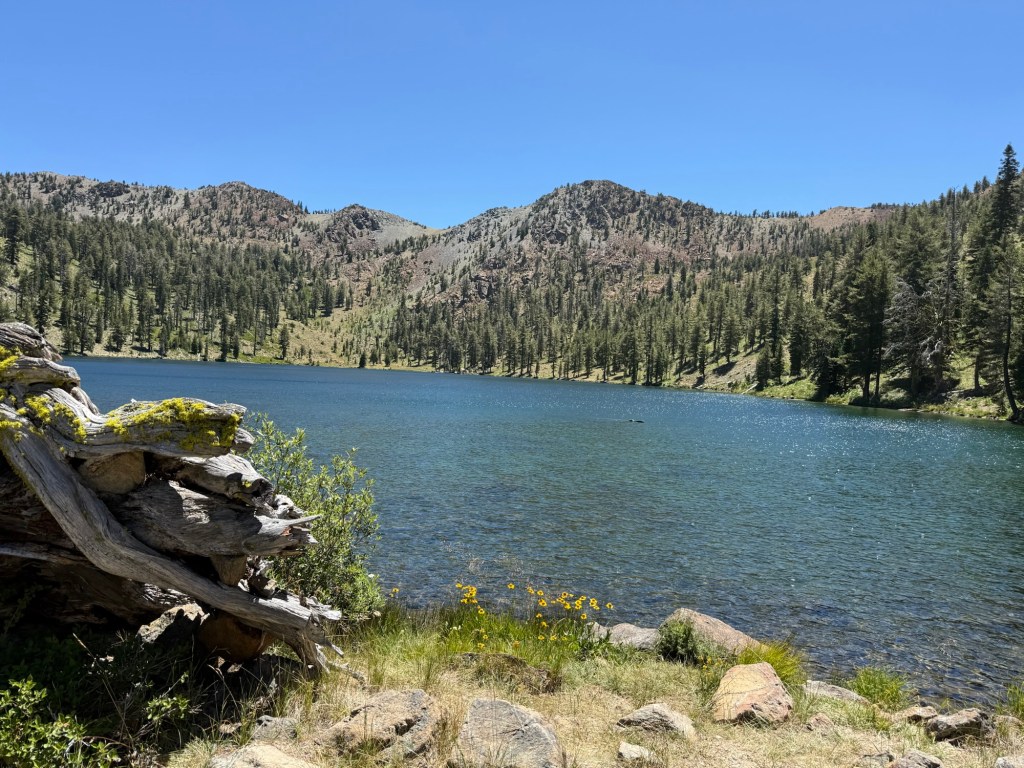
We had lunch at the halfway point, right at a gorgeous lake that was perfect for swimming. There are a lot of day hikers here, as it’s only 3 miles from a trail head. We met Rocky who has section hiked the whole trail in her youth. Easily in her 80s, she’s still out here hiking and keeping up with it. She’s an inspiration!
The last 15 miles were fine. The elevation and temperature lent itself to a good day to do 30 miles. During this second half of the hike I saw something I couldn’t believe – a wild horse!! Apparently there’s a whole bunch of them out here, so that was definitely what I “herd” last night. I never imagined I’d be woken up by a wild horse in such an inhospitable place, but I guess today is just the day for unexpected oddities.
The mystery horse
We got into camp with still a lot of daylight left. Because it’s an exposed site and fairly windy out, we debating going another mile to a more protected site. But after a long exciting day and having a great view, we decided to stay put. And we were rewarded with another gorgeous sunset.
Day 94: July 18; 29.5 miles
With another long day planned, it was up bright and early to get the miles in during optimal time. When I start this early, the first 5 miles go quickly since I’m still waking up and in a bit of a fog. It makes breaking down in the dark worth it.
Sea Gypsy
After 9 miles we ran into Sea Gypsy, a notorious trail angel who supports hikers all along the trail. He had fresh fruit and Gatorade waiting for us. We stayed a little before moving on. We entered Trinity Alps Wilderness and enjoyed our short time there. We met Mike, who has a cabin at one of the lakes in the wilderness. This is rare to have a civilian own land in a national wilderness, but he said he owned the land before it was deemed a wilderness and they let him keep it. He said it’s a pretty well known secret, but he has let hikers stay there. He stopped after two of them drank all his beer. Sounds about right.
We had 7 miles of burn zone from last year’s Peak Fire. Sure it was messy and aggravating, but it was nothing compared to the previous burn zone. If only they all could be that easy!
We got into camp exhausted, ready for dinner and sleep. Though I’m beat and my foot is still hurting, I feel strong after these long days. I definitely feel confident keeping it up in the future.
Day 95: July 19; 18.3 miles
Woke up early again, ready for a town day! Though a low mileage day, I knew it wasn’t going to be easy given the elevation profile. But it was going to get done one way or another.
It was a quiet day, but we did run into Kent, who we haven’t seen since Mammoth. It was quite shocking to see him, honestly, because we figured we were at least a hundred miles ahead of him. With conversation we learned he had a bad fall on Carson Pass, leading to a broken nose and hospital stay in Truckee. He determined then that he wasn’t going to bother with the burn zone and skipped ahead. Probably the wise choice! He said yesterday’s burn zone was horrible for him. I told him that was nothing compared to the Dixie aftermath. He was happy to have skipped. I’m sure we’ll see him in town.
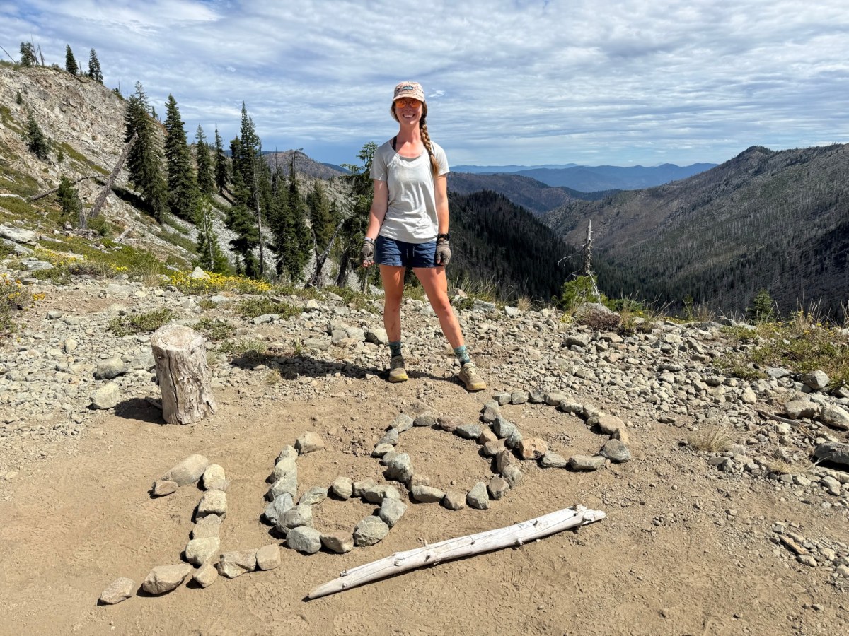
When descending to the highway, we were on the look for a 1600 mile marker. There was none to be found! We did, however, run into 5 groups of about 12 teenagers per group. They moved out of the way and were extremely polite and respectful, not entirely what I was expecting. In fact, I broke my however long record of not falling and fell like a sack of potatoes right in front of one group. There was no sneering, laughing, or mocking, which I was fully prepared to experience. I mean of all the ages for that to happen in front of, teenagers would be my biggest nightmare. But they acted like they didn’t even notice and congratulated on 1600 miles. I later learned they were part of a large church summer camp going on a week long backpack trip. I will always be thankful for their politeness.
Once we got to the highway we realized this wouldn’t be an easy hitch. There was no traffic and few cars in the parking lot. Well shoot. But timing was on our side. Dusty, a woman known for giving rides for a price, was there waiting for Gray Area, who was just a minute or two behind us. She had room for two more. So in a matter of minutes we were off. Cowgirl was also in the car. I was told in Sierra City we were basically twins, so I’ve been on the chase ever since. While I see the resemblance (she was even raised in Camden County NJ too!), I wouldn’t say we’re twins. But it was nice to meet her nonetheless.
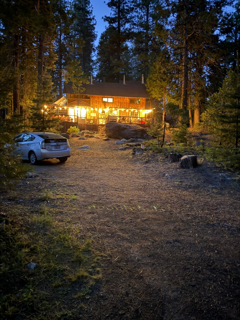
We’re staying at Kathleen and Rusty’s, a couple who own a few houses in Etna. The house we’re staying at is the one they rent out to hikers. They can fit 10 hikers in the house, so with the only options being a more expensive hotel or the city park, we lucked out with space here. They are a lovely couple and extremely accommodating to hikers.
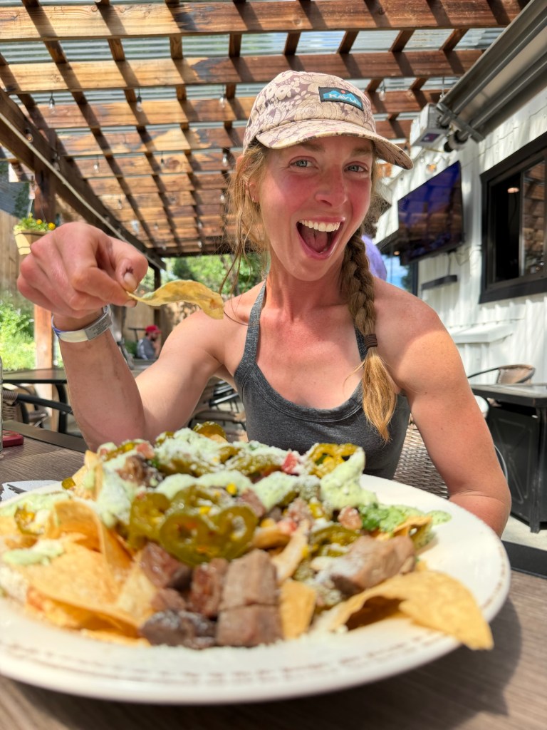
We got food at Denny Bar and the brewery and picked up more food at the store. My hunger is insatiable, especially since starting these longer mile days! It’s a full house, which is nice getting to know new faces. We met Flamingo (arguably the most infamous PCTer this year), Bigfoot, Artemis, Glissage, Kris, and Svetlania. These days I am going by Emilie. After so many people got Pippie wrong (I was called Pippin, Poppie, Hippie, and even Piggy – that’s when I drew the line and ditched the trail name) I decided my government name suits me perfectly.
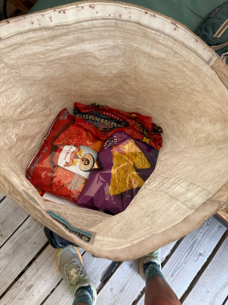
I could’ve eaten 5 plates of these nachos
With some hikers getting back to trail early in the morning, it’s a strict 9pm quiet time. You won’t hear me complain!
It was a glorious zero day. I’m glad to report it was boring and uneventful. After 10 hours of sleep the only thing left to do was resupply and eat, which I did plenty of. Burney is such a small town that you can walk for 5 minutes and see the whole thing. Aside from Jaden’s super generous offer to go to Castle Lake, there’s not much to do in town. Which was perfect for resting a very tired body. I will say it was great for people watching. We saw one woman get on her motorcycle and drive the 50 yards from her room to the motel office and back. After walking 1400 miles it’s hard to imagine a 50 yard walk being too much, but to each their own.
Day 88: July 12; 8 miles
It was another morning of sleeping in, which kind of led to a panic after finding out check out for the hotel is 10am, not the standard 11am. But we managed and after a huge breakfast we got picked up by Jaden and headed back to trail.
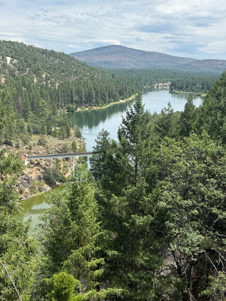
We decided that since we didn’t nero into Burney, we would nero out of Burney. And it was a perfect plan because only 8 miles up the trail was Burney Falls State Park, a perfect place to spend the afternoon.
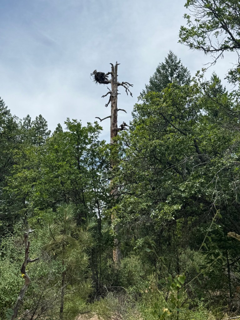
Along the way we saw a huge osprey nest and caught a glimpse of an iconic bridge. Iconic for me at least. Stand By Me is my favorite movie and if you’ve ever seen it, you know exactly the bridge I’m referring to. I got to see it from about 100’ up. There is a way to walk right up to it to see it, but on a nero day it wasn’t worth the extra detour. I’ll just have to settle for a birds eye view.
We made it to the falls around 2:30pm. I was blown away by how stunning they were. Standing at over 100’ tall there was water rushing out from everywhere. With over 100 million gallons traveling over the falls every day, you can imagine how powerful it was. We spent a decent amount of time there taking it all in before heading up to the general store for ice cream. We saw a lot of hikers there, also fully intent on indulging in some creamy goodness.
Then it was off to camp. The park has a hiker/biker area which I’m very familiar with from biking down the pacific coast. There are a number of us here, including Speedracer, Blue, and Stache. We were talking for a while when it came up that Blue is actually a viral sensation! I literally just watched one of his videos the day before. Recently retired from IT, he never thought he’d be an “influencer” in his 60s, but here he is!
It’s pretty hot here. I don’t think it’ll make for a comfortable night, but I’m still still so tired I don’t think it’ll matter much. I hope the day and a half rest is helpful to make the next few hundred miles a little easier. I ordered a new backpack that I’ll hopefully get in Etna, only 200 miles away! My current pack at that point will have well over 2000 miles on it. With the way I abuse gear I’m surprised it lasted even that long. It’s no wonder it’s uncomfortable and killing me slowly… it has zero padding left!
Day 89: July 13; 28.6 miles
I woke up late and in a tizzy but ready to go before 6:30am. It was so hot sleeping that I woke up a few times completely drenched in sweat, as if I was breaking a fever. I was too tired to pay much attention to it and went back to sleep. Ain’t no sleep like a tent sleep.
The morning was nothing special. There was a long climb but it was graded really nicely. We had cloud cover basically the whole time, a true blessing when it seems like the rest of California is experiencing a heat wave. Sure it was a little humid, but I dare not complain about that.
We were warned by a SOBO about all the rattlesnakes she had seen the day before, but spoiler, we saw not one.
After lunch was when the real fun started. I read FarOut comments that warned of downed trees and overgrown trail. At first, I thought once again people were being dramatic. The blowdowns paled in comparison to what we had been through and the vegetation was friendly, not the bristle bush that chewed up your calves. Well, the blowdowns remained fine, but the overgrowth really got to me. We were walking through 7’ growth with thick branches that slapped your face, pulled your hair, and grabbed at your pack. After a few miles of that, I had it. I still managed to get my legs cut up and at one point I thought I was following the trail, only to realize I was actually following a well established deer trail. Well, bound and determined to get back to the trail (David’s voice guiding me), I literally got stuck in a bunch of overgrowth. The only way out was to fall and crawl out, gashing my leg in the process. Let’s just say my shouts of frustration let David know right where I was, anyone within a mile radius could’ve located me.
Annoyed and done with the day, we made it out of the worst of it and to camp just before 7pm. We’re sharing it with That Brunette and Two Mile. We all aired our grievances, Brunette followed the same deer trail as me and also got stuck. Two Mile said this was her worst day on trail, she contemplated quitting. But the day is over and tomorrow is a new day.
Happy to have clear trail!
I spent a lot of the day thinking about Addie. Her bloodwork and urine test came back slightly abnormal, indicating she might have something going on with her kidneys. So of course I’m worried sick about her, but I know she’s in good hands and hopefully this will be resolved. Or at least treated. I hate being away from her, but I don’t think she’s gonna want to come back home after being so spoiled by my parents. Just say a little prayer or send good thoughts over for my best friend.
Day 90: July 13; 30.5 miles
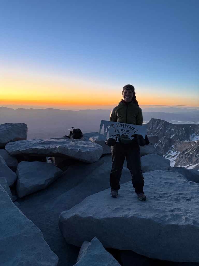
It was another warm night and I didn’t sleep well, likely because not having answers about what’s going on with Addie is stressing me out. In an effort to have enough time to have a big mile day, my alarm alarmed me that it was time to get packing, as I was already awake. This is the first time in a while (Mt. Whitney, I guess) that I set an alarm. But today we meant business.
It was a new day.. the terrors of yesterday, though still fresh, were past and it was time to see what today had in store. There were blowdowns, of course, and more bushwhacking where the bushes whacked back, but it was short lived and way more forgiving than yesterday. We had lovely views of Mt. Shastsa and even had some brief rain, which was welcomed.
But soon the clouds yielded to the sun and it got hot. I now see what all the hype has been about – we’re definitely in a heat wave. Thankfully we were mostly shaded and had a huge 12 mile descent, with plenty of water for swimming and hat dunking.
At 5pm we cameled up water for a carry and dry camp. It was 4.5 miles to camp all climbing, just how you want to end the day. While there we ran into a guy who quite frankly looked a little out of it. So much so that we asked him if he was Ryan, someone rumored to be very sick on trail. Nope, this guy’s name, ironically, is Out of It, a trail name he embraced because he’s very well aware that’s how he comes across.
But we had to break away from social hour (he’s only one of two people we saw all day) to complete the day. The climb was my favorite yet. After already 24 miles, I felt strong and ready to take on the challenge. I was shocked when I found myself at the site after what felt like 10 minutes! Unfortunately, we were not the first to get there. Although a large site, the guy already there did not give off friendly energy and made it pretty clear he didn’t to share the area. Feeling good and also not wanting to spend the night with grumpy pants, we moved on. It was only 0.7 miles to the next site and we got there well before 7pm.
It’s not the greatest site – pretty slanted and swarming with mosquitoes, but it’s definitely more welcoming. Plus it’s our first day hitting over 30 miles! Sure it was a lot of descent, but it was also 4500’ of climbing, so definitely not easy by any means. My foot is still giving me problems, but if it can handle these kinds of days without severe pain, it’ll be fine moving forward.
This sets us up well to get into town tomorrow relatively early. With only 22.7 miles to the road, we should be in by 5pm! Not sure if we’ll end up in Dunsmuir or Shasta, either way I’m just excited to get into a town!
Day 91: July 15; 20 miles
It was another uncomfortably hot night. I can’t say I had a particularly restful sleep, but 4:30am came rolling around and it was time to get moving. With 22 miles to go and a town to get into, we were on the trail at 5:30am with the target of Shasta in the early afternoon.
The trail was forgiving and cruisy. The miles came quickly with good shade from the hot sun. There was an opportunity to take a bit of a “shortcut” to shave off 3.2 miles of PCT which appeared to be out of the way and useless when a road took a direct shot to the same exact location. With feet that could use a bit of a reprieve, we opted for the shortcut. We were rewarded with beautiful views of Shasta, Castle Craggs, and Black Butte as well as bountiful ripe blackberries. After completing the shortcut it was only 2 miles to the road where we hit the 1500 mile mark!
We weren’t sure what the hitch situation would look like to get into Shasta. We knew there was an “angel” who charges for rides, so we’d call him as a last resort. Thankfully (or maybe fatefully) we saw a car pull right up to the trailhead as we approached. She asked us if we saw Doc, the ride guy, then offered us a ride into town. What are the chances?? We hopped in and off we went.
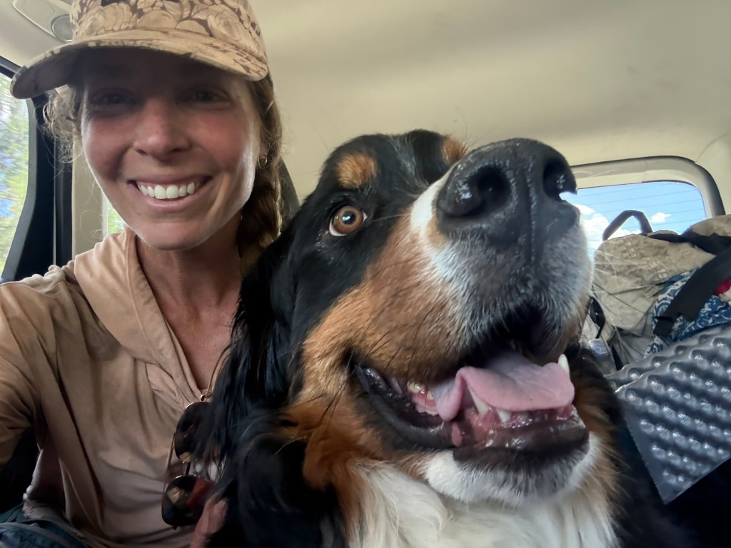
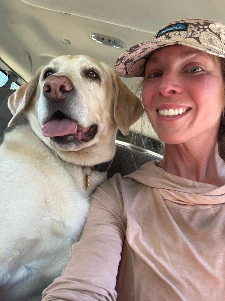
A dog always takes a hitch to the next level
Nancy splits her time between Shasta and Arizona. We were lucky to have caught her because she’s going back to AZ Friday. She said she and her husband have always wanted to do the PCT, but couldn’t find the time. Meanwhile she’s participated in ultramarathons, triathlons, and even an iron man. No wonder she’s so busy! She said those days are behind her and she’s excited to go to Antartica next year for her 60th. She’s a lovely person, I was so happy to have met her. She even offered us a ride back to trail tomorrow!
We got into Shasta early enough to get resupplied, grab lunch, and get severely judged. Seriously, I have never felt more like garbage than I did in this town. I by no means expect any special treatment, but wow it did not feel good to be in that town. We were literally scoffed at and given dirty looks. I immediately wished we went to Dunsmuir based on how we were treated in Shasta – and we didn’t even stink that badly!
David helped a Guy (literally, his name is Guy) get his jeep started in the grocery parking lot and was rewarded with a ride to the KOA, saving us a 1.2 mile walk. On that ride Guy explained that the town is getting fed up with the high homeless population, and while he knew we were hikers, he doubts other people think the same and lump us all together. It’s disheartening to think that’s how they treat anyone.
It was a rush to get set up and do laundry at the campground. I love KOAs, they are very nostalgic for me. I have many good memories from roadtrips with my family growing up. They were always fun and clean, particularly the bathhouses. This one was of no exception. We ran into a lot of hikers there and caught up a bit. But it had been a few very long days so it was time to hit the hay relatively early.
It’s hard to believe it’s been 1500 miles on the PCT. Canada feels so close, even if I’m still stuck in California.
It was a freezing cold night. I wasn’t expecting to wake to a 38 degree morning, especially when it was such a hot day and gearing up for the same today. After we got up and moving, though, the heat came out with a vengeance. It was hot, almost unbearably so. Being fully exposed in a burn section when going over blowdowns really didn’t help the matter.
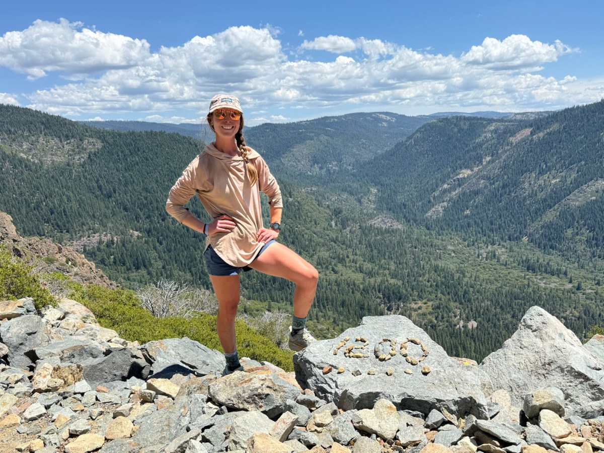
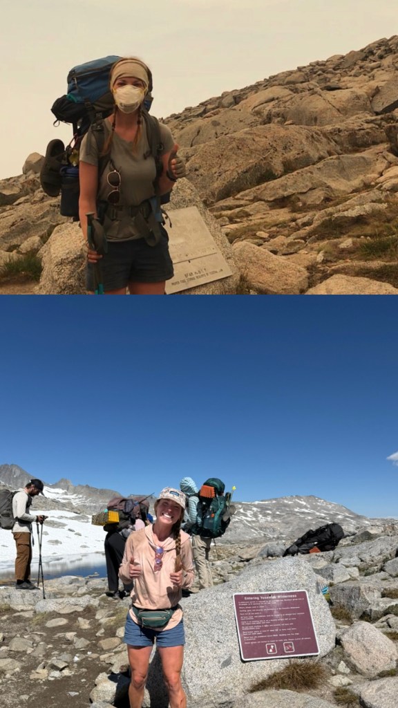
The only thing worth taking a picture of today was hitting the midway point of the PCT!! I was pretty awesome seeing the plaque in person, knowing that I had walked 1325 miles to get there, and only had 1325 miles left. While I don’t feel like the miles flew by, I do have a feeling that this second half is going to go by in the blink of an eye, especially with increased daily mileage.
Midpoint!
The excitement of reaching this literal milestone was slightly offset by how thirsty we were. We made a critical error of not thoroughly checking water sources and were stuck with a 10 mile water carry, each of us only carrying 3/4 liter of water. Rationing that little of water all those miles during a really hot day is kind of torturous. While we were never in any kind of mortal danger (a Sherpa literally just survived 6 days on Everest with one chocolate bar and snow), it was super uncomfortable. For once my mind wasn’t perseverating on food. All I could think about was water.
There’s a trail somewhere in this mess
And of course those 10 miles were dusty and overgrown, making for slow traveling. But eventually we made it to a creek and just about drowned ourselves with water. I don’t think we’ll be making that mistake again.
Got to a mosquito free camp fully intending on cowboy camping. But as soon as the sun started to set, the blood suckers came out in a fury. Just as furious, we quickly set up our tents, cursing those darn bugs the whole time.
I made myself a delightful egg burrito for dinner, complete with refried beans, cheese, and bacon bits. I’m trying to eat a little more throughout the day, and powdered eggs really help with calories and protein, though they are a bit high maintenance. We’ll see how long my patience lasts with them.
Day 84: July 8; 26.7 Miles
It was another cold morning, which made for slow camp breakdown. Or maybe because I was distracted with good phone service. The jury is still out on that one. I was just happy I could wish my brother a happy birthday.
We got out of camp and in less than a mile hit trail magic! Only we got there just as they were setting up, so we missed all the “good stuff”. Danny and Kim became enamored with the PCT after randomly deciding to pick up a hiker hitching one day when heading to Chester. They live 3 hours away but decided that today they wanted to do trail magic for the whole day. And they were doing it right. Pancakes, sausage, hot dogs, and hamburgers were all on the menu. I was extremely happy with the coffee, fruit, soda, and candy we got. We spent a while there talking with them. They’re a great couple and with 14 grandkids they knew about all the goodies we hikers might like. After all, our eating habits very much mimic that of a toddler.
After departing, we had an amazing stretch of trail. Not a burnt tree or blowdown in sight. It was a taste of what this forest must have been like before the 2021 Dixie fire. Unfortunately that didn’t last long. We arrived into Lassen National Park and soon the destruction returned. Rumor has it Lassen is the worst of the burn zone. Which isn’t as daunting as it may sound, it’s only a 19 mile stretch. You can do anything for 19 miles!
Not a burnt tree in sight!
I’ve never been to Lassen National Park, so it was great getting to explore a little. We had lunch off trail at the Boiling Lake, which is a very accurate name. It has boiling mud pits and smelled just like Yellowstone. Some might find the smell of sulfur a bit potent and unpleasant, but I love it. It brings back instant memories of exploring Yellowstone with my family as a young child. At lunch I feverishly drank the Dr. Pepper I packed out from trail magic. I never drink soda in my normal life, but out here I crave it. Sometimes it’s all I can think about! Especially orange soda, which I have become a bit of a snob about. I have tried just about every brand and will only drink Fanta. I wish I could find a grape soda somewhere, they’re so hard to come by!
It doesn’t look impressive but this mud pit was boiling away The Boiling Lake
It was a late lunch and we were back to walking at 3pm, with 8.5 miles still to go that I was dreading. We broke up the walk by rinsing some dirt off with a spigot and cooling off. After that was a modest climb that did provide some entertainment. As we were climbing we kept an eye on a person walking the road. They were easy to spot because they had a huge sun umbrella. I noticed that this person kept turning around… back and forth back and forth. Thinking they were confused, I realized the source of the problem – there was a bear frolicking in the middle of the road! It was actually pretty entertaining to watch… from 300’ up. This person was never in any immediate danger, the bear wasn’t paying any attention to them, but you could see this tortured soul trying to figure out how to get around the little guy. They ended up taking the creek the whole way back to their cabin, making it safe and sound.
The bear in question
After conquering the climb the rest of the walk was slow moving. It was nothing but overgrown brambles, scratching and cutting up my already raw legs. It was torture. We made it to camp, Lower Twin Lake, at 8pm with just enough sun to clean up the dust from our legs and set up camp. It’s a beautiful camp full of some very brazen deer. I had one sneak up scarily close to me when peeing, barely allowing me to stop before going hog wild to drink it. Let’s just hope they don’t steal my socks, which they are apt to do!
Day 85: July 9; 27.1 miles
Despite a 2am deer seance, I slept really well. Whether they were praying to the moon or foraging for more pee, I only woke enough to notice they were doing something weird that didn’t involve my sock so I went right back to sleep. The temperature was perfect for sleeping and made for a quick camp breakdown.
Happy to be done with Lassen!
We only had 12 more miles until we were out of Lassen and presumably out of the Blowdown City Blues. And like magic, we were! We were transported from dusty exposed trail full of widow makers and blowdowns to a beautiful forest that felt like home. In fact, if I had to guess where I was, I would’ve said confidently “Batona!”, the trail I did a shakeout on before coming out there. The pines and sand were so comforting, and the flat terrain made it easy to cruise. It’s ironic that it feels like Batona because I just so happen to be chasing down someone with that as a trail name! Hailing from NJ, I have seen this mystery person for the last several weeks on trail registers. We’ve been steadily gaining on them, to the point where they’re only a few miles ahead. I know I will soon have the opportunity to talk to them about Batona!
So cruisy!
With 11 miles left we did a quick detour to get ice cream at Hat Creek Resort, which proved worth the additional half mile. We were greeted with generous scoops of divine ice cream that were extremely cheap. On a hot day it was very welcome. We even got talking with the two ladies running the shop. They hail from a tiny town in Arizona that I actually spent a night in during my Southern Tier bike tour. The trips I’ve done that go to tiny little towns across the country are amazing for reasons like this. Every so often I see these small towns on the news and think, oh I’ve been there! Or I run into people from there, like these two ladies, which creates an instant connection.
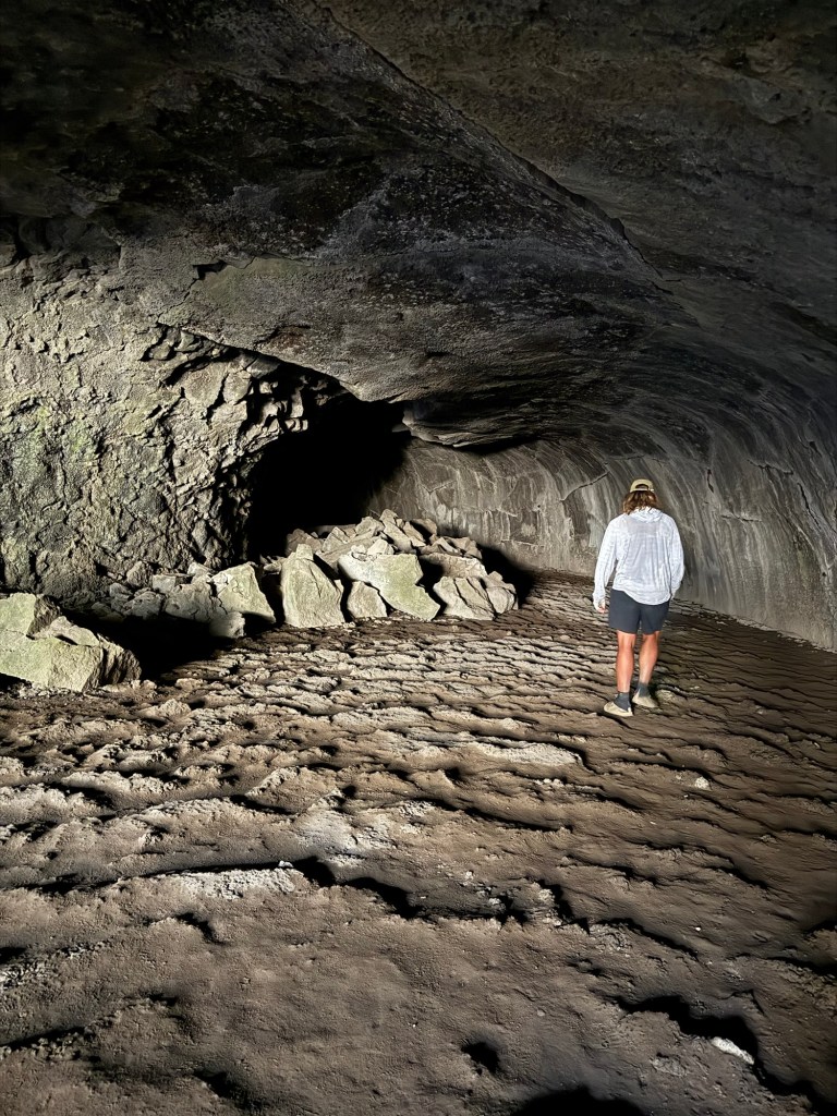
To break up the rest of the miles we took another detour to a lava tube. It was huge and rivaled the one I saw in Hawaii so many years ago. It went on for 1000’, which I was explicitly clear I cared not one bit to explore (I have a fear of caves) and it stays a cool 46 degrees year round. It was refreshing to get out of the sun and heat for a bit, but we had more miles to get done and I didn’t want to stick around for whatever might crawl out of that tube.
And just like that we were transported back to the desert. Only I don’t remember the desert being this hot or dry. We had a 20 mile water carry plus a dry camp. My pack weighed so much and is wreaking havoc on my body. My back, hips, and shoulders are raw and bruised from my pack. I know I’ve lost weight and my bony areas are bearing the brunt of it. There is no second of the day when I’m wearing my pack that I’m comfortable. I think it’s time to start looking for a new one, officially.
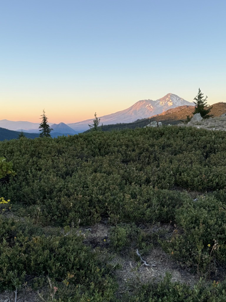
For 5 days we thought this was Mt. Shasta. It indeed is not.
We hobbled into camp around 7pm, greeted by a secret water cache. Which was fortunate because at the rate I’m drinking water I wouldn’t have made the 20 miles without running out quickly. We desperately need a rest day. After these long mileage days that were made even more taxing by terrain and heat, our bodies (really feet) need a break. I’m still battling whatever I did to my foot 3 weeks ago and David seems to be having some overuse issues pop up. We’re thinking of either taking it easy tomorrow and neroing into town Saturday or making it all the way to town tomorrow. It’ll be based on how we feel tomorrow I guess!
Rewarded with a beautiful sunset
Day 86: July 10; 26.7 miles
It was such a warm night. I had every intention of getting up early in attempt to beat the heat, but slept right in till 5:30am, clearly exhausted. Even so I was able to get myself together and leave at normal time. With easy elevation, the goal was to attempt to get into town today.
This is Shasta!
It was a decent day, with views of Shasta guiding us to Burney. The thought of an off day being motivation to maintain a high MPH speed. My appetite is either suppressed by the heat or my morning bean burrito (refried beans, BBQ beef, bacon bits, and cheese) is doing a bang up job of keeping me full. I think it’s the burrito. I am not bonking like I was and feel pretty strong. I just feel bad for anyone upwind of me.
I didn’t complain enough today, here’s a visual of what I did complain about in person: all the lava rock tearing up our feet.
With only 8 miles left at 2:30pm, we were bound and determined to make it to town. We passed by Crystal Lake, which was absolutely stunning and full of bird activity including actively hunting osprey. It was nice to break up the heat and dryness with a lake full of life. We even saw a black bear there! Minding his own business he was just chilling on trail until we spooked him and he darted, leaving a huge trail of dust behind him, never to be seen again.
The pocket ornithologist taking a picture of Great White Pelicans
We made it to the road in record time at 4:58pm. It took longer than expected to get a ride, maybe because I looked so raggedy, but Jaden pulled over happy to give us a lift. He grew up in the same town as David and they reminisced the whole drive to town. Jaden’s birthday is tomorrow and he’s celebrating by going up to Shasta with his family. He even invited us to join, but it’s a far drive and we need a day of doing nothing. It’s so hard to say no to offers like this, but our bodies need a decent rest.
No wonder it took so long to get a ride, no one wants this stinking up their car
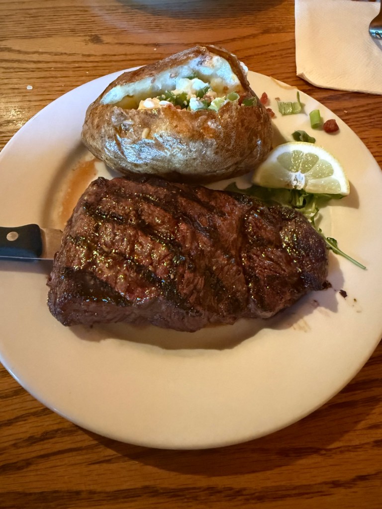
The motel we’re staying at is attached to a steakhouse. So after catching up with some familiar faces (including Code!) we got cleaned up and had an amazing dinner to refuel. It was one of the best meals in town yet.
Not pictured: wings, mozzarella sticks, bread, and salad. Not one crumb left behind.
I’m so excited to have a zero tomorrow. My body, though it feels strong, is tired. If I keep pushing this hard without rest I know I’ll end up either sick or injured. With Canada becoming such an achievable goal, I don’t want to risk either of those things happening and potentially derailing this trip.
The rest of the climb was indeed exposed and rocky, but the vegetation was recently cut back by trail maintenance. I was so thankful that I didn’t have to worry about thorny bushes scratching my legs. And the views were amazing. We did have a run in with an old familiar face, a rattlesnake. But he didn’t bother with us too much, just did a little rattle and slithered away.
At the top we had a decision to make – either stick to the PCT or stay on the ridgeline, which was the original PCT route. The ridgeline, from what I read, was 3 miles shorter and had less pointless ups and downs. Only issue being it had no water, so it’d be a 15 mile water carry and dry camp. But we’ve done worse, so we opted for the old PCT route. I can’t be sure this was the right decision. The route was slightly confusing, causing us to get lost more than once. It also seemed to have a lot of pointless ups and downs, but I guess that’s just par for the course. Eventually we made it the 5 miles back to the PCT and made camp just after.
After leaving Sierra City, we didn’t see a soul the whole rest of the way. It’s so strange, considering it’s such a popular trail. The only sign of life is a deer who’s been patrolling camp since we got here. It better not steal my sock!
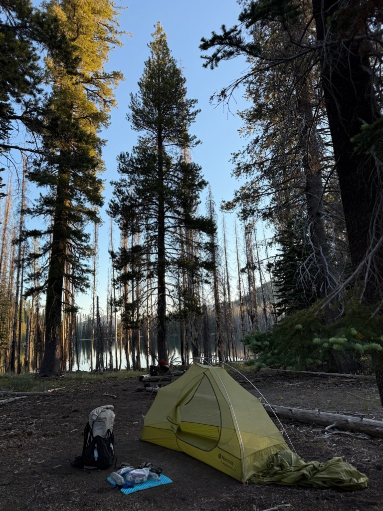
Trying to get better at taking pictures of the camp spots… it really helps to remember the day
Day 79: July 3; 28.7 miles
Woke up to a beautiful warm morning. It makes breaking down camp so much easier and faster when you’re not shivering. I’m sure it’s a sign of what’s to come. In Sierra City I saw that we were in for a warming trend, the high 90s. Fabulous!
Hopefully the endless lakes continue, especially if it’s gonna be hot!
Today was boring. There are going to be a lot of these in NorCal, I think. A lot of it is in the trees, which I like. It lets the body go into autopilot and I can spend miles just thinking. Really deep profound thoughts too, obviously.
At one point I caught up to David, who was standing by a blowdown staring at something. To my absolute horror, I saw it too. A baby fawn, not even a day old, laying by the blowdown in the middle of the trail. It wasn’t moving, eyes wide open but not seeing. It was beautiful- white spots, big floppy ears, tiny little hooves. Thinking it was already dead, my heart broke for the poor creature. Then, as if jolted alive, it moved and started to breathe slowly and shallowly. It had some fight left, but was quickly losing the battle. Unable to move it, I knelt down by it to offer some comforting words in between tears. As we left it, I pray death found it quickly and took mercy on it, ending its obvious suffering. How horrible that in a world I love and find so beautiful this creature only knew pain and suffering. I hope my words offered it some sort of comfort. It’s a stark reminder that nature isn’t always beautiful and is hardly ever kind.
Heartbroken, I thought about that baby the rest of the hike. What led to it being there without its mom and if there was anything we could’ve done to help it. There was nothing we could’ve done – it was too late and nature had to run its course.
After getting to our intended camp spot at 4:30pm, we opted to grab water and keep going another 3.6 miles. There were plenty of blowdowns, but manageable. From what I hear, they’re about to get a lot worse. Great!
So thankful for the folks doing trail maintenance… I can’t imagine how horrible it would be if this wasn’t taken care of.
Code passed us around 8:45pm, saying he was going a little farther. He was already at 29 miles! I asked him if he saw the baby deer, he said he was warned by a SOBO (who we warned) but he didn’t see it. By the time he passed, the deer was gone. Something inside me was hopeful, Code wasn’t that far behind us. Sure, something like a coyote could have gotten it, but I theorized that the baby was just born and we spooked mom. The baby was too young to do much, so it just laid there. Maybe mom came back and rescued baby and all was well! At least that’s what I’ll tell myself to get myself to sleep.
Day 80: July 4; 27.8 miles
It was such a warm night and a hot morning was definitely starting early. There is no denying it – we’re definitely in a heat wave. And to think, one week ago we were walking in the snow!
We set out at our normal time, a little disappointed that we weren’t eating hot dogs or at a parade to celebrate the Fourth of July, arguably my favorite holiday. I kept putting “trail magic” energy into the universe in hopes that we may be blessed with hot dogs on trail, but that may be a long shot.
The day started with a long descent. It kept going, and going, and going. I knew the entire way down we’d have to go back up. A 10 mile climb was in our future. But once we got to the bottom of the descent, we were greeted not only by Code (who ended up having a 32 mile day yesterday) but also a beautiful river. We decided to spend some time taking a dip, I opted for one mostly because I was so grimy from not showering for nearly a week. I’m basically a biohazard at this point.
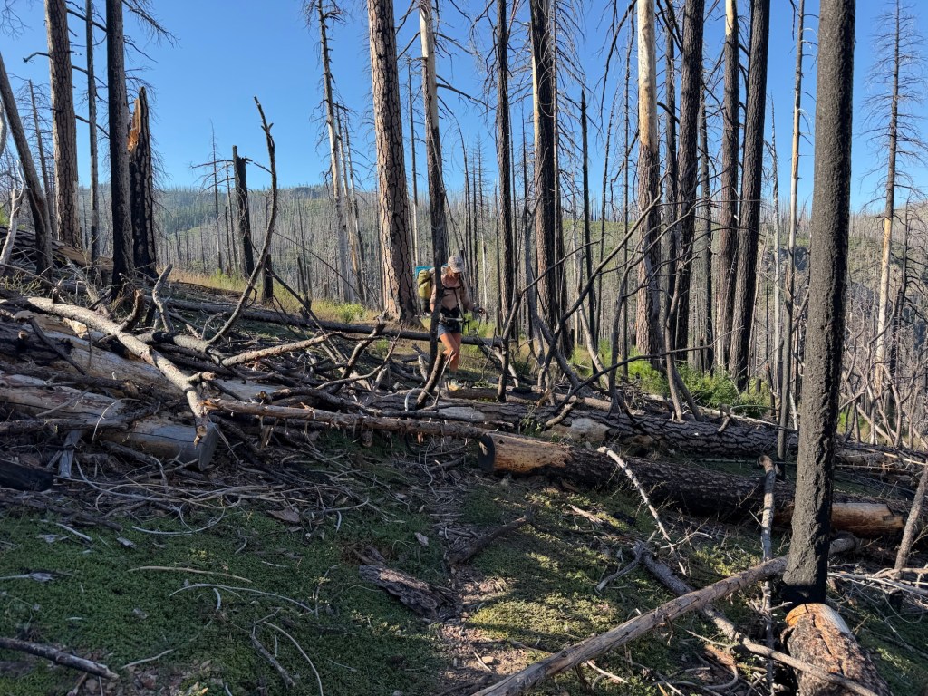
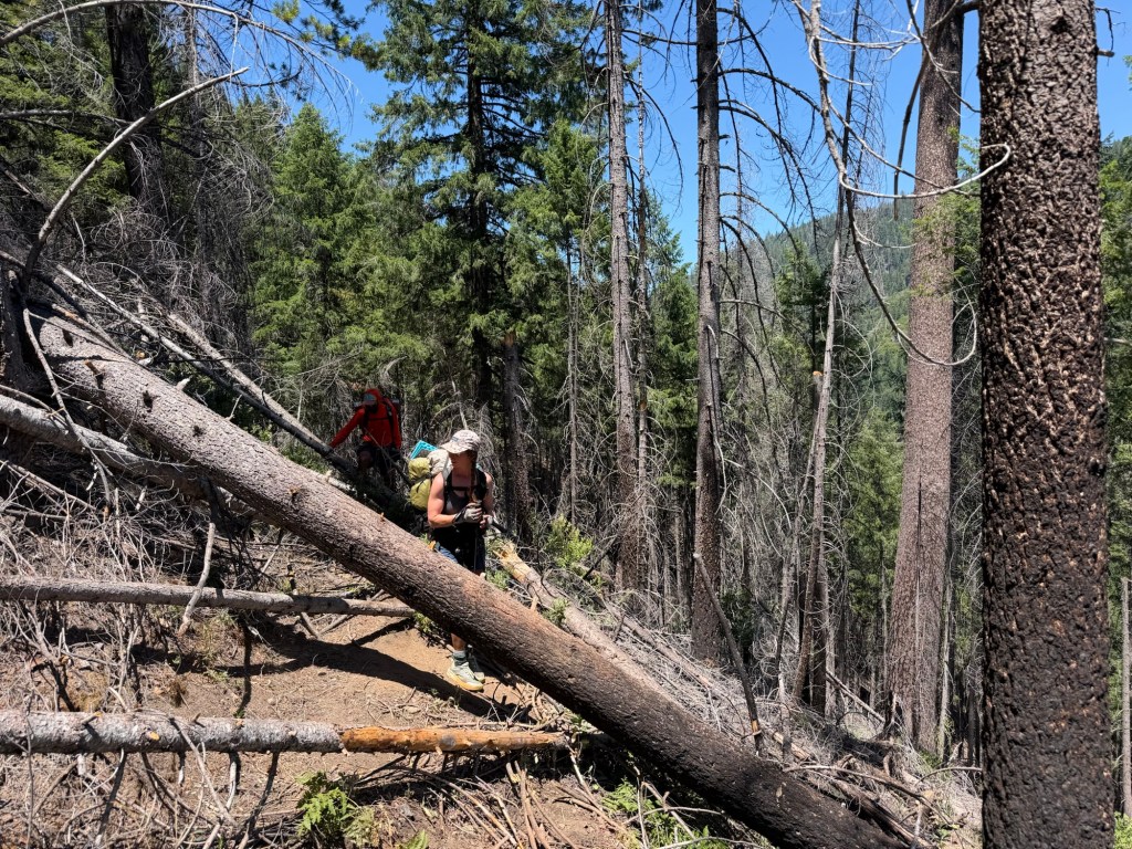
Then we started the climb. Based on the farout comments, it was a doozy. But this is the one time I don’t think the comments were dramatic enough. This climb was heinous. It had every negative thing a climb could possibly have, and then some. It was steep, it was hot, it was exposed. And on top of that, there were so many blowdowns that I couldn’t even keep track of. Seriously hundreds blocking the trail, forcing you to go under, around, or over them.
Me and Code figuring out the best way to get over this nonsense
There was also so much vegetation you lost sight of the trail, usually running straight into another blowdown. And there was severe erosion, forcing you to walk funny to avoid slipping down thousands of feet into the valley below. AND there was poison oak everywhere! So on top of keeping an eye on the trail, blowdowns, and not falling to your death, you had to make sure that you didn’t get touched by poison oak. I’m not a good plant identifier (thanks bio degree) so I have trouble recognizing it. Because of this, I tried to avoid all plants. Which is impossible to do given the trail was so overgrown. Ironically, those plants saved my life. I broke my one week record of not falling and fell backwards, the abyss calling my name. Thankfully two bushes cradled me, stopping me from certain death. More than anything I was frustrated and so done with the climb. But there were still 3.8 miles to go. Argh.
Overjoyed to be at the top!
But each step forward is a step forward and I found myself at the top, overjoyed. I was drenched in sweat and on the verge of a heat stroke (and maybe a mental breakdown), but it was done. That was probably my worst climb of the whole trip. Ever since Sierra City, we’ve barely seen anyone on trail besides Code. Not sure if it’s because of the holiday, but we also heard that people are skipping this section en masse. The Dixie fire caused over 100 miles of devastation on the PCT and is notorious for being awful. With its reputation and hikers skipping a significant chunk, I would think the forestry service or PCTA would be a little faster with cleaning it up. But alas, they know more than I do and I’m not the one cleaning it up, so I just have to suck it up. But I did have a bit of resentment that people were skipping the tough part while I was suffering through. But, as the old saying goes, hike your own hike!
We decided during the river dip that we were going to celebrate the 4th like true Americans – with hot dogs and fireworks. Sure it was 4pm and the road was still 8 miles way and we likely would wait a while before getting a hitch, but what kind of Americans would we be if we didn’t at least try?!
And so we went, hot dogs being our siren we reached the road quickly thanks to beautiful trail maintenance, not a blow down in sight. I did catch a glimpse of another bear! A big fella, I wasn’t quick enough to get a picture before it ran off. We got to the road a little before 7pm, it looked bleak and poorly traveled. But after 23 minutes and only 3 cars we lucked out with O’Sean, an 18 year old lifelong Quincy resident who decided to help us out. We got into town and soon found every motel had been booked. Rats. Being 18, O’Sean had plans for the 4th of July that didn’t involve driving us all over town, so he dropped us off in a Safeway parking lot. Resigned to getting some small snacks (and hot dogs of course) before getting a hitch back to trail, we were instantly called over by a woman in a car curious about what we were doing. After we explained our saga she asked, “want to stay with me?” Not entirely sure what she was offering, we were hesitant to accept. “I own a summer camp. You can stay there and have everything you need” I mean, sure why not! So we got our groceries and soon we were heading to camp with Yassi and Dan, totally unsure what to expect.
Well we made it in one piece. The camp itself was great. We had full access to a kitchen, showers, and laundry. Yassi said that they were in between families coming for the week so it was great that timing worked for us. Already 8:30pm, we quickly made a July 4th feast and went to bed, thankful that everything worked out (minus fireworks, but i was too tired to care).
Worth the hassle 🇺🇸
Just before going to bed, the thought of the baby deer popped back up in my head. With just a smidgen of reception I was able to do some research and lo and behold…. My theory was likely correct! Apparently baby deer will play dead if a perceived predator approaches. We likely did scare mama away in the midst of cleaning off the newborn, and the baby did a stellar job of acting dead/dying – it had me convinced. Once we left mama almost certainly came back to the rescue and nature was returned to peace and I can continue on knowing that baby deer will live a long and fruitful life.
Day 81; July 5, 18.7 miles
With an anticipated drop off time of 9:30am to trail, we had time to sleep in and do laundry/shower in the morning. Once 10am rolled around without any sight of Yassi or Dan, we got a little antsy. We still wanted to get to Belden by tonight.
Packed the essentials
Eventually they came out and we were ready to get back to trail. We called the owner of the RV park we are picking up our packages at, but it was little to no help. Once she knew our packages were at the post office and she wasn’t getting them until Wednesday, she hung up and stopped answering our calls. Well, looks like we have to head to the post office tomorrow. So far it’s the only hiccup of this trail, so we just have to deal with it.
On the way to trail, Yassi and Dan were picking our brains about how they can utilize their camp to help with hikers, obviously at a fee. We gave them a few ideas but told them we’d send them more. There is a ton of potential at that camp to really make it a PCT haven!
We started the day at 12pm. The hike itself was great – there was a climb initially but nothing like the day before. Then it was down down down. There were blowdowns of course, some requiring straddling and gripping on for life to avoid slipping. All charcoaled from the fire, my shower and laundry experience from earlier was made useless quickly. But aside from a few splinters, I was fine.
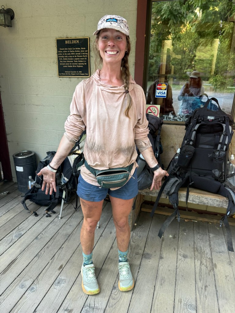
We got to Belden at 7pm where we saw the most hikers we’ve seen in days. There were 8 dirty charcoaled covered hikers in the restaurant enjoying hot food and cold drinks. We saw Silver and caught up with him as well as Sean, who was originally way ahead of us but with our increased mileage and his recent bout of suspected norovirus, we caught up.
Slightly dirty.
We’re camping by a river with everyone from the restaurant, including Code! The post office is about 20 min away and doesn’t open until 10am, so there’s no rush to get out early tomorrow. I’m not sure what the hitch situation is like, but I’m sure we’ll find a ride before it closes at 12pm. Such great hours! What really is annoying is there is a 10 mile 5000’ climb first thing. It would’ve been great to get it over with in the morning, but that’s just how it goes. If we had known we were going into Quincy, this all could have been avoided. Just luck of the draw sometimes!
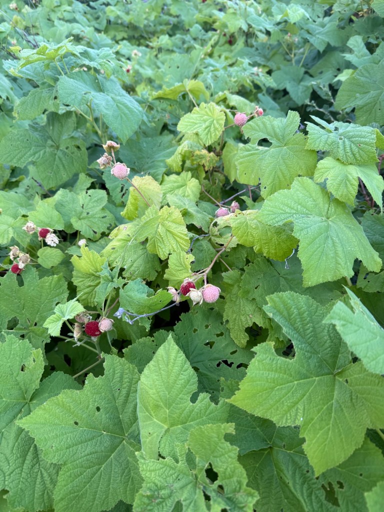
Feasted on wild raspberries
PS it’s the 11th year anniversary of me adopting Addie, the most wonderful dog in the world! I can’t believe it’s been so long, it feels like yesterday when I picked her up and cradled her in my arms. I hope we have many more years together.
My perfect pup
Day 82: July 6; 18.7 miles
Went to bed under an amazing and dazzling show of stars. There were thousands, including a comet! There must have been a meteor shower last night because there were also a number of shooting stars lighting up the sky. Taking in the night sky is definitely a benefit of cowboy camping. What wasn’t so pleasant was the train that felt entirely too close. There were a few times it sounded like it was going to derail and come barreling down the hill right towards all of us. But aside from some interrupted sleep, we all made it through the night unscathed.
Benefits of cowboy camping: the most dazzling night sky
There was no rush to get up early since we didn’t have to be in Twain until 10am. So we saw Code, Silver, and Sean off. Who knows when we’ll see them again. It’s kind of a bummer this package is holding us back, it’s a great group. There was brief consideration of forgetting the packages and moving on, but with all the trouble it put my parents through I was determined to get that package. Plus it had all the ingredients for breakfast burritos- I needed this package! Eventually we moseyed over to the road at 7:19am. It looked bleak. The only cars driving by were work trucks, totally uninterested in giving us a ride. Just when we thought we were in it for the long haul, Jeff pulled over at 7:23am. It’s shocking how easy hitching has been. We hopped in and were on our way to Twain. Jeff said that our story was not uncommon – packages get misdelivered or lost all the time. Just a lot of unnecessary chaos. He offered to let us stay with him in Quincy if our packages weren’t at the PO, but we were fairly certain they were and hopeful we wouldn’t have to take Jeff up on his very generous offer.
We got to Twain before 8am, hopeful that at least the cafe would be open. It wasn’t… at least yet. It was unclear when they would open, being still technically affected by the holiday. So we sat. And waited. The store did open at 9:30am and we enjoyed an amazing sandwich. I was able to load up on snacks before heading to the post office, where our packages were waiting. I now have entirely too much food and my pack is extremely heavy, but hey, I wanted to eat more so getting that weight down is great motivation.
We were lucky enough with our timing that we met John outside of the PO with 3 other hikers. He’s a trail angel from Quincy who just so happened to have a huge truck that could fit two more of us for a ride back to Belden. Seamless!
We got to trail at 11am and immediately started the climb I’ve been dreading all day. The climb itself is 14 miles with the most gain being the first 10. After all the blowdown nonsense, I wasn’t ready to do it again. Without boring you, I’ll get the complaining done now, short and sweet (not at all like that climb): it was long, hot, covered in bristlebush, poison oak, and other plant life that completely obscured the trail in several places. Now, that’s not to say there weren’t plenty of good things about the climb. We were rewarded with some of the tastiest blackberries I’ve ever had that lined the first few miles, water was so plentiful that I was constantly wet and hydrated, and there was a slight cool breeze. Certainly helps! In fact we went for full swims twice. With it being so hot, jumping into a river really helps make the day more manageable.
These were by far the most delicious blackberries I’ve ever tasted.
With the swims and climbing, we got into camp pretty late. Just enough sunlight to set up camp and eat a cold dinner. We saw Sean, who (and he said this himself) looks horrible. Whatever virus he had a few days ago really wiped him out. I see a town day (or week) in his future. We did get some trial magic – apparently the water trough by camp is a popular spot for dropping off sodas. Looks like I’ll be packing out a Dr Pepper for the morning!
Very creative way to surprise thirsty hikers with refreshing trail magic!1300 miles!
Today is the 25th anniversary of getting hit by a car. I don’t think about this day often, but I do think it shaped the person I am today. I like to think I bounce back quickly and don’t let things stop me from keeping on. The best compliment I’ve ever received was being called “resilient”. I give all the credit to my parents. Whether they knew it or not, they didn’t let me feet sorry for myself. Sure I was in a wheelchair all summer but there was no babying me. They made sure I still had a normal life, with a few adjustments here and there to account for all the casts. In fact, the day the last cast came off they took me to the pool to go swimming! I don’t think I even had the chance to feel sorry or traumatized. I’d like to think if that kid knew 25 years later she’d be hitting 1300 miles on the PCT, she’d think it’d be pretty cool. I mean current age me does.
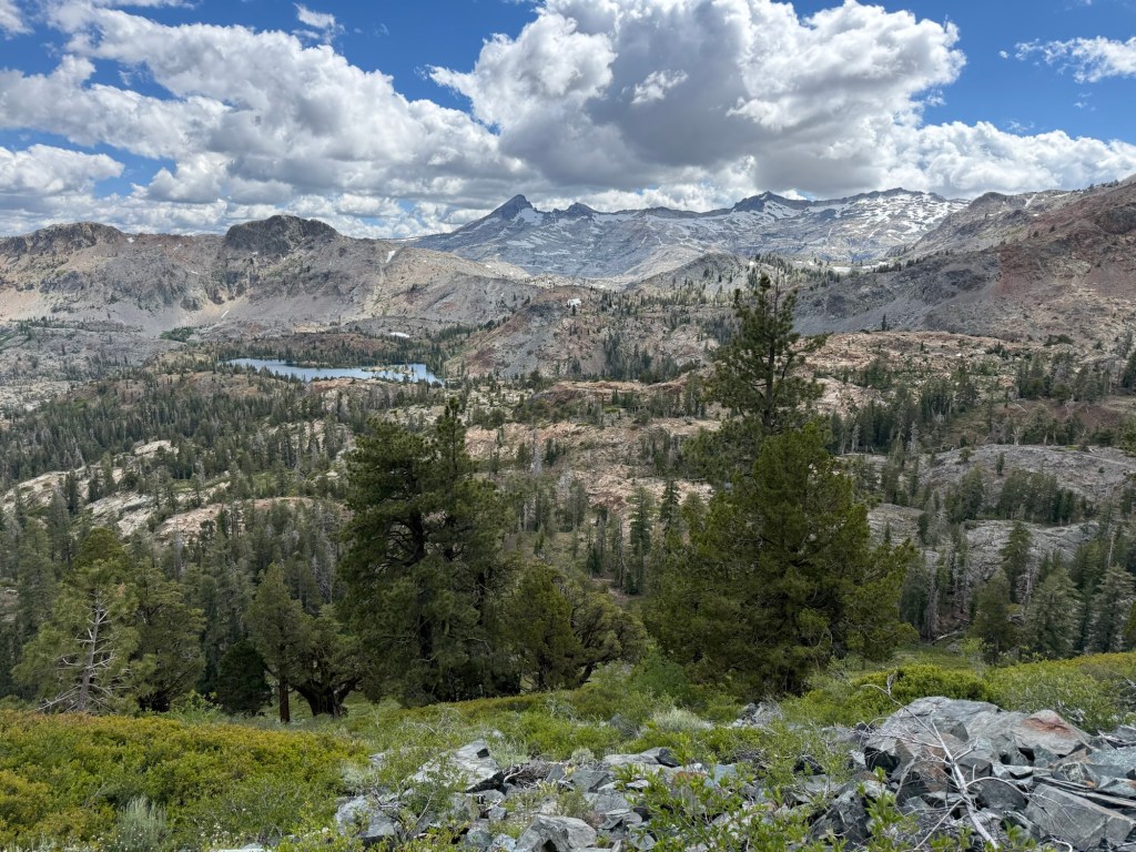
After hitting 1100 it was lunch time at Aloha Lake. Last time I was here it was inundated with mosquitoes. This time there wasn’t even one. I was so happy to eat my lunch in peace.
The rest of the day is honestly a blur to me. The clouds enveloped the sun and it got cold. But it was okay – we had a 4.2 mile climb up Dick’s Pass. It wasn’t a crazy climb and I handled it much better than 2021. It was during this climb that I decided I wasn’t going to finish the TRT. I was going to pick up my dog and go home. I had the same thought this time around too (I really really miss that dog) but know it’s only a little longer till I can see her again.
It was a descent the rest of the day past several lakes until we reached our destination – Middle Velma Lake. The clouds were still very much present. Unsure if it was going to rain or not, I begrudgingly put on my fly. And wouldn’t you know it, the sun came out that very moment to bless us with a beautiful sunset. Oh well, just how it goes. It’ll probably be an early bedtime, I’m wiped.
Day 75: June 29; 28 miles
It certainly was an early bedtime. I passed out almost immediately, even before getting fully ready for bed. So without my puffy and liner I zonked out, didn’t even wake up from being cold. I said it once and I’ll say it again – I sleep better in my tent than anywhere else. Even in the middle of bear country, I don’t think one of those could’ve woken me up last night.
And so we set out. The terrain looked forgiving, which was great for a long distance day. A lot of what I saw today reminded me of the TRT. I realize I don’t remember much from that trip, mainly because I was so preoccupied with Addie and her wellness. But some scenery really jolted back the memories, mainly a field of yellow sunflowers on a 200m stretch of trail.
This scene elicited a lot of memories
We ran back into Tarzan, Heaps, and Big Sur. We met them originally at Stone’s trail magic. They were walking with Grant and Courtney. We all ran into each other again at Evan’s house. And when I say we ran into them – it’s literal. They were running the trail. We talked with them briefly during a break. For some reason that was lost on me, they wanted to get into Truckee tonight. Approaching 1pm and still 30 miles to go, I couldn’t imagine what would make someone want to run 43 miles with pack on the PCT. But hey, hike your own hike. I wished them Godspeed and wondered for the rest of the day if they made it and if so was it all in one piece.
The intent today was to do 26 miles, however, due to complicated logistics that have been too annoying to relay here, we have to do 150 miles by Sunday before 5pm. That gives us 6 days… at 25 miles per day that’s doable, but likely not fun. So on days like today where we get into camp early, we’re going to tack on additional mileage to make the last day (Sunday) a lighter day to get into town earlier.
These moss covered trees are my favorite. And look at the quality of that trail!
It’s our longest day yet, but my body and mind feel great. I really think I could’ve gone farther, and would’ve opted to, but we were being chased by thunder and didn’t want to risk getting up an exposed climb without shelter. After getting through the whole Benson Pass ordeal, I feel so much better. My mental space has definitely improved and I have a much more positive outlook on the rest of the upcoming miles.
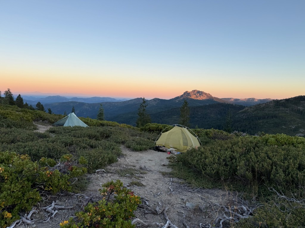
Our intended spot to camp was fully occupied, so we found a really good spot with great potential just a bit further up trail. With a little work it makes for a very cozy home for the night. And once again, once I put on my vestibule the threat of rain disappeared. Figures. Hopefully this means another great night of sleep.
Day 76; June 30; 26.5 miles
Another great night of sleep. No rain, no wind, no condensation. 10/10. We woke up early knowing that it was a mini town day. We were going to Donner Ski Ranch. A restaurant known for giving hikers free beer. I have been fantasizing about breakfast burritos for days now, but being 15 miles away I knew my craving had to continue, sadly. Since we’d likely spend significant time there and had a decent mileage day with huge elevation gain we had no other choice than to get it moving early.
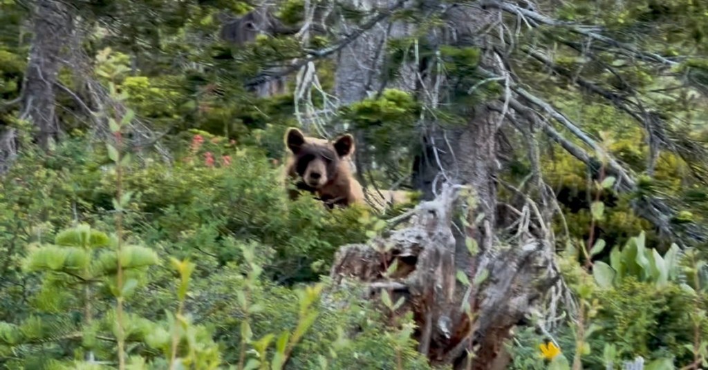
It was a ton of climbing (5303’ to be exact) and it started early. Still half asleep I was jolted awake almost immediately by a bear. It must’ve been near the trail when we startled it, very much startling us. He was only 15’ away and he was looking us up and down. Either by our stench or our incredibly intimidating look, he bounded away uninterested in bothering with us as little as we cared to bother him. He was a gorgeous bear, cinnamon colored with the most beautiful ears. Aside from the initial shock, I had no fear of him. Would I go up and pet him, of course not, but I felt comfortable just standing there, relatively close, staring at him. He gave off good bear energy.
Hey bear!
The rest of the morning was climbing, and more climbing, with a little dash of…. climbing! I walked with Turbo for a little, a college sophomore studying mechanical engineering who has only 3 months to complete the trail. Averaging 30 miles a day, I think he’ll manage it. From San Francisco, his family has a cabin in Truckee he’s going back to for his first zero day. I wish I had half his energy!
After 15.3 miles we finally got close to the restaurant around noon when we stumbled upon trail magic! The notorious Keith, who we got a ride from day 1, was back! Drinks and food he made everyone feel welcome. But snacks don’t cut it like a hot sandwich does so we left after a few minutes.
When we got to the restaurant we ran into the running crew (maybe more like the hobbling crew from the looks of it). They made it to Truckee! But at 11pm. I still don’t know why they did it. Either way they were grabbing a ride 20 miles up the trail. I’d be shocked if we run into them again.
After a French dip it was time to hit the trail again. We ascended up with a beautiful view of Donner Lake. The Donner story is still something I find fascinating. I thought about it a lot today, for obvious reasons. The rest of the day was nondescript. Lots of trees which I absolutely love. After the Sierra I do not mind at all “boring”. There have been a ton of blowdowns blocking the trail, but I think this is just a small taste of what’s to come.
We got to camp in good time and what wasn’t a good time were all the mosquitoes. After 3 days without much activity I couldn’t believe that as soon as we get to camp is when they made a reappearance. Impeccable timing.
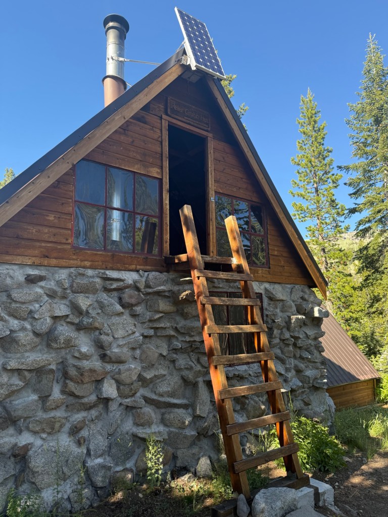
Peter Grubb’s cabin, a very interesting find on the trail
Tomorrow is going to be a easy one. Unfortunately Sierra City’s post office doesn’t open until 10am, so we’re pigeonholed to get there until late. And I need the post office. We’re officially out of bear canister territory and I desperately need to get rid of it. It has dug into my back the last week, making these high mileage days super uncomfortable. Plus I need to get rid of the microspikes, they have been useless for a while. With only 31 miles between us and Sierra City, it makes no sense to rush those miles. So it looks like I may get to sleep in! It does, however, impact our ability to get into Belden by early Sunday. But I have no doubt we’ll find a way!
Day 77: July 1; 26.3 miles
I cannot believe it’s July! June was the fastest month I think I have ever experienced. I can’t believe we accomplished so much in that time span. That’s probably why it felt like it flew by!
It was a full moon last night, shining directly into my tent to the extent that it made my tent look like it was glowing. But I was so tired it didn’t bother me.
This is the moon… not the sun!
We left at our normal time and when I say there was nothing to write about today, there was nothing to write about. It was mostly in the trees with only 3000’ of manageable climbing. We saw only two people all day. It was boring, but I loved it.
The reason why we were rushing to Belden by Sunday is because the store we sent resupply packages to is closed Monday and Tuesday. Give a guess as to what day we were due to arrive. Not wanting to have to wait two days for them to open to collect our stuff, we were making every effort to get there Sunday. But today (a Wednesday) we were finally able to call the store. The owner, Michele, said not to rush – we can still get our packages Monday. PHEW. With Sierra City likely holding us up, I was growing more concerned that we weren’t going to make it. And now we don’t have to worry about it! Just hoping the holiday weekend doesn’t throw a wrench in our plans. And huge shout out to my parents, who sent out my package just in time. I think it was just as stressful for them as figuring out how we’re gonna make it in time was for me.
We got to camp just after 5pm. We’re camping by Milton Creek and had enough sun to wash up. I can’t say it’s warm sun, we’re in the middle of a cold snap. It was 35 degrees this morning. Talk about brisk! Soon Code, Sherpa, and Quickdraw joined us at camp. I had all of them believing I was the winner of season 32 of Survivor. Maybe one day!
Even though the rush to get to Belden has been called off, we’re still trying to get to Sierra City early. There’s a breakfast burrito with my name on it, plus we were told it’s a tough hitch to get into town. If we have to, it’s a 1.5 mile walk in and out. I don’t want to add 3 miles to the day, but if we must at least it’ll get done early.
Day 78: July 2; 18.7 miles
With visions of breakfast burritos dancing in my head all night, I slept really well and woke up excited to finally get a breakfast burrito. Only 4.7 miles were between me and achieving that goal.
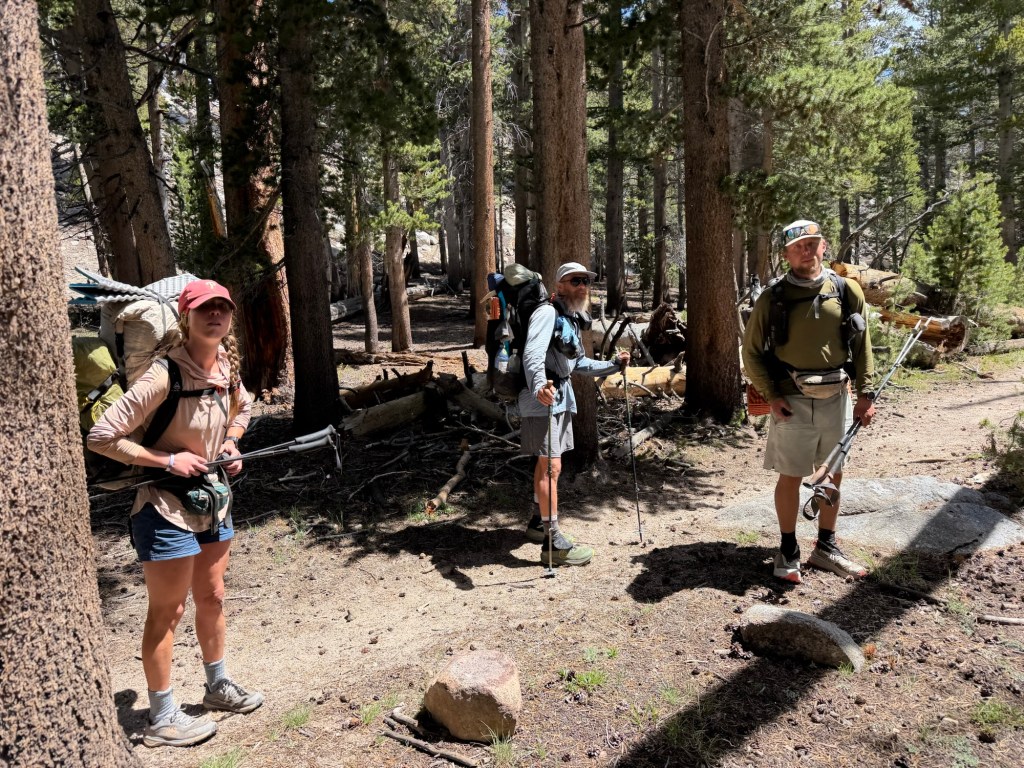
The miles went quickly with the company of Blaze and Code. Blaze is from Minnesota and just got back on trail after nursing an injury for a month. She is happy to be back and no longer has the goal of Canada on the forefront of her mind. Instead the goal is to take it slow and enjoy the little moments. She said it takes so much pressure off her and she is enjoying it more than ever. Since we’ve started picking up the miles, I have noticed a shift in “fun”. It’s shifted to a more focused and intentional plan, since Canada is still very much the goal. I wouldn’t say it’s any less fun, just a bit less “laissez-faire”.
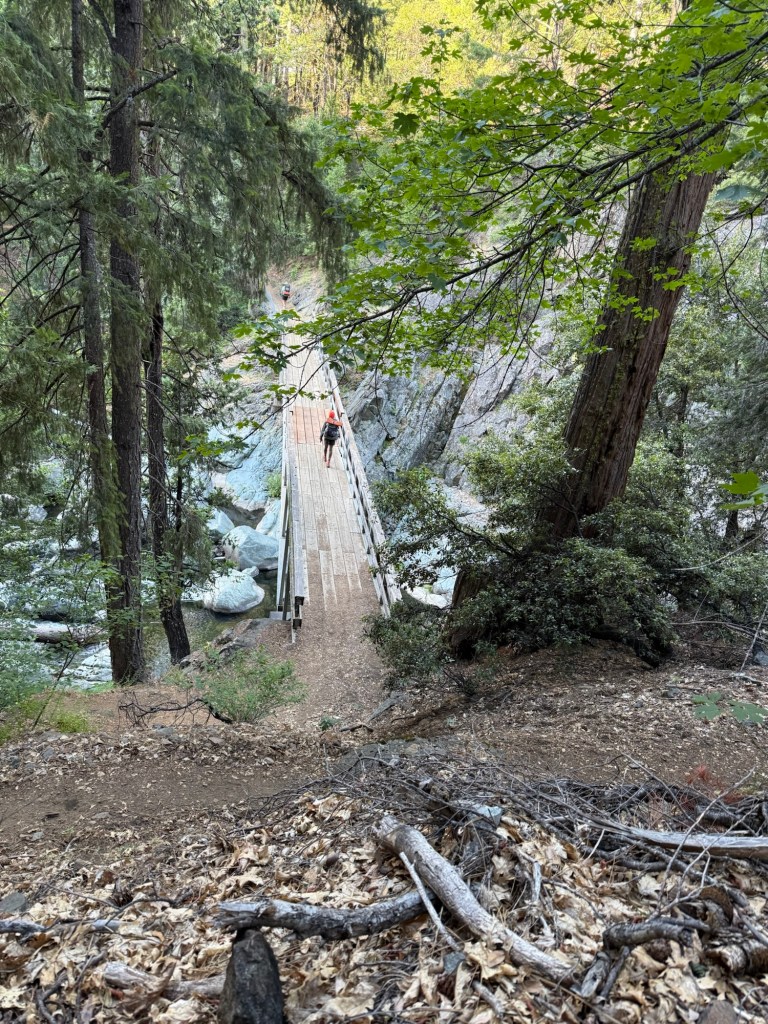
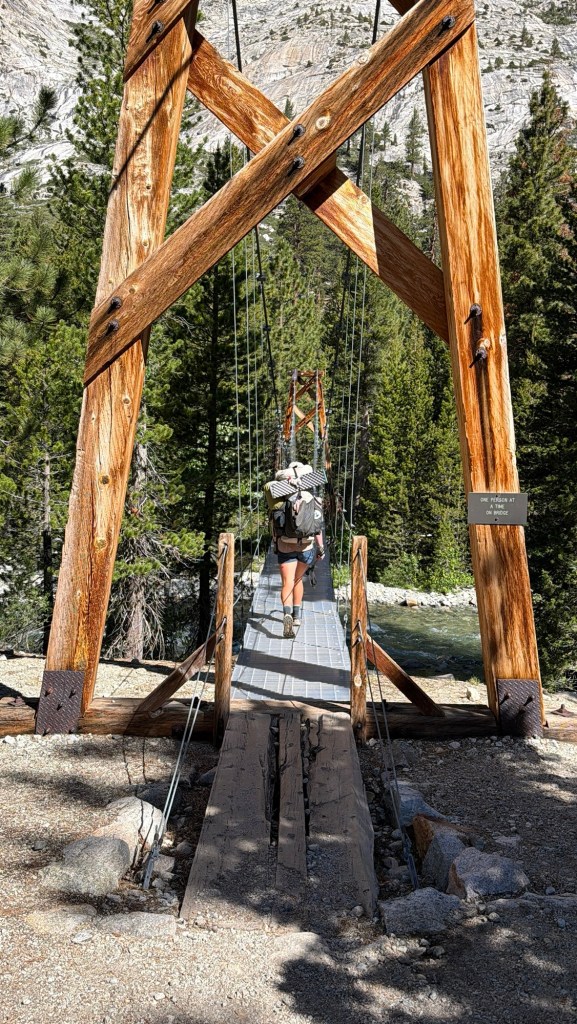
Code crossing the bridge
Sierra City is only 1.5 miles off trail. But of course, none of us wanted to walk it. The road is not heavily traveled, especially at 8:00am on a Tuesday, so we started walking. Eventually, only half a mile out of town, we lucked out and got picked up by a sprinter van, easily accommodating all 4 of us.
Sierra City is a cute tiny little town that has a country store, post office, and breakfast burritos. All a hungry hiker needs. I sent a small box there for resupply after hearing the store has limited stock. Well, they were wrong. The store, albeit expensive, was fully stocked with everything a hiker would need. Oh well.
I loaded up on a 3lb burrito (Code and I were the only ones to finish the whole thing) and a milkshake. I offset the weight in my belly by offloading weight in my pack. I happily sent home my bear can, some clothes, and microspikes. All in all, it saved me about 4lbs off my back.
All in all we spent about 3 hours in town. But alas, there were miles to conquer and we had to depart. Absolutely refusing to walk back to trail, we stood on the side of the road with thumbs out. Within minutes we were picked up by Vive and dropped off to trail, where we ran into Silver and Icelandic Poker. Great timing for them cause they caught the ride back into town with Vive.
With an exceedingly full belly, I was not at all ready for the huge climb waiting for me. I had been anticipating this climb for 2 days. All the comments made it sound heinous. At 8 miles and 3500’ elevation gain, I knew I’d done worse. But the FarOut comments claimed it was fully exposed, nothing but rocks/slate, and vegetation that scratched up legs. Well, the first 3.5 miles were great. Shaded and in the trees, I wondered what the next 4.5 miles had in store. As we were coming out of the trees we surely were exposed, we could see right down 1000’ to Sierra City. And there it was, the 1200 mile sign. The miles certainly are coming faster and easier, just like I hoped and planned for. I can’t keep dilly dallying, I need to get home to my dog!
Woke up excited for a town day. It’s funny how getting back into civilization is so motivating, but once in town the only thing to think about is getting back to trail. But for this morning, it was nothing but excitement.
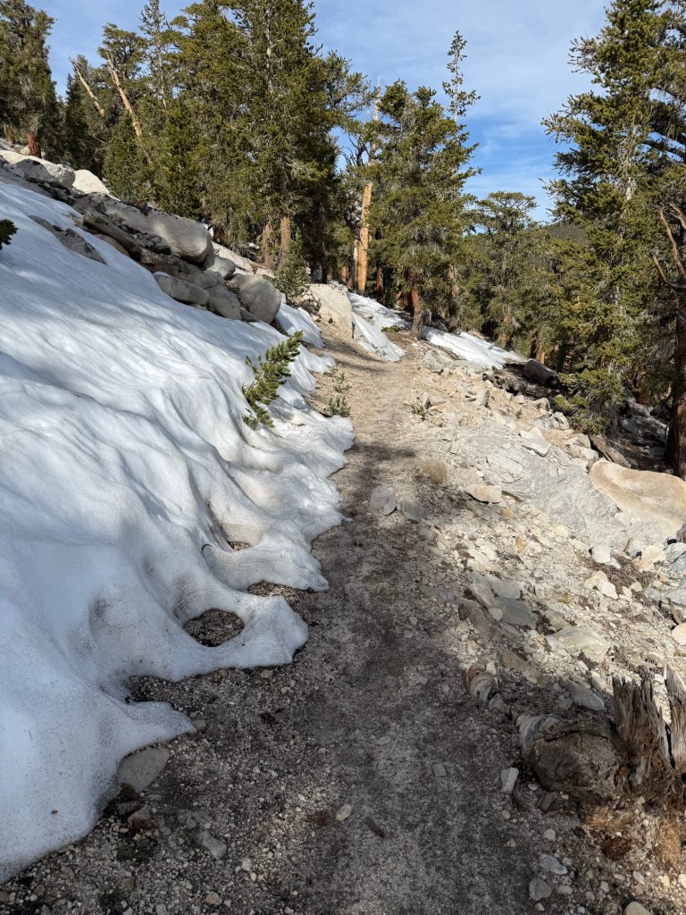
What wasn’t exciting, though, was the elevation map showing a long and significant climb. The last few days have only served to traumatize me to any semblance of a climb. I instantly think it’s going to be steep up and even steeper down. I cannot handle any more of that nonsense. Thankfully for me, it was one of my favorite climbs yet. It was exposed, it had views, the grade was gentle, I could see where the trail was going the entire time. I was in heaven.
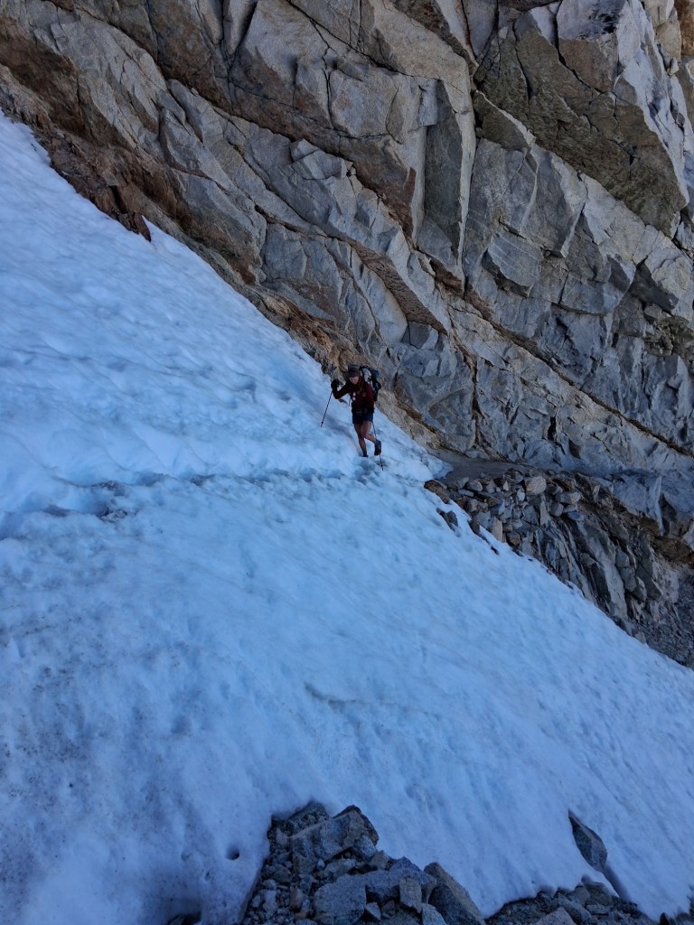
It was pretty sudden how quickly the mountains changed. From Sierra shaped peaks to what looked like the Grand Canyon. It was stunning. What wasn’t so stunning was the snowfields coming down. Just when I thought we were done with them, they show back up. After the most joyful glissade was when the real trouble started. The move down the ice was slow and frustrating. At one point my left foot slipped causing it to bend in a way it shouldn’t, likely leading to a strain. That on top of tendinitis I was in rough shape!
But finally we made it down to the parking lot just in time to catch the 2:30 shuttle to Kennedy Meadows North (no relation to KMS). We had no idea our plan, but knew we wanted to stop at KMN for burgers (in David’s case a birthday burger!) and hitch into Pinecrest for a stay with trail angel Cookies. We just didn’t know that KMN was a mile into a very unused road, which complicated the hitch. But all that could be figured out after burgers.
Bear was my van mate!
We chowed down and soon it was 5pm… if we were going by to hitch, now was the time. Wanting to avoid the mile walk back to the main road, we just roamed around the parking lot looking like lost puppies. I asked an older couple if they could give us a ride to Pinecrest (they said they were headed that way) but didn’t have enough room for our packs. Would I love to ditch it? Sure, but unfortunately it’s stuck with me. I thanked them, but heard someone yell out to me “I can get you there!” Thankfully Jasmine heard my pleas for help and offered us a ride with her mom, Nicole.
Pinecrest is a haul to get to, nearly an hour, but anything I’ve read said it’s worth the detour. After a great ride, we were dropped off right at Cookies’ doorstep in a gorgeous lake town that reminded me of the Poconos. I knew instantly I made the right decision. It felt like home, so comfortable. We saw new and old faces, around 6 of us are staying the night. Cookies is making dinner complete with dessert – what a treat!
Day 69: June 23; Zero in Pinecrest
It was never in the plan to have a zero in Pinecrest, but once we settled in last night we knew it was going to happen. It’s truly such a wonderful town and Cookies is so welcoming that there was no getting back on trail today. Plus we’re lining up to enter South Lake Tahoe, a notoriously expensive town, on the weekend. Why spend money in town when we can just truly relax here? It was a lazy day, which was perfectly fine given my left foot is a mess from suspected tendinitis and newly acquired sprain from yesterday. The only walking that was done was to the store for an expensive (and half expired) resupply and to the lake for a swim.
We hung out with Andy and caught up with Oats. Andy is from Germany and we first met him at KMS with his friend Code (who showed up later today). They were on their 9th day there waiting for packages to arrive, obviously itching to get into the Sierra. We’ve seen them a few times since then, which is always a treat since they are so friendly and great to have conversations with. Andy had a tool to convert fuel from can to can, so he filled mine up and now I don’t have to go back to KMN for gas! I also learned that the show Yellowstone is extremely popular in Germany. So much so, in fact, that Andy is skipping ahead to Oregon after South Lake Tahoe so he can finish the trail early and visit is favorite state – Montana. He has tickets already to see Dutton Ranch and he can’t wait. Even Code (who is from Canada) agrees that Montana is his favorite state (not related to the show). I found it so interesting that foreigners love Montana… meanwhile I don’t think too many Americans could even find it on a map.
Having some free time at the lake was wonderful and relaxing. I spent a lot of time watching a goose with one foot. At first I was so sad for it – it was limping around slowly and other geese were avoiding it. But after watching some more I found that the goose had so much resilience and tenacity… a goose after my own heart. I soon saw that I was not the only one enamored by this one footed goose. Everyone around me was watching it too, fascinated by how it was moving, not even fazed at all about its lack of a foot. Animals are amazing in that way – I see it every day at home with my own pirate crew! I asked Cookies that night if he knew this goose. Of course he did – the goose is basically a local celebrity. I hope it has a long and happy life.
After a nice dinner with everyone we went to the lake for one last look. What a special place.
Day 70: June 24; 18.5 miles
A place like Pinecrest is hard to leave. It was such a friendly little town whose atmosphere was nothing but inviting. And with such a gracious host as Cookies, it’s easy to see how people get vortexed in places like these. But, the trail is always calling and I don’t want to lose the forward progress we’ve been making the past few hundred miles.
I was pretty concerned about the hitch back to trail, considering we were an hour away from where we got off. But Cookie reassured me that anyone going east has to go over the pass considering there is nothing between here and there. Fair point. And he was right, in less than half an hour we got a ride. Bill and Bea are in the area to pick up their granddaughter’s boyfriend from the trail. They were so excited to be trail angels for the first time to us, and we were pretty excited to not have to wait on the side of the road any longer! Relatively local, the two of them have traveled all over the world and the country. They are coming up on their 50th anniversary and will be celebrating it in Denmark, Bea’s home country. It was wonderful hearing their story and sharing ours. It made the car ride fly by.
After dropping us off, it was time to get back on trail. The day off did my body good. My legs no longer protested during climbs and my shin and tendinitis were all but gone. The only thing bothering me was my foot. It’s been a theme of this trip. Once one thing feels good, another ache is quick to replace it. Speaking of replacing, I cannot wait to get into South Lake Tahoe to go to a proper gear shop. My socks have so many holes they’re officially useless and my shoes are falling apart! Andy and Code have the same brand of shoes as I do, and after 300 miles both of theirs blew apart (but they’re still wearing them!). Mine have at least lasted me 500 miles, but they are so unbelievably uncomfortable because they’re past their lifespan. But, apparently holes are contagious, because my right shoe blew out the exact same place as theirs! I couldn’t believe the timing. They only have to last 56 more miles, I think they’re up for the challenge.
The day itself was not hard. It was still a lot of climbing, but I wouldn’t call it steep. I felt refreshed and ready for it. The plan was originally ~15 miles since we didn’t get to the trail until 11am. But seeing a nearly 9 mile water carry, we didn’t want to dry camp. So an additional few miles it was!
The wildflowers are in full bloom here. It’s stunning all the colors – yellow, pink, red, purple, and green all over. The scenery was okay, but the flowers really put it over the top.
We got into camp at 7:30pm, plenty of sunlight to make camp and dinner. It’s pretty quiet here, but the wind is making sure it’s not too quiet. I just hope it dies down – it’s cold up here!
Day 71: June 25; 27 miles
Woke up with a slight chill in the air, but nothing a hot cup of coffee couldn’t fix. I slept really well, but my body didn’t feel ready to move quite yet. Well, that’s too bad. By 6:30am I was moving ready for a 25 mile day.
The scenery itself was nondescript aside from some really cool rock formations. We’re definitely out of the Sierra, the climbs are manageable and the views aren’t as epic.
As we were approaching a paved road, we thought we might run into trail magic. A quick farout check revealed that there had been trail magic! For the last two days. And tomorrow. No luck for today. Highly disappointed, we trekked on. At our lunch break, I ran into a familiar face. I was shocked to see Grant, an instagram influencer I follow. He hiked the trail last year, his daily videos launching him into PCT fame. He and his girlfriend, Courtney, decided to come back out and tackle the trail again. They started in early May, so I never expected to run into them. His videos convinced me that hiking the PCT is manageable and fun, they’re a big reason why I’m out here right now. So while I didn’t feel like I was talking with a celebrity, I did kind of feel like I was meeting someone inspiring. All that to say they understood our disappointment in just missing the trail magic, but told us that there was trail magic just ahead…. In 13 miles.
After doing 14 miles and it being 1pm already, I wasn’t sure I was up for the challenge but it’s amazing how the possibility of really good trail magic can be a huge motivator. As my old high school track coach would yell incessantly, “head down and drive!” I took this cheer to heart and did just that.
I found myself at a great trail magic set up by Stone by 5:15pm – a new record. Stone hiked the JMT last year and wanted to give back to the hiking community. He has been here for the last 4 days and was starting to run out of food. But I enjoyed a grilled cheese, cereal, veggie burger, and rice bowl. So in terms of food, he still had plenty.
We’re camping at the trail magic spot, I refused to go even a mile farther. Today wasn’t terribly long and gave me confidence that I can start shooting for 30 miles days in the near future.
Day 72: June 26; 25 Miles
Yesterday a day hiker told us that in the next two days temps were going to drop and snow was likely. He recommended staying in South Lake Tahoe for a zero until it passes. We thought he worked for SLT board of tourism and was looking to get some hiker cash in the economy. But as I went to bed, I felt a cold wind come through and saw clouds overcome the stars. Shoot, I was sleeping without a fly. I hope it doesn’t decide to snow at midnight.
Well the wind started howling and went all night, but no precipitation though I did wake up to mean looking clouds. Surely it won’t snow at the end of June… right?!
We were off and soon fully enveloped in dark gray clouds. The wind was howling to the point it was blowing me all over the place. I was up high on a ridge and fully exposed. One sudden gust and boom, I was 1000’ down in a lake. A very beautiful lake, I may add. I would’ve taken a picture, but I am positive the wind would’ve launched it right out of my hand. I now know that wind gusts today were clocked at 70-80 MPH. I believe it. It was hours of being battered. The only other time I experienced worse wind was on the climb up Mt. Washington where I literally had to crawl a short section because the wind would just knock me down. At least I stayed upright today.
Then the sleet started. Imagine being sandblasted by tiny shards of ice. With the aggressive wind, that’s exactly what was happening. It was like being stuck in a sandstorm, absolute torture. Then, atop Carson Pass, was when it happened. Snow. I kid you not, on this day June 26, it snowed. I couldn’t believe it. It wasn’t a blizzard, but big flakes of snow were being whipped around atop that mountain in just the same fashion as me.
Coming down off the pass we came across a visitor center that had trail magic offered by volunteers who work there. They were so kind and generous. Plus it was the perfect lunch spot to try and wait out some of the rain. But boy was it cold. Already wet, at 45 degrees I was full blown shivering. It was almost necessary to get out and keep walking to prevent chills.
It rained on and off the whole rest of the afternoon, wind still participating to its fullest. It was frustrating, but you can’t have good weather all the time. Eventually I found myself back on the Tahoe Rim Trail. I set out to do this trail with Addie back in 2021. I overestimated Addie’s abilities and ultimately had to bail her out – causing her so much trauma that to this day the sight of her little doggy backpack causes her to cower. But she is resilient and fully recovered (maybe not mentally). It was odd being back, none of the miles on it so far feel familiar. I think I was in such a panic headspace that I didn’t pay much attention the first time around. We’ll be on it for a bit longer, so maybe Desolation Wilderness will jog my memory.
We are only 5 miles from SLT and plan on getting there early tomorrow. We could’ve gotten there today, but it’s an expensive town and I want to spend as little money as possible. There are trail angels who will host us for free, so we’re gonna try that tomorrow. One of the most well known ultra marathons (Western States) is in town this weekend, so I’m sure that’ll just make it even more of a madhouse.
The rain seems to have stopped, for now, but I’m not convinced it won’t be back later tonight. So I’m sitting dry and a little chilly in my tent with the fly on, flapping violently in the wind.
Day 73: June 27; 3.5 miles
The wind was blowing all night but it didn’t seem to bother me, I slept great. With an incredibly short day and 8:30am pick up, there was no rush to get up and moving.
The hike went quickly and soon we found ourselves at Hwy 50 with Gordito waiting there for us. A South Lake Tahoe trail angel, we got his info through FarOut and he was gracious enough to not only pick us up but host us overnight as well.
On the TRT I only stopped into town to pick up a package, so I never really got to explore South Lake Tahoe. But today was the day and I was so excited to check it out!
After showering and throwing in laundry, I left for town in a very peculiar outfit. A lot of angels have loaner clothes so hikers have something to wear when their laundry is being done. I was given old basketball shorts and a tshirt 5 sizes too big. I think it was said best when someone compared me to Adam Sandler. I had nothing else to wear so out in public I went!
Having only the day in SLT, we had to be very focused on how to get everything done. First things first, though. I needed new shoes. My Topos had a hole so big my entire hand could fit through and my feet ached unbearably after 15 miles. It was time. I got new shoes and water filter at a gear shop that felt more like an REI. They had it all. After that it was time to eat before resupplying – never do that on an empty stomach.
Once all the chores were done we were able to have a relaxing afternoon by the lake. It’s still windy and a bit brisk, but the sun was shining making for a great beach day.
Contrary to popular belief, this shirt is not pro-communism, it’s in fact the flag of Thailand.
We got back to Gorditos around dinner time where we met Tea Time from Germany and Alligator from Italy. We hung out for a while until it was bedtime, 9pm sharp.
Day 74: June 28; 19.2 miles
I never sleep well in town. I sleep so much better wrapped up in a sleeping bag in the middle of the wilderness. This night was of no exception. After a restless night it was time to get up and hit trail. Gordito made a wonderful pancake breakfast and was nice enough to drop us back off at trail. A “semi-retired” high school math teacher and state champ cross country coach, he can add a great trail angel to his resume.
As always, it’s hard getting back into the groove of things. After a quick walk and long break at the Echo Lake Chalet, it was off to enter Desolation Wilderness.
I had a bad time here in 2021. The mosquitoes were awful and I missed Addie so much. It was during this section I decided I wasn’t going to complete the Tahoe Rim Trail, I needed to get my dog and go home. I still think about doing that on this trail, but haven’t given in to the temptation just yet.
It was a beautiful walk around Echo Lake, fantasizing about having enough money to stay in any of the lovely cabins lining its shore – accessible only by boat. But alas that was short lived and into desolation wilderness we went – marked by its abundance of rock and shale. Just about the worst thing to walk on. I’m on the fence about my new shoes. I went from Brooks to Topos to now Altras. I seem to be slipping a lot in them, hopefully tying the laces differently will help.
We had lunch at the 1100 mile marker sign that happened to be right at the beautiful Aloha Lake. Infested with mosquitoes the last time I was there, I was so thrilled at the lack of the bloodsuckers this time around. I could stop and enjoy both lunch and the lake without being pop inundated with the bzzzzzers.
1100 miles in the books. So close to half way! Just wish Oregon was a little closer, I’m ready to get out of California.
After hitting 900 miles it was a cruisy 3.5 mile off trail walk to Horseshoe Lake. Normally we’d walk to Red’s Meadow Resort, which is right on trail, and catch a shuttle into Mammoth. Just my luck, the resort is only open on weekends this season because of road work during the week. So it adds another 7 mile detour to the trip.
When coming down the trail we talked to so many locals enjoying the beautiful day and the beautiful McCloud Lake. So many people were curious about our journey. We even received some trail magic from Kim, who just dropped off her son and ex husband off to the trail.
We got a ride into town with Jolene and her dad. They dropped us off at the brewery where we experienced more trail magic. Jeff just finished a hike with his daughter when they saw us roll in. After asking a few questions he bought us lunch – a delicious burger and fries. It was truly a blessing.
After lunch we mosied around town. Last time I was here Mammoth was buried in a blanket of smoke. It was nice being able to actually see the mountains this time. We ran into Birdmaster and a few other familiar faces before checking into a motel that really is more like an apartment. After watching a bit of Survivor, it was off to bed.
Day 63: June 17; Zero in Mammoth
In an effort to rest my shin in preparation for more miles, I took this rest day extremely seriously. I barely did any walking – just the bare minimum. It looks okay, still hurts, but I’m confident it’ll slowly get better. I’m pretty sure I bruised my tibia. It’s often said a bone bruise can hurt worse than a fracture. With all the broken bones I’ve had, I can’t be too sure that’s true.
With a lazy resupply (I’m going to definitely be hungry this next stretch) and a delicious lunch, the rest of the day was spent planning and catching up on other duties (like this very blog). It was an early bedtime in anticipation for getting back on trail.
Day 64: June 18; 17 miles + 3.5 bonus miles
Once again, it’s so difficult getting back on trail after a zero day. The first shuttle to trail wasn’t until 9am so it wasn’t a rush to get going. I love Mammoth and wish I could’ve spent more time there, but alas it’s not feasible.
The rest day did some good with the shin, I’d say it’s at least 50% better than a few days ago. I’ll take any progress!
We got to the trailhead and were met with trail magic. It was an assortment of burritos and donuts. After just having a lot of town food and having a low appetite to begin with, I forwent the food and settled for a Capri Sun, memories of grade school flooding back with every sip.
The trial today was brutal. Not because of climbs, not because of ice, and certainly not because of lack of views. I had no energy. Plus the pack was extremely uncomfortable. The bear can was pressing firmly against my back and my hip belt can’t get any tighter, so it’s just bears down on my hips, my right one in particular getting the brunt of it. I probably complained more today than I have all trail.
The one positive was a gorgeous view of Shadow Lake. The PCT and JMT split during this stretch, with the PCT going higher in elevation through Agnew Meadows. Though the JMT passes through Shadow Lake, seeing it from further away at a higher vantage point was truly breathtaking. The lake with mountains in the background with dark clouds surrounding it all was truly dramatic and impressive. I couldn’t stop looking. It may be my favorite view this whole trail. Okay maybe second – nothing can ever beat the north face of Forester.
Speaking of those dark clouds. They boomed with thunder and dropped just a little rain on us. Which was welcome given how hot and humid it was. Doing some of those climbs fully exposed to the sun would not have been enjoyable at all, not that they were anyways.
Eventually, hobbling from fatigue and some pain, we made it to 1000 Island Lake. I blew past it in 2018 and was excited to camp here now. It’s stunning with another dramatic view of Banner Peak commanding attention.
The sun never made it out from the clouds, which didn’t really matter because we got here so late. Exhausted, I refused to set up my tent or stove. Cold dinner and cowboy camping it is! While eating, a JMTer Jessie came over to talk with us. As we were chatting, she looked over at me and what I was eating, eating, “that is the most PCT thing I’ve seen on trail yet”. I was eating Cheerios that I was dunking into canned frosting. I didn’t think twice about what I was eating – it’s high in calories and easy, and what’s not to love about canned frosting?! I guess when you’ve been out here 64 days, you start to forget what’s normal and devolve into whatever gets you through the day, which today was Cheerios and canned frosting.
Cowboy camping may end up biting me later… though it stopped raining hours ago, dark gloomy clouds are rolling in as I type. I pray I won’t be awoken by rain drops at midnight!
Day 65: June 19; 26 Miles
Well, it didn’t rain, but it may as well have. Woke up in the middle of the night to find my sleeping bag absolutely soaked from condensation. Dripping wet. But the good thing about my sleeping bag is it holds heat amazingly, even when wet. So I figured it was the morning’s problem and went back to sleep – after staring at the stars for a few brief moments.
Packed up the soaking wet bag and went onward at 6:18am on the dot. Because of camping restrictions, we knew we were in for a doozy of a day. We cruised over the speed bump known as Island Pass on our way to conquer Donahue Pass and enter Yosemite National Park.
Circa 2018 – I made this same face today when crossing Island Pass. Hardly a pass at all!
In 2018 I couldn’t see anything on the top of Donahue. The whole basin was filled with smoke. But today I got to see it in all its glory, complete with more snow navigation on the descent, which was quite a doozy. My shin does feel less painful, though I know it’s not loving these long mile days.
2018 vs today!
After finally getting down Donahue, it was 8.8 miles in Lyell Canyon to Tuolemene Meadows. Those miles were at least flat, but they kept going, and going, and going. They were so annoying and boring that even with a quick dip in the river, I was going crazy. But finally, we made it to the very crowded Tuolemene Meadows. This is where I ended my 2018 JMT experience, crying in disappointment. Today was a much different feeling. I conquered the high Sierra and was ready to move forward on the PCT.
After burgers, fries, and a milkshake, it was time to depart. Already 5:30pm, we had 6.1 miles to go to a campground outside of the restricted camping zone. My feet hurt, shin was angry, and I was just plain tired, but it was what it was. 6 miles really isn’t that much in the grand scheme of things.
Drinking directly from Soda Springs. A PCT challenge I could never even think to attempt.
And they were pretty awesome miles. Most people explore Yosemite Valley to catch glimpses of El Capitan or Half Dome. It was such a privilege to see the rivers, meadows, mountains, and waterfalls in Yosemite’s backcountry.
One of the many waterfalls
We got to the campsite at 7:30pm, but didn’t actually find a suitable spot until 8pm. Given that it’s the first available camping from Tuolemene, it’s understandably packed. And we’re certainly not the last ones to arrive. At 9:30pm currently, people are still walking in looking for a space. But I’m pooped. After a dinner of half a pita, some canned frosting, couple bites of cheese, and a fruit rollup, its eyes shut time for me.
Day 66: June 20; 25 miles
It has been a few days since this fateful day has ended, so I feel less traumatized writing about the sequence of events that led to my worst day on trail yet.
I went to bed with an uneasy feeling about where we were camping. Deep in the woods, it felt dark and heavy. I had a horrible nightmare this night in which all of my animals were ripped one by one from my arms in huge tsunami waves. I’m sure it had a lot to do with the fact I was camping very close to a large very loud waterfall, but let’s just say the day did not start off on the right foot.
The day was nothing but climbing and descending heavily steep grades. It was unbelievable. Going up Benson Pass was the worst yet. I had many moments where I cried, I was physically and emotionally drained and just wanted to sleep. I have never thought about quitting more than I did this day. But I knew these days were going to happen and it was simply a matter of just getting through it.
The day meagered on. And on. And on. After getting to the top of Benson Pass, it was still a number of miles to the intended camp, Benson Lake. I was recommended this spot by many people, referring to it as the Riviera of the Sierra. I was excited to check it out, but by the time I got over Benson Pass, I couldn’t be motivated to even care about any kind of lake, as gorgeous as it may be.
Full concentration to not fall in
Finally, we were half a mile from the lake. My feet were killing me, desperate for a new pair of shoes. I could not wait to throw down my pack and call it quits for the day. That’s when we descended into the 7th circle of hell. Down and down we went into a full forest full of hungry mosquitoes. They were rampant, and of course the trail was nothing but confusing water crossings. We spent well over half an hour navigating the crossings and trying not to lose all our blood to the mosquitoes. In the panic of trying to get away and not fall into the river during a harrowing crossing, I lost my sunglasses in the process. It was a worthy sacrifice to get out.
Eventually the idea of going half a mile off trail to Benson Lake was thrown into the trash in the effort of trying to get away from the mosquitoes. We climbed out a couple hundred feet to where the infestation was at least half of what it was in the pit. It was 8pm and we had been hiking for nearly 14 hours. I was so done with the day and spent the rest of the short night seeking refuge in my tent. I was too tired to cook dinner so tuna packet it was. The end of a day, I was ready to put it behind me and move on.
Day 67: June 21; 25.5 miles
With the trauma of yesterday worn off, it was a new day. I even had a dream that all my animals were happy and healthy. I felt good and ready to take on the day… until, that is, I got a garmin message that neither of my cats had eaten a morsel of food for two days. I went into instant panic mode, thinking the worst, as usual. I started to plan how I’d get back home if things took a turn for the worst and how I’d get back to trail.
With tears and constant thought, I was in autopilot mode. There were three very steep climbs that I know were bad, and were bad in the moment, but the thought of my cats suffering distracted me from it all. I was so happy to hear that they were fine – no infections, no kidney failure, just two cats being cats. Who knows why they do the things they do. But let’s just say I have saints for parents who are handling all of my animal messes.
A thought I did have during those climbs was that of Sisyphus, a figure in Greek mythology who was condemned to roll a boulder up an extremely steep hill for all eternity. Once he neared the top of the climb, the boulder would roll back down, forcing him to start all over. Going up steep climbs to come back down even steeper descents only to climb back up, I thought I was suffering his same fate. It felt like eternity and that maybe I had been condemned, but at least every time I looked at the map it was forward progression towards Canada.
After all the steep climbing, it was 10 miles of gradual climbing to Dorothy Lake, our original stop. The climb was actually wonderful compared to the last 2 days of nonsense steepness. Although, I did have another tumble and bashed my knee, just more scars to commemorate the trip. There was rumor that there was one spot just 2 miles ahead with great reception. Wanting to hear that the cats were indeed okay from my parents as well as wanting to wish my dad a happy Father’s Day through phone pushed me those extra few miles.
We are 0.3 miles from the 1000 mile maker, so I’m just including it now. I think after doing 100 miles in 4.5 days it’s earned. I am so grateful to have gotten this far. 1000 miles is a huge accomplishment for me. These past 100 miles really made me question what I was doing out here. With the steepness, long days, river crossings, constantly wet feet, and mosquitoes, it’s been the roughest 100 miles yet. But with the bad comes the good and I know more good things are coming.
After descending 7 miles, we made it to the Woods Creek suspension bridge. I camped here in 2018, in which I was snuck up upon by a bear. Luckily we didn’t stick around long enough for a replay.
An engineering marvel
After crossing the bridge it was time for a major ascent up Pinchot Pass. 4000’ in 7.5 miles… no biggie. Which is how it started. We had a gushing waterfall to distract us for the first 3 miles. There were unfortunately a ton of water crossings that did get a little dodgy. Because of the early snowmelt, these crossings are way higher and more aggressive when compared to later in the season. The waterfall we were walking by was about 3x stronger than it was in 2018. People have died crossing these streams. The current is so strong that one misplaced step can lead to quick danger. With a 30+lb bag on your back you can imagine all the things that could go wrong. I do not want to be another victim, so I cross with extreme caution.
The roar was deafening
Once we diverged from the waterfall things changed. I do not remember Pinchot Pass being this horrendous. It was so steep my legs were screaming. On top of that I was bonking, but had no food left. Well I have food, plenty of it, it was just buried at the bottom of my bag. And on top of that there were plenty of snowbanks to cross. After the last few days, I really felt it. I was mentally and physically exhausted. I wasn’t anywhere near to throwing in the towel, but darn did it sound nice. Eventually I made it to the top, where I had a bit of a cry fest. When I get into feelings like this, I really start to miss my dog. I wasn’t crying about having a horrible day, I was sobbing because I didn’t have my dog with me. My comfort for the last 11 years, I just wanted to hug her and kiss her on her nose. But she’s in great hands at home and I’ll get to do just that once I complete this quest.
I was sobbing moments before this picture
Coming down Pinchot we had a familiar view of Lake Marjorie. While taking a picture of it, I had an unfortunate accident. I rolled my ankle, as usual, and went down hard. This happens often. I have weak ankles, always have, and roll them constantly. My body at this point responds by going completely limp to protect that joint. This time didn’t go in my favor – I landed on some very very sharp rocks. Somehow the lower part of my shin got the brunt of it. At first I laughed, how could this day get any worse? And I realized just then that it was about to. I looked at the damage and was shocked by how horrible it looked and how quickly it was getting worse. I completely sheared the skin off from about 4 inches of my lower shin. It was hanging limp as the blood had a delayed response. I saw shining bright white, my brain instantly thinking it’s bone. It’s bone! Oh my god – I was in trouble. Soon blood poured out, I needed to take care of this, but in my shocked state I didn’t find it urgent. I casually got up, I’ll take care of it once I catch up to David. And when I did I told him, “I hurt myself again. This might be serious” and when I looked down I did see that it was serious, the shock wore off and soon panic set it. I got out my first aid kit (seriously, I haven’t needed it ever before this trip. Now it’s seeing daily use) and tried to see what I could use to fix it. Running low on supplies, the only thing I could do was use an alcohol wipe to clean it and wrap it in a gauze pad with neosporin. I nearly passed out cleaning it (no clue if I truly did see bone) but got it together to get it as taken care of as possible. I think it looks worse than it is. Another scar to commemorate this trip!
The picture that caused it all.
It hurt a lot, each step sending a jolt in my shin. But I knew it wasn’t an emergency. Just gotta keep it clean. Out here in the wilderness that should be a piece of cake – ha!
I thought we’d be able to make sure that happened, but then realized we had 5 major creek crossings coming up. I did not want to get this ankle wet. I was successful for the first 4. I used a smell proof odor bag (not so odor free now) to keep it dry. Coming up to just below my knee, I did a decent job making sure no water got in. That all changed with the last crossing. It was so intense and gushing that there was no way I could keep my streak going. I crossed at the lowest part and still had water up to my upper thighs. My hard work ruined.
Great in theory, failure in practice
We cut the day a little short. At 6:00pm we realized we had been walking for just under 12 hours. I for one was beat – quite literally. So we set up camp just a few miles from Mather Pass, which is so much more gentle than Pinchot, but appears to be holding onto a lot of snow. Crossing early is recommended so we won’t have a problem doing that.
Day 58: June 12; 22.4 miles
I’m so happy I didn’t invest in a new sleeping bag. I have been so warm at night that blowing all that money on a warmer bag would’ve been for nothing. Now I can really eye up a new pack!
We woke up early to get over dreaded Mather Pass. The reports all complained of snow and ice impeding travel. I’m really getting annoyed by this snow. Getting up the pass wasn’t difficult, and boy did it flood back memories. It’s funny how being back here I don’t remember much of anything from 2018, but passing by nondescript sections of the trail bring back a memory like it was yesterday. The daunting approach to Mather did just that. I wish I could forget coming down off of it today. It had route finding, it had snow banks, it had scree scrambling, it had everything I hate about coming down from a pass. At one point I was literally rock climbing down, looking for hand and foot placements so I wouldn’t tumble off the mountain. I was more than thrilled to be off that pass.
My shin looks a lot better than it did yesterday. The goal is to just keep it dry and clean.
If you zoom in, you can see the shin horror show.
Hard to do with all the alpine lakes begging to be swam in. I did take a quick dip, it was chilling to the bone, so I didn’t dunk my head under. It was refreshing in the afternoon sun.
The rest of the day was a slog. After such an intense morning, the afternoons always tend to be rough. The mental and physical toll these icy passes take on me is horrendous. Your mind has to be constantly firing – strategizing each foot placement, thinking five steps ahead, figuring out the safest and most effective way to bypass a large snow field. Physically, every muscle is firing to keep you from sliding down a mountain or a rock pile. It adds up quickly and just plain knocks me out. Plus it just takes such a long time to only go a few miles – it’s a lot. Yes, I’m complaining. And will continue to do so until I no longer have to deal with snow.
The meadows are amazing out here
We cut our day a little short after being told there were “25” other hikers ahead of us doing exactly what we were – going as high up Muir Pass (tomorrow’s venture) as possible. It’s known for holding onto snow and was reported to have 6 miles of snow/ice walking. Not wanting to walk in slush, the only way to do it is camp close to summit and go up and down early in the morning. Well with that amount of people ahead of us and already closing in on 6pm, we opted to go camp in the meadow, which is known to have an abundance of spaces.
It’s a great spot. Just as I was about to cook dinner, however, I noticed a tiny little chirping thing walking right over to us. I was overjoyed – it was a baby marmot! It was so unbelievably cute and coming right to us. I’ve never seen a baby marmot! And that’s when it hit me – you’re not supposed to see baby marmots. This guy was lost and tiny. He’s not supposed to be this far from nest or mama. I know that baby squirrels will come up to humans if they need help, it seems marmots follow the same protocol. Except there was nothing I could do to save this baby. There are no rescues out here, and I sure don’t carry rodent formula with me.
I knelt down by the shaking little guy – obviously cold with the setting sun. I put my hand out and he nestled right into it. I couldn’t help but pick him up. He just wanted warmth, and maybe a little comfort, and dang if he didn’t choose the right sucker. I looked around for his mama and even asked people camping nearby if they saw any marmots. Only the baby, they said, who they saw crawling around crying hours before we got there. This poor creature! I didn’t know what to do. He would die from cold during the night, and if he did make it, he’d just die from hunger/thirst. I theorized he wandered out of the nest or his mom rejected him. Either way his outlook was grim. The only thing I could do was keep him warm overnight. So I wrapped him up in my town shorts with a handwarmer and prayed that he’d at least know comfort and warmth over night. He nestled right in, calm and no longer crying.
Little Marmaduke
I, on the other hand, was bawling. This poor little creature just wants to survive, but nature has another idea. It’s just a fact of life, it’s cruel and heartbreaking.
Too tired from the day and marmot drama, I opted to cowboy camp, ready to get up early to tackle Muir Pass.
Day 59: June 13; 24.1 miles
Baby Marmot survived the night! I’m not sure if I’m happy or sad about that – the next sentences will highlight why. If he passed, he would’ve had a proper burial. I would’ve mourned his short life, but would find solace knowing it ended warm and with love. Having lived, I knew we’d have to say goodbye not knowing if he’d be okay. I can’t take him with me (I considered it), a pack is no place for him. As the sun was rising and it was time for us to leave, we made him a little nest and put him in it, trying to keep him warm until the sun did the job. Without food and water, he had little to no energy, but did put up a little fight. He clung to my hand, breaking my heart. I had to let him go, nature has to run its course.
Through tears I put on my wet and cold shoes and went on my way up Muir Pass. It was a rough one. The snow started a mile in, requiring more route finding and steep climbs up icy terrain.
Straight up.
After an hour or two, we made it up to the top, only 3 miles. Visited the cherished Muir Hut, which seems to have gotten a bit of a facelift since 2018.
Muir shut
Exhausted already, we had another 3 miles of snow walking down the pass. At least the bootpack was easy to follow and the grade was not steep. Though it was long, I’d take this over any other of the previous passes.
3 miles of this nonsense.
After conquering the pass, we took a dip in Evolution Creek. Only a few of us were brave enough to go under, somehow including me. It was enough to take my breath away. The half second I was under felt like an eternity. Water straight off snowmelt is unsurprisingly unbearably cold. But it does a good job of waking you up! We’ve been hiking on and off with Silver, who has made it a point to dip into just about every body of water he comes across on trail. I’m good with a rare dip here and there.
My shin has been acting up like crazy. I’m not sure if it has anything to do with the massacre, but it feels like I have horrible tendinitis just below the wound. Kent, an ER doctor, just happened to be on trail. He thinks I may have gotten some of my tendon on the fall, knicking it and now causing pain. I hope that’s not the case. He’s mostly worried about infection, but after taking a look at my left leg he noted that I obviously have a great immune system, seeing all the new scars I’ve acquired on the PCT.
The rest of the day was downhill, which I noticed absolutely kills my shin. This tracks with tendinitis, which I think I have because I need to roll down my socks to avoid the wound. My sensitive little ankles can’t tolerate compression – a big reason why I can’t wear boots with ankle support. I have to figure out how to make it all work because right now the pain is too much to push through, and I sure as heck don’t want to make it worse.
Best lunch stop yet.
After what felt like a century of a day, we made it to camp. Everyday out in the Sierra feels like 5, mainly because of the tough mornings dealing with snow. Thankfully, Muir seems to be the last of the passes still holding onto significant snow. I’ll be happy to say goodbye! I wish I could say the same about mosquitoes. It seems we’re entering the hatching season, it’s been so brutal. Today was the worst of it. Can’t even leave my tent because of the bloodsuckers! Which is really unfortunate because it’s a gorgeous sunset.
John Muir – the man of the Sierras
Day 60: June 13; 15.4 miles + 4.5 bonus miles
Woke up pretty darn refreshed. The temperature was perfect for sleeping. Slept in a little bit later because Seldon Pass was rumored to be snow free. Hallelujah!! Packed up quickly because the mosquitoes were already up and ready to annoy us.
The climb up the pass was my favorite yet. Relatively gentle with gorgeous lakes along the way made for an enjoyable ascent. The last time I was here I was completely alone. I remember stopping on the manzanita lined switchbacks just listening to the silence. There were no people, no birds, no planes. Just silence. Today was a different story, it was crowded and full of distractions. Both great experiences.
At the top we did see that there was some snow. Enough for a perfect glissade. After a quarter mile everything cleared up. I wish the same could be said about my shin. I’m fairly certain it’s tendinitis, the only thing that will help at this point is rest. But I don’t foresee that happening until Mammoth, 50 miles away. It’s not unbearable, just very painful on downhill descents. It slows me down considerably, frustrating me to no end.
Eventually we made it to Bear Ridge Junction. We were back and forth as to whether or not Vermillion Valley Resort (VVR) was worth the detour. VVR is widely considered a JMT and PCT staple. I skipped it in 2018 and told myself I’d stop this year to check it out. But what I thought was a 10+ mile detour didn’t sound pleasant. But after mapping it out on top of the pass with a number of other hikers, we saw it really only added 5 miles plus would cut off the next pass, miles I’ve already done. To me, this made it all worth it. So we took the detour and descended (well I hobbled) 3000’ to Edison Lake.
It was 4.5 miles to the lake and another 2.5 mile road walk to VVR. I was beat by the time I got to the lake. Already 4:30pm with dark clouds and booming thunder on my tail, I dreaded the road walk and was beginning to regret my decision. Was dinner and a free beer worth it? Lo and behold, I see a beautiful sight. Right there is a white pickup truck. David is standing with Adam, who apparently shuttles hikers back and forth from the trailhead. And just like that my hiking day is over! I was so happy.
And even happier still to see VVR in person. It’s a bit small, but feels a lot like KMS. It’s very hiker friendly and has enough for a small resupply to Mammoth. We hung out with a lot of folks, including local ranchers. We had a huge spaghetti dinner that honestly I could’ve eaten 5 more plates of. Apparently there is a UFC fight happening on the White House lawn tonight which is garnishing a lot of attention here. Watching it was a bit surreal, I think I’d like to go back to the wilderness and remain out of touch with some of this dystopia.
Day 61: June 15; 7.4 miles + 11.3 bonus miles
After a surprisingly decent sleep and a great breakfast, it was time to say goodbye to VVR. We headed out around 8am for the dreaded return back to trail. I say dreaded because it was a long trail with a lot of elevation gain. But all in all, it made more sense to go this way than from where we entered VVR. Think of the trails as a triangle. Maybe an acute one. Honestly, I don’t know much about geometry. My sophomore geometry class (honors, mind you) was so poorly behaved that the teacher quit and became a deacon. That should give some insight as to how much (or little) learning happened. Anyways, the bear ridge trail comes off of the PCT and takes you to VVR, the crux (?) of the triangle. Goodale Pass trail takes you north, cutting off several miles of the PCT. Having already hiked these miles, I didn’t mind skipping them to make for an easier escape. All in all, the VVR detour added 5 miles, worth it if you ask me.
Let me tell you, Goodale was not at all good. The first 4 miles were through a poorly maintained burn scar, requiring frequent navigation over or around huge blowdowns. The next 5.5 miles were tedious, varying from extremely steep climbs to flat marsh walking. It felt like hiking back home. Eventually we made it to the pass, and right when we thought we were done with snow, we met right back up to it. For 1.6 miles it was just navigating through snow and rock. This was especially difficult because the descent was steep without boot pack and several risky drop off points.
Just a casual cliff.
But soon we met back up to the PCT. As Enigma put it, it was like coming back home. I was so elated to be back on trail. I really don’t like these off trail miles. After the Sierra it should be less frequent. I’m already warming up my hitching thumb in anticipation!
The rest of the trail is a blur. There were several lakes, notably Virginia and Purple. We’re camping at Purple Lake, swarmed by mosquitoes. They have truly become the bane of my existence.
Tomorrow is town day! Even though VVR had great food and laundry, it’ll be so amazing to be back in town. It’s been almost a week since I’ve had a proper shower or had any service. Though I don’t especially miss it, I love being disconnected, it’ll be great to check in on family and friends and pets. It’s 10 miles to get to the junction to get into town, another 3.5 mile walk. Typically it’s more of a straight shot from Red’s Meadow Campground, where a shuttle takes you to Mammoth. Unfortunately, Reds isn’t open yet, forcing us to take this longer detour. Just more bonus miles!
Day 62: June 16;
One good thing about the exhausting days out here is that I sleep well. Extremely well. I’ve never slept as well in my tent as I have the past week. I blame all the snow and elevation gain (we’re literally climbing well over 5000’ daily). I’ll take the positives where I can get them! I woke up briefly and looked at the stars. They were gorgeous and I wanted to look longer, but I couldn’t keep my eyes open and it was back to snore city.
2 months on the trail! How crazy. It has gone by so quickly but also so slowly at the same time. Some of it is a blur, other moments replay constantly. And to have so much left in this journey!
Hit 900 miles, the past 100 have felt so quick. Probably because they have been. Hiking 20+ mile days out here adds up pretty quickly!
This picture exemplifies why the trail name “pig pen” was pitched for me.
It’s hard getting back on trail after a great few days. Kennedy Meadows South was definitely my favorite zero day yet. It was great being in such a hiker friendly environment full of support and understanding. But after a great breakfast, it was right back on the trail. A little later than usual mainly because I had to figure out how to put my bear can in my pack. But oddly enough, it fits perfectly and somehow makes my pack more condensed, though way heavier.
First day in the Sierra! But still felt so much like the desert. In fact, we had 2 rattlesnakes bid us farewell a little bit too close for comfort. But I’m fairly confident this should be the last we see of them for a while. Funnily enough, it’s also the first day we’ve seen the mascot of the Sierra, the marmot. It’s so strange seeing the two cohabitate, but I guess that’s what happens when two biodiversities collide.
We’re walking with Just Walking, a really nice guy from Maryland who’s sticking with us until at least Whitney. We talked with him last night and he said he was pretty nervous about summiting and was going to skip it entirely. We convinced him to at least give it a shot, especially since it’s such a low snow year. Seems to have done the trick, he seems pretty stoked to try it out.
Eventually the scenery changed into what I remember the Sierra being. Gorgeous meadows, water everywhere, and snowcapped mountains in the distance. We’re camping by a river with a lovely bridge, home to many swallows busy making nests. I sat there as I soaked my feet and watched them going back and forth from mud to bridge. It was fascinating watching them work.
Andrew met up with us pretty late. We had a bet going as to whether or not he was going to live up to his trail name and get vortexed at KMS or actually get on trail. It was a draw – he left way later than he planned, but did make it to trail!
Decided to cowboy camp, I have a feeling it’s going to be a cold one.
Day 48: June 2: 25.3 miles
Well, it was a cold one. One of the first times I have been actually cold sleeping on trail. Enough to keep me awake. Which now has me super concerned. If I’m this cold just under 8000’, what the heck is going to happen at 10k’+? I’m not scared of freezing to death, but I am scared of how bad sleep can affect every other aspect of performance out here. I want (well really need) a new pack, but now that I’m sleeping cold, I may have to switch the budget over for a 0 or 10 degree sleeping bag. I can deal with being uncomfortable during the day, but not at night. Luckily, Lone Pine has two gear shops that I’m hoping will have some in stock, and we’ll get there tomorrow.
We set out early for the day, freezing our butts off. We decided last night that we were going 25 miles, no biggie, but seeing as how we need to gain loads of elevation, we knew it was going to be a full day of climbing. Which started right from the first step. We had a 7.8 mile climb that went quickly but also so slowly at the same time. We were rewarded with a gorgeous downhill stretch that didn’t feel quite long enough before going back up.
We encountered our first taste of a Sierra staple – the dreaded mosquito. They’ve been at us everywhere today, including camp. Which is annoying because it’s a beautiful space, but we had to retreat to our tents to prevent getting attacked by the blood suckers. I hope they don’t stick around, but it seems we’ve arrived just in time for a huge hatch.
We hit 10,500’ elevation. I’ve been drinking water nonstop in an effort to prevent any attitude symptoms. The water plus the last 7 weeks of constant activity I think has effectively staved off any potential altitude issues. I just pray the same will be true for going up Mt. Whitney. It’s shocking to think that’s only a few days away.
We’re camping at 9,600’ so I’m expecting another cold night. At least this time I’m prepared, if only mentally.
Day 49: June 3; 8.5 + 4 bonus miles
Woke up to the sweet “cheeseburger” song of the mountain chickadee, a bird that I’ve come to really enjoy during the 7 past weeks out here. They have a three syllable song that is extremely distinctive. In my drowsy half awake state, it sounded like they were singing “Em-i-lie”, jolting me awake. I woke up rested and warm, truly shocking me. The temperature didn’t dip down too low, but I’m still fairly certain I’ll get a new bag in town. Another reason to wake up happy – it’s a town day! I’ve been to Lone Pine before, at the start of my 2018 John Muir Trail journey. Cut 20 miles short at Tuolomene Meadows for a major fire in Yosemite, I’m hoping this year won’t meet the same fate.
First snow encounter
The 8.5 miles to the junction were pretty but monotonous. It was mostly climbing, which I already know is going to be the theme of the Sierra. The junction of the PCT and Cottonwood Pass is where I started the JMT. As I approached the junction I felt an air of familiarity. My brain immediately recognized the rocks and the greenery. I felt a pit in my stomach. The last time I was here I was crying and puking, not sure if I’d even make it past the first day. I was sick as a dog with altitude sickness. It was one of my worst days on trail, but I persevered and had the trip of a lifetime. I knew the same fate wouldn’t befall me this time.
Atop Cottonwood Pass
We set out for the long descent down to Horseshoe Meadows. My body decided that it wasn’t going to be easy. The very first switchback down my ankle gave out, as it tends to do 472942x a day. But this time it was bad. I could tell instantly a decision had to be made – either suffer from a broken/sprained ankle or go down. Not wanting to be airlifted off the mountain, I opted to go down. Right on my left knee. All was fine, I wasn’t hurt, but dang that knee got banged up. All bloody and smashed, I continued on. My poor left leg has gotten so beat up on this trip. Just as all the old scabs turned into scars, it was only natural it was time to sport a brand new wound.
It was shocking how intense the descent was. Having already gone up it 8 years ago, I didn’t remember it being so drastic. I had no desire to go back up in 48 hours. But with the knowledge that I’d done it before plus another 10 miles, I knew I’d be okay. Happy about it? Nah, but I’d be just fine.
Already not looking forward to going back up
We met David’s dad in the parking lot of Horseshoe Meadows and high tailed it to Lone Pine. It’s crazy how the memories come rushing back. All the restaurants I’d been to before, the hostel, the gear shops – it was like I was just there yesterday. Lone Pine is a tiny town that basically is operational only because of its close access to Mt. Whitney. You could walk from one end to the other and back in less than 10 minutes, but its charm is undeniable. It’s comfortable and cozy with sweeping views of the Sierra, Mt. Whitney being front and center.
Day 50: June 4; Zero day in Lone Pine
Zero days are hardly relaxing, but I gotta say today’s was as much relaxing as it gets. Sure we did laundry, resupplied, and planned out a strategy for conquering Whitney and Forester Pass, but we managed to get in some fun too. Even though Lone Pine is a super small town, there’s still plenty to do.
After looking at the gear shop, I decided that I’ll have to suffer through the cold. They didn’t have a sleeping bag that would meet my needs, so it looks like I’m sticking with the one I have. I drowned my sorrows with a milkshake and sitting by the hotel’s pool. It’s about 97 degrees in town so a pool is a blessing.
Got to bed early after a Mexican dinner, ready to get back on trail in the morning.
Day 51: June 5; 10.2 + 4 bonus miles
I’m so excited to get back on trail. Lone Pine is truly a gem, but time is ticking and I’m anxious to get moving and deep into the Sierra. The debate of the day was whether to take an ice axe or risk transversing ice fields without it. Pros: it could save your life. Cons: it’s added weight and I don’t know how to use it and the snow is melting and even if there’s enough snow on Forester to justify it you’ll slide into the rocks and perish before you even have the chance to deploy it. Phew… looks like the cons win so moving on without the life saving equipment was deemed the wise choice.
Fully loaded with the bear can, we ventured onward back up Cottonwood Pass. Today I conquered it. No falling, no puking, no clutching the SAR in fear of impeding death. Was a tear shed? Maybe, if only because I was so happy none of that happened. I stayed on my feet and I had zero altitude issues.
It’s funny walking the same route I did 8 years ago. A lot of the JMT is seared into my brain. It feels so different now, almost a decade older and questionably wiser. I have learned so much from that trip that I still use daily all this time later. I’m proud of that person for getting out there and doing it, cause without her I wouldn’t be sitting on a log next to a creek typing this very sentence.
We made it to camp early enough to dip into said creek and dry off in the late afternoon sun. With so much time left, it was discussed to keep moving on, even all the way to Crabtree Meadows, the junction for Mt. Whitney. With only 5 miles it was easily doable, but this site is too perfect to give up. Besides, what’s the rush? We’re going up Mt. Whitney in two days, let’s enjoy the blessings we have now.
Day 52: June 6; 8ish miles
Woke up to a brisk morning. It got down to 32 degrees and I was a bit cold, but nothing that really bothered me or my sleep. Because we knew we had such a short day, we decided it was okay to sleep in. I slept until 6:20am which really surprised me – I must’ve really needed it!
The hike today was actually tough. Not because of climbs, not because of terrain, but mainly because my body is tired. I think the main culprit is the high altitude.
We got into Crabtree Meadow late morning with plenty of time to relax and set up. We set up camp right by a stream crossing which was beneficial in so much as we could talk to everyone coming off Mt. Whitney. We got mixed reviews, and just about everyone had an ice axe. Basically, from what I gathered, if you have microspikes and poles you’ll be totally fine. An ice axe was more for peace of mind. There are allegedly 3 “sketchy high risk” fall zones on the switchbacks and one large ice field to cross. Doesn’t sound horrible but also doesn’t sound fun. With good boot pack, though, I feel confident that leaving behind the ice axe wasn’t a critical error. One Australian girl gave me the most hope, however. She was adamant for us to not “believe the bulls-“ that other people were exaggerating, according to her. It was reassuring to hear such an honest down to earth reaction.
Whitney was obviously a big topic of the day. Everyone who summited today left at 11:30pm yesterday night. And they still didn’t make it in time for sunrise. Yikes. Because we want to see sunrise we decided on a 12am departure from Crabtree Meadows. That’s extremely early, but we’re guessing that the snow will slow things down.
We met Nightingale who attempted a thru hike last year but had to get off trail from injury. She started where she stopped – right at Cottonwood Pass. What a tough way to start the venture. We had dinner and now are ready for bed. With an 11:15pm wake up call, 5:30pm is bedtime.
Day 53: June 7; 10 miles + 15 bonus miles (Mt Whitney!)
After a few restless hours of sleep it was time to go. I was happily surprised by how warm it was. I only slept in a fleece and shorts, by far the least amount of clothes I’ve ever worn to sleep. Which made getting up at 11:11pm that much easier.
Woke up to a very dark night but the stars were abundant, moon nowhere to be seen. I started to see people going up at 11:30pm, their headlamps easily spotted guiding them through the night. Soon it was our turn. Right at midnight we started our ascent up Whitney, with the homage “don’t believe the bulls-“ flowing through my mind.
Headlamps in the distance
This was one of my favorite mountain climbs yet. It had it all. Stars, the Milky Way, headlamps bobbing in the distance, the feeling in the presence of great tall giants, and harrowing snow crossings that one poorly placed step could send you sliding to your death.
The whole way up was in the complete darkness. With nothing but the dim shine of your headlamp to guide you, it was one to remember. The whole ordeal was wonderful aside from the snow banks covering small portions of the trail. Being that it was so early, the snow was truly ice and microspikes were definitely necessary for traction. But all snow fields had flat boot pack – meaning that plenty of other hikers have already come through, leading to packed down trail to provide a somewhat safe passage. I made the mistake of looking down during the first ice field. In the spotlight of my headlamp the slope of the ice field below looked hundreds of feet long and at an angle that would definitely not be survivable. I was beyond scared, but was able to shake it and lock in, passing over all the ice safely.
We got to the summit of Whitney at 4:55am, plenty of time to spare for sunrise. The sky was already turning shades of orange and pink in anticipation for the big reveal. Eventually the sun peeked out, bringing slight warmth to the summit. At 23 degrees, it was welcome. By 6am I was frozen to the bone and decided it was time to get down off the mountain. I had a headache, some nausea, and felt a little drunk. Classic altitude symptoms- meaning it was time to go. Which was a delight.
I gleefully bounded down and realized the ice patches that elicited such fear only hours prior were actually not bad at all. The daylight exposed them – they were hardly anything to bat an eye at. If you fell, sure it wouldn’t be great, but you certainly wouldn’t die.
After a quick nap back at Crabtree, it was back to trail for another 10 miles to Tyndall Creek. None of us wanted to, especially after a Whitney summit, but it was necessary. This puts us in a safe zone to cross over Forester Pass early in the morning. This is crucial because Forester Pass holds on to a lot of snow, particularly the last little bit going up the south side (that if you fall puts you into a huge rock chute, with a potential 500’ drop you won’t survive). The north face of the mountain is nothing but snow fields the entire way down. Early morning is the preferred time to do the pass to ensure solid snow. Sliding down slushy snow or postholing not only slows you down, but puts you at a high danger risk.
So, with heavy legs and heavy hearts sad to leave Crabtree Meadows, we departed for 10 miles to the creek. Andrew stayed back. After a failed summit attempt likely because of altitude issues, he is trying again tomorrow.
The ten miles to Tyndall Creek were mostly uneventful, aside from 3 large stream crossings. The Sierra is melting and it’s apparent from all the snow meltoff creating gushing streams. This can make crossing dangerous. But with steady feet and good confidence, we all managed to cross without getting swept away.
We have a lovely mosquito free campsite right by the creek. It’s another early bed time with an early wake up call to conquer Forester.
Day 54: June 8; 14 miles + 2 bonus miles
A 4:15am wake up call is so much better than a 11:11pm one. It was time to conquer Forester Pass, which has been weighing on me since day one of this trip. Like I said before, Forester can be extremely dangerous. But I had faith we’d find safe passage.
I was eager to get to it. Coming down the pass during my JMT experience was a highlight for me. I remember like yesterday the gorgeous mountains, the green meadow, and the abundant streams flowing throughout. I don’t think I’ve ever been anywhere as beautiful as the north side of Forester Pass and could not wait to see it again.
The approach was much like I remembered. It felt like I was teleported to Middle Earth. If you are a Lord of the Rings fan, you can imagine what that might look like. Intimidating mountains but also lush green grass and even a waterfall. This time, however, the approach was covered in snow. I didn’t need microspikes to cross it, but put them on as soon as we got to the switchbacks of Forester.
My heart was racing
Just Walking and I got up the icy switchbacks easily. Then there it was – the dreaded chute. All the planning and worrying led to this moment. It was only 30’ of walking, but the slope of the ice and rocks beneath it provoked fear and caution. So with a cautious cadence, I put one foot in front of the other paying close attention to not look down. Mission accomplished and I made it across and to the top of Forester Pass in one piece! The highest point of the PCT complete!
And the views were nothing short of breathtaking. Exactly as I remembered, but this time accented with snow. I was back in heaven and enjoyed every second walking down from off the pass.
Well, not all of it was walking. Forester is notorious for glissading, really just sliding down the snow on your butt. It is a lot faster than walking, plus it’s fun. I did it twice. I certainly don’t regret it, but let’s say I regret doing it in shorts. I now have a pretty nasty road rash on my butt. Battle scars!
Eventually I said goodbye to my favorite place on earth and had lunch by a rushing creek. What a stark difference from the desert. We could go days without hearing any water. Out here it’s a constant soundtrack. Sure helps keep the pack light when you don’t have to worry about 20+ mile water carries.
I had a difficult time finding motivation to keep going after lunch. I was coming down from the emotional high of Forester and just didn’t want to do the miles, especially with a hefty climb coming up. But like any other day, I strapped on the pack and kept it moving. We’re going off trail today to start Kearsarge Pass. Most people have to do the 15 total mile detour to resupply. We’re heading halfway up the pass to Kearsarge Lakes to spend the night before heading into Bishop. This is a first for me. I opted for a mule resupply for the JMT to skip having to get off trail. I don’t regret that decision at all, but I’m excited this time around to experience the pass and the town of Bishop.
I mean come on!
The last 2 miles of the day were wicked. All the action from yesterday plus going over an ice covered pass in the morning finally caught up to me. Not only was I tired, but I was extremely hungry. I am a bottomless pit. I could eat everything in my bear can and still want more. They call it hiker hunger, I call it annoying. It’s hard to pack enough food and maintain discipline to ration it, especially when limited by the size of a bear can. But I’ll survive, I just might be a little hangry.
The skies were dark and threatening rain. We opted for a protected spot that would handle wind and any precipitation that may come our way. Just as everything was set up, wouldn’t you know the sun popped out, followed shortly by blue skies. This was great, but we would’ve opted for a site closer to the lake. Oh well!
Dark and ominous
The lake is unbelievably gorgeous. It’s still too cold to take a dip, but it was nice to admire from the shore. It’s so peaceful and relaxing, there is nothing quite like an alpine lake. While taking in the views, I couldn’t help but notice something in the sky flying erratically. At first I thought it was a plane falling from the sky, but soon realized it was much smaller than a plane when it made its way into the lake area. Only for a minute or two – I couldn’t make heads or tails of what it was. It was small, but not a drone. Almost as quickly as it came, it left. It went higher and higher into the sky until it left view. No drone can just go off into the sky like that. I’m not an alien believer, but I can undoubtedly say that it was truly an unidentified flying object. It’s a mystery that will plaque my mind for the rest of my life.
And just like that, no clouds!
It’s pretty chilly here so after the sun went behind the mountain, we retreated to our tents. I have a lovely view so I’m not complaining. Plus I have plenty of sleep to catch up on!
Day 55: June 9; 6.26 bonus miles
With a short day of mostly just getting up and over Kearsarge Pass, I was happy to sleep in a little. I woke up to cotton candy clouds dancing in the sky in the glow of the rising sun. Watching it while sipping a hot cup of coffee was sublime, it’s the little moments like this that really make the hard times worth it.
We’re fairly certain a bear walked through camp in the early morning. Something that sounded like someone walking heavily walked right by my tent around 5am. It woke me up but for whatever reason it didn’t bother me and I went right back to sleep. Upon waking up I discovered very fresh bear scat only meters away from the tent. With everyone seeing bears in the Sierra, I’m confident I did have a little furry visitor. Thankfully it wasn’t interested in anything more than a spot to do its business.
We said goodbye to Kearsarge Lakes and started the short rest of the ascent up the pass. It was a little over a mile of relatively steep climbing, but first thing in the morning before the sun peeked over the mountain made it a little less troublesome. Once at the top it was nothing but 5 miles of descent. At a gentle grade, it was nice stroll. I was dreading having to do it all over again the next day, but at least it wasn’t steep.
Finally saw what all the Kearsarge hype was about!
David’s dad was waiting for us at the trailhead. We hopped in the car and high tailed it to Bishop. This is apparently the go to town in the Sierra, where many hikers unintentionally get vortexed. I never visited it during my JMT trip, so I was excited to see what the hype was about this time around.
We stopped at the renown Schaat’s Bakery, which was certainly worth the hype. The sandwiches were huge and delicious. The bread reminded me of the bread from home. The west coast just doesn’t do bread like the east coast.
A lot of the time in town was spent doing chores. Laundry, resupply, planning the next few days. Doesn’t sound like a lot, but when facing the snow covered Sierra, strategic planning is a requirement. There are 10 major passes along the route, all with various levels of snow cover. If I was postholing on Forester Pass at 9am, I couldn’t imagine what disaster could befall on other more covered passes. It was necessary to map out each pass and attempt to guess the level of snow cover of each. The ones that have more (Glenn, Mather, and Muir) would need to be done early morning. This limits how many miles can be done each day, particularly tomorrow.
Originally we wanted to get over Glenn Pass. But at 10 miles in and an hour ride back to the trailhead, getting to it before 9am was deemed impossible. But after careful consideration, doing a shorter day tomorrow actually makes sense and sets us up better for the following passes. At least that’s the hope!
Bishop is a cool town, but not at all what I was expecting. It’s the largest city in Inyo County and as such is relatively busy. There’s a lot to do, but I didn’t find it as great as it was hyped up to be. I would love to zero, but don’t find it necessary. I’d rather conquer the Sierra and continue to move on. Plus this 100 mile stretch has taken forever to complete. I blame the nearly 50 miles of bonus miles with all the side quests (Cottonwood pass, Whitney, and Kearsarge pass). But that’s just how it goes when the Sierra is so remote.
Day 56: June 10; 4.7 + 7 bonus miles
With an anticipated short day, there was no real need or rush to get out of town. After sleeping in until 7am, it was time to get back on trail at 10am. On the way back to trail the news was being reported on the radio. Wow I do not miss not knowing what’s going on in the world. Going weeks without knowing what messes are happening has been such bliss. It’s definitely a perk of being on trail.
We started back up to Kearsarge, 5 miles of consistent climbing that I was dreading. Not going to lie, it sucked. Really sucked. Mainly because of heavy packs. I definitely think they’ve been heavier before with water carries in the desert, but the bear can adds a totally different feel to the pack. Having a big heavy plastic container poke you in the back for miles is anything but comfortable. But that’s just how it goes in the Sierra.
Eventually we got to the top and descended back down to meet back up with the PCT. Those few miles were beautiful, we took a different route than exiting and I loved it. Even though it’s 15 miles added to the trip, Kearsarge Pass was worth the effort and detour because of its pure beauty.
Glenn Pass continued to be a topic of debate today. Most of the PCTers we talked to were going to go over it. There’s definitely strength in numbers. I talked to someone doing the Rae Lakes Loop and asked them how their journey over Glenn was, as they were going the opposite direction and just went over it. At first she said it was fine and we’d be fine, but then backpedaled, cautioning us that it would be messy in the afternoon. It was 12pm and already pretty hot. The sun is intense at 11k’, making any snow on the north side of the pass a slushy mess.
But after talking with a guy who said he didn’t care the condition of the pass, it was too early to quit, we decided to adopt the same attitude and just get over it to spend the night at Rae Lakes. And so we did.
I don’t remember Glenn Pass being that steep, mainly because I was battling knee and hip pain going up it in 2018. But my goodness was that a horrible terrible climb. With exhausted legs I made it up. The heavy pack certainly didn’t help. Upon getting to the top we could assess the snow situation. There certainly was a long snow field to get over, but it looked well boot packed. We were on the summit with 4 other people who were going to go across it as well.
And so it was time to descent. The snow itself wasn’t horrible – it was slushy and I did posthole a few times, but it was fairly easy. I again made the mistake of looking down, even in the daylight it looked terrifying. One slip and there is no coming back from it – you’d steeply slide hundreds of feet down into rocks. It shook me but I continued on.
Get me off that snow!!
After the snow field I thought the worst of it was over. I was wrong. A lot of the switchbacks were covered in snow, so it was a pick your own journey of rock scrambling. The north side of Glenn Pass is steep under normal conditions. I remember feeling sorry for SOBOs in 2018. I still do, but getting down that was nothing short of a nightmare. Loose rock and jumping from boulder to boulder made crossing an ice field seem like a piece of cake. It took so much time getting down, but we did it safely so that’s all that matters.
Eventually we made it to Rae Lakes, which again feels like it belongs in Middle Earth (Rivendell, more specifically). We found a perfect camping spot and are only sharing it with mosquitoes. Lots and lots of mosquitoes.
I am a little nervous about bear activity. The rangers have been telling everyone about bear sightings and the Rae Lakes Loop crew said they saw 5 in their 26 mile journey, including a mom and two cubs. Yikes. But with a bear can, I’m hoping the bears won’t be interested in harassing little old me.
Day 57: June 11; 20 miles
It was a beautiful night. I stayed warm and was awoken by a lovely trio – the sun, birds, and fish jumping in the lake. It was only 5:03am, but I was awake and ready to take on the day. After all, it’s finally the day we hit 800 miles! It’s about time.
The day started with gorgeous views of Rae Lakes. I was already anticipating the views that were coming. In 2018 I remembered descending down into one of the most breathtaking views I’ve ever beholden. My hip, knee, and feet were aching but that all disappeared once I looked up. Before me were mountains of epic proportion, complete with a waterfall accenting its beauty. It was raining (as usual) and the dark clouds really made it look epic – so much like Mordor. I was so excited to see this again!
While still absolutely stunning, I don’t think it lived up to that fateful day in 2018. These mountains need dark gloomy clouds to really make them pop!
I’m so excited to have finally hit the 800 day mark. Keep tuned to see how the rest of the day went… it was a doozy and one I hope to never repeat.
It was a beautiful night. My bladder woke me up at 2:30 am. When I opened my eyes I was rewarded with a stunning clear night sky full of stars and the Milky Way. I enjoyed it for a few moments before I heard a relatively terrifying noise. Something in the distance was not happy – made clear by it screaming for about 2 minutes. Suddenly having pee was deemed less vital as I laid motionless waiting for whatever it was to stop howling. And it did, and my bladder was relieved. I prayed that whatever it was stayed far off and didn’t view me as a midnight snack burrito.
I survived fully in tact and woke up groggy, leading to a slow camp break down. There was no plan for the day, so a slow start didn’t seem to really matter too much. It was a great start to the day, walking through what felt like the Sierra. It was short lived, as we walked right back into the desert.
Logging in the trail register as Pippie, my trail name.
Our first break was 12 miles in at a very well stocked cache. Mike, the cache keeper, happened to show up as we got there. We helped take about 40 5 gallon containers out of his truck. He said he typically brings lots of food for hikers he knows he’ll run into, but there was someone doing trail magic who had just left only minutes before we got there. Figures! You win some, you lose some. But he did give us sodas. Plus with the water, it was more than enough.
A great trail cache
This stretch is extremely dry. There is no water between where we camped and just before Ridgecrest – that’s a solid 40 miles. If Mike didn’t keep up with this cache I’m not sure how people would survive, considering it’s so hot and exposed. We realized during break that the next cache, also maintained by Mike, is 15 miles away. We decided right then at there, at 1pm, we were going to go there for the night. We didn’t expect this long of a day, and if we did we certainly wouldn’t have dilly dallied, but that’s just how it goes. So we strapped on our packs and carried on.
And it wasn’t a horrible 15 miles. There was loads of climbs, but that’s normal. Walking on sand, however, was easily the worst of it all. But we got into camp just in time to witness a beautiful sunset, the best on the trip! Our first marathon day and we survived. I’m sure there will be many more in our future.
Day 40: May 25; 20.2 Miles
Great spot, worst sleep. Woke up groggy and fully tired, but ready to take on the day. After all, it is a town day! Packed up and headed out for what was known to be a drag of a climb.
And a drag it was. I got through the first half fine, but got gassed out by the second half. I was ravishingly hungry. It’s impossible, for me at least, to eat while climbing. I have to focus all my energy on moving and when I add eating to the mix, I get out of breath and tired. And as someone who refuses to stop until I get to the top, it was onwards and upwards. But eventually I made it and enjoyed a great snack.
The rest was downhill from there. I breezed through 13.2 miles without a break, and was happy to finally get some rest at the only water source the whole day. Everyone eventually met up at a cabin 1/4 mile off trail. We enjoyed shade and food and got to know each other. After hiking for a bit together, I got to learn more about Sponge and Jelly, a couple from Calgary as well as Yowie, a PE teacher from Australia. Eventually we all departed for a quick 7 miles to Walker Pass where we’d all get a ride into town.
First sight of the Sierra!
We lucked into some trail magic just before the pass and made our way to the road. We experienced the Great Hitch Debacle of 2026. Let’s just say that hitching with a good number of people can be a high stress situation and a little territorial. But all was resolved in less than 10 minutes. We got a ride back with Sprinter, who always seems to pop up right when we need him.
We booked a room in Ridgecrest and eventually made our way to a local dive bar. Let’s just say that was an experience. Weather is looking not great for the next few days so we may have to adjust our plans moving forward.
Day 41&42: May 26&27; Double Zero in Ridgecrest
After spending the morning at the hotel and seeing lots of familiar faces get dropped off, we made our way over to Sandy’s, a trail angel who is hosting us. Molly decided to go back on trail so it was just me and David with Sandy and her two dogs Hops and Oliver. We opted to stay in town for two reasons. The main one was not wanting to get to Kennedy Meadows South (KMS) too early. KMS is known as the start of the Sierra. With a late May snow storm rolling in today, we didn’t want to get stuck there to wait it out (potentially days) to safely enter the Sierra. We’d rather be in the comfort of a town. Secondly, there was a wicked wind storm blowing through town. We figured if it was this bad down here, it’s likely worse in the mountains.
So we spent those two days hanging out at Sandy’s. The body was happy for it, but the mind got antsy. I felt guilty not being on trail. That’s what I’m out here for, after all. Not to be spoiled with food, dogs, playing pool, TV, and a comfortable bed! But reminding myself it’s either here or camping at KMS brought me back down to earth.
We spent each night watching Survivor with Sandy, who is a very die hard fan. I, a once faithful Survivor fanatic, admit I fell off the wagon. I mostly blame not being casted on a season 10 years ago (it was between me and another girl… my heart broke when it wasn’t me). But watching these episodes reawakened my love for the competition. I know I’ll have something to do when I get home (binge all the missed seasons and make another audition tape) and I promised Sandy she’ll see me on that show one day.
Day 43: May 28; 16.7 Miles
It’s hard coming off a double zero in town. The last two days were relaxing and needed for the body, but the mind just wants to go. Well the mind won this round and we decided to get back on trail.
Was this the right decision? It’s hard to say. There are cold temps predicted for the mountains as well as chance of rain. Definitely not ideal. But if we hold off too long we run the risk of hiking during a heatwave, or as the locals like to say, normal temperatures (95+ degrees). A 50 mile walk over at Kennedy Meadows South (KMS), many people who departed from Ridgecrest two days ago are back in town for a few days after dealing with freezing temps at KMS. We know we made the right call waiting that out, the weather up there should be sorted out by the time we get there, but it may be an uncomfortable few days to make it happen.
With some doubt, we got dropped off at the trailhead by Larry. He gives free rides to hikers in memory of his late wife. Together they raised 8 children during their 50 years of marriage. He is an extremely sweet and caring man, which was apparent during the 30 min car ride.
Up we went. And up. And up. It was an endless climb that went on for what felt like centuries. At 7.5 miles, it may as well have. But we got to the top and saw where we were headed – right into angry misty clouds. My heart sank. I didn’t doubt the decision we made, but I just didn’t want to have to deal with it.
Trying to outrun the storm
And so it began. At mile 12 it started raining. I was annoyed and perturbed. We’ve been spoiled such amazing weather this entire trip, why did it have to rain?? And why did it feel like the end of the world to me!? Then it dawned on me, hiking in wet and cold certainly isn’t foreign to me (it monsooned nearly everyday of my JMT and Colorado Trail excursions) but it certainly is this trip. Realizing that I made it through those countless other nights mostly dry, mostly warm, and wholly alive gave me comfort and bravery. So I zipped up my rain jacket and marched on.
We made it to camp in good time, but despite that, nearly had to keep going because there was barely any room left! There were 10 tents already set up and by a stroke of luck, we found the only site big enough to hold 10 tents. I’ve never seen so many people set up so early! Likely to beat the rain. We set up as quickly as my cold useless hands allowed me to. Which certainly wasn’t breaking any records. Granted, I haven’t set up my tent in like a month, but having numb and dumb hands lent itself to a very frustrating ordeal.
I’m happy to be in my tent. Sure, I love cowboy camping and the ease/simplicity it provides, but it is nice to have privacy and coziness in a tiny little home. I’m also happy to have a stove. Cold soaking would’ve just made this night even more miserable. A hot cup of instant refried beans, mashed potatoes, baby bell cheese, pulled pork, and chips really did the trick. This meal right here is gourmet hiker food and by far my favorite dinner to eat. Beats the heck out of ramen.
Day 44: May 29; 25 miles
Slept surprisingly well and warm for such a wet night. The rain lulled me to sleep almost immediately and I didn’t wake up until the birds started to sing their songs.
I awoke to fog and dampness but it wasn’t terribly cold. It made for an easy camp breakdown after a hot cup of coffee. Again, so happy to have a stove.
Felt more like Oregon than SoCalLorax
We ascended into the fog for 6.5 miles. I’m getting annoyed with these climbs. I know I should just expect them (and they’re definitely not going anywhere), but they’re just long and monotonous. But at least the fog added something to look at. As did all the blooming cacti. I was astounded by how many there were, littering the climb with dazzling pinks and fuchsias. As of now, this seems to be the only thing I’ll miss about the desert. Surely not the long water carries, rattlesnakes, or now monotonous views.
Pretty lady
As we approached the end of the climb the sun breeched the clouds. Finally able to warm up, we marched forward.
Defeated the clouds!
At one point we saw someone off in the distance who we didn’t recognize at first. In my head I thought, “wow, he looks like Andrew”, but brushed it off. We first met Andrew way back when in Cajon Pass and hiked with him into Wrightwood. He was nursing a pretty gnarly ankle injury that was so swollen he earned the name Elphante from us. From Minnesota, he has the best sense of humor and is just in general a fun person to be around. Being that he had to take a few days off to recover, we didnt think we’d see him again. But, as I’m sure you figured out, as this stranger got closer he yelled out “hey!” – and sure enough it was Andrew! I was so excited to see him and so happy to see he was fully recovered from injury and now tackling miles. He and a few others got a ride the day before from Tehachapi, skipping the worst miles of the desert. I certainly don’t blame him. We hiked with him for a while, exchanging good old trail drama (unsurprisingly, there’s a lot to share) and just catching up. It’s looking like he might stick with us at least through the beginning of the Sierra.
Speaking of which, the last 6 miles of the day was nothing but views of the start of the Sierra. Today is our last full day in the desert and I couldn’t be happier. The desert was amazing in all its own ways, but as I’ve mentioned more than once, I’m ready to move on. We have a gorgeous camp spot that we were going to cowboy camp at, but given the ant situation, we’re forced to deploy the tents once again.
Andrew AKA Vortex formally known as Elephante
Day 45: May 30; 8.6 miles
Last night in the desert!! And not at all what I expected. Woke up to soaked tents and bags because of extreme condensation. But who cares – we had a mission to accomplish: to get to Kennedy Meadows South and close this chapter of the desert.
Look at those calves!1950 to go!
It was an easy 9 miles into the little town and we were received with cheers and cowbells, a tradition on the PCT. I got a little emotional. Planning this trip I was always eager to get to KMS, but never entirely confident I would make it the 700 miles to get here. I always thought if I made it to KMS, I’ll make it to Canada. And here I am, basking in the Sierra sun with a cool breeze. The desert was amazing, but I’m so ready to move on.
We’re planning on zeroing here, spending one night at Grumpy Bears and the next at the General Store before heading out Monday for the Sierra. It’ll be June 1, which is exactly when I wanted to start. Love it when a plan comes together!
Made it!!
Day 46: May 31; Zero
After a loud night at Grumpy’s and the biggest pancakes I’ve ever encountered (I could only easy 1/4 of), we rode off to the General Store to just relax until heading into the Sierra.
It was a pretty great day. We caught up with a lot of familiar faces and met a ton of new hikers as they came in to a cheering crowd.
At one point I was talking with Jeremy who I hadn’t seen since Wrightwood. We were catching up when out of the corner of my eye I saw someone fall in the parking lot. My brain clocked that the fall wasn’t a normal run of the mill fall and when I realized he was making no attempt to get up, I knew something was wrong. I sprinted over to him and quickly realized he was unconscious, yelling for someone to call 911. It was so odd. It looked like he had decided to take a nap right in the parking lot, lying on his back snoring peacefully. Obviously this was not the case and I tried every means to wake him up, starting with shaking him, pinching his thumb nail, and finally performing a sternal rub. When none of this worked I rolled him onto his side, which did the trick. He clutched onto my arm with an extreme grip which I didn’t care – he at least was coming to. Eventually 5 other people showed up yelling questions at him and barking orders. Clearly too many cooks in the kitchen, I stepped aside.
Eventually EMS came and performed an evaluation as a helicopter circled above. I was surprised that these measures were being deployed, but realized that out here this is the quickest way to provide emergency care or transport. After a bit he was taken away by helicopter to a hospital for care. From my understanding, he had just arrived from a 4 day backpacking trip and likely passed out from dehydration. However, once coming to he was not oriented to time or place, was belligerent, and extremely confused. It wasn’t clear how hard he hit his head, but it was obvious he did given a fresh wound right on his temple. The risk of brain bleed given his symptoms was high enough to require in depth follow up.
After all the intense drama, I was quite shaken up and needed to come down from all the adrenaline. I am positive he will be okay. I didn’t expect to see a helicopter rescue in KMS of all places, but hopefully that’s a one and done experience. Imagine if you were a hiker walking in to KMS to a helicopter taking off! There were quite a few who got that show.
The rest of the night went smoothly with a friendly cornhole game and campfire. All in all it was a great experience at KMS, a staple of the PCT.
The desert was an amazing first chapter of this journey. I met so many amazing people and had such amazing experiences. Everything has gone smoothly and what hasn’t has evolved to great stories. I am happy to close out this part of the saga and move on to a new and familiar one – the Sierra.