A Hero’s Journey is Riddled with Obstacles

Alright well I’m no hero, but boy oh boy has the JMT thrown some obstacles my way – and we’re not even on the trail yet! From a wildfire evacuating Whitney Portal, to a mudslide taking out the road into Horseshoe Meadows, to the discovery of a huge tear in my sleeping bag, to a trip to urgent care, the past week has not been easy or relaxing. But the wildfire was quenched, the slide was cleared, the sleeping bag was patched, and the health scare was handled (and I scored some altitude sickness meds!). More than one time did I think I’d have to cancel the trip – and believe me when I tell you that it caused quite a panic that my lucky parents got to deal with. But alas, here I am in Lone Pine, sitting outside the hostel staring at the cloud shrouded Mt. Whitney as I type my last blog post until I get off the trail – whenever that may be. All disasters have so far been averted, and we all made it!

Here’s how I got here: I left Philly and flew into Reno Thursday. Because I had an entire afternoon devoid of anything to do, I rented a car and spent some time at Donner Pass and Lake Tahoe, both of which were less than an hour drive from Reno. If you know anything about the Donner Party, then you might know why I found it a must see. Though you wouldn’t know at the peak, the Donner Party resorted to cannibalism when stranded in the Sierras for months at a time during the height of winter. The plaques at the top just touch upon the “hardships” the pioneers faced and how so few of them survived. It makes for a less gruesome story I suppose. But I paid my homage and ironically thought how such a tragedy could happen in a place of such striking beauty. I also dwelled upon their crisis and hope a similar one doesn’t befall me on the trail!

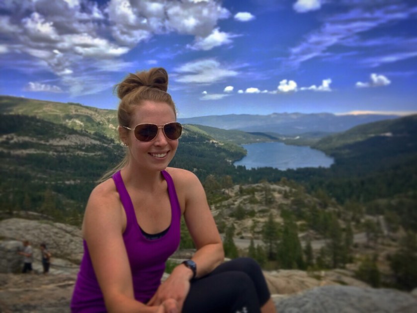
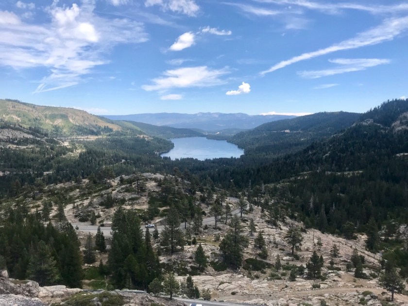
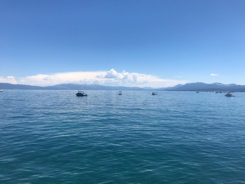
Because I still had plenty of afternoon left, I decided to ride to Lake Tahoe. I have heard nothing but great things about it and wanted to see it for myself. And I’m sure glad I did – it was worth the hype. It strongly resembled one of my favorite lakes that I’ve been to, Colter Bay in the Grand Tetons. The water was clear and blue as anything with snow capped mountains in the background. It was beautiful and a great way to spend the rest of the afternoon.

After that I made it back to Reno. Let’s just say I didn’t fall in love with Reno and I have really no desire to go back. I visited the REI to pick up some fuel that I couldn’t bring on the plane and spent the rest of the night in the motel. I went to bed early and slept in. In the afternoon I returned the car and waited for the bus to take me to Lone Pine. And waited. And waited. Luckily I wasn’t alone. There were a few other hikers also waiting around (including a father son duo – the kid couldn’t have been more than 10 – thru hiking the entire trail in 17 days!), so I knew I didn’t miss it. It eventually came an hour late. When telling the driver I was going to Lone Pine, the very last stop, he straight faced said, “oh I’m running so late. I hope you make it”. Uh what? I thought he was kidding so I took it with a grain of salt.

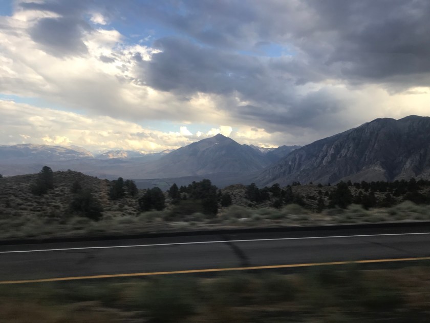
The bus ride was gorgeous. We were surrounded by the stunning Sierras and every turn brought unbelievable views. I do admit I dozed off a few times during the ride, but what else is there to do during a 5.5 hour bus ride?! We pulled into Bishop when I realized that the bus driver was completely serious about not being confident about me getting to Lone Pine. I had a connector in Bishop and since we were so late, it wouldn’t be unlikely that the other bus would’ve just departed without me, leaving me stranded! But lo and behold, the bus was there, waiting for me. I felt sorry that I made everyone wait, but at the same time I felt so relieved! I hopped on and off we went to Lone Pine.

On the bus were a few other hikers also going to Lone Pine. Two guys were doing a section of the JMT (Whitney Portal – Mammoth Lakes). I chose to carry my pack in a bag for convenience of flying (not so convenient for carrying). They saw me hauling around the bag and instantly nicknamed me “Body Bag”. Thank God I’ll never see them again and that name won’t stick as my trail name. Not entirely the most becoming name that could be bestowed upon me.

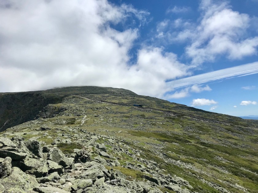
The town of Lone Pine is tiny. Super tiny. It took me 10 min to walk from one end to the other. But there are plenty of places to eat! I stopped by a Mexican place upon arrival and sat facing the Sierras. My brain wasn’t functioning very well after such a long bus ride when I found myself asking just what mountain I was looking at. It looked huge and scary and menacing. Then it struck me – I was staring right at Mt. Whitney! And with that I felt my stomach drop – I’ll be climbing up that fierce looking mountain in less than a week. I almost threw up the delicious tacos I had just scarfed down.

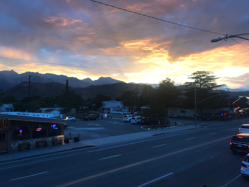
I saw a beautiful sunset and went back to the hostel for some shut eye. The next morning I met up with Sam, a girl who joined us for the hike! She had a few other obstacles thrown her way. A day before she was supposed to fly out to meet a friend who would then drive her to Lone Pine, the friend bailed. Essentially, Sam had a few hours to change flights and figure out a totally new game plan. And apparently the same thing happened to Mary Beth! Unbelievable. I am beyond thankful that all my forms of transportation worked out for me. Pretty curious how many other hurdles are thrown our way before we leave for the trail! I find solace in the fact that the pacific bike route started so horribly too, but turned out to be one of my favorite trips to date. Hopefully I find the same pattern in the JMT!

like I said before, Lone Pine is tiny. There isn’t much to do. And it’s enough to drive a person crazy. Saturday I spent the day reading a novel in McDonalds. 6 hours later, I was left disappointed in the book and the McDonald’s I think was pretty annoyed that I set up camp there for the afternoon. But what else is there to do?! But I gotta say, the sunsets here are pretty hard to beat.

Sunday I walked the 4 mile round trip trek to the Interagency Visitor Center to pick up the permits. They were there waiting for me! Having them in my possession definitely made everything real. We now have everything we need to get this party started! I even booked a guy to drive us to the trailhead. A much more reliable way of doing it than relying on unreliable hitchhiking. Mom and Dad, you can sleep easy at least for tonight.

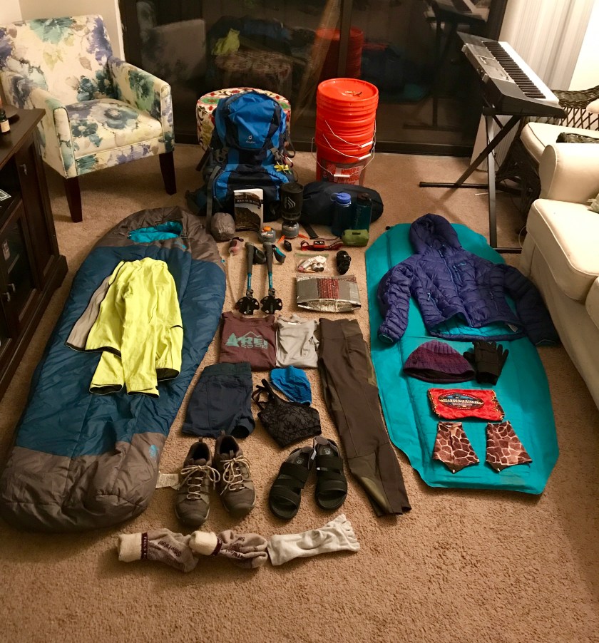
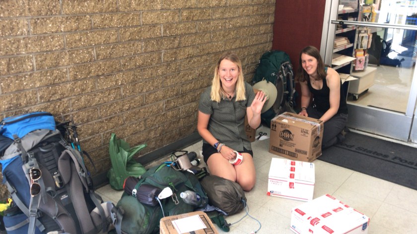
We ate our last good meal – a huge breakfast and are gonna get subs for dinner tonight. We shipped back all our extra gear and will head up to the trailhead campground this afternoon!

Can’t believe all the planning has led to this – I am excited and also a little terrified to see what comes our way, but at least we’re not alone on this journey!

JMT Prep: The White Mountains

Let me just start off by saying I’m pretty happy the John Muir Trail is in the Sierras and not the White Mountains. Not that New Hampshire isn’t beautiful and mesmerizing – because it most definitely is that and more, but whoa is it tough. Which I’m very grateful for because it made for a great shakedown for the JMT!

As the sign above clearly states, the White Mountains (particularly its most famous peak, Mt. Washington) is significantly dangerous and should be treated with respect and safety should be prioritized. Over 180 rescues occur yearly, mostly due to hypothermia (even in the summer!) and overexposure. I was aware of this going into this hike and made it all the more exciting to a semi- adrenaline junkie like myself.

I am lucky enough to have a wonderful father who was willing to plan the whole outing and even hike it with me! So fresh off the bike tour, I quickly packed my backpack and we were on the road for the 8 hour journey to NH.

We originally were going to have a first day starting at Pinkham Notch and hike 7 miles to Valley Way tentsite. However, after weather reports indicated that there were going to be afternoon thunderstorms we reconsidered. Because that trail is exposed and above tree line for the last portion of the hike, we decided we didn’t want to worry about getting struck by lightning just yet. We got dropped off at the Valley Way trailhead via shuttle late morning for a 3.8 mile hike up to the tentsite.

The hike was mostly in trees, sheltered from the late morning/early afternoon sun. Yes, sun! Barely a cloud in the sky, making us pretty hopeful we might outrun the storm and be able to climb Mt. Madison before the heavens opened. The trek to the tentsite was pretty challenging. Nearly 3000′ in 3.4 miles means a pretty significant and relentless climb steeply up rocks and boulders. Thank goodness I caved in and bought trekking poles – a piece of equipment I used to believe was unnecessary and if I’m being honest, I saw as quite pretentious. But now I see people using them no longer as snobby, but smart! They are a huge help when hoisting yourself up rocks and assist tremendously with maintaining balance, especially when you have a 40lb pack trying to knock you down with every step.

But alas, we carried on (literally) and eventually made it to the site with empty bellies and a quickly clouding over sky. We ate lunch and set up the tents. As we were debating whether or not to attempt Madison, the clouds made the decision for us. Rain started and we sought shelter in the tents. The rain was on and off (mostly on) for hours on end. At times it was aggressive and I thought a river might form and sweep us down the mountain. We awoke the next morning with wet tents and soggy gear.

Nothing is worse than breaking down a saturated campsite, but ya gotta do what ya gotta do! All the wet gear likely added a couple of pounds to our already heavy packs, but we threw it on our backs anyway and headed up for Madison.

The fog we encountered affected visibility quite a lot, but still below the tree line, we had no idea what was awaiting us. As we ascended above the tree line we encountered some pretty significant gusts of wind. I didn’t think much of it – I’d rather hike in it than bike in it was as much thought as I gave it. I never questioned the safety of it until, that is, we got to Madison Hut to refill on water. All the guests were in a full out panic trying to reschedule their whole hike based on weather reports and the wind they deemed was too strong and unsafe to hike in. I then began to question everything. The staff in the hut were recommending people seek alternative routes to Mt Washington, including going down Valley Way and hopping the shuttle on over to the peak. No way! I was already content with skipping Mt. Madison, but there was no way I was going to skip the star of the show! Dad and I decided all the hut folks were being sissies and we were determined to get to Mt. Washington. Is it any surprise to see where I get my stubbornness from??

We almost immediately reconsidered this decision as we exited the hut and were hit smack in the face with wind that seemed to have increased exponentially. But we persisted, despite warnings from hikers who turned back claiming it was too windy for them to continue. Psh. It’s just wind folks. For 5 miles we battled the said winds that at times full out pushed me over causing me to crash into a boulder. There was one patch where the only way I could cross was by literally crawling. I couldn’t even stand up the wind was so aggressive! With a 40 lb pack, crawling was not the easiest, but it was the only way.

Despite the treachery we encountered, I loved every second of it. There was only one moment during the crawling bit that I got truly frustrated by it, but I wouldn’t have it any other way. Even though there wasn’t any sort of view due to the thick blanket of fog, I loved the eerieness and spookiness vibe it added to the hike. The treachery continued with full out rock scrambling (not the easiest thing in the world with a pack!) and a snow crossing!

We took lunch in a random spot, unable to make heads or tails of where we were because of the fog. As we ate, we saw patches of blue sky float above us for brief seconds. Eventually the time increased and we realized we were eating right in front of Mt. Washington! It was spectacular to finally see views of the mountains that we were missing out for miles and hours before. It made me even more excited to get to the top!

With a clear sky, we were only a few miles from the summit. It was an absolutely stunning hike. The wind was still blowing us around, but with views like that I didn’t mind too much. We even saw the famed Cog Railway!

After a pretty grueling 0.2 miles, we made it to the top!! The wind was pretty angry up there and it dropped a lot in temperature. After snapping a few pictures, we sought refuge in the lodge for a break. We layered up, snapped a few more pictures (so cold I forgot to take scenic shots), and we went on our way to Lake of Clouds Hut!

We arrived right before dinner and attempted to sleep in a room full of snoring strangers. The hut itself was interesting to say the least. I’m just thankful I brought earplugs! We did get to witness a sunset so beautiful it rivaled those of the west coast.

The morning weather report was beautiful – warm temps with low winds! Perfect compared to the day before where Mt Washington had recorded wind gusts of 94mph!!

The hike back to the car was gorgeous and awe inspiring. We could see the trail for miles ahead of use before entering back below the tree line.

The hike was a lot more difficult than either of us were anticipating due to the rocks and boulders we had to scramble across. Plus, it was mostly downhill. Like biking, I’d almost always rather go up than down. Taking time to carefully go downhill affected our ETA back home, but it was worth it! We stumbled back to the car early afternoon with weak and tired legs.

Despite the adversity we encountered between the rain, wind, rocks, fog, and huge elevation gains, I had a blast. I wouldn’t change a thing about the hike to make it easier. I loved the challenge and I got to test out all my gear before the JMT! Despite a leaky tent, I’m gonna count that it doesn’t rain out in the Sierras and I’m gonna keep the old girl in commission.

So, JMT, hit me with your best shot! I’m coming for ya 😉

2.5 Month Countdown Till the JMT!

In July 2013, my two brothers, my father, and I hiked the last 23 miles of the John Muir Trail.  We spent three days two nights hiking through the wilderness of Yosemite National Park and even got to climb up the world famous Half Dome!  Being my first overnight backpacking trip, I was nervous yet excited to experience what I would consider my first true grand adventure.  Granted it was tough and I did have one mental breakdown (I blame trail mix raisins for that), this trip planted the seed for what has now come to fruition – hiking the entire John Muir Trail!


When I told people I was planning on hiking the John Muir Trail, I was received with blank stares and “Oh… okay, cool” responses.  I briefly described the trail, but the lack of enthusiasm persisted and “Why would you want to do that?” was a quick retort.  Well let me explain just why I would want to do it, and no, it’s not because I’m crazy! Named after the naturalist John Muir, the JMT is a 210 mile long distance trail in the Sierra mountain range in California, passing through King’s Canyon National Park, Sequoia National Park, and Yosemite National Park.  Having already hiked some of the Yosemite portion of the trail, I can attest to the awe inspiring stunning beauty of 10% of the trail, I can only imagine what the rest looks like!

John Muir Trial Map

Now that I have certainly sold you on the wonders of the trail, I’m sure you’re asking yourself, “wow, that sounds absolutely wonderful!  How do I sign up for it!?” Well, I’m here to walk you through that, and boy, prepare yourself for one heck of a stressful planning process.

I was always aware that in order to hike the JMT, you would need a permit.  Having gone through the permit process two years in a row to hike rim to rim in Grand Canyon, I know of the serious and permanent heart break/trauma that comes with being denied.  I was very well aware that getting a denial for the JMT was a very real likelihood (I believe 65% get denied) and that all my dreams could potentially be shattered.  A few days before the permit lottery process was going to start (February 1st), I decided to do a little more research on obtaining a permit.  After rummaging around the internet for a little, I stumbled upon a blog that suggested starting at a different trailhead than the wildly popular Whitney Portal (the southern terminus).  Not reliant on a corrupt lottery system (only my opinion that it’s corrupt… stupid Grand Canyon….), you can get a guaranteed permit online months ahead of time.  I must’ve looked at the website to book the exact moment it opened reservations, because I could reserve any day for up to 24 people! I had the pick of the litter! After 2 days, the majority of the permits were already reserved, including 4 heading out from Horseshoe Meadows July 17th.  Those were mine!  After reserving the permits, the reality that I will soon be hiking my first thru-hike really hit.

If you’re anything like my mother, the fact that I reserved 4 permits likely allowed you to breathe out a sigh of relief.  I am not crazy enough to hike through bear country alone!  In a long convoluted story, one of my childhood friend’s sister caught wind that I was interested in hiking the JMT.  She contacted me and said she wanted to join.  Just the year prior she herself was denied permits for the trail, those pesky permits!! So far it is just me and Mary Beth hiking, but she has two friends who might meet up with us further along the trail.  We’re still working on logistics for that to work.

Speaking of logistics, there are a ton that go into planning a hike like this.  Starting south of Mt Whitney, we are adding around 20 miles to the entire trip.  Worth it to be guaranteed a permit for hiking AND a permit for climbing Half Dome!  In fact, Half Dome was a huge inspiration for starting at the Southern terminus of the trail. Most people go SOBO, however, ever the rebel, I wanted to go NOBO just to end the trail climbing Half Dome.  With a 45 degree slope up/down a slick granite rock face, your only hope for not sliding to oblivion is clutching for dear life onto a cable.  Climbing Half Dome in 2013 was easily top 5 scariest moments of my life, and I can’t wait to do it again!

But, back to logistics.  We obviously will be carrying everything we need on our backs.  Being in bear country, it is necessary that we carry a bear canister to prevent those nosey bears from knocking on our tents late at night and stealing our food – ultimately putting them in danger.  In fact, that’s why canisters are required.  Not for your safety, but so bears don’t become accustomed to getting food from humans easily, making them more brazen than they already are and increasing their chances of having to be euthanized.  If you are caught without a canister, you will be escorted off the trail and served with a $5,000 fine – yeah, no thanks.  Being confined to a bulky canister with limited capacity poses a pretty huge problem.  Planning on taking 23 days to complete the trail (July 17-August 8th), we cannot possibly fit all our food in the canister.  Not that we would even want to… hello back pain! Only able to carry 7 days of food at a time, we are forced to resupply along the trail.  For the Northern end of the trail, that’s easy!  There are a surprising amount of resorts who perform resupply in the backcountry wilderness.  Essentially you mail them a bucket of your food, pay a fee for them to hold it, and pick it up right along the trail.  Being so remote, they have to mule pack train it in, accounting for the relatively high fee for holding the bucket.  Perfect! Simple solution to a huge problem.

Ah, not so fast.  The Southern end of the trail does not practice typical southern hospitality.  There is a huge span without any on trail resupply options.  A lot of people hike 7 miles off the trail and hitchhike into a town to resupply, which adds a day to the trip.  Being on a time constraint, we are not able to consider this as an option.  Instead, we are likely going to use a pack train of mules to haul our food in, where we will meet them on the trail.  Able to carry 250 lbs of food, we will not be at a risk for going hungry!  However, there is an extremely high cost that comes along with this.  We are looking for other hikers to share the cost and resupply with us.  Here’s to hoping someone bites at our offer!

itinerary

Okay, so food and timeline is all figured out (itinerary is above… a lot of time and frustration was put into that schedule, but look at how beautiful it is!), what about camping?? Where do you camp in the middle of the wilderness?? Well the beauty of backpacking in the middle of the wilderness is that you can camp basically anywhere.  Just as long as you’re so many feet from the trail, pretty much anywhere is fair game.  I used Elizabeth Wenke’s guidebook at my number one resource for mapping out the itinerary.  Within the pages of the book are suggested areas to camp as well as trail notes for every section of the trail.

Food

Because I’ll be shipping out my food weeks before I arrive, I have to prepare it weeks in advance.  Obviously, I have to pack food with a long shelf life.  Can you tell I have a super sweet tooth? In addition to candy (gummy bears not pictured) I’ll basically be living off of freeze dried food, peanut butter, and tuna.  Can’t wait!  Without a doubt I’ll be craving a nice juicy cheeseburger the entire time.  But suffering builds character, right?

So how does one prepare for a trail that remains above 8,000′ elevation with a total of 47,000′ elevation change?  Well, my friend Sheena and I will be biking down the pacific coast just weeks before embarking the JMT.  That will hopefully help with cardio!  Once I get back from that, my father and I will be hiking the White Mountains in New Hampshire to make sure all the gear works and if I have to make any last minute cuts/additions, I’ll have a good 3 weeks to make the necessary adjustments.  New Jersey isn’t ideal for training for a high elevation adventure.  I’ll be heading out to California 5 days before the start date in an attempt to acclimate.  Also, I’m forced to go out early because transportation doesn’t run during the weekends.  Really.  What bus company doesn’t run on the weekends?!  As inconvenient as it may be, at least it gives me time to acclimate, right? Cause with conquering Mt Whitney (elev 14.5k’) day 3, I’m gonna need all the time I can get so as to not get altitude sickness.

JMT gear

Above is a picture of my gear.  It is by no means a full representation of all that I’ll have to pack (literally just ordered more junk online), but all the important stuff is there!  Except the bear canister. Of course, I forgot the canister. But I’m too lazy to set it all back up just for that. So it gets a solo shot.  All in all, I’m expecting the pack total weight to come in at just under 40 pounds.  That was actually my goal.  Now to some super experienced ultra light backpackers, 40 lbs is blasphemy and they potentially risked an aneurysm just reading that last sentence.  In fact, I am totally expecting people who I run into on the trail to pick apart my pack and actually judge me for all the weight I’ll be carrying.  People can be such snobs.  But you know what? I simply don’t care.  I have a few items some might call “a luxury” and poo poo on my decision to pack it.  Psh,  I would rather be comfortable with all my “luxurious” items  (I would hardly call a pillow a “luxury”… please that’s necessary!) than miserable with a lighter pack.  I’ll so tell them to go pound sand.  Hmph.

bear canister

July 17th is right around the corner and the anticipation is already mounting.  I can’t wait to get out there and see all the sights and be amongst some of the greatest scenery few have ever experienced.