Day 47: June 1; 14.8 miles
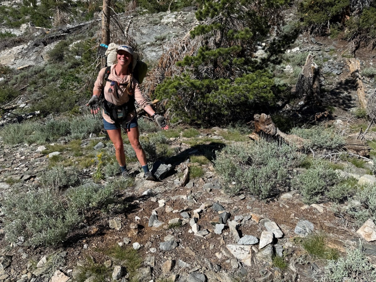
It’s hard getting back on trail after a great few days. Kennedy Meadows South was definitely my favorite zero day yet. It was great being in such a hiker friendly environment full of support and understanding. But after a great breakfast, it was right back on the trail. A little later than usual mainly because I had to figure out how to put my bear can in my pack. But oddly enough, it fits perfectly and somehow makes my pack more condensed, though way heavier.
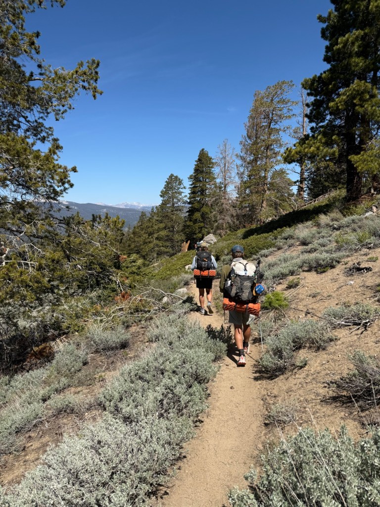
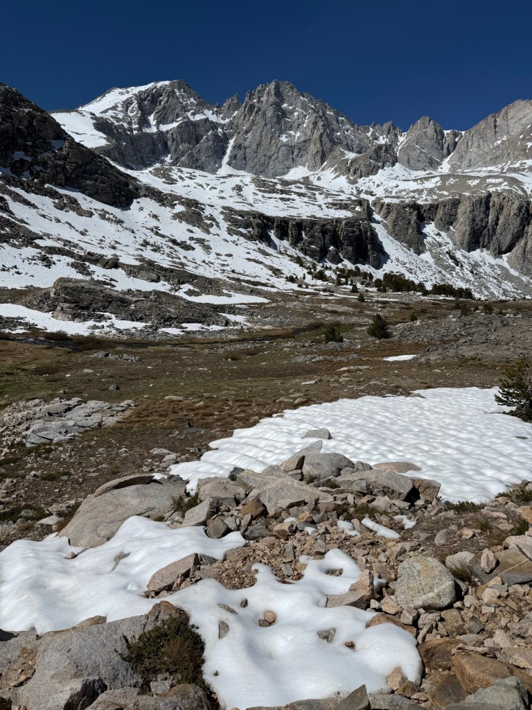
First day in the Sierra! But still felt so much like the desert. In fact, we had 2 rattlesnakes bid us farewell a little bit too close for comfort. But I’m fairly confident this should be the last we see of them for a while. Funnily enough, it’s also the first day we’ve seen the mascot of the Sierra, the marmot. It’s so strange seeing the two cohabitate, but I guess that’s what happens when two biodiversities collide.
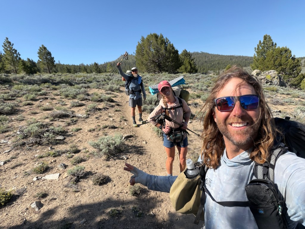
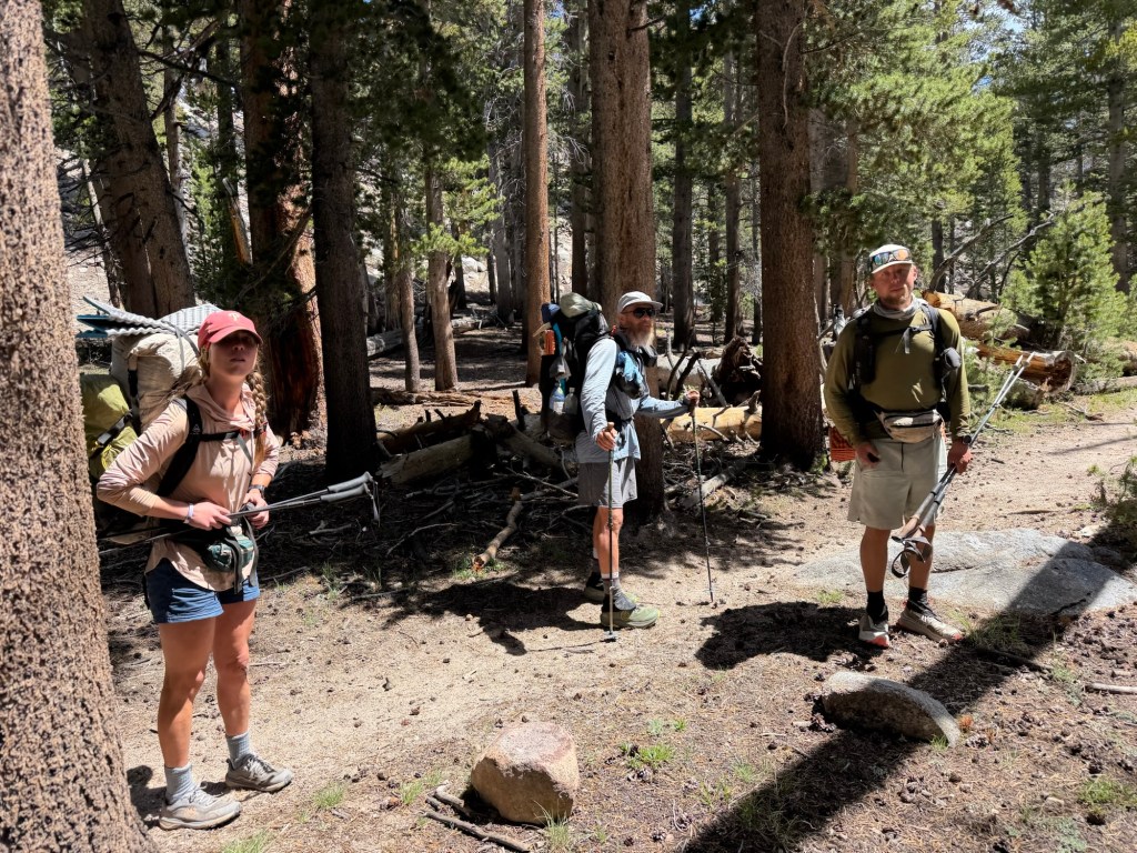
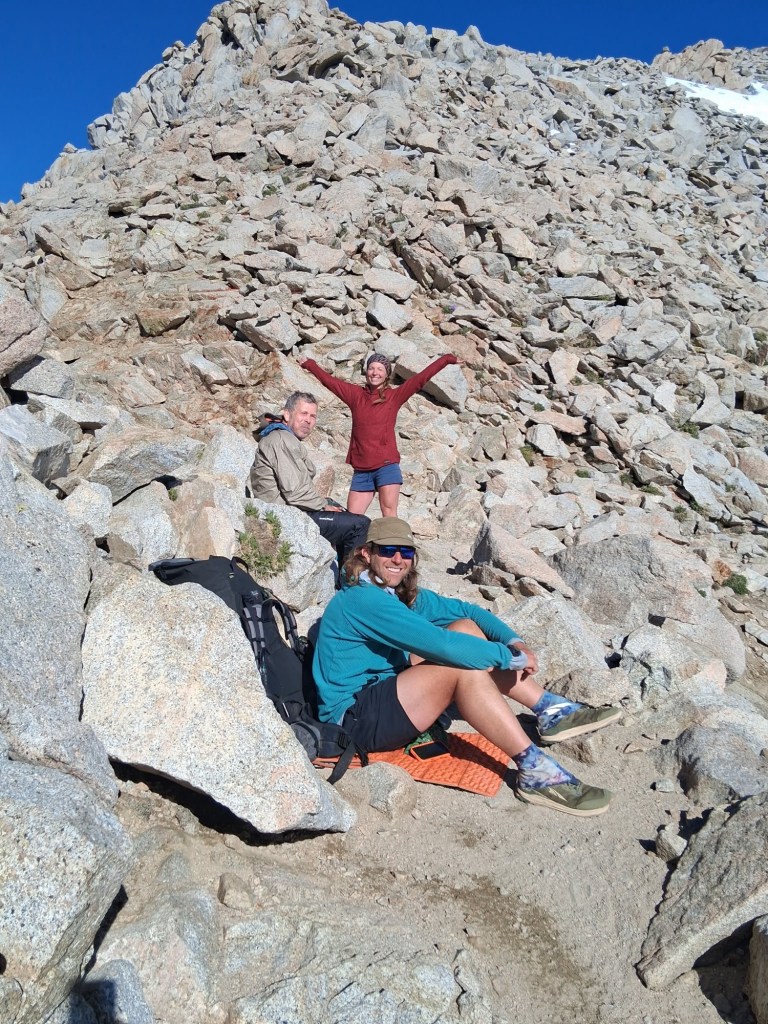
We’re walking with Just Walking, a really nice guy from Maryland who’s sticking with us until at least Whitney. We talked with him last night and he said he was pretty nervous about summiting and was going to skip it entirely. We convinced him to at least give it a shot, especially since it’s such a low snow year. Seems to have done the trick, he seems pretty stoked to try it out.
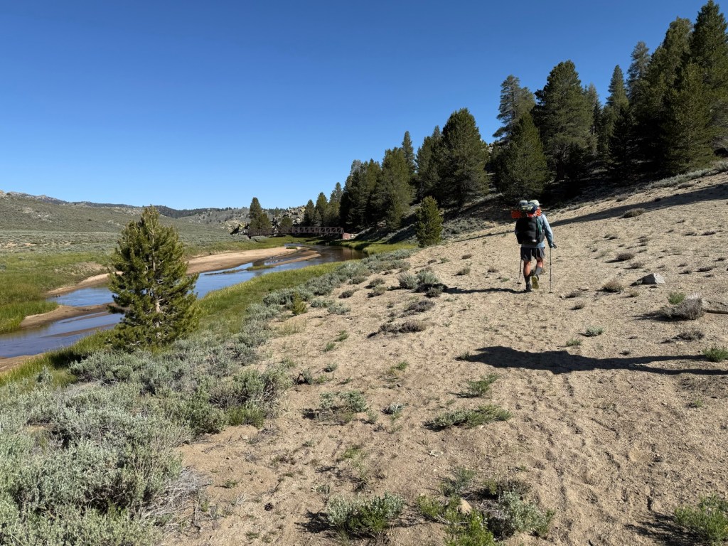
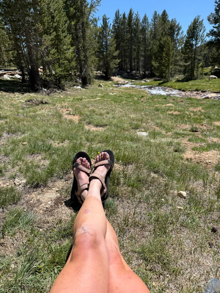
Eventually the scenery changed into what I remember the Sierra being. Gorgeous meadows, water everywhere, and snowcapped mountains in the distance. We’re camping by a river with a lovely bridge, home to many swallows busy making nests. I sat there as I soaked my feet and watched them going back and forth from mud to bridge. It was fascinating watching them work.
Andrew met up with us pretty late. We had a bet going as to whether or not he was going to live up to his trail name and get vortexed at KMS or actually get on trail. It was a draw – he left way later than he planned, but did make it to trail!
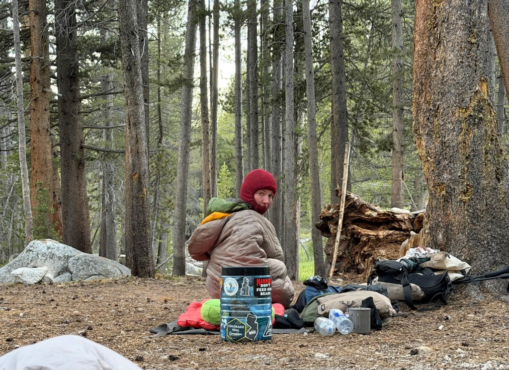
Decided to cowboy camp, I have a feeling it’s going to be a cold one.
Day 48: June 2: 25.3 miles
Well, it was a cold one. One of the first times I have been actually cold sleeping on trail. Enough to keep me awake. Which now has me super concerned. If I’m this cold just under 8000’, what the heck is going to happen at 10k’+? I’m not scared of freezing to death, but I am scared of how bad sleep can affect every other aspect of performance out here. I want (well really need) a new pack, but now that I’m sleeping cold, I may have to switch the budget over for a 0 or 10 degree sleeping bag. I can deal with being uncomfortable during the day, but not at night. Luckily, Lone Pine has two gear shops that I’m hoping will have some in stock, and we’ll get there tomorrow.
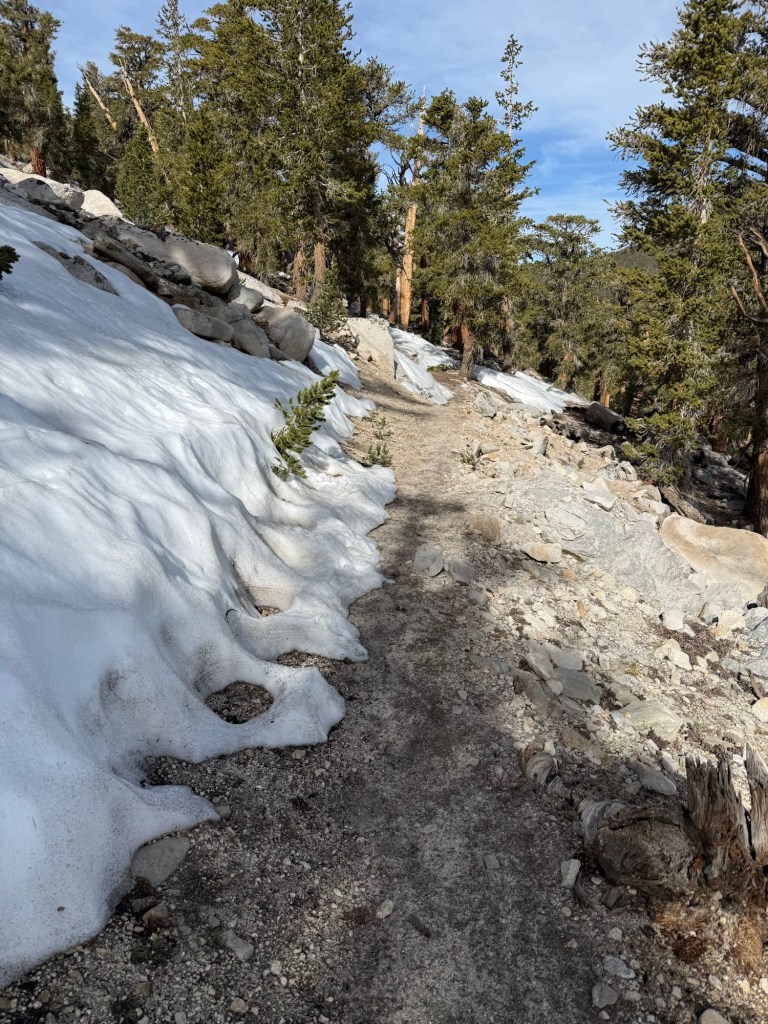
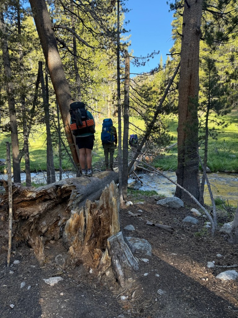
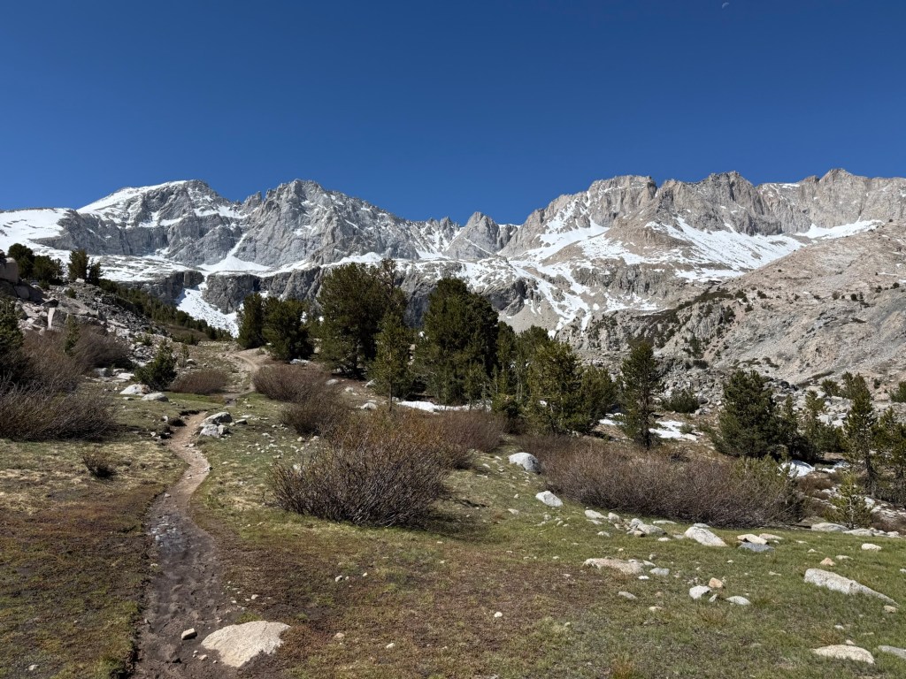
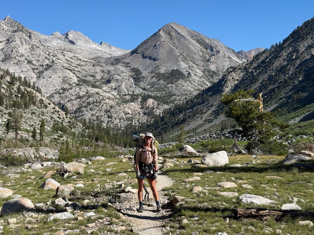
We set out early for the day, freezing our butts off. We decided last night that we were going 25 miles, no biggie, but seeing as how we need to gain loads of elevation, we knew it was going to be a full day of climbing. Which started right from the first step. We had a 7.8 mile climb that went quickly but also so slowly at the same time. We were rewarded with a gorgeous downhill stretch that didn’t feel quite long enough before going back up.
We encountered our first taste of a Sierra staple – the dreaded mosquito. They’ve been at us everywhere today, including camp. Which is annoying because it’s a beautiful space, but we had to retreat to our tents to prevent getting attacked by the blood suckers. I hope they don’t stick around, but it seems we’ve arrived just in time for a huge hatch.
We hit 10,500’ elevation. I’ve been drinking water nonstop in an effort to prevent any attitude symptoms. The water plus the last 7 weeks of constant activity I think has effectively staved off any potential altitude issues. I just pray the same will be true for going up Mt. Whitney. It’s shocking to think that’s only a few days away.
We’re camping at 9,600’ so I’m expecting another cold night. At least this time I’m prepared, if only mentally.
Day 49: June 3; 8.5 + 4 bonus miles
Woke up to the sweet “cheeseburger” song of the mountain chickadee, a bird that I’ve come to really enjoy during the 7 past weeks out here. They have a three syllable song that is extremely distinctive. In my drowsy half awake state, it sounded like they were singing “Em-i-lie”, jolting me awake. I woke up rested and warm, truly shocking me. The temperature didn’t dip down too low, but I’m still fairly certain I’ll get a new bag in town. Another reason to wake up happy – it’s a town day! I’ve been to Lone Pine before, at the start of my 2018 John Muir Trail journey. Cut 20 miles short at Tuolomene Meadows for a major fire in Yosemite, I’m hoping this year won’t meet the same fate.
The 8.5 miles to the junction were pretty but monotonous. It was mostly climbing, which I already know is going to be the theme of the Sierra. The junction of the PCT and Cottonwood Pass is where I started the JMT. As I approached the junction I felt an air of familiarity. My brain immediately recognized the rocks and the greenery. I felt a pit in my stomach. The last time I was here I was crying and puking, not sure if I’d even make it past the first day. I was sick as a dog with altitude sickness. It was one of my worst days on trail, but I persevered and had the trip of a lifetime. I knew the same fate wouldn’t befall me this time.
We set out for the long descent down to Horseshoe Meadows. My body decided that it wasn’t going to be easy. The very first switchback down my ankle gave out, as it tends to do 472942x a day. But this time it was bad. I could tell instantly a decision had to be made – either suffer from a broken/sprained ankle or go down. Not wanting to be airlifted off the mountain, I opted to go down. Right on my left knee. All was fine, I wasn’t hurt, but dang that knee got banged up. All bloody and smashed, I continued on. My poor left leg has gotten so beat up on this trip. Just as all the old scabs turned into scars, it was only natural it was time to sport a brand new wound.
It was shocking how intense the descent was. Having already gone up it 8 years ago, I didn’t remember it being so drastic. I had no desire to go back up in 48 hours. But with the knowledge that I’d done it before plus another 10 miles, I knew I’d be okay. Happy about it? Nah, but I’d be just fine.
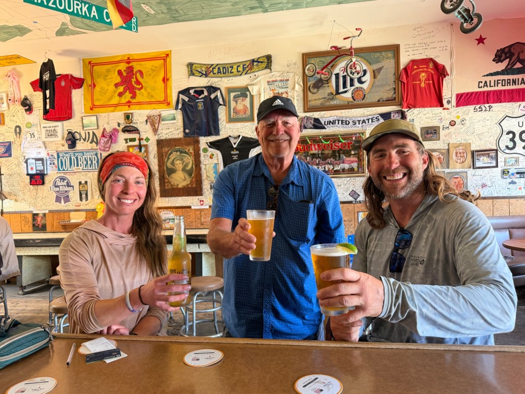
We met David’s dad in the parking lot of Horseshoe Meadows and high tailed it to Lone Pine. It’s crazy how the memories come rushing back. All the restaurants I’d been to before, the hostel, the gear shops – it was like I was just there yesterday. Lone Pine is a tiny town that basically is operational only because of its close access to Mt. Whitney. You could walk from one end to the other and back in less than 10 minutes, but its charm is undeniable. It’s comfortable and cozy with sweeping views of the Sierra, Mt. Whitney being front and center.
Day 50: June 4; Zero day in Lone Pine
Zero days are hardly relaxing, but I gotta say today’s was as much relaxing as it gets. Sure we did laundry, resupplied, and planned out a strategy for conquering Whitney and Forester Pass, but we managed to get in some fun too. Even though Lone Pine is a super small town, there’s still plenty to do.
After looking at the gear shop, I decided that I’ll have to suffer through the cold. They didn’t have a sleeping bag that would meet my needs, so it looks like I’m sticking with the one I have. I drowned my sorrows with a milkshake and sitting by the hotel’s pool. It’s about 97 degrees in town so a pool is a blessing.
Got to bed early after a Mexican dinner, ready to get back on trail in the morning.
Day 51: June 5; 10.2 + 4 bonus miles
I’m so excited to get back on trail. Lone Pine is truly a gem, but time is ticking and I’m anxious to get moving and deep into the Sierra. The debate of the day was whether to take an ice axe or risk transversing ice fields without it. Pros: it could save your life. Cons: it’s added weight and I don’t know how to use it and the snow is melting and even if there’s enough snow on Forester to justify it you’ll slide into the rocks and perish before you even have the chance to deploy it. Phew… looks like the cons win so moving on without the life saving equipment was deemed the wise choice.
Fully loaded with the bear can, we ventured onward back up Cottonwood Pass. Today I conquered it. No falling, no puking, no clutching the SAR in fear of impeding death. Was a tear shed? Maybe, if only because I was so happy none of that happened. I stayed on my feet and I had zero altitude issues.
It’s funny walking the same route I did 8 years ago. A lot of the JMT is seared into my brain. It feels so different now, almost a decade older and questionably wiser. I have learned so much from that trip that I still use daily all this time later. I’m proud of that person for getting out there and doing it, cause without her I wouldn’t be sitting on a log next to a creek typing this very sentence.
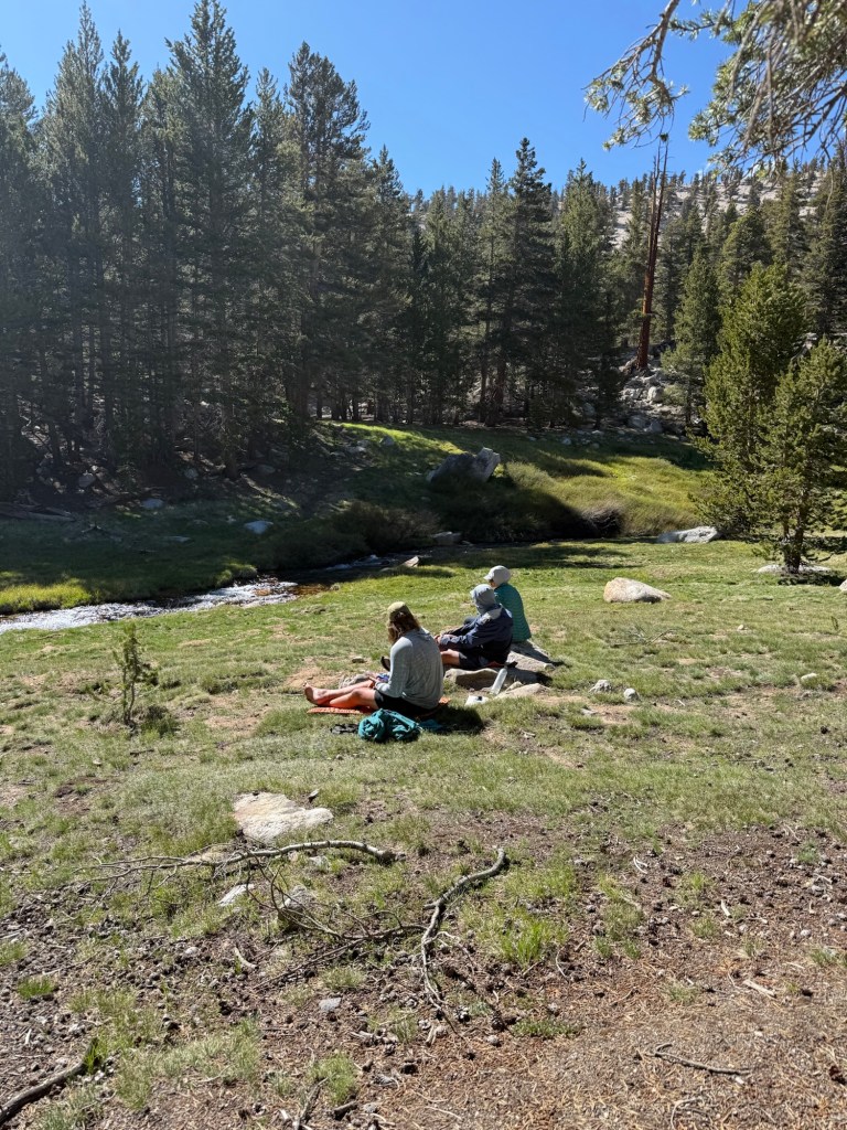
We made it to camp early enough to dip into said creek and dry off in the late afternoon sun. With so much time left, it was discussed to keep moving on, even all the way to Crabtree Meadows, the junction for Mt. Whitney. With only 5 miles it was easily doable, but this site is too perfect to give up. Besides, what’s the rush? We’re going up Mt. Whitney in two days, let’s enjoy the blessings we have now.
Day 52: June 6; 8ish miles
Woke up to a brisk morning. It got down to 32 degrees and I was a bit cold, but nothing that really bothered me or my sleep. Because we knew we had such a short day, we decided it was okay to sleep in. I slept until 6:20am which really surprised me – I must’ve really needed it!
The hike today was actually tough. Not because of climbs, not because of terrain, but mainly because my body is tired. I think the main culprit is the high altitude.
We got into Crabtree Meadow late morning with plenty of time to relax and set up. We set up camp right by a stream crossing which was beneficial in so much as we could talk to everyone coming off Mt. Whitney. We got mixed reviews, and just about everyone had an ice axe. Basically, from what I gathered, if you have microspikes and poles you’ll be totally fine. An ice axe was more for peace of mind. There are allegedly 3 “sketchy high risk” fall zones on the switchbacks and one large ice field to cross. Doesn’t sound horrible but also doesn’t sound fun. With good boot pack, though, I feel confident that leaving behind the ice axe wasn’t a critical error. One Australian girl gave me the most hope, however. She was adamant for us to not “believe the bulls-“ that other people were exaggerating, according to her. It was reassuring to hear such an honest down to earth reaction.
Whitney was obviously a big topic of the day. Everyone who summited today left at 11:30pm yesterday night. And they still didn’t make it in time for sunrise. Yikes. Because we want to see sunrise we decided on a 12am departure from Crabtree Meadows. That’s extremely early, but we’re guessing that the snow will slow things down.
We met Nightingale who attempted a thru hike last year but had to get off trail from injury. She started where she stopped – right at Cottonwood Pass. What a tough way to start the venture. We had dinner and now are ready for bed. With an 11:15pm wake up call, 5:30pm is bedtime.
Day 53: June 7; 10 miles + 15 bonus miles (Mt Whitney!)
After a few restless hours of sleep it was time to go. I was happily surprised by how warm it was. I only slept in a fleece and shorts, by far the least amount of clothes I’ve ever worn to sleep. Which made getting up at 11:11pm that much easier.
Woke up to a very dark night but the stars were abundant, moon nowhere to be seen. I started to see people going up at 11:30pm, their headlamps easily spotted guiding them through the night. Soon it was our turn. Right at midnight we started our ascent up Whitney, with the homage “don’t believe the bulls-“ flowing through my mind.
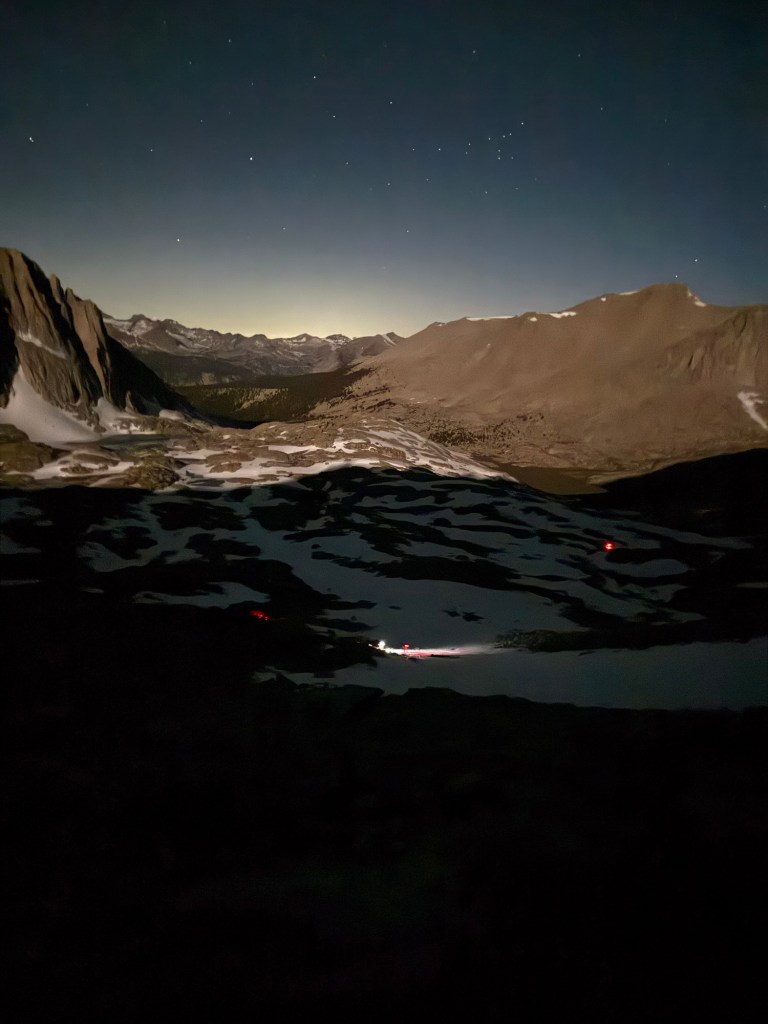
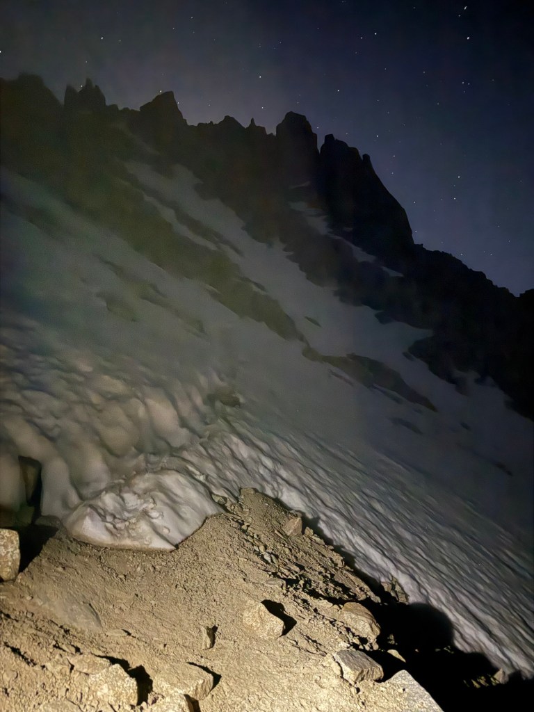
This was one of my favorite mountain climbs yet. It had it all. Stars, the Milky Way, headlamps bobbing in the distance, the feeling in the presence of great tall giants, and harrowing snow crossings that one poorly placed step could send you sliding to your death.
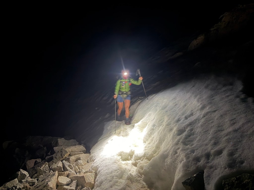
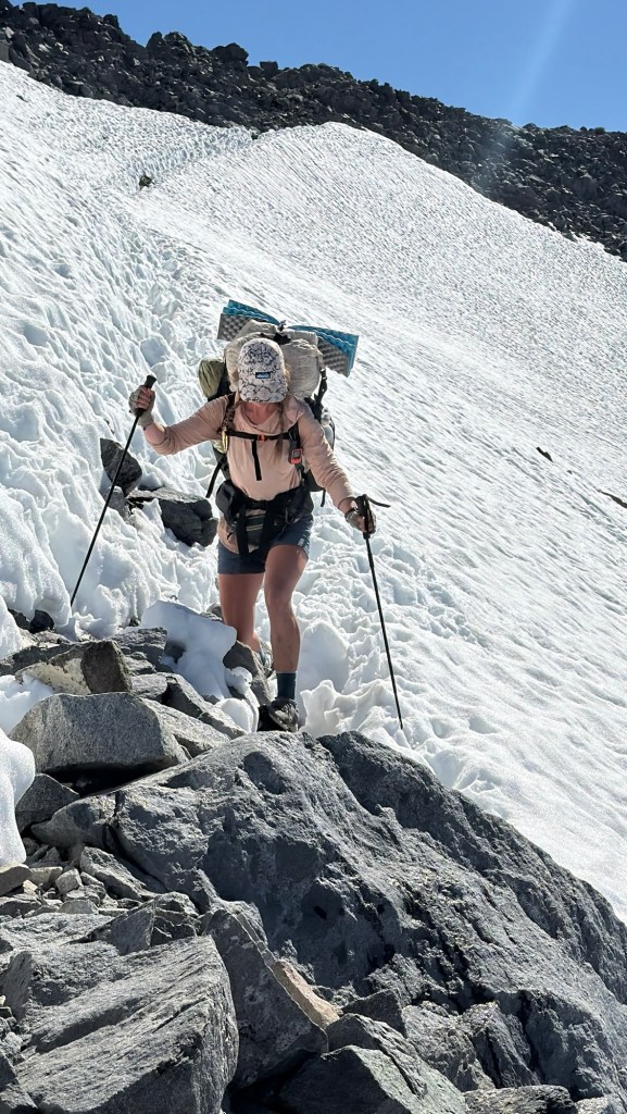
The whole way up was in the complete darkness. With nothing but the dim shine of your headlamp to guide you, it was one to remember. The whole ordeal was wonderful aside from the snow banks covering small portions of the trail. Being that it was so early, the snow was truly ice and microspikes were definitely necessary for traction. But all snow fields had flat boot pack – meaning that plenty of other hikers have already come through, leading to packed down trail to provide a somewhat safe passage. I made the mistake of looking down during the first ice field. In the spotlight of my headlamp the slope of the ice field below looked hundreds of feet long and at an angle that would definitely not be survivable. I was beyond scared, but was able to shake it and lock in, passing over all the ice safely.
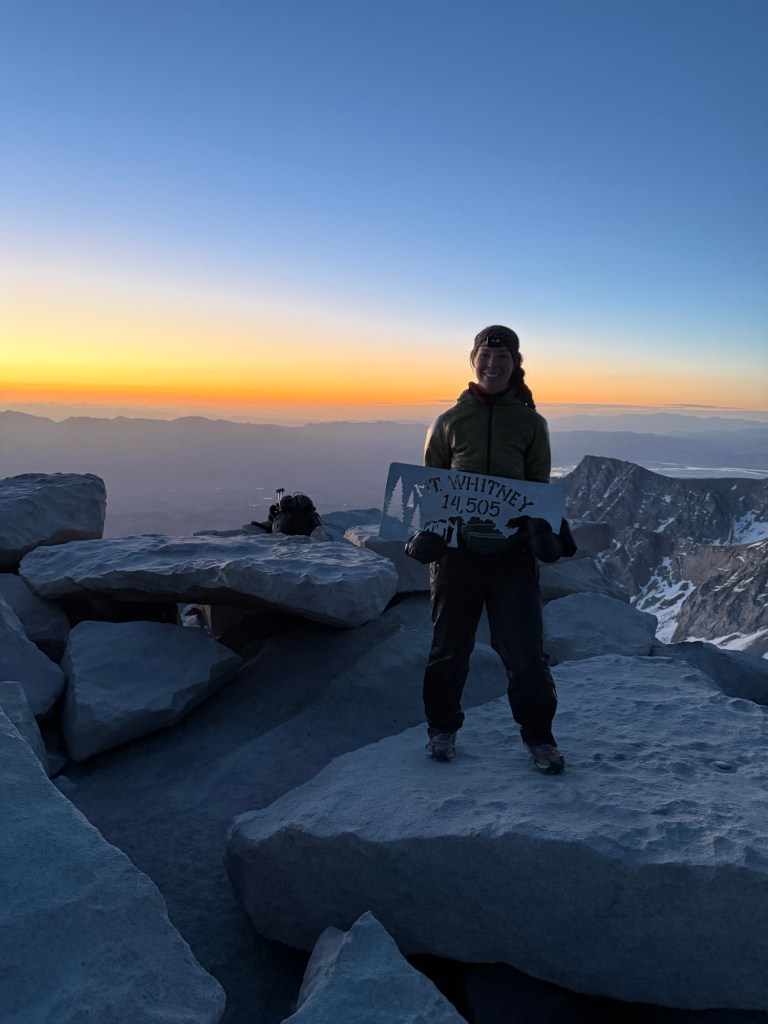
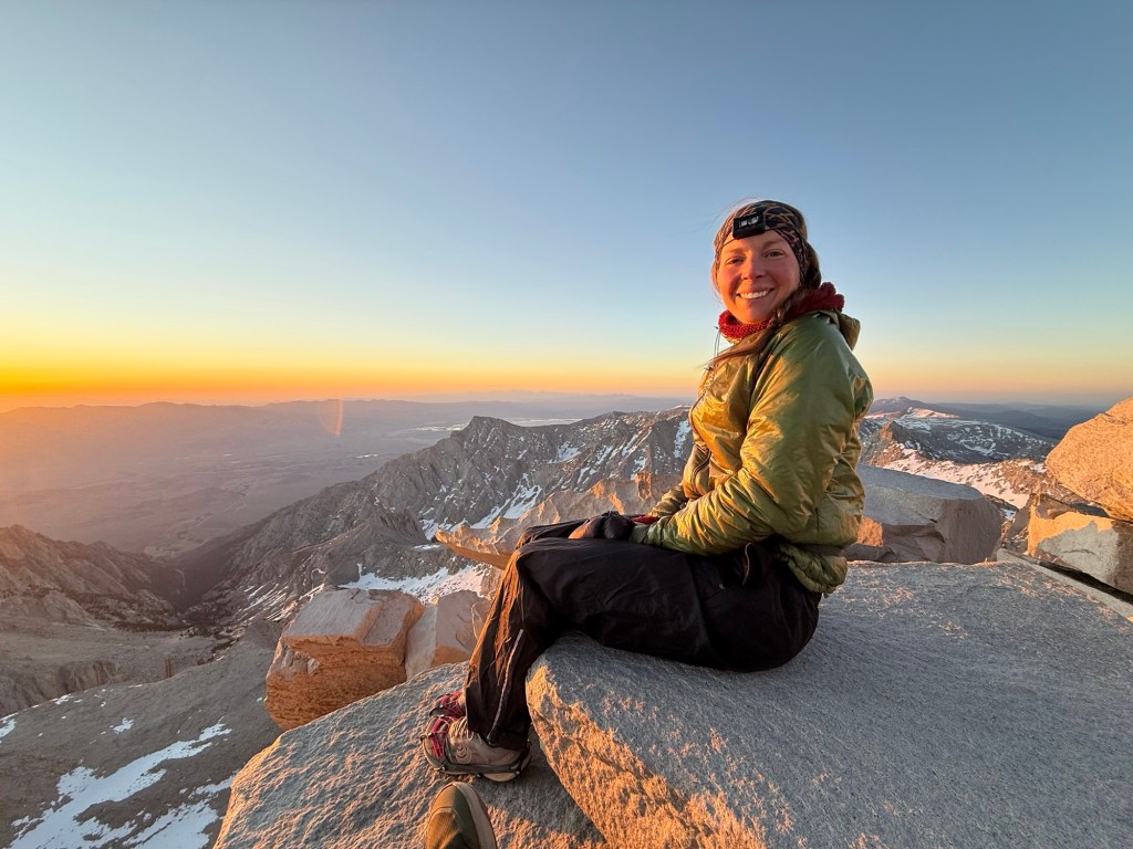
We got to the summit of Whitney at 4:55am, plenty of time to spare for sunrise. The sky was already turning shades of orange and pink in anticipation for the big reveal. Eventually the sun peeked out, bringing slight warmth to the summit. At 23 degrees, it was welcome. By 6am I was frozen to the bone and decided it was time to get down off the mountain. I had a headache, some nausea, and felt a little drunk. Classic altitude symptoms- meaning it was time to go. Which was a delight.
I gleefully bounded down and realized the ice patches that elicited such fear only hours prior were actually not bad at all. The daylight exposed them – they were hardly anything to bat an eye at. If you fell, sure it wouldn’t be great, but you certainly wouldn’t die.
After a quick nap back at Crabtree, it was back to trail for another 10 miles to Tyndall Creek. None of us wanted to, especially after a Whitney summit, but it was necessary. This puts us in a safe zone to cross over Forester Pass early in the morning. This is crucial because Forester Pass holds on to a lot of snow, particularly the last little bit going up the south side (that if you fall puts you into a huge rock chute, with a potential 500’ drop you won’t survive). The north face of the mountain is nothing but snow fields the entire way down. Early morning is the preferred time to do the pass to ensure solid snow. Sliding down slushy snow or postholing not only slows you down, but puts you at a high danger risk.
So, with heavy legs and heavy hearts sad to leave Crabtree Meadows, we departed for 10 miles to the creek. Andrew stayed back. After a failed summit attempt likely because of altitude issues, he is trying again tomorrow.
The ten miles to Tyndall Creek were mostly uneventful, aside from 3 large stream crossings. The Sierra is melting and it’s apparent from all the snow meltoff creating gushing streams. This can make crossing dangerous. But with steady feet and good confidence, we all managed to cross without getting swept away.
We have a lovely mosquito free campsite right by the creek. It’s another early bed time with an early wake up call to conquer Forester.
Day 54: June 8; 14 miles + 2 bonus miles
A 4:15am wake up call is so much better than a 11:11pm one. It was time to conquer Forester Pass, which has been weighing on me since day one of this trip. Like I said before, Forester can be extremely dangerous. But I had faith we’d find safe passage.
I was eager to get to it. Coming down the pass during my JMT experience was a highlight for me. I remember like yesterday the gorgeous mountains, the green meadow, and the abundant streams flowing throughout. I don’t think I’ve ever been anywhere as beautiful as the north side of Forester Pass and could not wait to see it again.
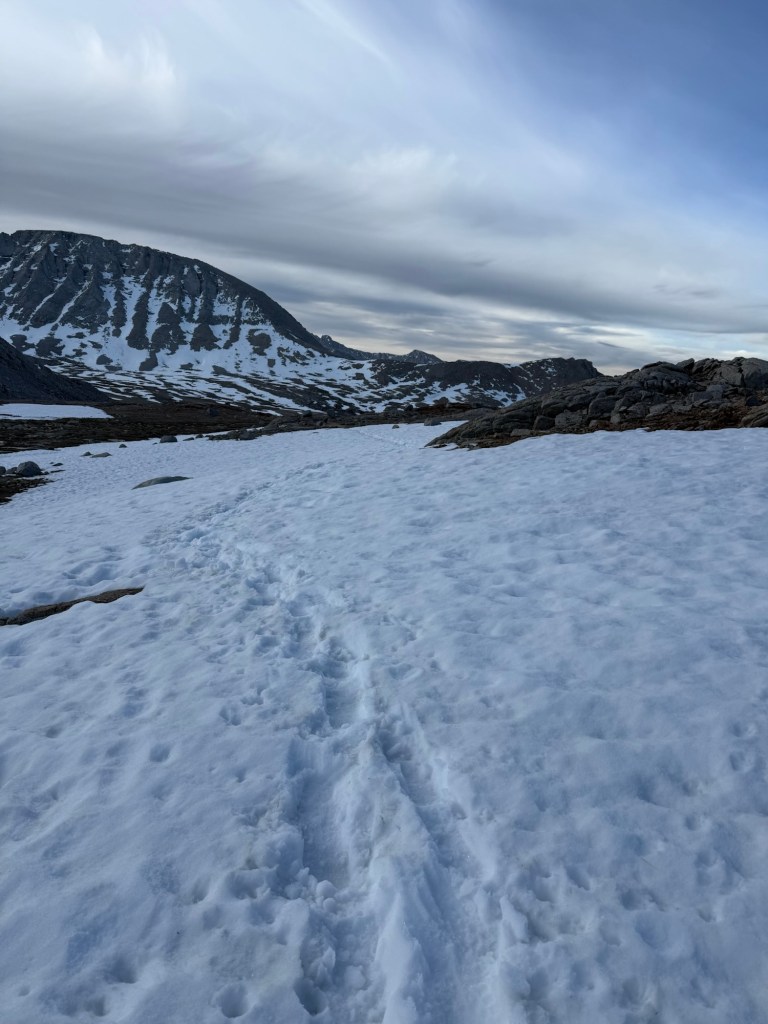
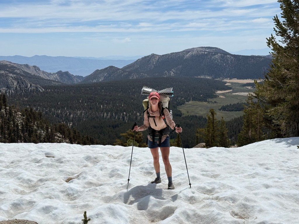
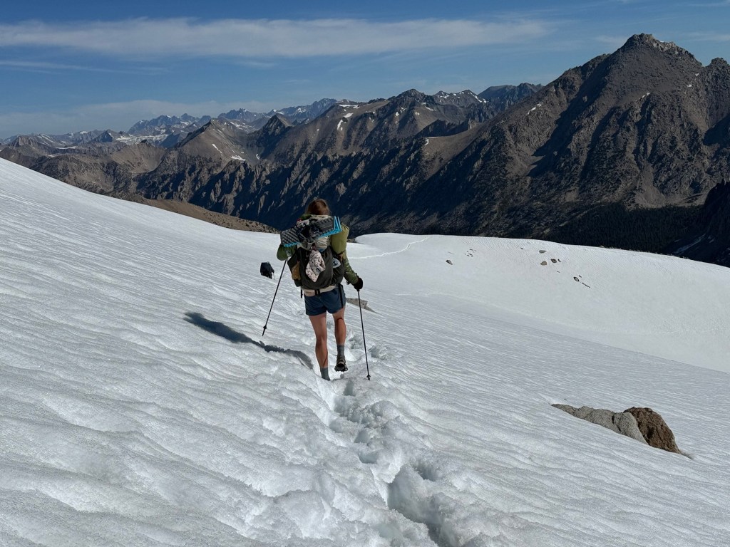
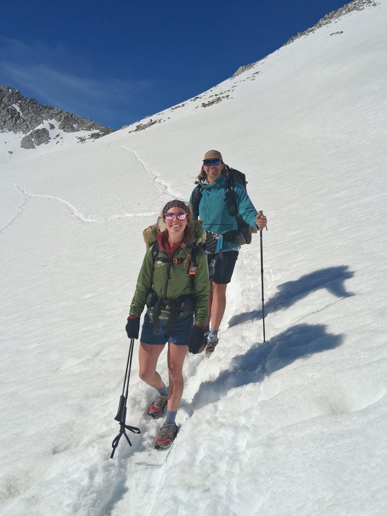
The approach was much like I remembered. It felt like I was teleported to Middle Earth. If you are a Lord of the Rings fan, you can imagine what that might look like. Intimidating mountains but also lush green grass and even a waterfall. This time, however, the approach was covered in snow. I didn’t need microspikes to cross it, but put them on as soon as we got to the switchbacks of Forester.
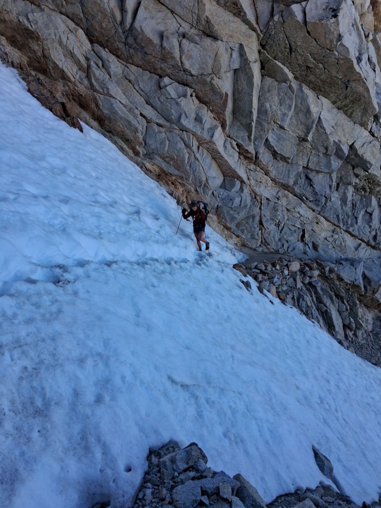
Just Walking and I got up the icy switchbacks easily. Then there it was – the dreaded chute. All the planning and worrying led to this moment. It was only 30’ of walking, but the slope of the ice and rocks beneath it provoked fear and caution. So with a cautious cadence, I put one foot in front of the other paying close attention to not look down. Mission accomplished and I made it across and to the top of Forester Pass in one piece! The highest point of the PCT complete!
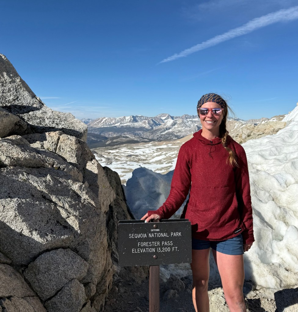
And the views were nothing short of breathtaking. Exactly as I remembered, but this time accented with snow. I was back in heaven and enjoyed every second walking down from off the pass.
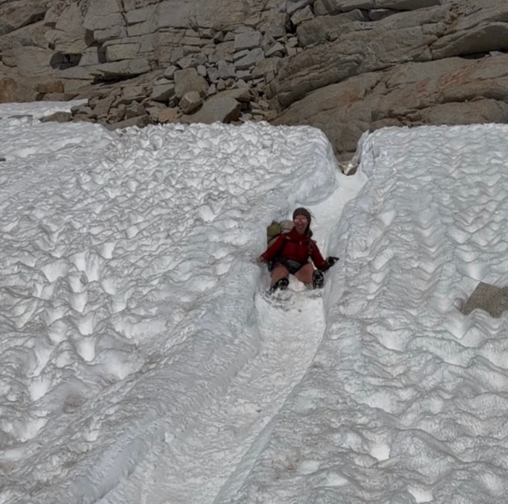
Well, not all of it was walking. Forester is notorious for glissading, really just sliding down the snow on your butt. It is a lot faster than walking, plus it’s fun. I did it twice. I certainly don’t regret it, but let’s say I regret doing it in shorts. I now have a pretty nasty road rash on my butt. Battle scars!
Eventually I said goodbye to my favorite place on earth and had lunch by a rushing creek. What a stark difference from the desert. We could go days without hearing any water. Out here it’s a constant soundtrack. Sure helps keep the pack light when you don’t have to worry about 20+ mile water carries.
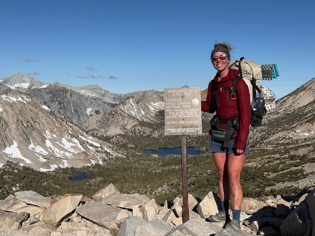
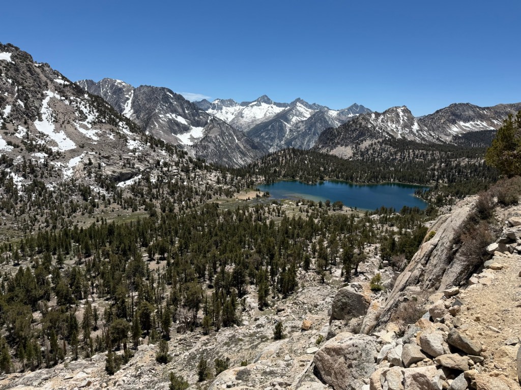
I had a difficult time finding motivation to keep going after lunch. I was coming down from the emotional high of Forester and just didn’t want to do the miles, especially with a hefty climb coming up. But like any other day, I strapped on the pack and kept it moving. We’re going off trail today to start Kearsarge Pass. Most people have to do the 15 total mile detour to resupply. We’re heading halfway up the pass to Kearsarge Lakes to spend the night before heading into Bishop. This is a first for me. I opted for a mule resupply for the JMT to skip having to get off trail. I don’t regret that decision at all, but I’m excited this time around to experience the pass and the town of Bishop.
The last 2 miles of the day were wicked. All the action from yesterday plus going over an ice covered pass in the morning finally caught up to me. Not only was I tired, but I was extremely hungry. I am a bottomless pit. I could eat everything in my bear can and still want more. They call it hiker hunger, I call it annoying. It’s hard to pack enough food and maintain discipline to ration it, especially when limited by the size of a bear can. But I’ll survive, I just might be a little hangry.
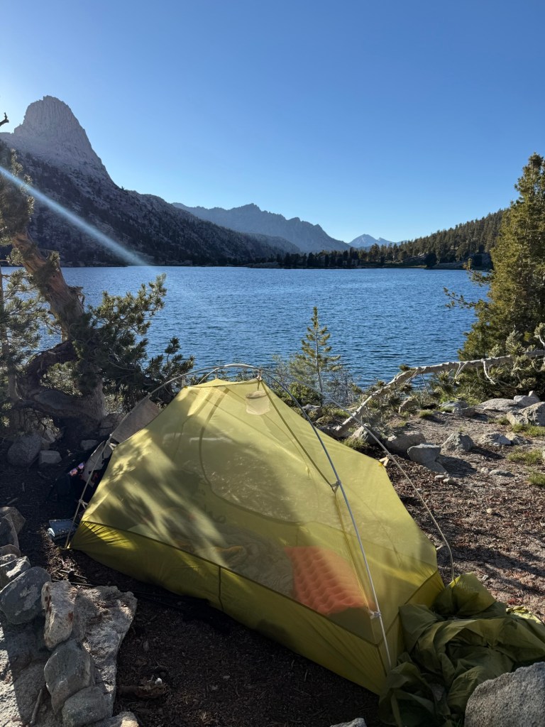
The skies were dark and threatening rain. We opted for a protected spot that would handle wind and any precipitation that may come our way. Just as everything was set up, wouldn’t you know the sun popped out, followed shortly by blue skies. This was great, but we would’ve opted for a site closer to the lake. Oh well!
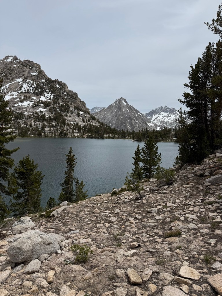
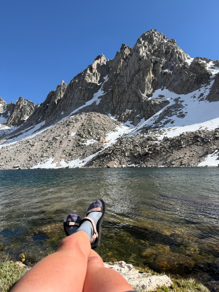
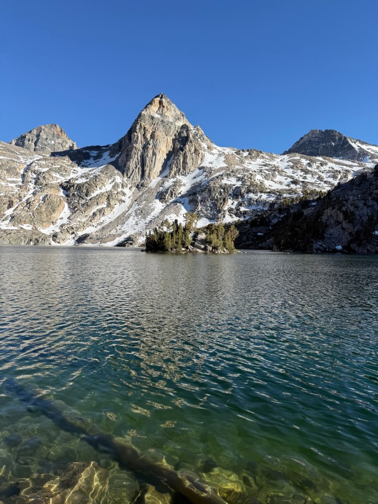
The lake is unbelievably gorgeous. It’s still too cold to take a dip, but it was nice to admire from the shore. It’s so peaceful and relaxing, there is nothing quite like an alpine lake. While taking in the views, I couldn’t help but notice something in the sky flying erratically. At first I thought it was a plane falling from the sky, but soon realized it was much smaller than a plane when it made its way into the lake area. Only for a minute or two – I couldn’t make heads or tails of what it was. It was small, but not a drone. Almost as quickly as it came, it left. It went higher and higher into the sky until it left view. No drone can just go off into the sky like that. I’m not an alien believer, but I can undoubtedly say that it was truly an unidentified flying object. It’s a mystery that will plaque my mind for the rest of my life.
It’s pretty chilly here so after the sun went behind the mountain, we retreated to our tents. I have a lovely view so I’m not complaining. Plus I have plenty of sleep to catch up on!
Day 55: June 9; 6.26 bonus miles
With a short day of mostly just getting up and over Kearsarge Pass, I was happy to sleep in a little. I woke up to cotton candy clouds dancing in the sky in the glow of the rising sun. Watching it while sipping a hot cup of coffee was sublime, it’s the little moments like this that really make the hard times worth it.
We’re fairly certain a bear walked through camp in the early morning. Something that sounded like someone walking heavily walked right by my tent around 5am. It woke me up but for whatever reason it didn’t bother me and I went right back to sleep. Upon waking up I discovered very fresh bear scat only meters away from the tent. With everyone seeing bears in the Sierra, I’m confident I did have a little furry visitor. Thankfully it wasn’t interested in anything more than a spot to do its business.
We said goodbye to Kearsarge Lakes and started the short rest of the ascent up the pass. It was a little over a mile of relatively steep climbing, but first thing in the morning before the sun peeked over the mountain made it a little less troublesome. Once at the top it was nothing but 5 miles of descent. At a gentle grade, it was nice stroll. I was dreading having to do it all over again the next day, but at least it wasn’t steep.
David’s dad was waiting for us at the trailhead. We hopped in the car and high tailed it to Bishop. This is apparently the go to town in the Sierra, where many hikers unintentionally get vortexed. I never visited it during my JMT trip, so I was excited to see what the hype was about this time around.
We stopped at the renown Schaat’s Bakery, which was certainly worth the hype. The sandwiches were huge and delicious. The bread reminded me of the bread from home. The west coast just doesn’t do bread like the east coast.
A lot of the time in town was spent doing chores. Laundry, resupply, planning the next few days. Doesn’t sound like a lot, but when facing the snow covered Sierra, strategic planning is a requirement. There are 10 major passes along the route, all with various levels of snow cover. If I was postholing on Forester Pass at 9am, I couldn’t imagine what disaster could befall on other more covered passes. It was necessary to map out each pass and attempt to guess the level of snow cover of each. The ones that have more (Glenn, Mather, and Muir) would need to be done early morning. This limits how many miles can be done each day, particularly tomorrow.
Originally we wanted to get over Glenn Pass. But at 10 miles in and an hour ride back to the trailhead, getting to it before 9am was deemed impossible. But after careful consideration, doing a shorter day tomorrow actually makes sense and sets us up better for the following passes. At least that’s the hope!
Bishop is a cool town, but not at all what I was expecting. It’s the largest city in Inyo County and as such is relatively busy. There’s a lot to do, but I didn’t find it as great as it was hyped up to be. I would love to zero, but don’t find it necessary. I’d rather conquer the Sierra and continue to move on. Plus this 100 mile stretch has taken forever to complete. I blame the nearly 50 miles of bonus miles with all the side quests (Cottonwood pass, Whitney, and Kearsarge pass). But that’s just how it goes when the Sierra is so remote.
Day 56: June 10; 4.7 + 7 bonus miles
With an anticipated short day, there was no real need or rush to get out of town. After sleeping in until 7am, it was time to get back on trail at 10am. On the way back to trail the news was being reported on the radio. Wow I do not miss not knowing what’s going on in the world. Going weeks without knowing what messes are happening has been such bliss. It’s definitely a perk of being on trail.
We started back up to Kearsarge, 5 miles of consistent climbing that I was dreading. Not going to lie, it sucked. Really sucked. Mainly because of heavy packs. I definitely think they’ve been heavier before with water carries in the desert, but the bear can adds a totally different feel to the pack. Having a big heavy plastic container poke you in the back for miles is anything but comfortable. But that’s just how it goes in the Sierra.
Eventually we got to the top and descended back down to meet back up with the PCT. Those few miles were beautiful, we took a different route than exiting and I loved it. Even though it’s 15 miles added to the trip, Kearsarge Pass was worth the effort and detour because of its pure beauty.
Glenn Pass continued to be a topic of debate today. Most of the PCTers we talked to were going to go over it. There’s definitely strength in numbers. I talked to someone doing the Rae Lakes Loop and asked them how their journey over Glenn was, as they were going the opposite direction and just went over it. At first she said it was fine and we’d be fine, but then backpedaled, cautioning us that it would be messy in the afternoon. It was 12pm and already pretty hot. The sun is intense at 11k’, making any snow on the north side of the pass a slushy mess.
But after talking with a guy who said he didn’t care the condition of the pass, it was too early to quit, we decided to adopt the same attitude and just get over it to spend the night at Rae Lakes. And so we did.
I don’t remember Glenn Pass being that steep, mainly because I was battling knee and hip pain going up it in 2018. But my goodness was that a horrible terrible climb. With exhausted legs I made it up. The heavy pack certainly didn’t help. Upon getting to the top we could assess the snow situation. There certainly was a long snow field to get over, but it looked well boot packed. We were on the summit with 4 other people who were going to go across it as well.
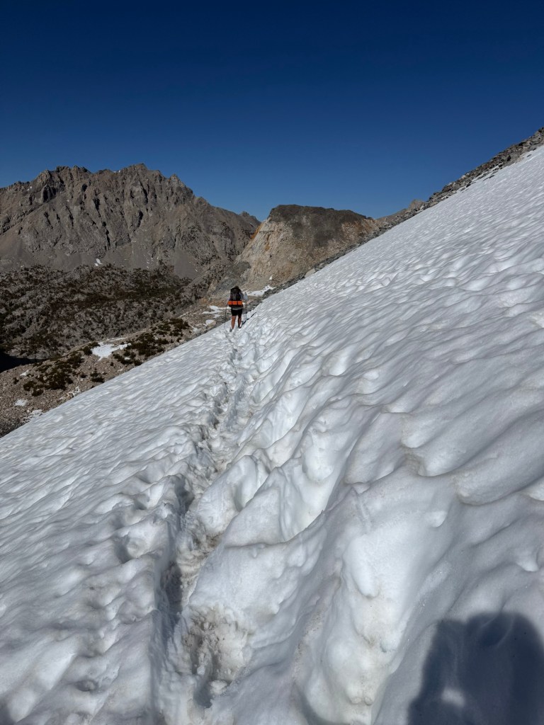
And so it was time to descent. The snow itself wasn’t horrible – it was slushy and I did posthole a few times, but it was fairly easy. I again made the mistake of looking down, even in the daylight it looked terrifying. One slip and there is no coming back from it – you’d steeply slide hundreds of feet down into rocks. It shook me but I continued on.
After the snow field I thought the worst of it was over. I was wrong. A lot of the switchbacks were covered in snow, so it was a pick your own journey of rock scrambling. The north side of Glenn Pass is steep under normal conditions. I remember feeling sorry for SOBOs in 2018. I still do, but getting down that was nothing short of a nightmare. Loose rock and jumping from boulder to boulder made crossing an ice field seem like a piece of cake. It took so much time getting down, but we did it safely so that’s all that matters.
Eventually we made it to Rae Lakes, which again feels like it belongs in Middle Earth (Rivendell, more specifically). We found a perfect camping spot and are only sharing it with mosquitoes. Lots and lots of mosquitoes.
I am a little nervous about bear activity. The rangers have been telling everyone about bear sightings and the Rae Lakes Loop crew said they saw 5 in their 26 mile journey, including a mom and two cubs. Yikes. But with a bear can, I’m hoping the bears won’t be interested in harassing little old me.
Day 57: June 11; 20 miles
It was a beautiful night. I stayed warm and was awoken by a lovely trio – the sun, birds, and fish jumping in the lake. It was only 5:03am, but I was awake and ready to take on the day. After all, it’s finally the day we hit 800 miles! It’s about time.
The day started with gorgeous views of Rae Lakes. I was already anticipating the views that were coming. In 2018 I remembered descending down into one of the most breathtaking views I’ve ever beholden. My hip, knee, and feet were aching but that all disappeared once I looked up. Before me were mountains of epic proportion, complete with a waterfall accenting its beauty. It was raining (as usual) and the dark clouds really made it look epic – so much like Mordor. I was so excited to see this again!
While still absolutely stunning, I don’t think it lived up to that fateful day in 2018. These mountains need dark gloomy clouds to really make them pop!
I’m so excited to have finally hit the 800 day mark. Keep tuned to see how the rest of the day went… it was a doozy and one I hope to never repeat.

