The Pacific Northwest is one of my favorite scenic spots in the United States. With hidden picturesque waterfalls around every corner, green moss hanging from trees who were just saplings during the American Revolutionary War, and rivers dusted with grey gloomy fog, the PNW is the setting of fairytales and holds a very special (and magical) spot in my heart. Coming off of the Grand Canyon Rim to Rim hike, I was looking for a loop hike I could do in less than a week. When I stumbled across the Three Sisters Loop in Sisters, OR, I knew I found the one. In 2016, during my cross country bike ride, we rode through Sisters on our way over McKenzie Pass on the second to last day of the ride. Being the last pass on a 2.5 month journey, this little town made an impression. I was happy to go back and explore the Three Sisters. Plus, though this loop does require a wilderness permit to hike, you can fill one out at the trailhead. There is no limit to the number of walk-up permits so there is no silly lottery system. However, starting next year they are beginning a lottery system, so the timing was pretty darn perfect!

The Three Sisters Loop is a 50 mile trail that loops around – you guessed it – the Three Sisters. Set in the cascade mountain range, the trail takes you around the North, South, and Middle Sisters – three volcanoes of various levels of (in)activity that make up the notorious Three Sisters. Known for a very limited window of opportunity to hike due to early and late snowfall, I knew that hiking this trail in the beginning of August would be perfect.
When doing my research for this trip, I scoured the internet for trail descriptions and maps, mainly so I knew how to break down the 50 mile loop trail. I found a few great blog sites authored by folks who had hiked it, but couldn’t find much information on campsites along the trail. Being so, I winged it. All I knew was I definitely wanted to stay at Camp Lake, a 10 mile addition that takes you to a lake right at the base of Middle Sister. I also saw (last minute) that you can actually hike up South Sister. Why wouldn’t I opt to hike an additional 10 miles up an active VOLCANO!? It was a done deal. I was prepared to hike 70 miles over the course of 5.5 days. Relatively easy hike.
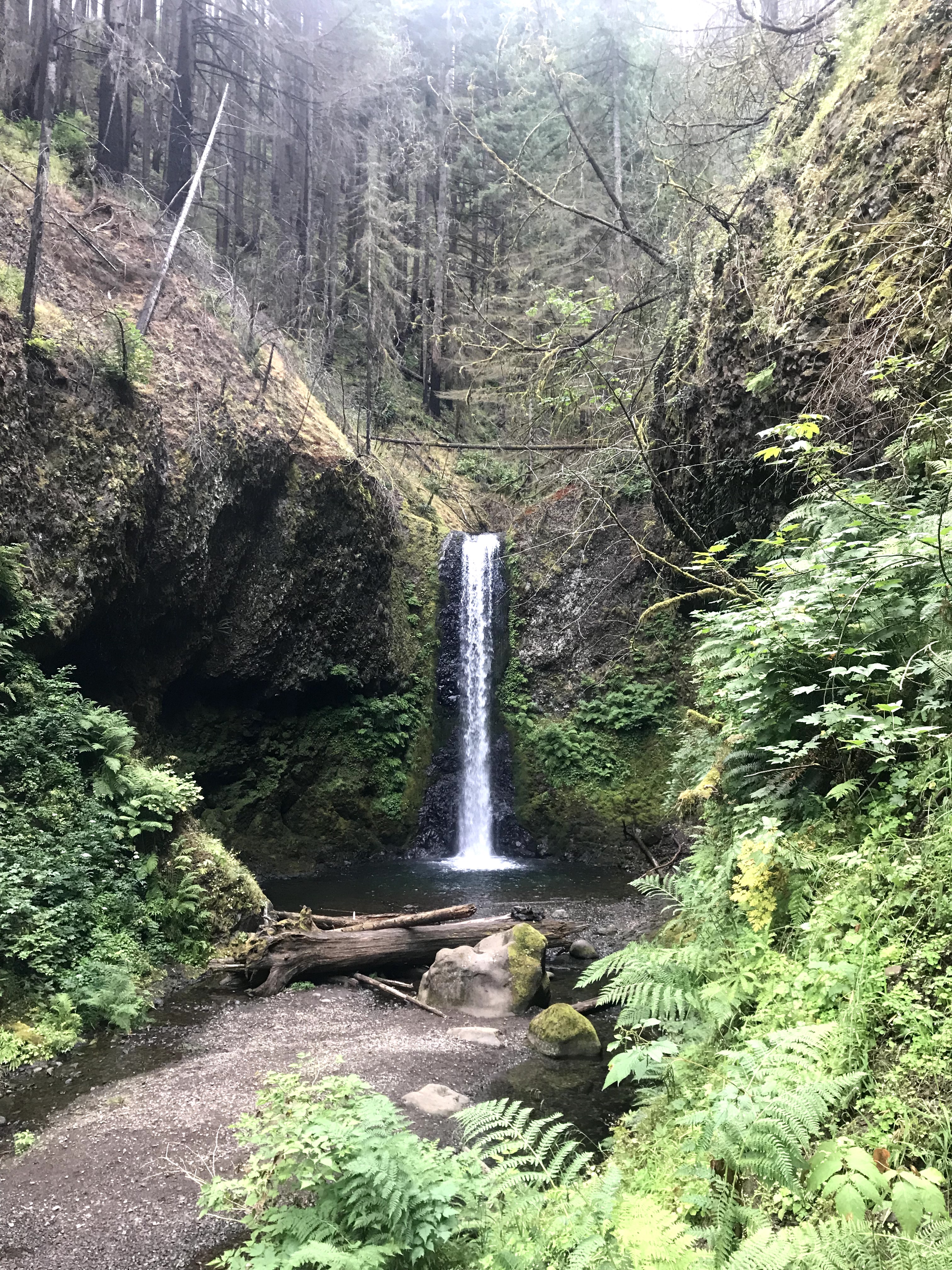
After gathering gear and buying a lifesaving map off Amazon, I was on my way! I flew into Portland and stayed 2 nights at a hostel there. I explored the Columbia River Gorge and revisited my beloved Multnomah Falls – true magic that not even Disney could replicate. The next morning I woke up super early partly because I had a 3 hour drive to the trailhead to start this solo journey, and the majority being that my body was still on east coast time, so I couldn’t sleep in even if I wanted to.


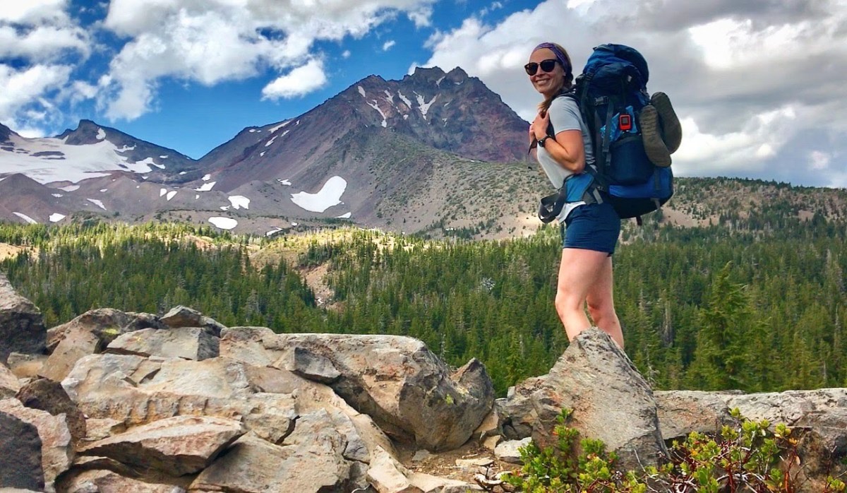
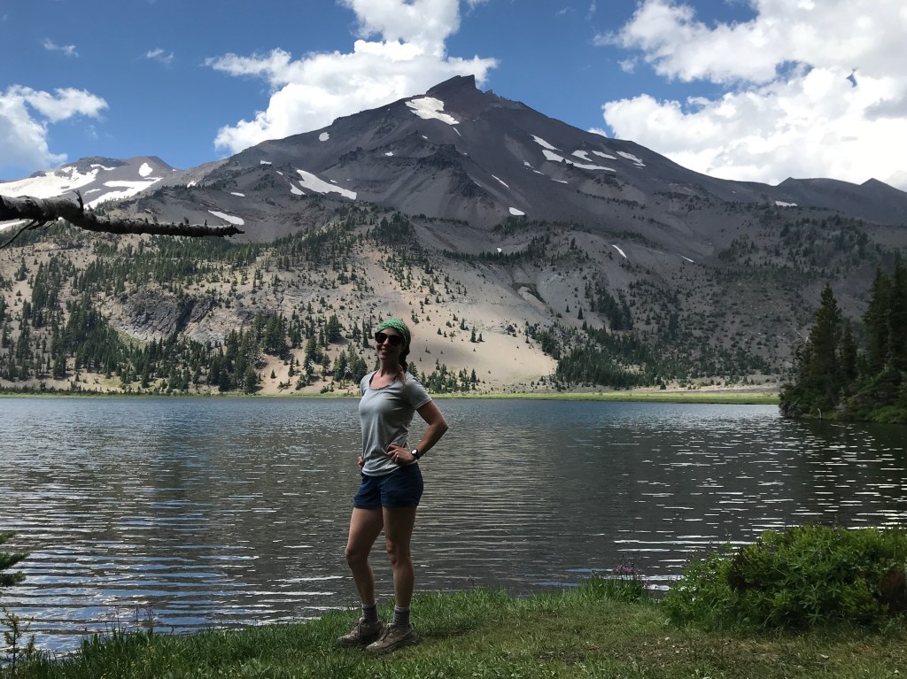
At 10:30am I arrived at the Pole Creek Trailhead, one of the many trailheads you can use to access the Three Sisters Loop. It was a rough ride to the parking lot on an unpaved road full of crazy kamikaze chipmunks who took pleasure in watching unsuspecting motorists swerve out of the way to avoid running them over. The parking lot was full – except for one spot that I very quickly grabbed. It was pretty darn hot out and the lack of shade definitely exacerbated that. In 2017 there was a devastating fire that wiped out the majority of the forest in this section. Without trees, the whole area is pretty exposed without respite from the sun. So I lathered up plenty of sunscreen, gathered my stuff, and filled out my permit. at 11:19am I set out for the loop, ample time to make it the 7 miles to Camp Lake.


The beginning of the trail was 1.7 miles of uphill to the official loop. Once on the loop, it’s practically impossible to get lost. With the Sisters as landmarks, if you just keep them to your right (I was going clockwise), you are going in the right direction! After 1 mile on the official loop trail, I took a right and started my journey to my first “excursion” to Camp Lake. Having the time and hearing amazing things about this little lake, I didn’t mind taking the side trip. Although, the 5 miles to the lake were unpleasant and I couldn’t wait to get them over with. They were uphill and just not my cup of tea. But I did meet a very friendly ranger who was checking permits. We talked briefly about our time in the Sierras/JMT (he took kids there for summer camps) and talked about weather – in which he said I should expect thunder storms this evening. Oh my old nemesis – we meet again.


When I stared out, there was barely a cloud in the sky. The few that were there were convening over South Sister. They were cute little fluffy buggers, innocent looking enough. However, this wasn’t my first rodeo and I could hear them talking in my head. “Hey! Did you hear Emilie is on the trail?! Let’s get everyone together and put on a show for her this afternoon!”. Having experienced horrible storms on all of my backpacking trips (it monsooned 17 of the 20 days on the JMT), I knew that even the smallest most innocent clouds can turn the nastiest. And I was right. The party was meeting right above South Sister and they were not happy. I picked up the pace hoping to get to camp before the storms unleashed their power.
As I was rushing, I heard a loud BOOM that stopped me dead in my tracks. All simultaneous thoughts, I began to worry about thunder, gun shots, or a car door slamming. Being that none of these were viable causes for the loud and sudden noise, I looked around and right in front of me was a huge rock slide coming down from Middle Sister. Not my first rock slide (I witnessed one climbing Mt Whitney) I watched in awe. It is the most jarring sound and the cloud of dust that followed was huge. I may have been the only person who witnessed that powerful moment.


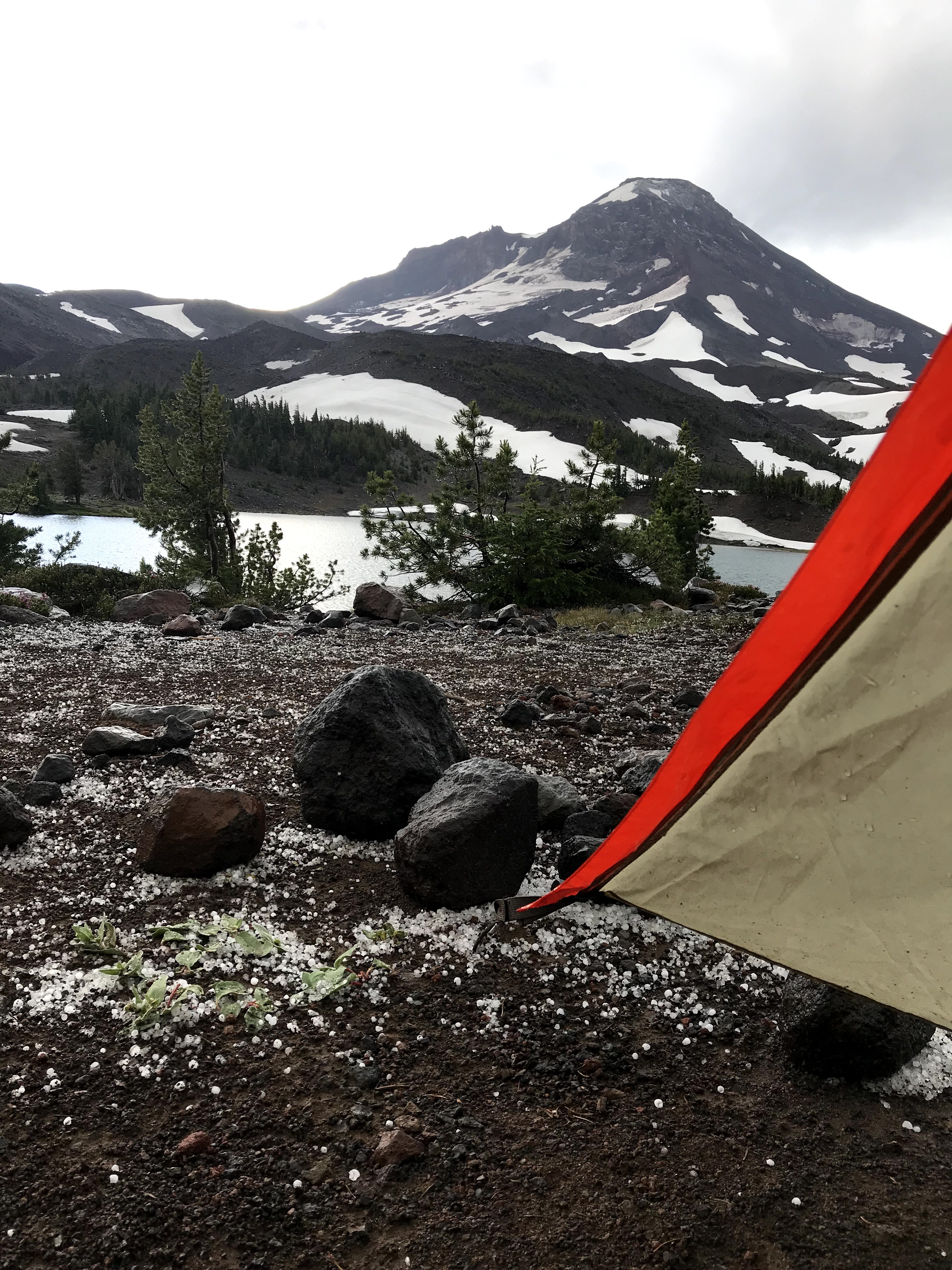
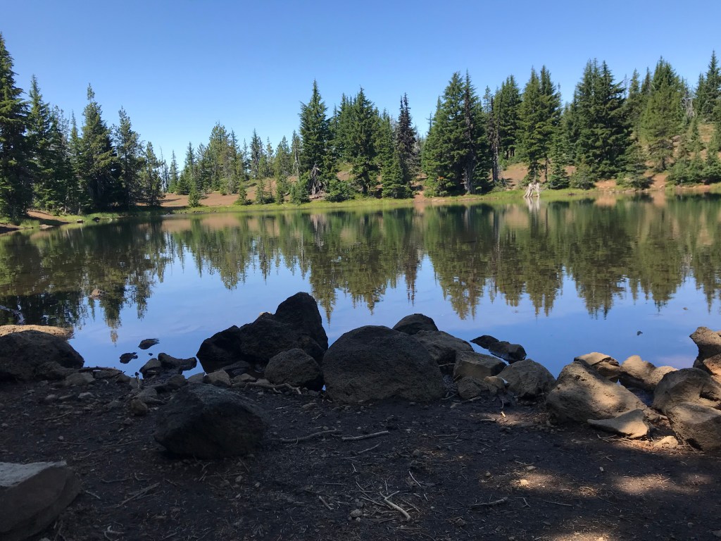
After what felt like eternity, I finally made it to Camp Lake! I quickly found a campsite (not hard to do, there was only one other group there) and right as I finished setting up camp, the thunder rolled in. I saw 2 guys sprinting down Middle Sister in sheer panic and I soon sought shelter in my tent. I quickly wished I bought a new tent because the old Marmot ain’t what she used to be. But I had to deal with what I had. At first I didn’t think anything of this storm. Sure I was pretty exposed at 7,000′ in a crappy little tent, but like I said, this wasn’t my first rodeo. The rain was pouring down in sheets and the lightning turned pretty violent. Then the rain did too, aggressively so. I looked out and saw it wasn’t rain at all, but pea sized hail. If they got any bigger, I knew it would shred the tent. So I just buckled down and prayed that didn’t happen.

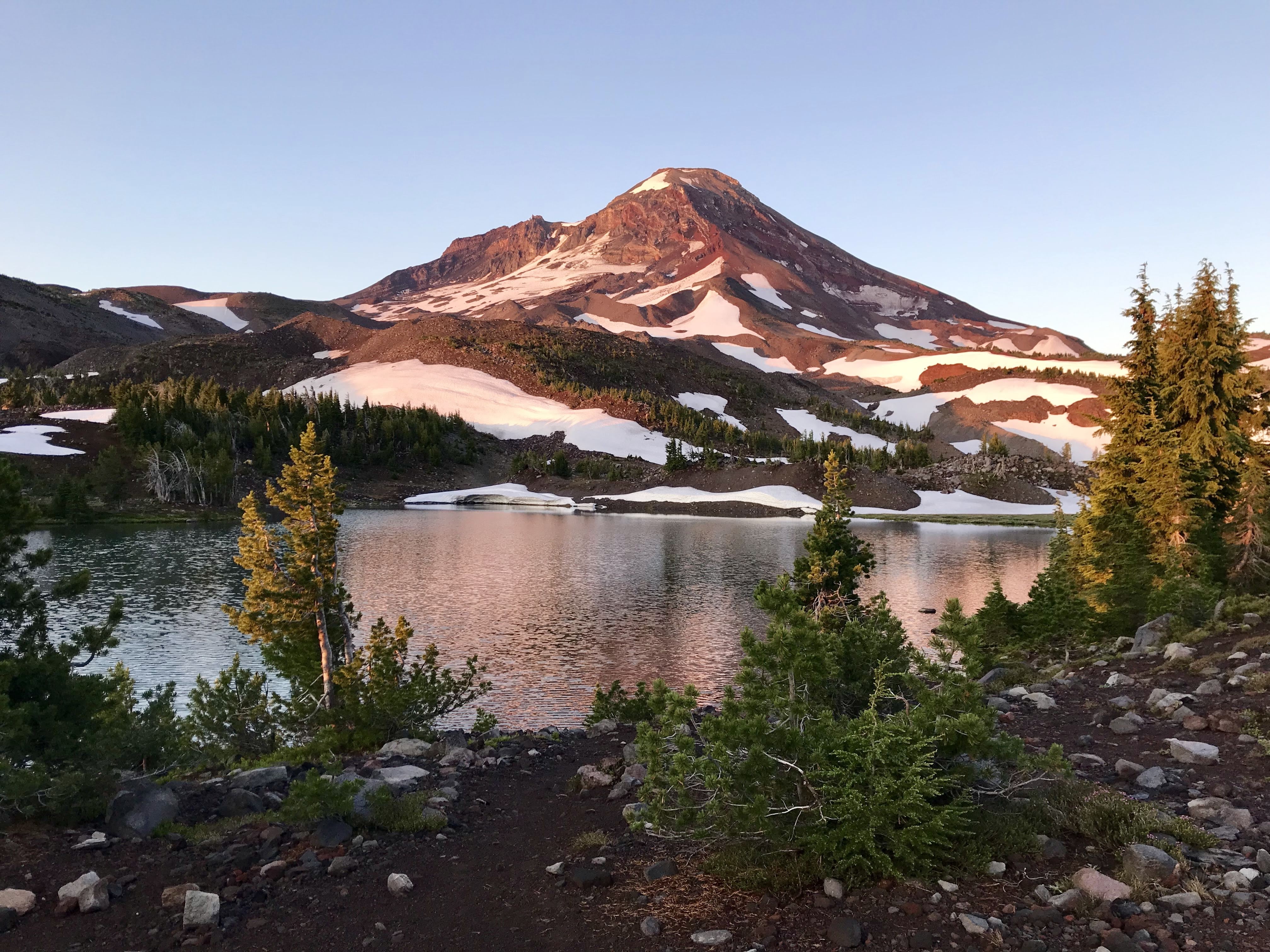
Eventually everything slowed down to the point where I was relaxed enough to take a nap. During the storm the temperature dropped at least 20 degrees. But when I woke up the sun was shining and it was starting to heat up again to the point where my tent felt more like a sauna. I took advantage of the pleasant weather change and took a walk around the lake. It was simply beautiful. During the trek, I stumbled upon a pretty awesome snow tunnel carved by a crystal clear stream. The sun soon was taken up by more clouds and I went back to my site to cook dinner before another storm rolled through, much less aggressive than its predecessor.
At 12am I woke up and took a peek out of my tent. What I saw took my breath away. I have seen some beautiful night skies in my day, but I have never seen such a marvelous display. The milkyway was brilliant and dazzling, like a knife carving through the dark night sky. I could see it with such clarity that it was as if I could reach up and take a bite. Making the side trip to Camp Lake was worth it, if just to witness that night sky.
In the morning I broke down camp quickly and set out for the trail at 7am totally not at all thrilled with the prospect of having to backtrack almost 5 miles to the trail junction. But it was at least a down hill 5 miles so I packed up camp, strapped on Big Booty Judy and away I went, totally zoned out. After 2 hours I finally reached the split and set out for Green Lakes – my prospective home for the night. Being only 9 miles away, I knew I’d get there before 2pm leaving a whole afternoon to just sit around. Not one to overly enjoy free time, I toyed around with the idea of going an extra 5 miles to Moraine Lake, which would make it a pretty hefty day. My original plan was to stop at Green Lakes tonight then get up SUPER early tomorrow to drop my gear at Moraine Lake so I could summit South Sister. Going the extra distance to Moraine would logistically make sense, but I was going to play it by ear and listen to what my body told me.
The trail to Green Lakes had its ups and downs – literally. But let me tell you, it was pretty. What wasn’t so pretty was the attitudes of the limited amount of passerbyers I ran into. Most were not very friendly, barely getting out of your way on the trail and not even acknowledging your hello. However, the ones that were friendly donning smiles all asked about last night’s thunderstorms. We all shared the same terrifying experiences.
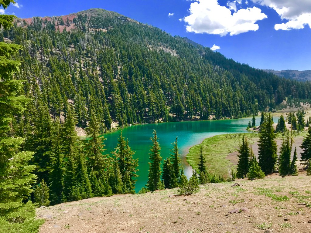
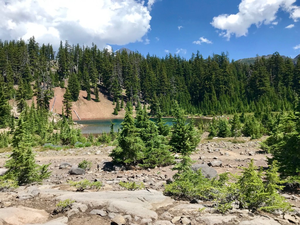
The trail opened up into a meadow with a full view of all three Sisters and Broken Top. It was stunning. I made it to the very aptly named Green Lake (I’ve never seen a more radiant emerald green in my life) at 1:15pm – as did the clouds. I decided then that I would go the extra 5 miles to Moraine Lake. I was worried that if I delayed getting there until the morning, all the sites would be taken and there wouldn’t be a place for me to drop my pack before the ascent up South Sister. With my mind made up and the clouds rolling in, I figured I’d better set out quickly to beat any potential storm.
The 5 miles to Moraine Lake were mentally exhausting, but came with reward. It led me through lava fields and streams that were truly gorgeous. Finally I made it to the lake at 3:32pm. With thunder booming in the distance and physical exhaustion setting in after 18 miles of hiking, I found a great spot to set up camp and lay down. I was almost immediately rewarded for my decision to go the extra distance because within 2 hours all the spots were taken by other eager hikers.

I spent some time down at the Lake’s shore. Moraine certainly isn’t as scenic as Camp Lake – especially with 3 grown men bathing in it – but at least it’s only 0.3 miles away from the South Sister cutoff trail. I spoke briefly to the three bathing men who had just completed summitting South Sister. They admitted it was tough, but totally doable. It took them 4 hours to get to the top because of the massive elevation gain. The pit in my stomach grew only slightly. But I effectively squashed its growth. Surely if these guys could do it, I can too!

After going to bed early, I woke up early to get moving by 6:24am. With an elevation gain of 4,000′ (Moraine Lake sits at 6.3K’ where as the summit of South Sister sits pretty at 10.3K’) over 3.5 miles, I knew my body was in for a rude awakening. I don’t think I’ve ever gained that much elevation in such a short distance before (event the Grand Canyon was more forgiving) but I was ready for the challenge.
I set out at a leisurely pace, allowing my legs to enjoy what was surely to be the only relatively flat part of the trail. Then did things change – quickly. The gentle grade yielded to a steep slope with pretty efficient elevation gain. Soon Moraine Lake was looking smaller and smaller and the summit was inching closer and closer to my grasp. In fact, 2 hours in, I swore I was about to reach the top! Not too shabby! I was pretty impressed with myself when I asked a couple coming down (they spent the night at the top) if it indeed was the summit. They laughed. Nope, it was a false summit hiding the true summit. I still had a ways to go. My legs were starting to protest after the initial climb. But their protests fell on deaf ears cause I was making my way to the top, with OR without them.
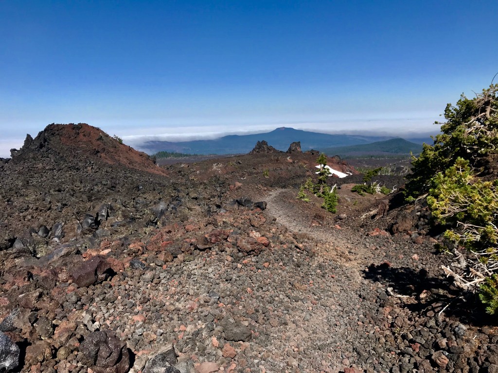
The ascent up South Sister was insane. Being an active volcano, the whole way to the top was cinders, pumice and lava rock, all of which are very unstable and loose. It’s very similar to hiking on sand – one foot forward, 6 inches back. Thank God I had enough sense to bring my trekking poles. A couple I ascended with (Paige and Ken from Lexington KY) did not have poles and I felt so bad for them. But hey, they were doing it – and I heard not one complaint from either of them.


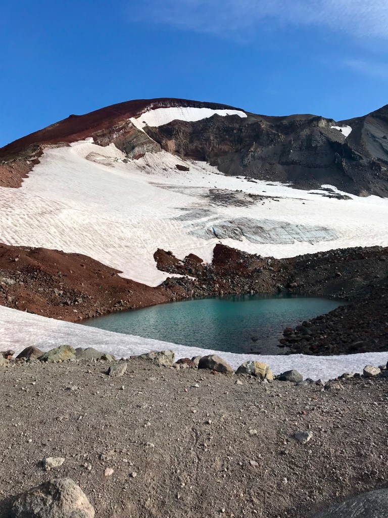
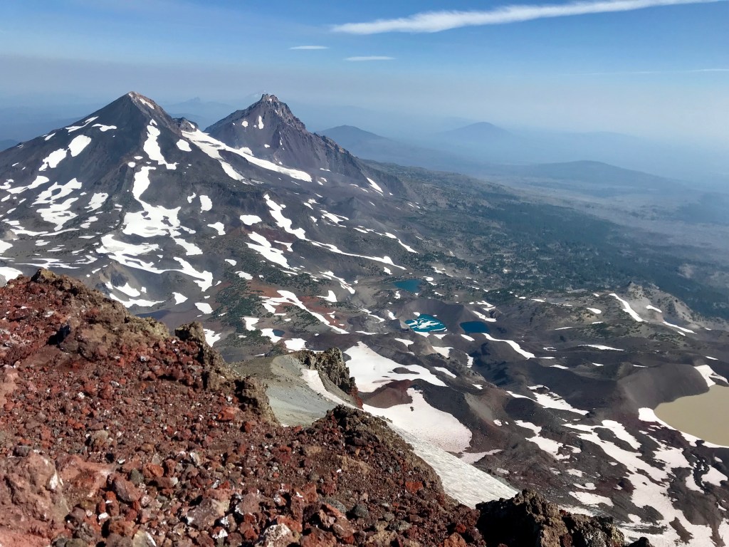
The trail follows a razorback ridge with Lewis Glacier to the east. The glacier named for the second half of that famous expedition – Clark Glacier – is to the West. I didn’t know it at the time but I was between the arguable founders of the West! While taking some time inspecting the glacier, appreciating its immense and powerful presence, I noticed that it was carved with crevasses. Even with my limited understanding of glaciers I knew that crevasses are often times hidden and extremely unstable. One is liable to fall in and never come out – the cause of much of my hiking anxieties. Just as I was having this thought, I heard Paige and Ken as well as another couple we were keeping pace with gasp and say, “Oh my God! There are people crossing it!” I looked over and sure enough, there were 2 people who looked surprisingly like ants crossing over the glacier, heading straight to the deepest crevice. My stomach dropped. They were dangerously close, like 5 feet away. It made me sick. I was sure I was about to witness the traumatic death of two strangers. The other couple (Christina and Marcus from San Jose CA) took pictures every minute of the thrill seekers, tracking their progress across the glacier so when they eventually do fall in, there is a record of where/when for search and rescue. After about 10 minutes, the daring duo SOMEHOW made it across the frozen tundra and were making their way to the top on the same trail as us. We knew we’d run into them at the top.

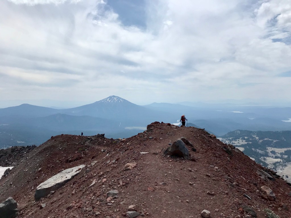
After a tremendous climb, we made it to the ice field that was covering the opening of the dormant volcano. The worst of the climb was over! Only 0.5 miles to the true summit with an elevation gain of 100′. I was elated. The whole rest of the hike I talked with Christina and Marcus. What an interesting couple. They have hiked 1000s of miles all throughout the country in all kinds of weather conditions. They had stories where they thought they might never make it out alive as well as stories of pure elation enjoying scenery, adventure, and good company. I could’ve talked to them for hours.
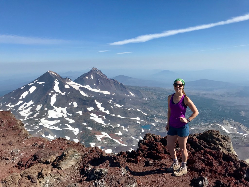
The summit offered gorgeous sweeping landscape views of North Sister and the surrounding mountains. However, after only half an hour at the top, I started to feel sick. Like violently vomit sick. I knew this feeling all too well. At 10K’ I knew I was getting altitude sickness and needed to get down ASAP. I told Christina and Marcus, and they started the descent with me, along with Paige and Ken. While we were descending, we were in the midst of 1000s of tortoise shell butterflies making their annual migration. I felt lucky that I happened to schedule this hike during the migration unknowingly, for it was such a magical moment.
During the descent, I got to know both couples better. Paige and Ken are planning on retiring in Bend, OR in just a few short years to spend their golden years skiing and hiking. During the conversation, we were passed by a young man who looked familiar. Paige instantly recognized him as one of the two daredevil glacier crossers. She questioned him about his death defying trek. Dressed in baggy basketball shorts, sneakers, and equipped with a draw string bag, he was totally clueless the danger he put himself in. He admitted this was only his 3rd hike – ever. He only started hiking last week. And the other person he crossed with? They had just met that day. Beginners luck I guess.
Soon all the couples and I parted ways at Moraine Lake. They had another 2 miles to get to Devil’s Lake, where they started. I got back to camp at 2pm completely wiped. I thought about going 5 miles to Rock Mesa Creek, but just the thought put my legs and feet into full panic mode. This time I listened. I decided to give my body a rest and enjoy the afternoon. I filled my water, went for a dip, and just relaxed, reflecting on the almost perfect day I had climbing South Sister.
*Prior to this very sentence, I gathered all this information from my trail journal, detailing every boring detail of the day. Now that I’m writing this 17 months after the journey with a lot of life changes, the trail journal is stuffed in the deepest darkest corner of my storage unit. Retrieving it requires a level of finesse and patience that I lack at this moment, so the rest of this excerpt will rely solely on my memory – admittedly my worst attribute. But because waiting to write this blog till forever has been weighing heavily on my soul (and needing to check it off for future entries this spring), I will trust in my memory and make any edits when the little red diary resurfaces.*
After a storm free night, I broke down camp and set out for another day on the trail. My expected overnight stop was only 9 miles away at Reese Lake. Thinking I would get there early, I looked into pushing a little further. I was going to make that decision once I reached Reese Lake.
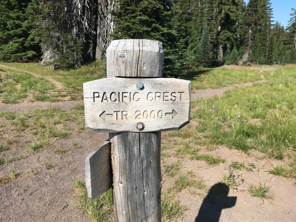
My morning was quiet and I didn’t see many other hikers along the way. After a few miles, I turned onto the PCT where I figured was a perfect spot for a short rest. At the junction, as I was grabbing some snacks, a hiker joined me. While I forget his name a year and a half later, I will never forget this particular man. In his 60s, he was an accomplished orthopedic surgeon who did not seem overly impressed that I was a physical therapist, all but telling me he thought rehab post surgery was pointless. He was section hiking the PCT and he was on day 2 of a 5 day jaunt. At the time, though a little rough around the edges, I enjoyed his company. We set out together and hiked a few miles before I rethought my first impressions. The conversations that ensued left me feeling a little uncomfortable (not in a creepy way) with undertones that were not exactly politically correct. After he lit his 6th cigarette on the trail, I decided I needed some solitude and told him I was going to pick up the pace in an effort to ensure a camp spot at Reese Lake and I bolted, unsure but hopeful this would be my last encounter with him.

I reached Reese Lake right around noon, entirely too early to stop. The lake was full of happy hikers reveling in the cool water on such a hot day. With much of the trail exposed, I could see where the water was tempting for a hot and sweaty hiker. But terrified of the far-fetched possibility of obtaining a brain eating amoeba, I never indulge in an alpine lake dips. I sat far from the trail with the lake still in view in an effort to avoid being spotted by Richard (I know for a fact, that’s not his name, but let’s just call him that for now until I find my journal). I ate my lunch in peace, entertained by the swimmers and the occasional dog.
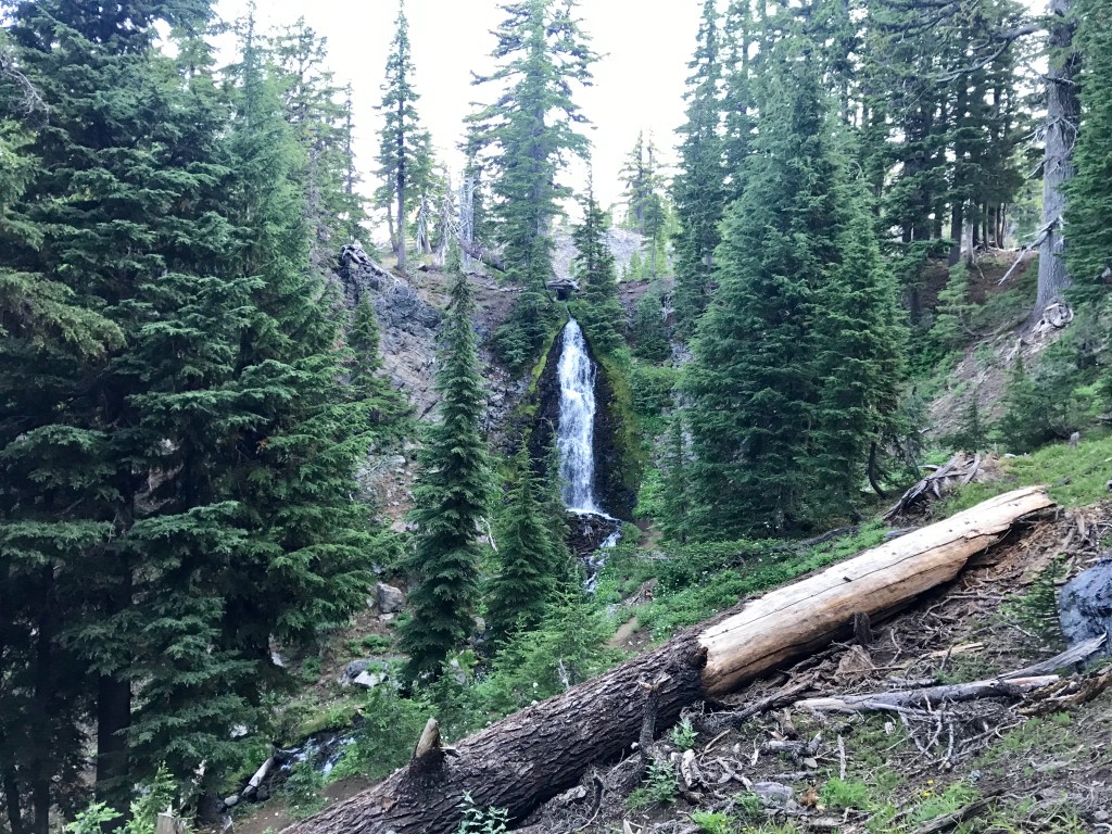
As I was relaxing, I looked at the map and tried to come up with a plan for the afternoon. The next few miles of the trail looked pretty bare in the way of campsites. Obsidian Limited Entry Area was 5 miles away and though would make a great spot to stop overnight, it’s illegal to do so without a specific permit. And I was plum out of specific permits. Only a mile long stretch, Obsidian was detailed as an oasis full of ferns, life, and waterfalls. I figured that outside of it’s borders there should be camp sites. Based solely on a guess, I packed up and set out for 5 miles to the southern border of OLEA.

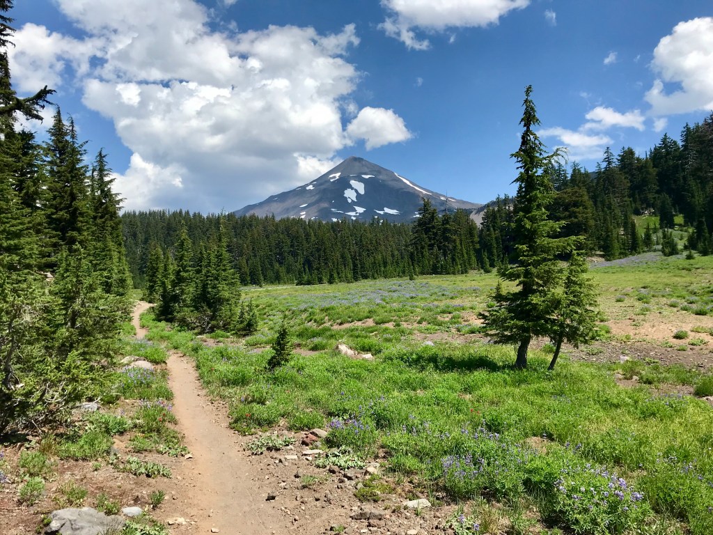
The hike there was gorgeous, with purple wildflowers showing the way and grand views of The Husband with barely a hiker in sight, I was in basking in solitude bliss. It was a flat stretch and I was able to cover ground pretty quickly. I found myself at the edge of OLEA around 3pm. Still earlier than I wanted, I found a perfect camp spot and dropped my pack. Before setting up camp, I took a short snooze in the shade. I explored the area around camp and found the perfect site for a tent. The tent was pitched and dinner was eaten and I took in a beautiful sunset all to myself. I was so enamored by it I didn’t even think to photograph it.
After the sunset in the purple dusk, I saw Richard pass by. Not wanting to disturb my peaceful spot, I ducked low in my tent, fairly certain that he did not see me. In this moment, I wondered “am I the unfriendly hiker I was so annoyed with just 2 days ago?”. But this thought was fleeting as I told myself no, Richard was just difficult to tolerate for long stretches.
I had a disturbing night sleep that night and was happy to get moving in the morning. Though a perfect spot to stay for the night, I had an uneasy feeling about that campsite. Right before strapping on Big Booty Judy, I figured I should empty the old tank. I went over to a tree I used just the day before and right before I was to release my bladder, I noticed a black book. Where did that come from!? I picked it up and flipped through it, trying to find any information with regard to its owner. As someone who journals all my adventures, I would be heartbroken if I lost mine. I would hope that if someone picked it up, they would try their best to return it to me. However, besides some deeply disturbing doodles, there was no information as to who this journal belonged to. Despite this, I strapped it to my pack and decided I would look more thoroughly later, determined to return it to its owner.
I entered OLEA and what I read about it was true. It was stunning. I walked down to the waterfall, where I ran into Richard again. We talked briefly. He camped just right past where I was. He saw he saw my tent, but wasn’t sure if it was me. I told him I must’ve been asleep already. A little white lie never hurt anyone.

We trekked together on and off that day. Despite being in his 60s and a chainsmoker, Richard was in pretty good shape and could keep up with me the majority of the time, with the exception of steep inclines. We stuck together through the Sister Springs. It reminded me so much of the JMT it filled me with nostalgic yearning to go back to the Sierras.

When we reached the lava section, Richard slowed considerably. I went ahead and fell completely in love with the landscape this section offered. It was like walking into an evil castle, with pumice spires and dragon fire ravaged decay. I hiked through those two miles with a smile on my face. Though gorgeous, this section was relatively steep. The switchbacks up Sawyer Bar were intense and hot, but worth every drop of sweat for that view of clouds bathing in the valley. At the top, I waited for Richard, cheering him on as he slowly ascended to the top. He was very proud of himself, and I was proud of him too. Knowing that he was pretty tired, I figured this would probably be the last time I’d see him. I told him I was planning on having lunch at South Matthieu Lake, where I’d be turning off the PCT and onto Scott Pass Trail. He’d be continuing on the PCT. We agreed we’d meet at South Matthieu Lake for a final farewell. With him still catching his breath, I continued on to make my way over Opie Dilldock Pass.

Compared to other passes I’ve trekked, Opie Dilldock Pass was a piece of cake. It offered fantastic views of Mt. Washington, Mt. Jefferson, and Mt. Hood. I took in the view for a few minutes before starting back up to South Matthieu Lake.

Having only hiked 7 miles to the lake, I didn’t feel super tired. But it was only 11am so I figured with only another 5 miles to my camp, I took some time to just relax waiting for Richard. It was at this point that I remembered I still had the mysterious journal from the morning. I took it out and started to read it. What I found within its pages was deeply disturbing and I had no clue how on earth this journal ended on the PCT in Central Oregon. The only entry that even alluded to the PCT was a day hike in the Sierras, hundreds of miles away. The other entries spoke only of a European backpacking trip, substance abuse, and internal struggle. The author clearly had a lot of demons, but the author was never identified. I couldn’t even tell if the author was male or female, let alone any kind of information to return the journal to them. After noticing a chill in the air, I took note of the time. It was 1pm. I couldn’t believe it! I was so engrossed in the journal I lost all concept of time. The chill was to the bone. I checked the temperature. It dropped 20 degrees since I took rest. The sky looked the ever familiar gray I have grown accustomed to and the clouds consumed the sun. I grabbed my jacket and looked at the journal. It emitted such a horrifyingly negative energy that I didn’t want to carry it anymore. So I made the decision to leave it. The 7 miles it hitchhiked on my pack was enough. I looked around for Richard, but there was no sign of him. With an impending storm and having already spent 2 hours waiting for him, I couldn’t wait any longer. I had to go. Indifferent towards not saying a final farewell to the man who I didn’t altogether enjoy hiking with, I said good riddance to the journal and headed out.
Sure enough, thunder boomed in the distance and I was sprinkled with a light cold rain. I made it to the camp early, once again. Only 5 miles to the Pole Creek Trail Head and the end of my trip, I considered pushing it. But considering I wouldn’t make it into Bend until late and I didn’t know where I would stay, I decided to make camp and enjoy my last night out in the wilderness. I wasn’t all that thrilled with my camp spot – not because it wasn’t great, cause it was. It was right next to the flowing Alder Creek and pretty secluded. I just had an eerie feeling about it. That night I tossed and turned, with images of the journal floating through my mind. I’m glad I got rid of it. I’m convinced it was evil and I didn’t want it anywhere near my tent.
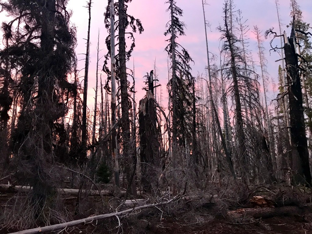
I got up early that morning and got out of Dodge. The 5 miles in the wildfire stricken forest went by quickly and I soon found myself at the parking lot, the end of another journey.

While I enjoy any adventure I go on, this one was different. Devoid of too many other hikers, I was alone for a good portion of it, not something that usually bothers me. But this time it did. Looking back on it, I should’ve planned to hike longer mileage days so I didn’t have so much free time. I could’ve easily hiked this trail in 4 days as opposed to the 6 I took. The terrain was not difficult and aside from the voluntary South Sister venture, the elevation change was manageable.
Soon I was on my way to Bend, where I explored, got souvenirs, and had a wonderful dinner. At dinner I met Alex and his friend. We spoke of the adventures they went on together and of the Three Sisters Loop I had just finished. We agreed to hike Mt. Bachelor the next day before I had to head to the airport. However, that night I opted out after doing some research. The road to the trail head required a 4×4 and I did not want to risk damaging the rental car. So I thanked Alex for the invitation via text, but declined the offer. I was saddened that I had to refuse, as the pictures he showed me were awe inspiring.
This trip confirmed my love for the PNW, offering different landscapes that I fell in love with. My night at Camp Lake and the hike up and down South Sister was so incredibly memorable, it was worth every step just for those two experiences.
