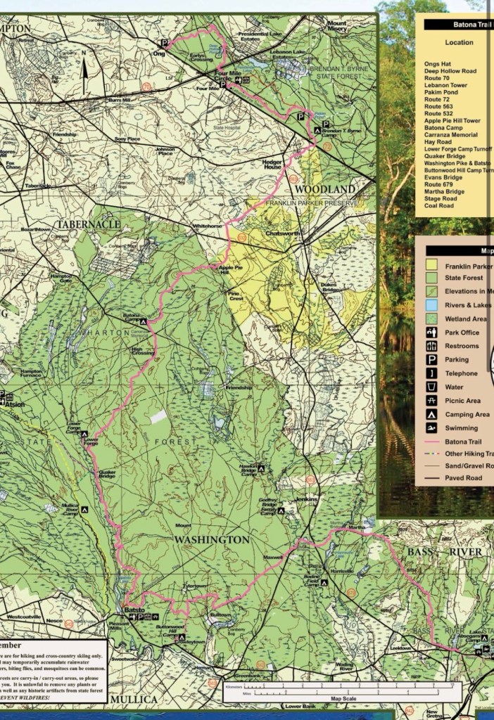
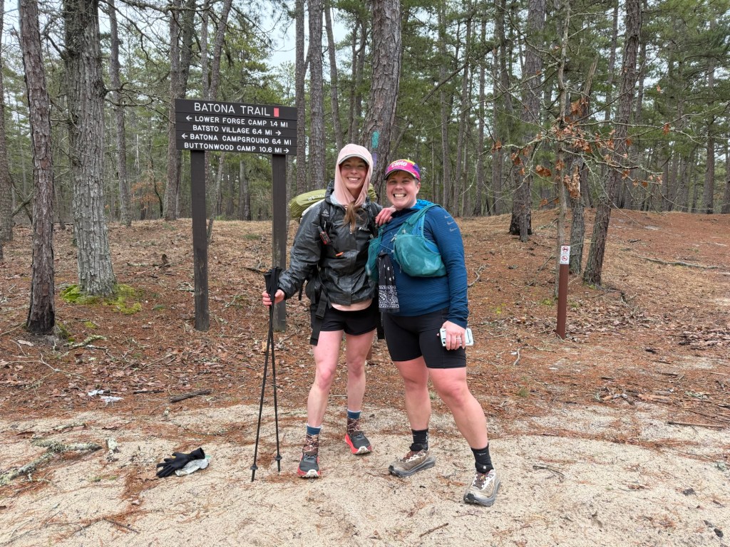
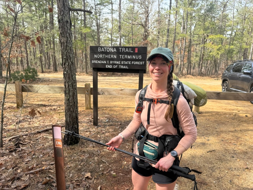
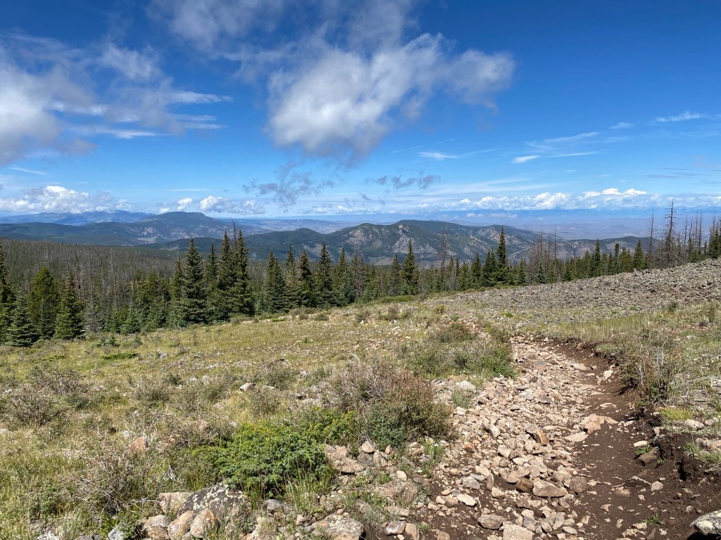
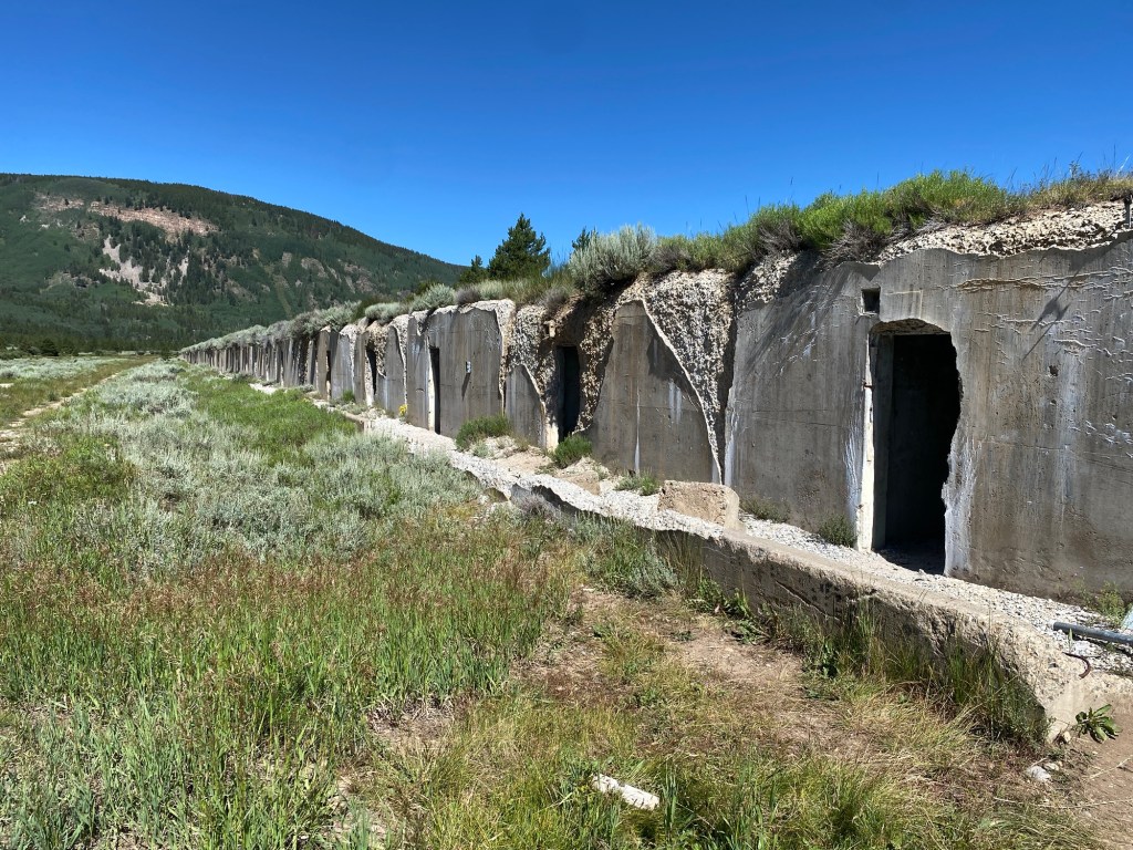
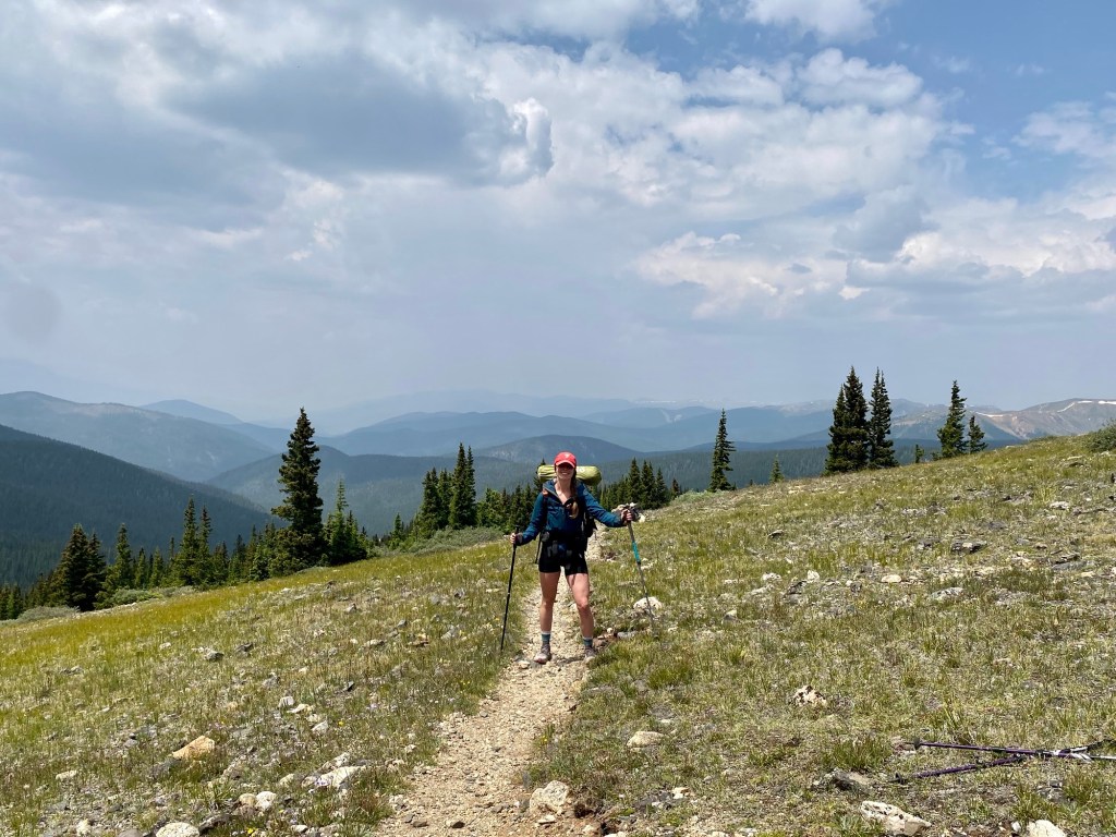
The Batona Trail is a 50-53 mile (honestly I don’t think anyone knows. It’s impossible to find a correct and accurate mileage report, more on that later) thru trail that got its name from condensing the phrase Back To Nature into the cute little name it goes by now (Ba-To-Na). The trail cuts through three state forests at the heart of the Pine Barrens. Common in Jersey lore, the pine barrens are a unique habitat punctuated with pine and oak trees and home to many cedar water rivers, flora, and fauna. And above all, the pine barrens are home to the infamous Jersey Devil, a figure who just the thought of sent shivers down my spine camping in Girl Scouts. But really, the Batona Trail is just a boring flat trail that held no interest to me. With sandy trail and monotonous views void of sweeping landscapes and vistas, why would I ever waste my time completing this trail?
Well, all these negatives are exactly why I decided to thru hike the Batona Trail. In preparation for the PCT, I needed a shakeout trail that would test not only my gear and physical abilities, but something that would test my mental fortitude. Cue The Batona Trail. Can I handle big mile days? Sure. Can I handle all my gear and survive if something fails? Hopefully. But can I manage to not want to jump out of my skin if I’m bored out of my mind on a trail that brings nothing to the table? Well, this is where I have my doubts. So I packed my pack (Minnie is back), strapped on my new (discounted!) trail runners, and set off in hopes of conquering the BT.
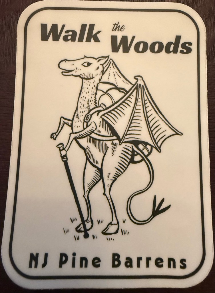
A sticker I picked up at the Visitor Center. Isn’t the Jersey Devil such a cute little guy?? Nothing to be afraid of!
Logistics for this trail were… difficult. I only could afford 3 days and 2 nights. 53 miles in that timeframe is totally doable. The wrench in the plans is camping. You cannot wild camp on the BT. You can only camp in established campgrounds that you have to register for. The problem is they are horribly spaced for a 3 day attempt. The only way I could work it would be a 17 mile, 18 mile, then a 20+ miler. Not ideal, but could be worse.
So it begins.
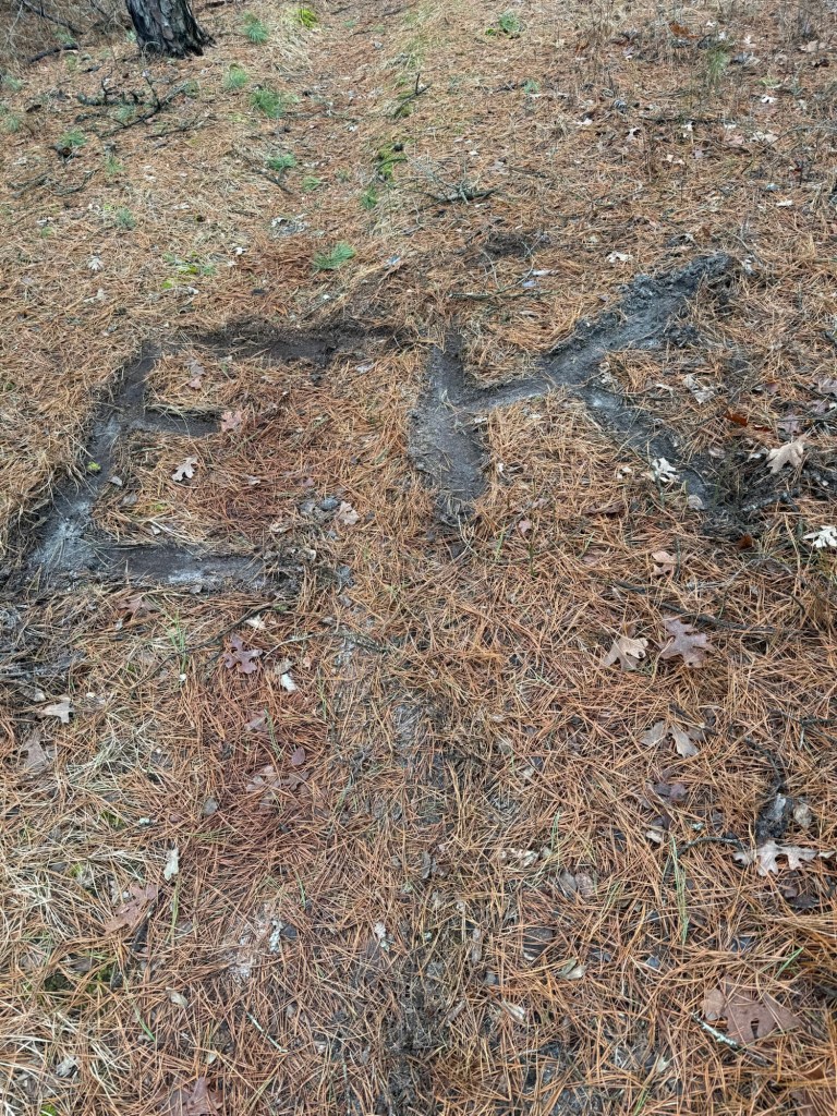
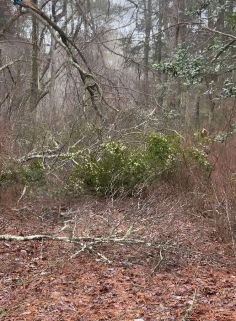
The first day set off without a hitch (literally, my dad dropped me off). I started excited to see what the trail would bring. Well, that excitement turned to frustration when faced with the first hurdle – blowdowns. A blizzard passed through this area 2 weeks ago, dumping well over 18 inches of snow 2 weeks after an ice storm of the century that had only just started to thaw out. The Blizzard of 2026 destroyed many trees who were unable to withstand the weight of the snow. Many of those fallen trees happened to land right in the middle of the trail. Navigating through that was difficult and taxing, but luckily most were easy to pass. I only saw 2 people the entire day and stopped dead in my tracks when I spotted my initials etched into the trail right before my very eyes. Is the Jersey Devil out to get me?! My brain could not comprehend the coincidence until my dad texted me… the jokester did it when coming back home. I have to remind him of the leave no trace principles, ha!
Enough to stop you dead in your tracks!
The day was fine until I got to the cutoff for the campground. It was a mile of blowdowns that were all but impossible to manage. The only way through was around them, in feet high brambles of angry greenbriar, better known as thorns. It took patience and time to pass, both of which I was running out of just by the time I got through. My legs took the brunt of it, the thorns pierced through my skin leaving many scratches. Knowing I had to go back through in the morning was daunting, but hard things will happen on the PCT so no use complaining.
This picture only brings trauma.
Camp was empty and quiet despite being right on a road. I learned that my air mattress was holey and unable to hold air. Fabulous! I knew I was in for a rough night. I couldn’t find the holes to repair, so my best bet was to blow it up and pray that I would fall asleep in the 7 minutes it took to deflate before I felt the icy ground. That’s the issue – not the discomfort of sleeping on a hard ground, but the lack of insulation from the frozen ground the mattress provides. At 37 degrees F, I was certainly shivering through the entire night. But again, the PCT will surely provide fairly numerous nights of discomfort, so I may as well get used to it.
I slept in (yes I was actually able to get in a few hours!) and broke down camp lazily the next day. I managed to get through the mile connector trail at the loss of my Frogg Togg rain pains. Stepping over the blow downs ripped the crotch in record time (any Frogg Togg pants owner knows these crotch rips are notorious. I held together my pants with Duct Tape the entire CT) and the thorns tattered the rest. Adding to the list of gear to get. The night before I realized I grossly underpacked food and did not have enough for the next day. Imagine my delight when 6 miles into the hike I spotted a beautiful sight – Julia running towards me with plenty of goodies to get me through the hike! We walked together briskly for a few miles until our trails departed. The trail provides, and Julia certainly is a trail angel!
Trail Magic!!
Trail magic is something that hikers refer to as tiny unexpected blessings usually from strangers that make your hike better. In the three days I was out, I encountered a surpingly high amount of trail magic from (unbeknownst to them) trail angels for such a quiet trail. Julia obviously was one example. I had one woman offer me an armful of snacks at the Batsto Visitor Center and another woman offer me an entire peanut butter sandwich on trail. While I wasn’t desperate enough to accept, it’s nice to know that there are people out there who offer what they have to a stranger. For all they know, their kindness could have made the difference between quitting and being able to go on.
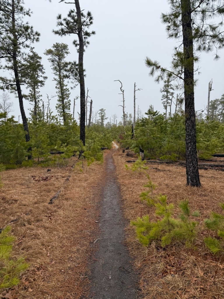
Last time I was here (2 years ago) this was almost a completely burnt out section. It’s amazing to see how quickly the forest regrows!
I made it to camp early and had an uneventful evening – other than finding the holes in my airmattress! I was able to hunt them down and patch them. I was so unbelievably excited that I wouldn’t have to spend another night on the cold hard ground! Bedtime was as soon as the sun went down. With daylight savings that night and a 20+ mile day the next day, I knew I had to get up early.
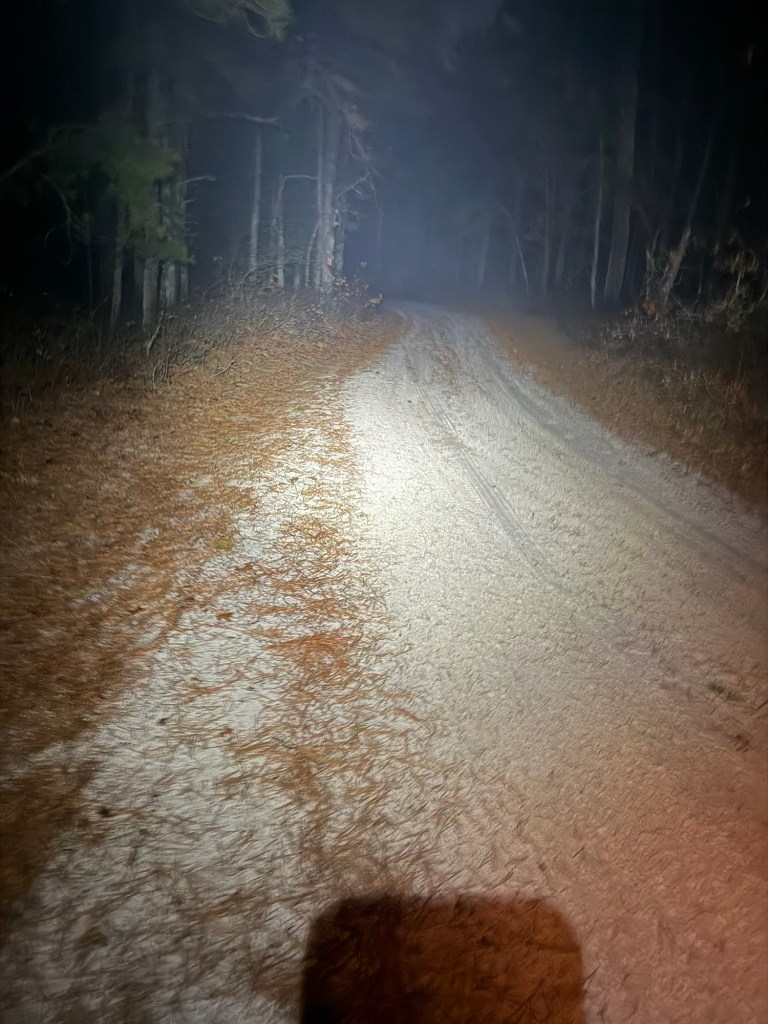
This doesn’t capture how truly dark and spooky it was
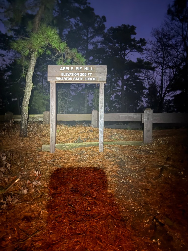
And so I did. I woke up dazed and confused at 4:15am not sure exactly what time my body thought it was (3:15am as I have come to realize in an unconfused state). I got on the trail at 5am and used my new and fancy headlamp to guide me through the dark forest. At first I was a little nervous about what lurked in the woods (I heard a very unsettling half hour scream/chant fest at midnight that night) but after a mile or two I settled in and was able to navigate the trail without issue. I learned that the little green glitter that caught the light of the headlamp were spider eyes and was deeply unsettled by the amount there were lining the forest floor – literally thousands. I got to the high point of the trail – a whopping 205 feet! That’s only 12,948 feet difference between the high point of the PCT, HA!
Ooof, I had to stop for a minute to catch my breath from such a high elevation!
The morning brought rain that quickly changed to hot and humid as the sun came out. My feet started to hurt and the last few miles were truly a sufferfest. But again, I’m expecting to hurt on the PCT so may as well get used to it. After 22.2 miles, I ended the trail with my dad and high tailed it home. Overall, it was a fun experience and definitely got me ready for all that I would expect on the PCT in a smaller scale. And happily, my mental state held strong – mission accomplished.
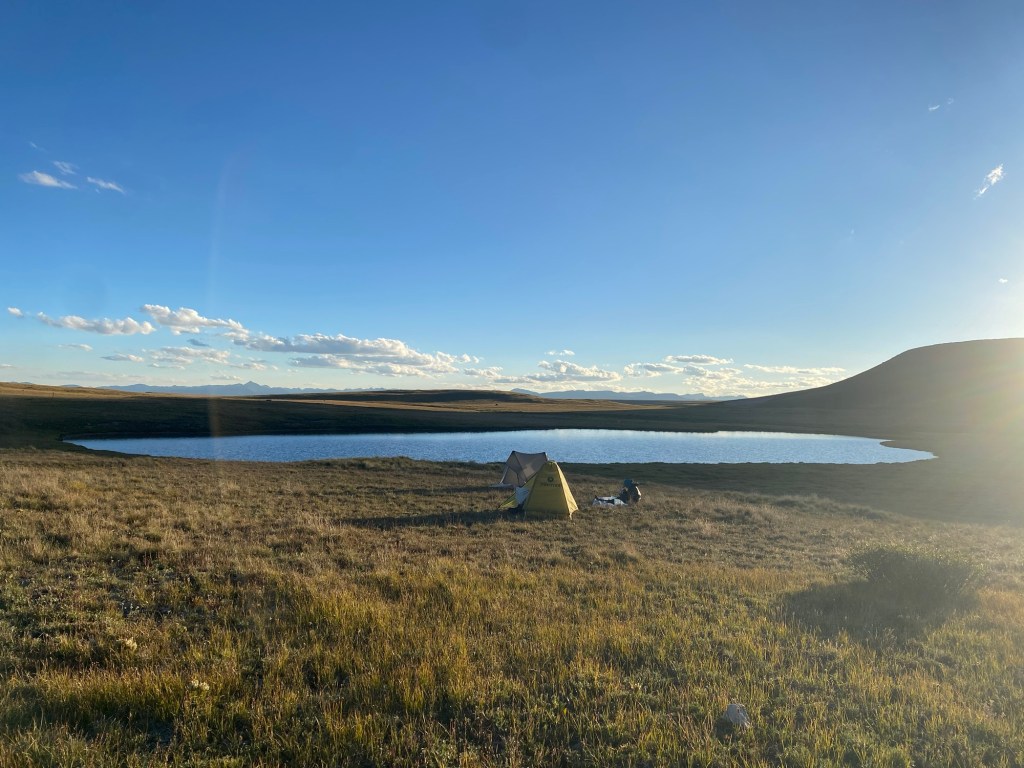
Slept almost perfectly on an actual flat spot, it was glorious.
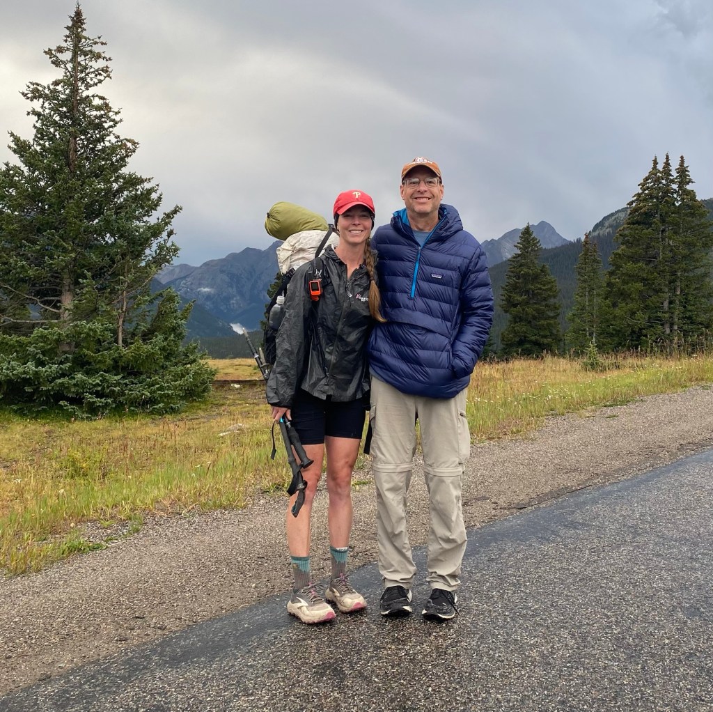
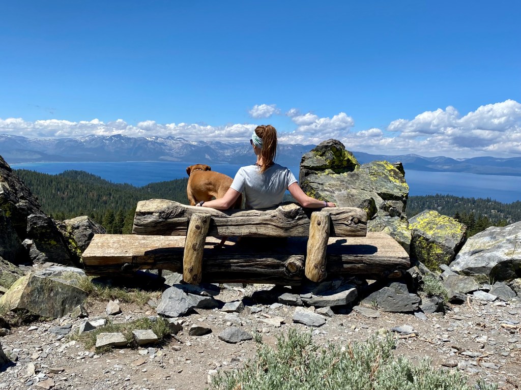
After 5 miles of climbing, we reached our destination- the road where we were to meet my dad! It was great seeing him after so many weeks out on the trail. He has been road-tripping around and met us to take us into Silverton and will also meet us in Durango our very last day. Then we’ll road trip home together to relieve my mom of taking care of 4 animals!
We satiated our craving for pancakes at a delicious diner and roamed around the town looking at all the shops. Sheena and I are opting for a hotel while Bear Bait Bob satisfies his craving for camping, hopefully not living up to his nickname.
After a delightful BBQ dinner, we were off to bed in preparation for our final days on the trail.
Day 35 August 21: 16.5 miles
Phew what a night that was. The walls of the hotel we stayed in were paper thin so we could hear just about everything anyone was saying. Then we were awoken by a violent thunderstorm that shook the entire bed. THEN we heard a herd of coyotes murder what I can only assume to be a fox (trust me, you never want to hear a herd of coyotes murder a fox, that will live in my head forever) [edit: I am aware there is no such thing as a “herd” of coyotes, but instead it’s a pack of coyotes. This is a prime example of what sleep deprivation, calorie deficit, and physical exertion does to a brain!], then ANOTHER thunderstorm. We at least were dry, my poor dad’s tent leaked all the way through. Regardless, none of us slept well.
But the trail of course doesn’t care how well you slept, so my dad dropped us off where he picked us up and we were on our way to our final stretch of the Colorado Trail.
See ya later!
The day started out cloudy, then the sun came out. But of course, right before we were about to go over a pass, the darkest clouds I’ve ever seen consumed the sky. Thunder boomed, but we felt comfortable that it was far enough away that we could scramble over the pass unscathed.
Well, wouldn’t you know, just as we were about to do just that, hail fell from the sky and we knew we were in for it. Luckily, we weren’t alone. There were 5 mountain bikers who happened to be in the same predicament. We were all looking around seeing who was brave (or dumb?) enough to go up the pass first. The decision was quickly made for us when lightning struck what felt like feet away with an instant deafening thunder clap. We all noped right on out of there and sought shelter as best we could – which when you’re exposed at over 12k’, it’s impossible to find shelter. Sheena and I decided to wait it out 10 minutes to see if it clears up or gets worse. Luckily, that was the last of the thunder for the time being and we hustled our butts up and over that pass safely.
Those clouds! Right into the thick of it
We were greeted on the other side with kinder clouds and a beautiful view. But the whole descent was accompanied with thunder, both near and far.
We made it to our perspective campsite only to find it occupied by Josh, someone we met in Lake City who hails from South Philly. We talked for a little during resupply when he recognized my Phillies hat. We haven’t seen him much since then, but there he was and we were happy to see him! No problem, this was the first time this whole trip we couldn’t set up camp where we wanted, not so bad with how many people use the trail. We backtracked a little to a less desirable site, but hopefully after a full day of hiking and a poor night’s sleep we won’t even notice the uneven ground, or the wind, or the thunder… one can only hope.
Day 36 August 22: 16.3 miles
Well last night was another insane night. We didn’t hear any coyotes, but man did we get a storm. Just as I was finally finding sleep, I was awoken at the late hour of 8pm by what sounded like a freight train rolling through the valley. Then, all of a sudden, my tent went flat. The wind storm (well, wind was the main player, there was rain and lightning as well) lasted about 2 hours before finally dying down. After fighting off the tent and making sure no poles snapped, I was able to catch some pretty good sleep.
I don’t want to talk too much about today. It was miserable and rained almost the entire time. Luckily, it was too cold for another round of way too close for comfort lightning, but I was cold the majority of the day. Which wouldn’t be so bad if the cold (I mean it was still in the high 50s, so not freezing) didn’t render my hands completely useless. I lose all fine motor skills and can’t even tie my shoes or zipper my jacket because they become numb, dumb, and clumsy. Probably should see a doctor about it when I get home… maybe.
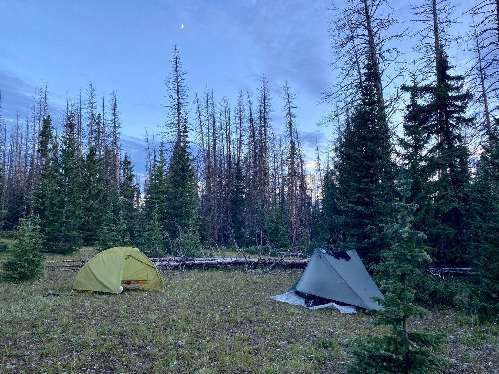
We arrived at a camp large enough to share with Josh (and a few very brazen deer). Thankfully it stopped raining for us to put up our tents, have dinner together, and at least start the night dry. But of course, right on time, clouds are rolling in. Hopefully they’ll roll right on by, but I’m sure we’ll get a few drops tonight.
Oh deer!
Day 37 August 23: 14.6 miles
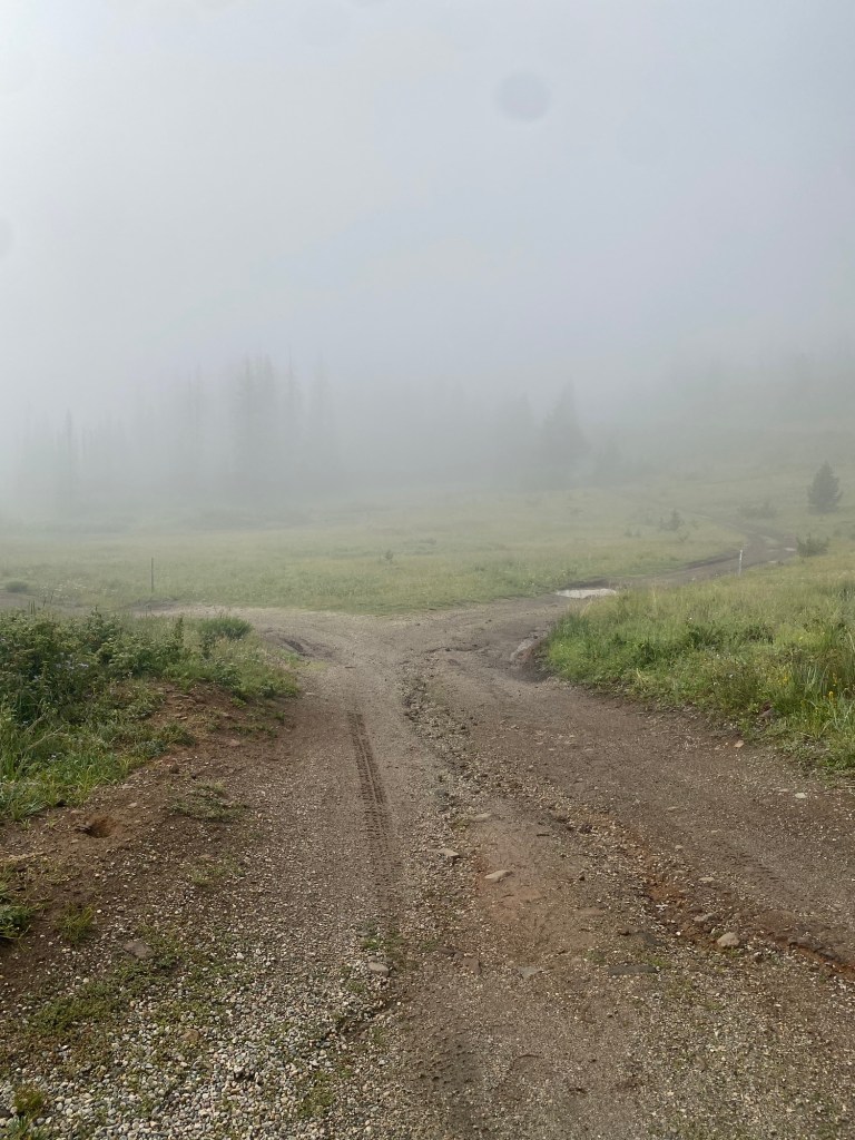
Spoiler alert, it rained throughout the night and morning. Thought we were in for a repeat of yesterday, but the morning steered clear of rain and we walked through an eerie foggy landscape devoid of views until early afternoon.
Around lunch time, the sun finally peeked out and we celebrated by basking in its glory and drying out all of our wet gear. You don’t know what uncomfortable is until you put on cold, drenched socks at 5:30 in the morning, only to slide your feet into cold, drenched shoes. My shoes and socks are going straight into the trash after this hike – they smell like garbage from a mile away.
With easy elevation, we hit 10 miles pretty quickly. We had a long lunch to enjoy the sun and were on our way to figure out where we’d be camping tonight. We couldn’t find any great spots on the FarOut app for the distance we wanted, so we decided to wing it, hopeful that we would find a flat spot higher in elevation.
Josh stopped early, about 11 miles in. We decided that though it was a prime and beautiful spot, it was far too early to call it quits. We said see ya later to Josh and continued on. We soon realized that if we wanted to make the desired mileage (16.5 miles) we’d have to go over a pass of 12.5k’ as dark clouds were rolling in. We stood around for about 10 minutes deciding if we wanted to risk bad weather while exposed for another 2 miles or call it quits early, with the hope of making up miles tomorrow.
I admit, I have a hard time quitting when the job isn’t done, especially when it was so early (4:30 in the afternoon!). I want to get into Durango early and didn’t want to sacrifice that for potential safety. But we came to the conclusion that it wasn’t worth the risk. We’ve avoided getting struck by lightning this long – let’s not tempt fate with only 25 miles to go!
And thank God we did stop. We set up our tents with only seconds to spare before one of the biggest storms we’ve encountered yet blasted us for 2 hours. There was wind. There was hail. There was lightning and deafening thunder. And there was rain. Lots of rain. Thankfully everything stayed dry.
When it ended, I took a peek out of the tent and saw quite the sight. It’s hard to describe and a picture doesn’t come close to capturing the oddity of the dark clouds against the brightly lit mountains as the sun started to set. It’s otherworldly and scary and beautiful all at the same time. I’m fortunate to have experienced it.
Pictures can’t hardly do this scene justice!
But just as I was watching, another storm started to roll in. So it’s time to batten down the hatches and hope this storm takes it easy on us.
Only one more night of being assaulted by weather to go!
Day 38 August 24: 19.1 miles
Well it was an all night affair – lightning, wind, rain, everyone was at the party right until it was time to get up for the day. So I’m thankful we at least weren’t getting rained on during camp break down after 12 hours of consistent storming.
I talk about weather a lot, that is because it dictates so much of how we plan our days out here. When you’re outside 24/7 for weeks on end, life revolves around the weather. Typically you want to start early to avoid afternoon storms. But this year the weather has been so unpredictable that timing means nothing. Throughout the whole night last night I was thankful I let the weather dictate when we settled for camp. Otherwise we would’ve been exposed at over 12k’ on a ridge for hours at risk of getting struck by lightning or becoming hypothermic. Two very unfortunate scenarios so close to completion that we thankfully avoided due to smart decision making.
We went on our way into the mist and had very limited views the first few hours. We only had peek-a-boo views when the clouds allowed it. Soon, after passing over Kennebec Pass, the start of the last segment, the fog lifted and we enjoyed some short lived sun during lunch.
The rest of the day was just walking. We had absolutely no intention of hiking such a long mileage day, but when a spot we wanted was occupied and we later were chased down (or felt that way at least) we decided to keep adding miles. And Josh was there to save the day – he found a great campsite and saved some spots for us! With more than anticipated miles, it gets us into Durango all the earlier!
How surreal – our last night out here. It’s been such an incredible journey with so many highs and lows, I can’t believe it’s almost over.
Last camp!
Day 39 August 25: 6.6 miles
Final morning on the Colorado Trail! After another rainy night, Josh greeted us with hot coffee! One last piece of trail magic. After going this entire trip without a stove (we got many “whoa that’s so hardcore” comments), it was amazing to have something hot. While neither of us complained about day after day of cold ramen (I shutter to think about it now) and cold rice and cold oatmeal, having our first hot item on trail after almost 40 days was a blessing.
Buzzing from coffee and excitement, we eagerly broke down camp and were on our way to meet my dad in Durango!
One last peaceful moment
With all of the miles downhill, we practically ran down and got to the terminus trailhead before 9:30am. Any day hikers we encountered congratulated us on our achievement, it was like being greeted by a welcome committee! And there at the very end was my dad, clapping us in. It was great to be done the trail and at the terminus, but it felt a little hollow. There was still a whole other segment I had to go back to and finish to officially say I completed the Colorado Trail in its entirety!
Our classic high five finishers photo!The infamous Josh
We grabbed Josh and took him into Durango with us. After we got into the town we hit up all the spots that awarded hikers with free swag. We got free beer, stickers, a patch, and even a discounted breakfast. Soon we retired to a hotel to clean up and fall asleep never to worry about bears or storms or tired legs again… or at least for a while.
The Final Day: Playing Catch Up; August 27: 26 miles
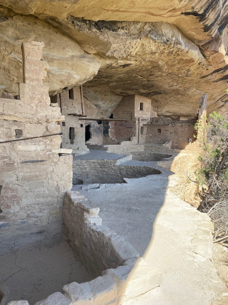
After a day of rest exploring Mesa Verde and getting Sheena back home, I set out to complete segment 15 of the CT back in Salida.
Mesa Verde has always been special to me
With 16 miles and a very light pack, my mindset was to just get this segment done as quickly as possible. I took limited breaks and made sure to keep up a speedy pace. I just wanted to get back home and see my Addie girl!
One last big view!
Mission accomplished. I finished the segment by 12:30p and was ready to get an early start on the drive back home. Or so I thought…
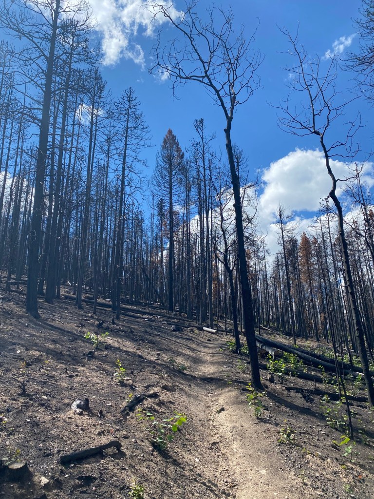
On the ride I was reminiscing about how I technically still had 10 miles of the trail I hadn’t hiked – the miles we hitched to get past the Interlaken Fire trail closure and detour. Since it was still early and those miles are flat, my dad suggested going to Twin Lakes and getting those miles done. Sure I was tired from the morning’s jaunt, but what’s 10 miles when I’ve already done 483?! And so dad drove the little Honda over some pretty sketchy dirt roads and I was dropped off at the trail.
All this was on fire 3 months ago… could still smell the burnt treesTwin Lakes was definitely a highlight of this hike, so stunningly scenic
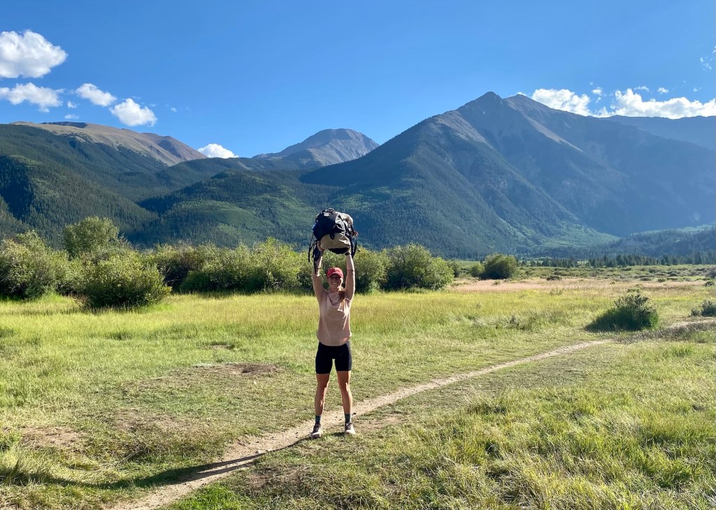
After 10 miles I met up with my dad and I can officially officially say I completed the CT in its entirety. Can’t say I feel any kind of emotions about it other than accomplished. It was a mentally and physically draining endeavor that proved to be difficult in so many ways, but conversely, just as rewarding. I’m proud of me and Sheena for getting through it successfully, supporting each other at our best and most importantly- our worst. This has been a bucket list item for a while and I am happy to have completed it. But for the moment, I feel very much like Forrest Gump. I’m pretty tired, I think I’ll go home now.
Raising the pack in jubilee or ready to throw it into the lake?
Along the trail met so many kind and generous people willing to help in any way possible. Whether it was a ride into town, trail magic, company to break up the monotony, or even a hot cup of coffee in the morning, we met so many people who were happy to make our hike as comfortable and exciting as possible. But most of all, I’m so appreciative of the support of my parents. My dad took the time to drive from NJ to CO to meet us and ensure we had a ride in and out of towns and even a ride home from Durango! And I couldn’t have done this hike without the help of my parents with taking such great care of my beloved animals. It eased my mind knowing they were in such capable and great hands.
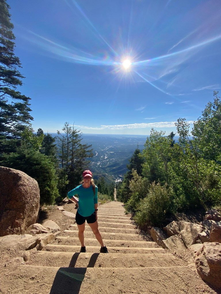
Before saying goodbye to CO, I just had to scratch off another bucket list item – the Manitou Incline! It’s a 2768 step journey up 2,000’ elevation over 0.88 miles. Even at 8am it was a hot and difficult climb, but sans a 30lb pack, it felt like a joy – ha!
One last climb before heading back to flat Jersey
And now that we’re on our way home, it’s time to wrap up this journey with a pretty little bow. While there are a lot of things I’m not looking forward to back home, I cannot wait to be reunited with my friends, family, and pets!
Vacation is over, Addie… I’m coming back for you!!
Another morning, another wet tent. Went to bed with clear blue skies, awoke at 10pm with rain. It didn’t last long, but was enough to ensure a cold and wet pack up in the morning. It wouldn’t be so annoying if not for the fact that a wet tent adds probably 3 additional pounds to the pack. But hopefully it’ll be dry and clear during the day to dry it out during a break.
Mission accomplished. After a few miles we were able to dry everything out, opting for an early morning dry out because of inclement weather reports for the rest of the day, great.
We’ve been leapfrogging the last few days with a lovely couple from Germany. We originally met them in Twin Lakes, where they departed for the western collegiates while we went east. After hearing their (and others as well) reports on the western route, I’m very happy with our decision. Mostly above tree line, they were pelted with daily violent storms. In fact, the storms were so horrific many bailed out. Having experienced exposed storms on the JMT, I know how utterly terrifying that can be. That along with nightly rain I’m sure has dampened their spirits, but they always greet us warmly and with a smile. I hope we continue to see them!
We also ran into Shaggy (aka Hamburglar) and his trusty sidekick Scooby (aka Grimace). They’re thru hiking but Scooby has had some issues with his paws (yes he’s a dog), and needed a few days off while Shaggy continued. Luckily for them, Shaggy’s dad is following along in an RV and can resupply or help with Scooby the whole way! Lucky dog.
Not the most flattering picture of Scooby
While talking and walking with Shaggy and Scooby, we came across the most amazing sight – a trail angel! Yesterday’s morale was at an all time low and seeing the most amazing spread of everything a hungry and exhausted hiker could want truly lifted spirits. Having hiked the CT 5 times, Tim knew exactly what we were craving! From fruit to snacks to candy to even bug spray and sunscreen, Tim and his wife Judy were truly what the doctor ordered. Made the next several miles all the more merrier.
Trail Magic!
Today could not have been a more picture perfect day with regards to trail, elevation, and views. The trail was rock less and actually flat. We were mostly exposed in gorgeous meadows with sweeping panoramic views. After yesterday, that was much much welcome. But we did pay the price with afternoon clouds and rain.
After almost 19 miles, we were ready to call it quits. The site we wanted to stay at was problematic- dead tree central. With more clouds rolling in, staying under dead trees with a storm is just plain dumb. We decided to join Shaggy, Scooby, and another hiker Mark in a semi exposed area just as the rain really started to come down. It’s a cozy little party of tents. And misery loves company, which looks like we’ll have plenty of misery to share.
Though the rain ended in an hour and lent itself to a beautiful rainbow. We quickly ate dinner and went to bed, hopeful that maybe, just maybe, we’ll have a dry night.
Close quarters!
Day 28 August 14: 16 miles
No such luck. It rained, and we got frustrated, but moved on. At this point it’s better to just be prepared and expect to wake up wet. It ultimately isn’t a huge deal, but totally dampens spirits. Woke up to a sad Shaggy saying he was going to backtrack a few miles to meet with his dad to get Scooby off the trail. His paws are not doing well and he made the right decision to bail him out. I know the feeling all too well!
After such a long day yesterday, we were hoping for another forgiving day today. Which is exactly what we got. Lots of views with easy elevation.
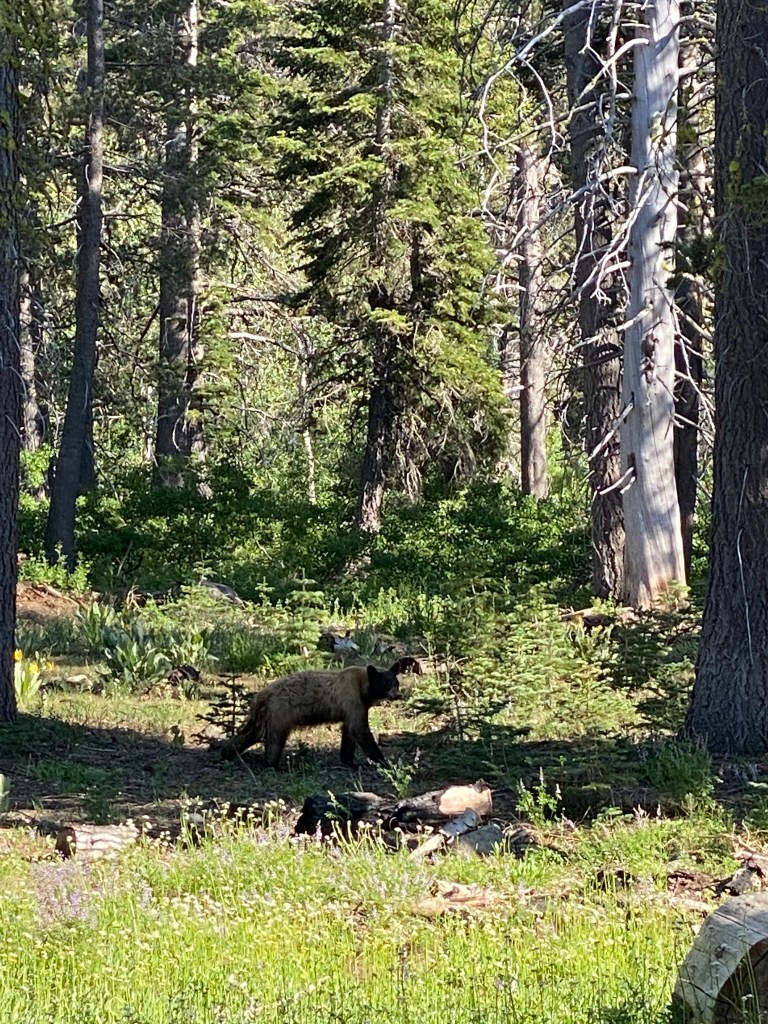
Towards the end of the day I was slightly ahead of Sheena when I turned a blind corner and entered into an open field. I saw what I initially thought was a deer run from the water into the trees. Only deer don’t run so close to the ground or so nimbly. I recognized that run immediately – it was a cat! Only way bigger and more stealth than my one eyed and my three legged cats. It definitely wasn’t a mountain lion, I can only assume it was a bobcat. First sign of wild life other than deer or elk! Now if only a moose or bear would show up (in the far distance, of course).
Also of note, we’re officially out of cow county! No more camping next to cow poop or worrying about contaminated water! Oh happy days.
We have a really great camping spot we are sharing with the Germans. We are both praying for a dry night, but certainly not holding our breath.
Day 29 August 15: 16.5 miles
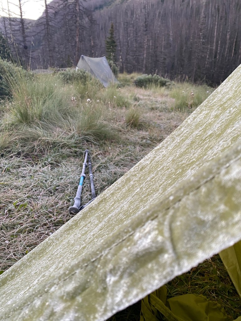
Well it didn’t rain! But darn was it cold overnight. For a second I thought it was just me until I opened my tent and it was completely stiff from being encased in frost. Huh… I guess it really was cold!
Frozen!
After thawing out, we were off for what was anticipated to be a very challenging day. Lots of miles with what looked like 5 very challenging climbs. Despite all that, today was by far my favorite day of this entire trip (don’t tell anyone I hiked with today this!). It was what I’ve been waiting to see and what I’ve anticipated from the Colorado trail. Today was a dream.
The climbs weren’t horrible, most were short and manageable with two being longer. But with the majority of the day being above tree line and completely exposed, there was so much distraction from the discomfort of a steep climb. So much so, I had a bit of a tumble that my knee took the brunt of. But I was able to shake it off and keep going.
The Germans!
After the second climb, I looked across the valley to a set of mountains. I saw what looked like a trail going right up to the highest peak. I laughed to myself, “man I feel sorry for the sucker who has to go up that!”, and even pointed it out to Sheena. As we descended, it became increasingly clear that we were headed straight towards that dreaded trail. It was a mile and a quarter of straight up, but conquerable.
A picture worthy of distraction
I absolutely love being out of the trees and exposed. You can see for miles including where the trail is going. When weather is on your side it’s an absolute delight. You can even see who’s ahead or who’s gaining on you! We maintained our leapfrog relationship with the Germans and have added Mike AKA Critter AKA Cricket to our crew, though I’m sure he’ll blow past us soon.
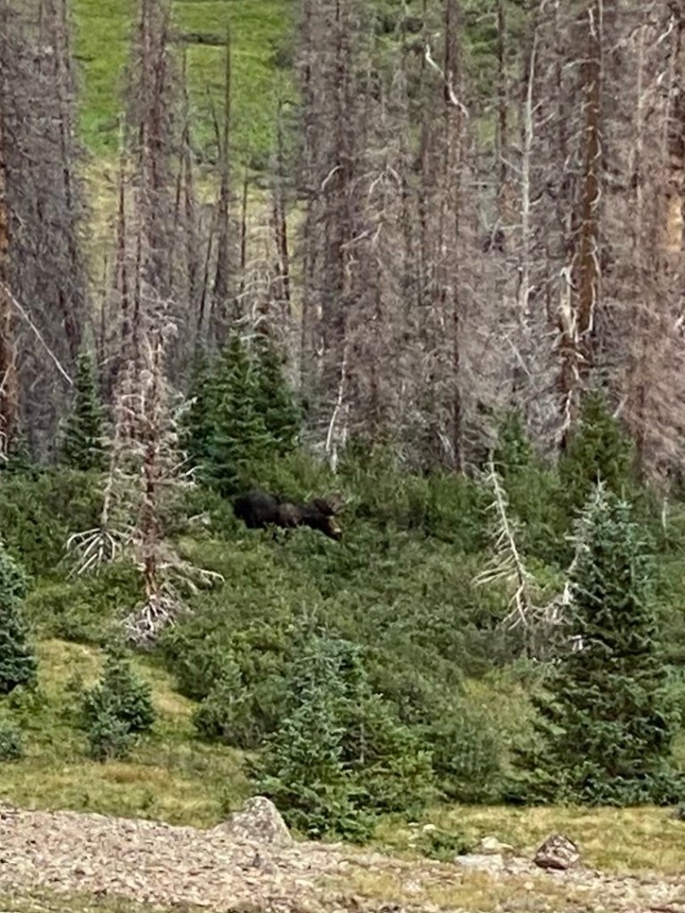
One of the highlights of the day was seeing not only one, but two moose! With yesterday’s bobcat encounter and today’s bull moose sighting, I just need to see a bear to win wildlife bingo.
If you look realllll close and strain your eyes just so, you can see the bullmoose! Thankfully he was very far awayIt’s impossible to not take a million pictures!
We got into camp late (for us) today, around 7pm. Still plenty of daylight, we were able to Set up camp and eat dinner but retreated to our tents because it’s already so cold. There are 6 of us scattered around a tiny lake and I’m predicting a cold cold night again. All 6 of us have the same idea – hike an easy 5 miles to get into Lake City for a resupply. It’s going to be tricky navigating how 6 people are all going to get a hitch into town, but if the past is any indicator, Sheena and I should be alright.
Day 30 August 16: 5 miles
After waking up yesterday encased in ice, I went to bed prepared with 2 pairs of socks, 2 pairs of pants, 3 shirts, and a hat and gloves. Though I was still pretty cold up at 12.3k’, at least we woke up dry!
We had an easy 5 mile walk to the trailhead to try and hitch into town. We didn’t expect to see 3 other people we’ve never met before trying the same thing! Competition isn’t great when hitching and there definitely is not strength in numbers. Fortunately, after about 15 min a truck came by to drop off CDT hikers. We asked if he could take us all back into town and he said of course! And wouldn’t you know the Germans were coming down off the trail at this very moment. Sheena ran to them to tell them to hurry their butts up if they want an easy ride! And just like that Casey fit all 7 of us in his truck and took us into Lake City.
Just about anyone hiking the CT stops in the little quaint town of Lake City. Because it’s 100 miles from Salida, hikers need a good resupply stop and Lake City fits the bill – and boy do they cater to us hikers! The community center is open 9-5 to help hikers with just about anything they could need. From food to toiletries to gear, they welcomed us with open arms.
We did laundry, grocery shopped, and most importantly- booked a hotel and ate. It’ll be great to sleep in a warm clean bed!
We’re only staying here for an overnight, but this town is worth so much longer of a visit. The people here are so warm and eager to help, it’s a heartwarming little place with some pretty rich history. We were told about the town’s most well known celebrity – a cannibal. Lovely! We have a ride set up for back to the trail tomorrow with Casey, one less thing to worry about.
Day 31 August 17: 17.3 miles
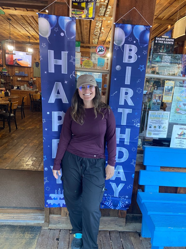
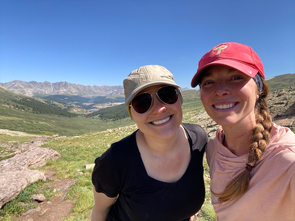
Happy birthday Sheena!!! I truly couldn’t imagine doing this hike with anyone else. She can handle my eccentricities with patience, humor, and kindness. So happy to be spending her special day with her!
Lake City knew the birthday girl was coming to town!
Can’t say that sleeping in the hotel lent itself to a great night’s sleep. Whoever was above us decided 3:45am was a perfectly fine time to audition for a river dance! It was beyond frustrating, but I will give him the benefit of the doubt and hope that he was getting up early to conquer a 14er.
Casey picked us up right on time and made a pit stop at the local bakery. And let me tell you this bakery is worth the hype. A delicious donut and sausage kolache hit the spot perfectly! With that sitting in my belly I was ready to conquer whatever today threw our way.
And whoa did it threw us a doozy. We knew we were in for it when looking at the map. Lots of elevation gain with little camping potential. But we made our way through just like we always do.
Cricket leading the charge up to the highest point Doesn’t get any more epic than this!
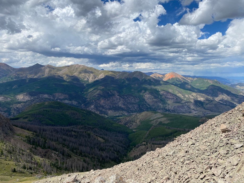
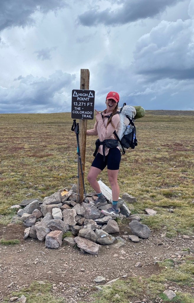
We are officially in the San Juan’s and boy am I happy we saved this for last. We were above tree line the majority of the day with views that will last a lifetime. I have so many pictures it’s hard figuring out which ones to post! We even hit the highest point of the CT, 13,271’! It’s all downhill from here, right? Right?!
We were chased by some pretty gnarly storms all day that we managed to outrun. We’re still pretty high at 12.7k’ and super exposed. After watching the sky for about an hour, we are fully surrounded by storms. Lightning and thunder are everywhere around us, but not over us. Hopefully it stays that way and we have a dry night without being terrorized by lightning and thunder.
Day 32 August 18: 15.4 Miles
Well we weren’t able to dodge the storms, but at least we were already in our tents. Thunder, lightning, wind, rain, and coyotes soothed us to sleep. The lighting, while frequent and close, didn’t last all too long. We even got a second dose of rain right before getting up, great!
Not sure if it’s mental fatigue or I just really miss her, but just the mention of Addie’s name puts me into tears. I cannot wait to see her again!
I’ll be home soon!!
In fact, all of today was physically grueling. More up and down which is getting pretty old. Legs are fatigued, feet ache, and mentally I’m pretty spent from not sleeping all too great the last few nights.
But still, the views were amazing so here are some pictures in place of words:
We have also been running into a number of mountain bikers taking place in a Colorado Trail Race. It set off last Sunday at 4am and the first place racer came in at 4 days. The crew we ran into today are apparently at the back of the pack, but they’re having fun anyway (but really how much fun is racing a bike in the mountains on 1 hour of sleep??). One guy we ran into, Eric, was especially a character. He was wearing a fox costume which was explained by his company, Embark. Embark is a 2 person operation (Eric and his wife) and they make endurance nutrition supplements with maple syrup they make on their maple syrup farm. So if you’re into ultra endurance activities (I mean who isn’t?) check them out!
Exhausted from yesterday and today, we ended today a little short and will make up the distance tomorrow. We’re shooting for an end date of exactly one week from today – final stretch!
Day 33 August 19: 16.2 miles
Very much not a good night’s sleep. Where we decided to camp was pretty sloped and i constantly woke up to stop from sliding all the way to the bottom of the tent. We were also surrounded by chirping marmots, and while I do have “Marmot” plastered all over my tent, it surely isn’t an open invitation. We got rain about an hour before our alarm, but woke up to dry tents. I even had to ask Sheena if it truly did rain to make sure I wasn’t going totally crazy!
Our hike started with more ups and downs and ended with an extreme 8 mile downhill. The sights were gorgeous as usual and we even saw another moose, but from a distance too far to capture by camera.
We are surrounded by old mining operations and saw many remnants of what was once a booming business, drawing thousands out to Colorado. Unfortunately, over time, a lot of these operations have contaminated much of the rivers we draw water from for drinking. Even with a filter, I don’t feel comfortable drinking from these water sources. Which means practicing discretion when obtaining water and even longer water carries.
Brave little Sheena exploring the terrifying mine
We were hit by two storms today, the second being a little more violent than the first. But now that we’re below tree line, we’re not so worried about the threat of being struck by lightning.
Just before storm #1Walking straight into storm #2, what a doozy
We’re camping just shy of our intended goal for the day. We saw a flat spot and jumped at the opportunity, as we’re not sure what further on would have camping wise. After the last 2 nights of unflat camping and all the woes that come with it, I’ll happily add on an additional quarter mile to tomorrow’s hike to make it up. In fact, we only have 5 miles tomorrow to Silverton, our last supply and where we’ll meet my dad who so selfishly drove out here to see us!
Had the option of flagging down the train to get into town, but I’d rather meet my dad at the trailhead! No, Sheena does not hike in crocs.
We hit 400 miles today, we only have about 86 more miles left before this adventure comes to an end. We’re so close!
The storms blew back through overnight, but nothing too crazy. We all slept well, expect Mike, who was nursing an injured knee. Prior to the trip he was receiving injections to help stave off arthritic pains, but they only do so much… I foresee a knee replacement in his future. He was contemplating bailing out at Buena Vista, especially after a fall a few miles into the morning.
After yesterday’s climbs, we were all hesitant to get to what looked like a monster climb in 3 miles. At the base of the mountain by a trailhead, we stopped to have breakfast when a lovely woman rolled up and asked if anyone needed a ride into town. After much reflection, Mike found it to be the right time to call it and took Fullbird up on her gracious offer. A very teary goodbye (or see you later?) was had by all. I have a feeling we’ll see Mike again.
Because we have an awkward food carry situation right now, we scheduled a pickup with Fullbird on the other side of the mountain to take us into Buena Vista for a small resupply to get us confidently to Salida. I’ve also noticed I’m losing weight and hungry all the time. Hiker hunger has officially set in. And while I purposely tried gaining some weight in preparation for this hike, I think I’m running out of reserves. It’s insane how many calories are burned during thru hiking and while it may be impossible to keep up, I have to beef up my calories. So a resupply is necessary. We were so thankful for Fullbird’s offer… we just had to get over the nasty climb.
And what a truly nasty little climb it was. It took a decent amount of time to conquer it. With steep grades and hot sun, we welcomed in the building storm clouds if only to block out the grueling sun. Eventually we got to the top and David and I decided to go the extra 100’ to the very tippy top for an excellent view. There I was able to coordinate with Fullbird (we now call her Mamabird) for a later pickup. This was where David parted ways. He’s tacking on quite a few more miles today to get to Princeton Hot Springs for a nice relaxing nero day tomorrow.
Selfie at the top!
With less pressure to make it to the trailhead so soon, we carefully managed the steep descent to county rd 306. During that time we did get rained on, but we were on our way into town so who cares.
A soggy descent to 306
Mamabird was ready to grab us soaked drowning baby birds and took us to get some groceries as well as actual food. Having hiked the PCT with her sister and niece last year, she knows how difficult trail life can be and now finds fulfillment by giving it back to needy CT hikers. She even let us into her home to fill water and dump trash. Had she not have family coming from New Zealand tomorrow, she would’ve even offered us a spot in her house for the night! What a true angel. And I think all those prayers from home are being answered because we have been nothing but blessed by the folks we’ve met out here on the trail.
After a huge dinner and goodbye to Mamabird, a bad batch of weather started rolling in. We originally were going to hike a few more miles, but being exhausted from two tough days and not wanting to get caught in a storm, we quickly set up camp right by the trailhead. And as I type this out now, it’s loudly thundering right over us and pouring rain, so I think we made the right call. The next few days look very forgiving, so I think we’ll be able to make up some miles and even have a rest day soon! And just like that, a group of about 30 soaking wet kids, likely Boy Scouts, just rolled up looking for a space to camp. Poor things are waiting out the storm before setting up camp. They might be in it for the long run, but hopefully it ends soon so they’re not loud when it’s time to go to bed, we all need our sleep!
The next morning with all the tents!
Day 20 August 6; 15 miles
What an odd night. With the storm lasting hours, I was in and out of sleep starting at 7pm. I was shocked when nothing woke up me up – not Sheena or the 13 people who showed up in the middle of the storm setting up camp. It was lights out for me until my bladder forced me out of the tent, only to come back to a migraine that lasted all night. When I woke up in the morning I was shocked to see all the tents surrounding us. What a good crew – they were so quiet and respectful!
We started off the morning with a small climb that was so much more manageable than the previous 2 days. The grade was forgiving and the clouds started rolling in shortly before we reached the top. We had lunch and were able to dry out our soaking gear. Just in time for the rain! We had a good downhill where we experienced on and off rain with thunder. If anything it really made the mountains look mean, shrouded in clouds with lightning striking the granite.
The sky was angry that day, my friend!
Towards the end of the descent to Mt Princeton, we had a decent road walk. At one point we were walking on a cliff edge with blind corners, not the most ideal place for a walker, especially with the rain. At this point it became a matter of safety. I lazily put out my thumb to see if anyone would want to give two hikers who smelled worse than a wet dog a short ride to the hot springs. Sure enough, on the first try, Bruce stopped and offered a ride, quite surprised that we only wanted a 1/4 mile hitch. He offered to take us to our final destination (our campsite for the night, not Durango – though I’m sure he’d drive us that far even!) but I wanted to walk the last 2.4 miles. What I didn’t realize was those miles were also on the road. D’oh!
So after a quick snack at the Mt. Princeton hot springs we were on our way avoiding cars on the very busy no shoulder road. Soon we turned onto a small county road running parallel to a busy river that was lined with the cutest little cottages.
Eventually we made it to our destination, bootleg campground. And wouldn’t you know, for the third night in a row we made camp with seconds to spare before getting poured on with a side of deafening thunder. This time the storm got a little spicy and threw some hail our way. This is quite honestly getting old, would love for some good weather to come back our way.
You wouldn’t believe that it was dumping rain and hail just 10 min before this
Day 21 August 7; 8 miles
After a night of on and off rain, the universe decided to wake me up with a wickedly nauseous stomach. I won’t go into too much detail, but thank god Sheena brought a whole pharmacy with her. We both haven’t been feeling great the last day or two, we’re hoping we picked up a small bug from somewhere and not the infamous giardia.
Just a small note on how small the world is, at dinner (impeccably timed between rain), I spotted someone with an Eagles hat. Having sold Eagles merchandise (hats specifically) for a few years in college, I can spot them from a mile away. Turns out he’s from the next town over from me. Lots of South Jerseyians gracing the trail with our presence!
We set out for what was expected to be an easy day with small and manageable climbs. Unfortunately for me, my stomach made every step feel like an effort. I had no energy and my muscles did not want to work to get me moving normally. With long rest breaks required every half mile not only for exhaustion but bathroom breaks – I knew something was wrong. We formulated a plot to ask anyone we saw day hiking to potentially take us into town.
During a rest two ladies on horses (of all the horse poo we’ve seen on this trail, we had yet to see a horse – until today!) strolled by us. After talking and petting the horses, Sheena asked if they could take us into town. If we could coordinate our end times, they’d be happy to. We had 2+ miles to get to the trailhead by foot vs their steeds, so the chance of meeting them was unlikely but worth the risk.
With the only thing I could stomach being fruit snacks, I felt a little better after talking to the ladies. But it didn’t last very long. I was right back to walking like I had a few too many drinks and feeling even worse. Knowing we probably wouldn’t make time getting to the trailhead (it was an additional 1.5 miles), we ran into a woman waiting for her husband and daughter hiking a falls trail. We let her know we were meeting someone to get picked up, but wasn’t likely to happen. She said if we were still at the trailhead when they came down, they would take us.
Turns out we didn’t make it in time for the horse ladies and thankfully the family was happy to give us a ride. They were such a nice family from Florida visiting for the week. With it being such a bumpy ride, I had to work at not throwing up in their rental with such a queasy stomach. And I was successful! They were so kind and friendly, we couldn’t thank them enough for their generosity.
I have a saint for a cousin who lives in Salida who was gracious enough to host us as we recovered. I showered and am planning on going to bed super early to help fight off whatever is going on in my body.
No pictures, I barely even remember this day!
Days 22/23: off days in Salida
I woke up the next morning at 6:30am. I have never slept that much in my life. Almost 16 hours! I felt refreshed but my stomach was definitely not where it needed to be to get back on the trail. We decided to take at least 2 days off trail to recoup, it would be a disaster to push forward with a bad stomach and total food aversion. I have already lost 12 pounds at this point, I’ll be running low on reserves soon!
Taking Fetty for a walk, got in my cat fix!
I went to urgent care where I was given antibiotics as a precaution for girardia. Really hoping it clears up before that happens!
The rest of our time in Salida we putz around, exploring the town and going shopping for resupply. By the time Friday rolled around, I was feeling up to eating. We had breakfast with Stephen, someone I met on Instagram who has also hiked the CT in addition to the PCT and AT and has also ridden the transam and the southern tier. Talk about a resume! He happened to be in town and we picked his brain for CT tips all while I accidentally insulted his mother. Debbie sounds like a lovely woman who raised an excellent son.
We also were reunited with David who just wrapped up his section hike, only to return to the trail next week to complete the whole trail! After back to back 25+ mile days, he was understandably famished and we enjoyed a good dinner with him while also picking his brain, without insulting any family members.
We are going to slackpack tomorrow in an attempt to see if we’re truly ready to be on the trail after the last few days. With easy elevation and a light back, fingers crossed we’ll be okay!
Day 24 August 10: 14.4 miles
Feeling better, I was ready to test the waters with a slackpack day. Tess was kind enough to brave a rocky unpaved road to get us up to Marshall pass trailhead. We said see ya later and headed out on our way.
When we reached the summit of a short climb, we were greeted with epic panoramic views of mountains and green valleys. We also were accompanied by what felt like thousands of mountain bikers, for whom we constantly had to jump off trail to prevent a wreck. While they were obviously having fun and enjoying a nice Saturday ride, it was concerning as a hiker how fast they were going around blind turns. Luckily we avoided any fatalities.
After a few pictures, we were ready for our 8 mile descent. It was quick and unnoteworthy aside from Sheena meeting some women who offered us a ride back into Salida. Soon, however, we realized they were taking the west route while we opted for the east. Alas, another opportunity gone with the wind.
After an uneventful descent down to rt 50 (encountered one small storm and a lot of sad soggy hikers who have spent the last few nights getting dumped on), we were ready for what was expected to be a long hitch. According to everything I’ve read and everyone we talked to, I thought it would take no shorter than 20 min to get a ride into town. Without much time to spare, we got right to it and wouldn’t you know, we got a ride in 1min30sec. A new record!
Shane and Braxton were on a father son road trip before Braxton was headed to his freshman year at Kansas State this week. They were on their way back to Kansas from Durango when they decided we didn’t look like axe murderers and gave us a ride to town.
In all, I feel about 85% back to normal. I’m still a little queasy with certain foods and appetite hasn’t kicked in fully, but I’m certain with time I’ll be back to full capacity. I’m confident that getting back on the trail tomorrow with a full pack is the right move, and should things go awry there are bailout points along the way.
After dinner, showers, and arranging a ride back to the trailhead for the morning, we’re off to sleep for the last night in a bed for a while.
Day 25 August 11: 16.6 miles
What a sad morning. I said goodbye to the comfiest bed I have ever laid in, Tess’ 3 amazing cats that medicated my pet need, and Tess. I cannot thank her enough for her hospitality and kindness during our stay in Salida. She was integral on getting us healthy and back on the trail.
Because she’s flying back home this morning, she wasn’t able to give us a ride back to the trailhead. So we arranged for a taxi and we were on our way.
With our next resupply close to 90 miles away, we have a very heavy food carry to get us there. After yesterday’s light pack, that food felt like a ton. But luckily the elevation profile for the next few segments looks forgiving for not only the heavy food, but also for picking up miles.
The day started with heavy fog right out of Middle Earth. It did start to lift after a few hours and we knew we were entering the dreaded “cow patty” section. This is where the water is scarce and the water that is available is contaminated with cow poo. Yum, just what an unsettled tummy wanted! So along with a heavy food carry, we knew we would want to stock up on water too, just adding to the already busting packs.
We’re upping mileage in an attempt to make it to Durango by the 24th. We’ve been out here long enough, no need to drag it out!
My appetite has not returned and I am a little worried about losing more weight. I’m definitely losing muscle (but when men would routinely comment on how jealous they are of my arms, I’m happy to lose a bit of muscle), and I’m not sure how sustainable living off reduced calories is when we still have well over 200 miles left. I still feel strong and capable- but for how long? Hopefully my hiker hunger comes back soon!
Lil Bessie is reunited with her cow family! We are officially in the dreaded cow country, where cow patties are bountiful and water must be ultra filtered
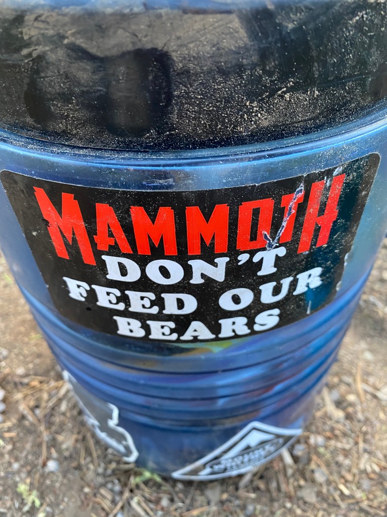
We ended the day a little shorter than anticipated when a good camping spot showed up. We ate dinner, reacquainted ourselves with a bear hang, and are ready for bed. Hopefully no cows come along in the middle of the night!
Day 26 August 12: 17 miles
I don’t even know what to say about last night. We went to bed with clear skies, convinced that we evaded what most other hikers weren’t so fortunate- the nightly rains. When preparing for this trip, I was ready for daily afternoon storms, after all July is monsoon season. What I was not prepared for were nightly terror sessions with abundant lightning and buckets of rain. But sure enough, at 11pm I was awoken by paparazzi lightning and booming thunder. What was so specifically odd about this storm was there wasn’t any rain or wind. It was so still. But up here, if there’s lightning you want rain, as wildfire can be sparked with just one strike – and there were thousands of them. Some a little too close to our tents. But alas, after about an hour, the rains came and didn’t stop for what felt like the entire night. Great – another wet morning with wet gear.
I can’t speak for the view for the vast majority of today’s hike, as I was forced to keep my head down looking at the trail to manage the excessive amount of rocks. I understand why they’re there – for drainage and to prevent erosion, but my goodness are they beyond annoying. Careful attention has to be paid lest you roll and break an ankle.
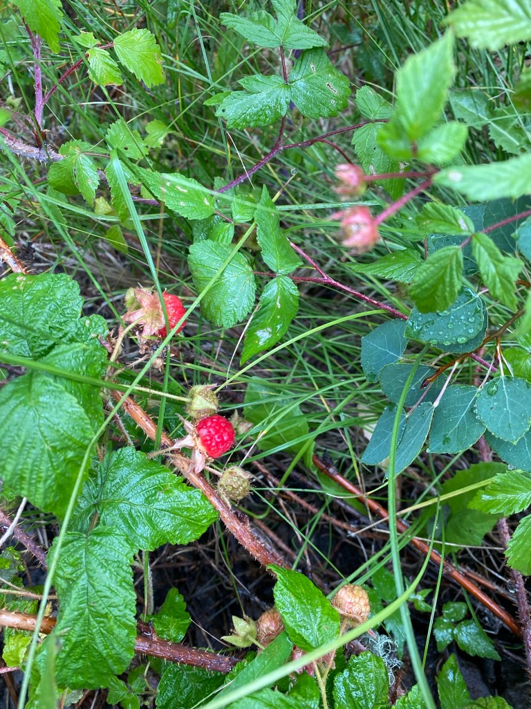
In addition to rocks, there was an abundance of wild raspberries that lined the trails! Now I’m not one to go off and taste random berries I see out in the wild, but I know a raspberry when I see one. And wow were they good. Tart and perfectly ripe, I had my fair share and left the rest for the bears.
Best raspberries Mother Nature could produce
Afternoon storms blew through soaking us with rain, but they were short lived and we kept our fingers crossed that there won’t be any more 11pm lightning storms tonight.
Today was one of those days where I really missed home. I miss my cozy house and all the animals that live there, my friends, family, and particularly badly, I miss my old routine. Being out in the wilderness is definitely difficult (but rewarding) and really makes you yearn for just simple routine. If only I could not have to worry about going back to work!
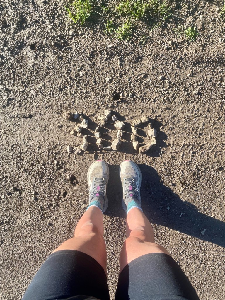
Officially hit 300 miles today, only a few hundred more separate us from returning back to normalcy!
After having a great and filling dinner with Mike and a night’s rest in an actual bed, we woke up ready to take on the day of slackpacking.
For those who don’t know what slackpacking in, it’s when you leave all your gear at a safe place where you finished your previous day’s hike, take transportation up the trail, then hike back. It’s favorable because you can get in a lot of miles with a lighter pack. We thought this was a great idea, and even convinced Mike to join us.
We caught the bus over to Copper Mountain and after an unnecessary mile road walk, we finally found the trail. And it was all serendipitous because guess who we saw crossing the street just as we were approaching? KDog! We were so excited to see him looking strong as ever. After a short hello and goodbye, we set off for the day.
Mike leading the charge
The first 5 miles were a climb. An unrelentless climb. People suggest slackpacking because it’s easier to get a big climb out of the way early and enjoy a less intense descent back to Breck. Boy, were we served a lesson. We quickly realized that maybe this wasn’t the best idea, the grade of that climb was aggressive even with a light pack. But it’s the decision we made and we were gonna stick with it.
After a few hours we made it above tree line and what a sight that was. It was dizzying how exposed we were and with one misstep we would surely meet our maker. We could see for miles which commanded frequent stops just to take it all on.
During our ascent, we ran into many people we met on the trail. Because we were going the opposite direction, we were met with many confused looks. We saw the Lobbyist, Ben and Matt of the former Foursome, Chickadee, Liz, and Gizmo.
We finally got to the top and took plenty of pictures, elated that the climb was finally over. But soon dread took over. It was already early afternoon and we still had 8 whole miles to address. Sure it was all downhill, but 8 miles is 8 miles and we were already fatigued from that Appalachian graded climb!
But we troopered on. After outrunning a nasty storm, we arrived back at the bus stop at 6:46p, just one minute after the bus. Shucks. We had to wait a whole hour before the next one. This day just didn’t want to end! Luckily with good conversation that hour flew by and we arrived back at the air bnb exhausted and ready for bed.
At least the wildflowers were in full bloom
Looking back on it, I would not choose to slackpack this segment. It wasn’t worth the aggravation, but hindsight is 20/20. We got to know Mike (aka skyline aka jolly rancher) really well and saw what an inspiration he is. At 70 he’s kicking butt! I’m sure one day we’ll look back on this day with a smile, but that will probably take a while.
Day 11 July 28 13 miles
After the long and arduous journey slackpacking yesterday, we decided to take advantage of warm beds free from bear threats and sleep in a little. And a few cups of coffee help wash down whatever the heck yesterday was!
We had to take the bus back to Copper Mountain to pick back up the south bound route. Mike is taking a few off days in Breck with his family, so I’m sure the next time we see him he’ll be well rested body and soul.
But alas we must trudge on. We had a little later of a start with an unsure plan mileage wise. We have two passes to get over both of which are very exposed at over 12k’. So, like most days, we decided to wing it.
When we got above tree line we were greeted with one of the most gorgeous views. Sprawling green rolling hills with Sierra flavored mountains in the background. I would think I was back on the JMT if not for all the green surrounding me.
After passing Janet’s Cabin (no vacancy) we crossed over Searle Pass. Past this point we considered setting up camp for the night, as we were exhausted from not only yesterday, but the past 10 days of hiking without a rest day. But being over 12k’ and the wind kicking up, we didn’t want to risk a sleepless and freezing night – though for once we weren’t threatened with rain! There was a beautiful blue sky smiling down on us all day. We made the decision to forge forward and push to below tree line. We knew we were in for another late night, but that’s just a part of backpacking.
Atop Searle Pass
We crossed over Elk Ridge, then actually descended to Kokomo Pass. The views were enough to make you involuntary break into singing, “the hills are aliveeeee with the sound of….” But no one actually wants to hear me sing.
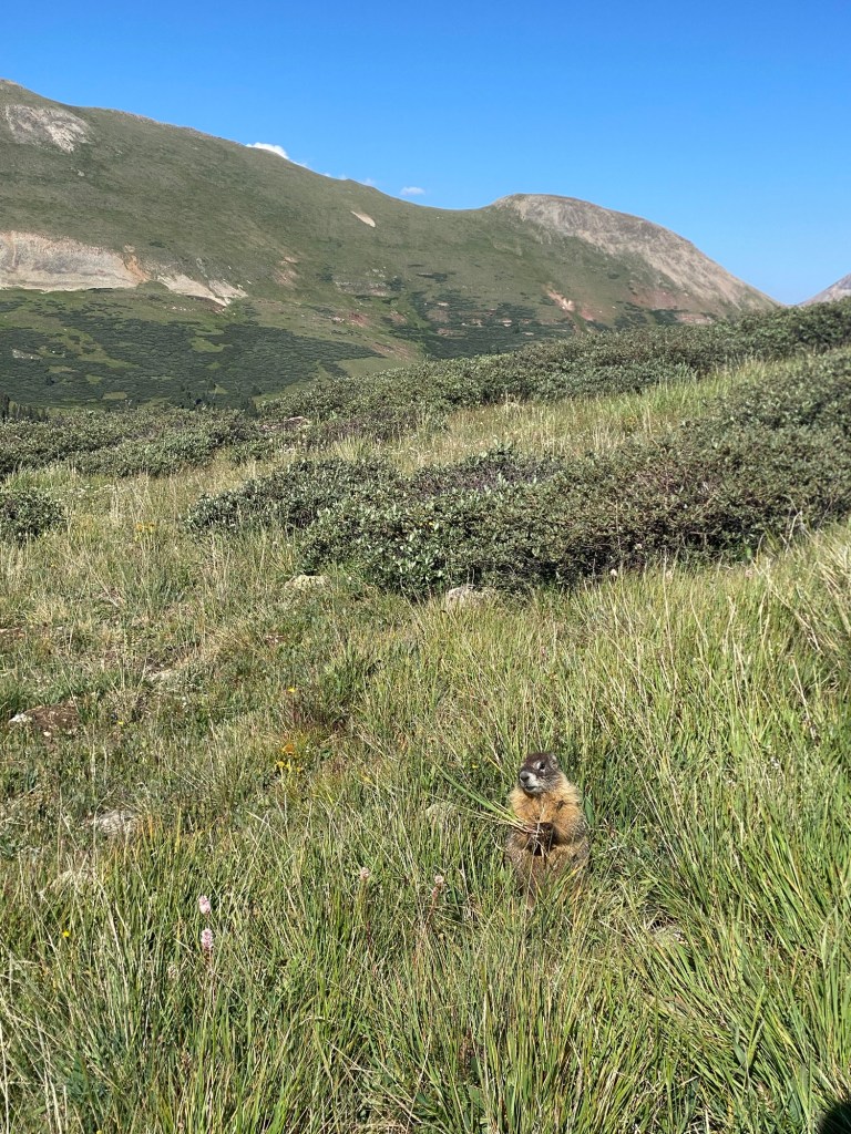
This marmot posed for about 10 minutes. He knew how to work it!
Soon we made it to below tree line and found the first acceptable place to camp. It isn’t remotely close to flat, but it’ll do in a pinch. We set up camp, ate, and pulled off a frustrating (though beautiful) bear hang. After that it was dark and time to be reacquainted with our tents and sleeping bags. I’m sure I’ll be dreaming about the delicious food (blueberry pie!) I’m missing out on for family Sunday dinner, but mostly sad I’m missing out on niece and nephew time! Those kids are gonna practically be adolescents by the time I get back!
Day 12 July 29; 12 miles
I really like this campsite. Yes it was a last minute decision made in exhausted haste, but it was quiet, free from animals, and not incredibly cold. I’m expecting to be cold every night moving forward, it’s just what level of cold will I be? Mild? Moderate with shivering? Or maximum with minimal sleep? Last night was mild and manageable, though the sloped ground didn’t promote great sleep.
But the trail doesn’t care about how well you slept so we got ourselves moving right along. The first 5 miles were all downhill and we finished them relatively quickly and stopped for a long break by Camp Hale bunkers, a WWII training camp for the 10th mountain division of the US Army. Pretty cool!
Camp Hale bunkers
The rest of the afternoon was a relatively gentle climb up to Tennessee pass, nothing really to write home about.
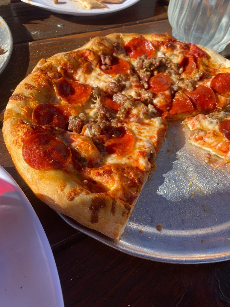
When we got into camp (early this time!) Sheena realized she had service and was able to talk to Steve. Ever the brilliant mind, Steve suggested he drive the 15 min to pick us up and spend a night indoors and he’ll drop us off in the morning. What an absolute brilliant plan! Shower, pizza, ice cream, a bed, and coffee in the morning? No brainer. We hustled down to the road and awaited Steve.
Pizza beats cold ramen every time
Day 13 July 30; 13.8 miles
After a night of indulging in pizza, ice cream, and TV, I went off to bed early and had a wonderful night sleep. When you wake up in the middle of the night not knowing where the heck you are, you know you were in a deep sleep.
Got up early to enjoy a cup of coffee or two and to get the pack ready for a little jaunt in the woods. And that’s about all it was. Some nice views, some steep climbs to get there, and ran into a lot of new and old faces.
Freddy heard we had leftover pizza for lunch and refused to leave until we satisfied his craving
With a lighter pack the miles felt much easier and we were ready to be picked up at 4:30p. Thankfully, Sheena’s neighbor was able to grab us so we could enjoy an evening and night complete with tacos, can’t ask for a better way to end a long almost 2 weeks of hiking. We’ll have 2 days off in Leadville as Sheena catches up with real world things and I plan the next few weeks as well as bag the highest mountain in Colorado – Mt. Elbert!
Off(ish) days July 31- August 1
Four whole nights in a bed and four days of real good (and coffee!). Going back to the trail is going to be tough after spending all this time being spoiled in Leadville!
Wednesday I walked into town and planned out the next few weeks. We have some big mile days in our future! Because of time and resupply concerns, we have decided to take the Collegiate East route, as it isn’t as treacherous and has more resupply options, lending itself to lighter packs which is always a plus.
Thursday I decided to take on Mt. Elbert – the tallest mountain in Colorado and second only to Whitney in the contiguous United States. I originally was going to do a side trip up it, as its trailhead is right off the CT. But since Sheena lives so close to it, I decided to seize the opportunity of doing it on a rest day!
It’s a 10 mile out and back route with over 4k’ of elevation gain to the summit of 14.4k’. And it was every bit as tough as you can imagine! Air is thin up there and there are some hefty stretches of over 22% grade. But with time, rest, and persistence I got up there before 9am. It was the most beautiful day – blue skies, 70 degrees, and no wind! So unusual for being that high, I really picked the right day!
There were a lot of folks at the summit, including two women I recognized! We met Kristen and Yvonne a few days prior on the trail. From Switzerland and Germany, they are used to beautiful views! I spent some time at the summit before making my way down. While I could spend all day up there, I had things to do to get back on the trail the next day!
Those things included dropping off our resupply package at Twin Lakes. What a beautiful little town! Driving up to it almost took my breath away with the towering mountains protecting the lake twins underneath. I can’t wait to go back!
Day 16 August 2; 15 miles
4 nights of sleeping in an actual bed and days of eating actual food have made us spoiled. Getting up early to get back on the trail was only worth it for the coffee. Steve saved the day again and dropped us right where we left off Tuesday and we were on our way back to the depths of the forest.
Can’t say this segment lent itself to too many views, it was primarily in the trees. But that’s okay because it was not super strenuous. With rest breaks we were able to cruise into camp at a decent hour. The best part of the hike was walking with views of Mt. Elbert right in front of us. I could even see the exact trail I went up and down yesterday! I knew Elbert would be special, probably why I knew to name my welcome bear after it!
Mt. Elbert
Something of note I forgot to mention in the first 100 mile blog. I can now add hummingbirds to the list of birds I’ve been attacked by. And unfortunately for me, it’s a long list. Birds seem to hate me as much as I hate them. But of all the birds, hummingbirds are the only ones I actually really really love. So imagine how upset I was when I am constantly being attacked by them out here. And there are a ton of them. The most egregious event was one flew right by my head (you can hear their fluttering wings from a mile away) and landed in a tree just feet away from me. We had a mini stare off where I called him a pretty boy and wished him well on his search for nectar. Well he must have taken offense because that small little torpedo of a bird launched itself off that branch and went straight for my head. It was absolutely terrifying. I soon noticed that hummingbirds fancied my head and although I didn’t have any more kamikaze attacks, they loved hovering around me. That’s when it clicked – they don’t actually hate me, they think my head is a flower! I am never without my red Phillies hat, which looks a lot like a hummingbird feeder. I was so happy when I made this connection. Though I’m sure they’re not happy to come out empty beaked (there’s not much in my head – and nectar sure ain’t taking up any valuable real estate), I’m happy my truce has been made with the hummingbird population.
With a good dinner, great bear hang, and a good hour to finish a book (bringing a kindle was worth its weight in gold), I was off to sleep by 9pm. Pretty good day in my book!
Day 17 August 3; 20 miles (10 walked, 10 hitched
Even after all those nights in a bed, there is something comforting about the coziness one finds in a tent. While KDog thinks my tent reminds him of a coffin, I do find great peace and solitude inside that little tent. I would much rather choose to have a toilet than a bed. But all that to say I enjoyed a great night sleep and wasn’t cold for once!
We set out early for a 6 mile walk to Twin Lakes. I dropped off a resupply there after Elbert and was excited to go back. But after carrying only one day’s worth of food, getting a heavy resupply is going to be a wake up call. That’s just the nature of the beast.
It was a relatively mellow walk into town, but a fortunate one for as, as we bumped into Gabby and Ava. We spoke to them for a little and arrived into town together. That’s where we saw Mike! We caught up and he told us all about his wonderful visit with family. He also told us he was apprehensive about doing the collegiate west, as the last few days have been a struggle. I suggested hiking the East with us, as it’s less strenuous and many options to bail out should misfortune arise. He agreed (to his wife Sally, you’re welcome – I’m sure you were worried about him!) and just like that the three amigos were reunited.
Approaching Twin Lakes
Talk about misfortune- we also ran into LifeSaver, who we saw in the beginning and figured he’d be practically done by now. He unfortunately suffered from a pretty severe infection that landed him in the hospital for almost a week. I couldn’t imagine what would’ve happened if things took a turn for the worst when out in the wilderness. But at 19 he has youth on his side and seemingly can bounce right back from near death.
Back in late June there was a substantial wildfire that greatly affected the Twin Lakes area. For a while, both the East and west collegiate routes had significant detours. Prior to today, there was a lot of misinformation about which was opened when. Turns out the East has an 8 mile detour in place through exposed highway and county roads. Being that it was in the 90s, blazing hot, no shade, and no water, walking the detour was out of the question. We decided we were going to hitch it then and there, and with the general store telling us it was currently the busiest day of the year, we figured getting a hitch may not be so hard.
That’s when I remembered Gabby telling me her wife would be picking her up around noon. I relayed the information to Sheena who felt comfortable asking if we could join and get dropped off at the end of the detour. Fortune favors the bold and while mike and I were unsuccessfully sticking out our thumbs for a ride, Sheena gave us a thumbs up that we had a ride! And before we knew it 6 of us stuffed into a Subaru and we were on our way. And we couldn’t be more grateful because wow that road looked treacherous, hot, and dusty. We passed one unfortunate soul huffing it but with Gabby stuffed in the trunk, we had no room to offer her.
When we were dropped off we realized that the hitch took off 10 miles of the hike, giving us a good excuse to have a shorter afternoon hike and a good reprieve at camp. With it still hot and exposed, we again were grateful for our fate. And the views were incredible, some of the best so far. Upon coming to the ridge of a climb, we were greeted with one of the most beautiful canyon sights. Cloaked in green, it felt like we were in the middle of a fjord in Norway. Very magical.
The view stopped us dead in our tracks
We got into camp late afternoon with plenty of time to soak our feet in a creek and just relax. Again, could not have asked for a more perfect day.
Day 18 August 3; 15 miles
After a great night of sleep on an actual flat surface, I was ready for what the day was to bring. And that was some pretty hefty climbs. We had David join us. He’s segment hiking the trail throughout the summer and liked our 15 mile/day plan so he decided to join the crew.
4500’ climbs over a few miles is pretty aggressive, and we afforded a lot of time to complete them. Thankfully we managed and completed 15 miles before 6pm, just in time for the heavens to open. We had just enough minutes to set up our tents before the big show started with drenching rain and loud thunder. Luckily it didn’t last long and we all emerged from our tents eager to eat dinner. We also showed off our bear hanging skills and taught David the fine art of finding the perfect tree, tossing the rock over (though he has impeccable aim – just ask any squirrel – they curse his name), and heaving and hoing until it’s perfectly nestled high up in the trees. We have become bear hang masters.
Made a side trip to Rainbow Lake. Wouldn’t say it was worth it 200!!
Today was a super long day, but we have officially gotten 200 miles under our belts. The next few days look like they could go any which way, hopefully everything goes in our favor.
Is there really a better way to start a hike other than sitting at the airport watching a video of a CT thru hike sent to you by someone you met on the JMT while waiting for your flight to Denver? I met Matt and his son back in 2018 and they thru hiked the CT a few years later. After catching wind that I was heading out for a CT hike Matt sent an email of a video of their thru hike. Talk about motivation! All the beauty and adventure in that video inspired me even more to seek out my own experience out in the mountains of Colorado.
I got to Colorado two days before the first day of the hike. Meeting Sheena in her town of Leadville lent itself to a fairly decent acclimation process. Sitting at over 10k’, Leadville is the highest incorporated city in the country. Thankfully I drank what felt like gallons of water (I made sure to get an aisle seat on the plane) and staved off the worst of any altitude sickness. I even felt good enough for a 4 mile walk to Turquoise Lake! And rumor has it I’ll be seeing this lake again soon in my future…
Sheena and I spent all day running errands and ensuring we weren’t missing anything for this adventure. We finally wrapped everything up around midnight… just in time for a 4:30am wake up call. Good practice for what I’m sure will be plenty of lack of sleep nights on the trail.
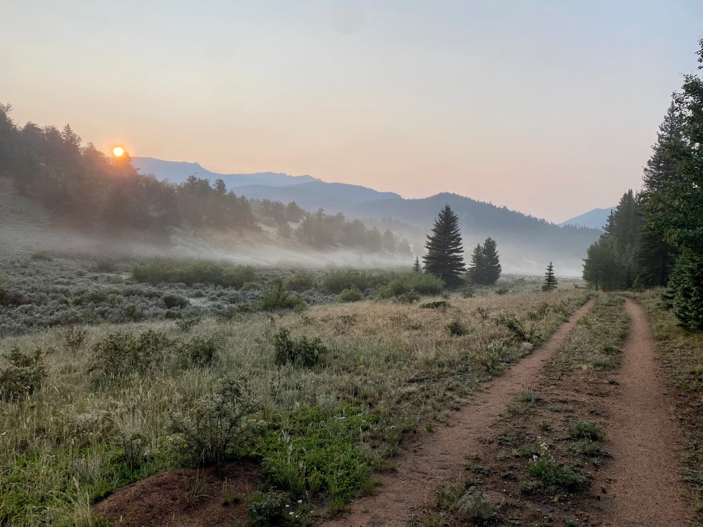
Day 1 July 18; 11.8 miles
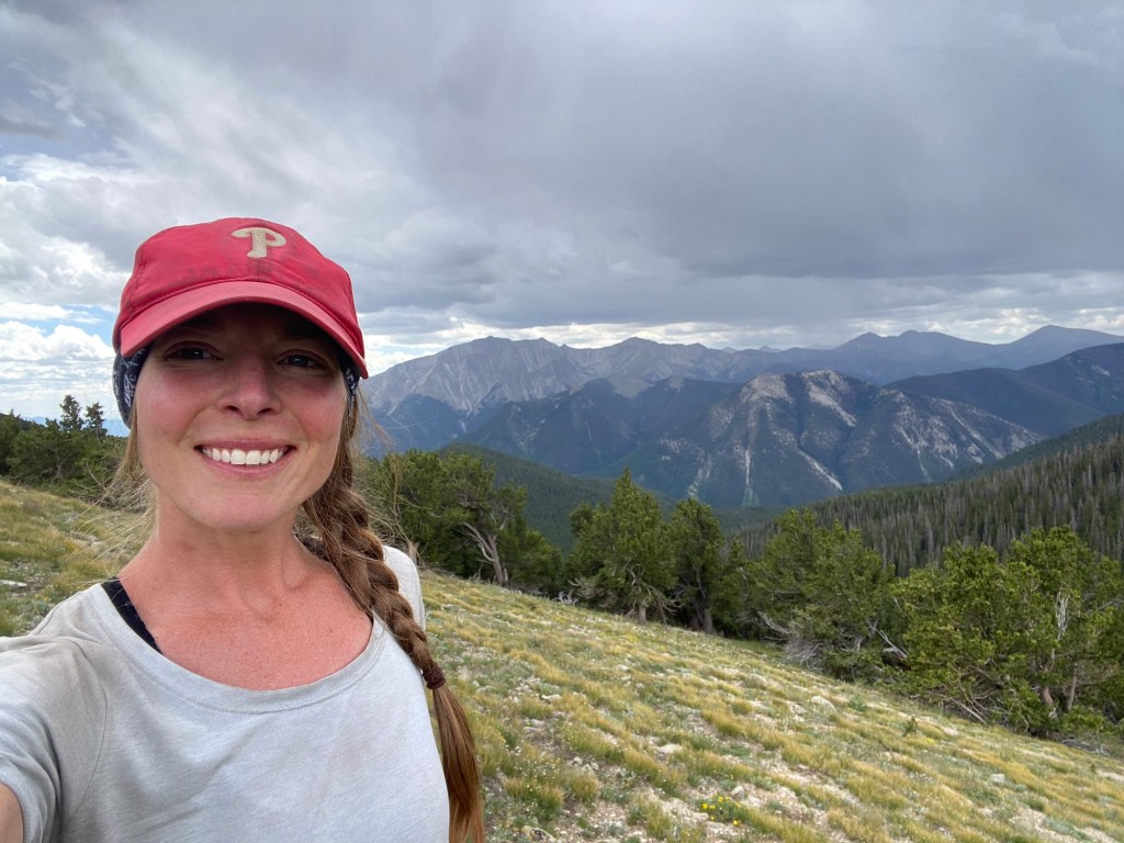
“Please, don’t get eaten by a mountain lion!” were the departing words from my dear friend Carolyn. These words I’m sure will ring through my head plenty this trip, along with avoiding many other maladies.
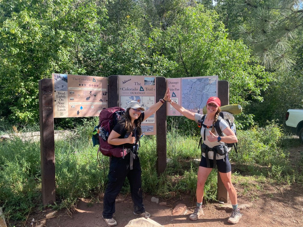
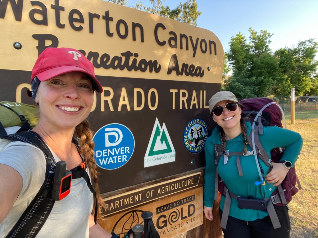
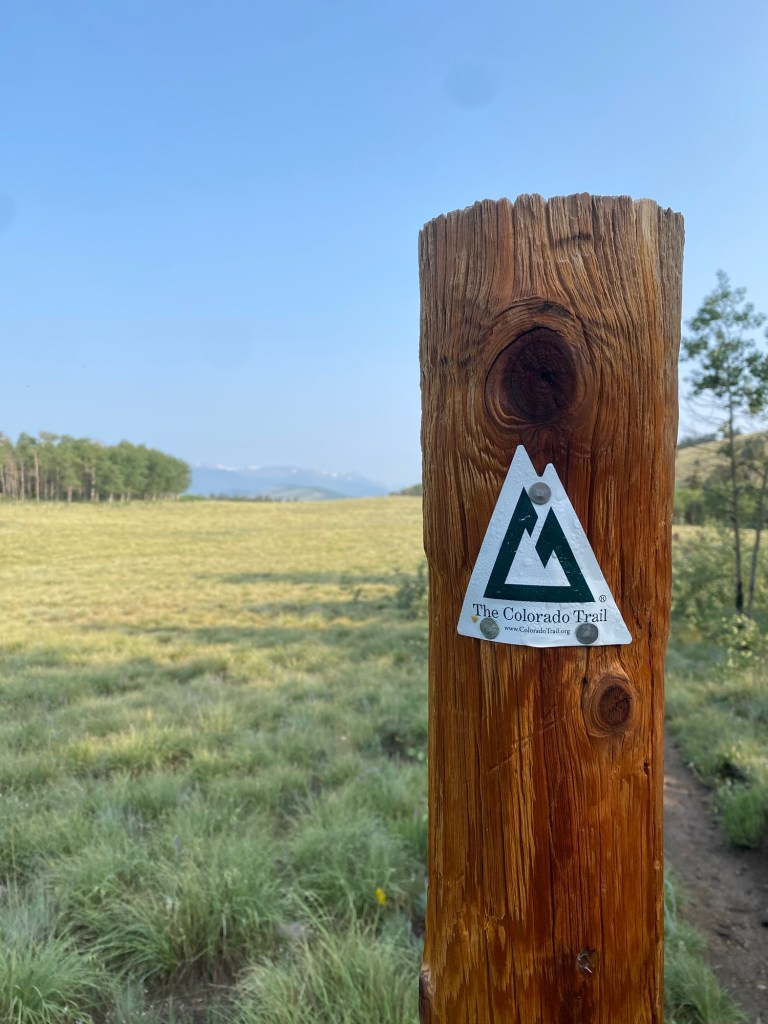
With a 2 hour drive from Leadville to Denver, we woke up super early to get to the trailhead before the predicted high temperatures. After a ceremonial stop at McDonalds for breakfast and a few pictures with the trail head sign, we were on our own and off to head for Durango.
All smiles before 500 miles!Can’t not have a photo op with the trailhead sign!
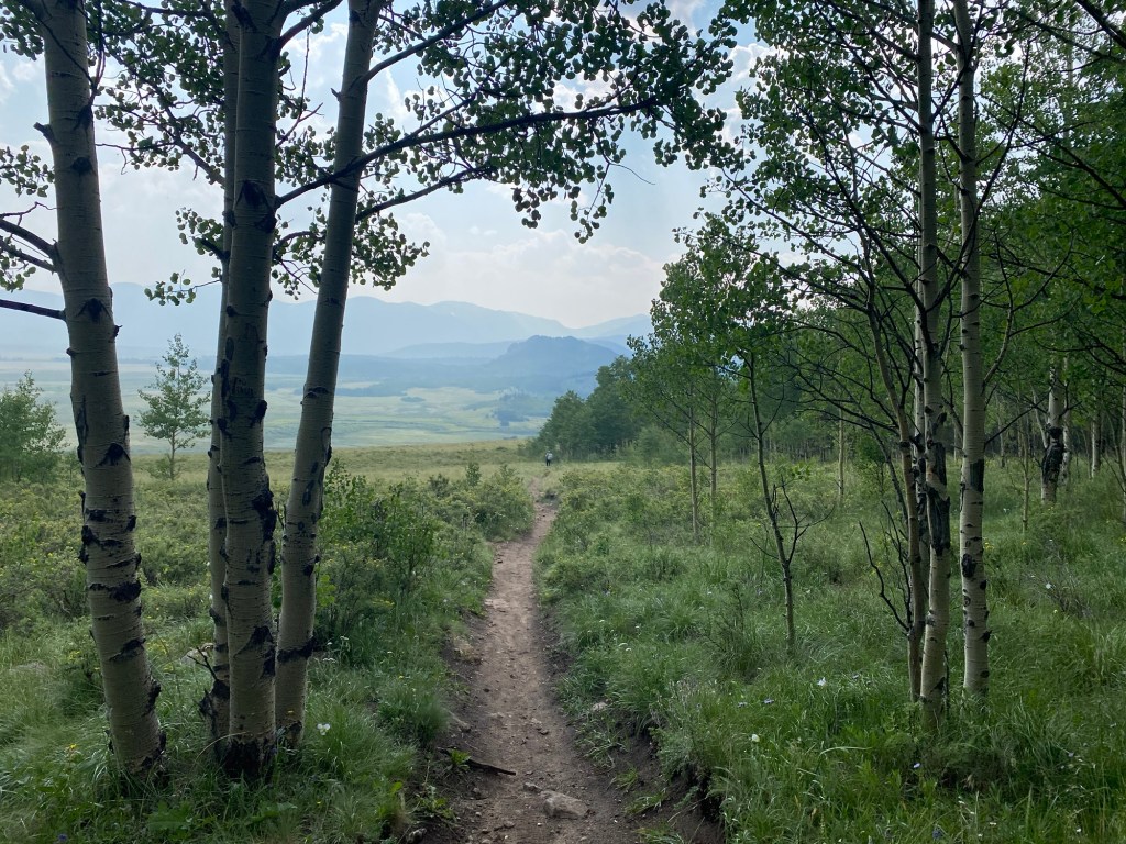
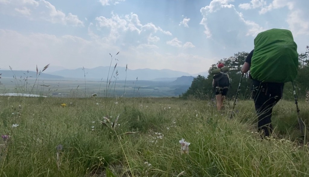
The trail itself started as a road that followed along the river. It was exposed but we were hiking in the morning when the shadows shielded us from the sun and the temperature was mild enough to avoid a full blown sweat. We logged in 8 miles before noon – my goal was already achieved! There is no camping allowed for the first 7 miles of the trail, so we had to make it at least that far. So imagine how happy we were to bust out nearly 12 miles on day 1! But those 11.8 miles weren’t easy. Our packs were loaded with days worth of food and a ton of water. Being in the high desert with limited water and a dry camp, we had to carry close to 4 liters of water. That’s a lot of weight to be hauling up climbs!
Without going into too much detail, it took about 4 hours before we reverted back to our bike trip days where real world etiquette and social manners become a thing of the past. This is our lives now – we live in and are one with the dirt! We met a few thru hikers also starting their journey. One of whom was Bob, but his schedule sounds a little more aggressive than ours, so I’m sure that’s the last we’ll see of him.
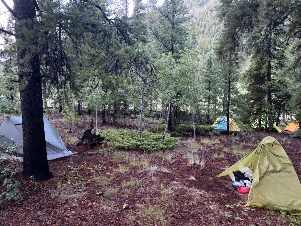
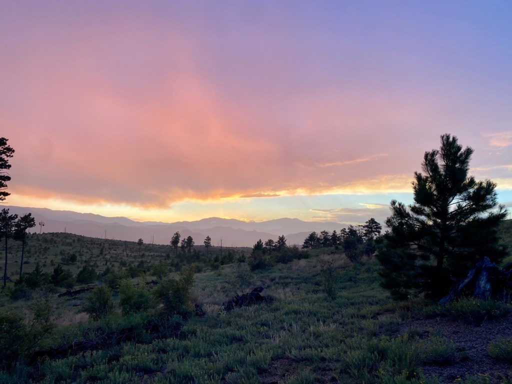
We rolled into camp around 6:30pm with plenty of daylight to set up camp, eat dinner, watch a beautiful sunset, and do a most frustrating bear hang. I have a feeling we’re going to regret not bringing our bear canisters.
Night one camp!
Day 2 July 19; 15.1 miles
Right before going to bed, I (along with probably anyone within a 10 mile radius) heard a bone chilling shriek. Poor Sheena was charged by a mouse and put us on high alert. What’s so scary about a tiny little mouse? Well if they feel it necessary, they will happily chew through your backpack, tent, or anything else they can get their grubby little teeth through. They are so destructive I have a hard time deciding if I’d rather go up against a bear or a mouse. All I can say is thank God there aren’t any raccoons out here. But all that to say we slept very poorly. I was very worried about waking up to a mouse nibbling on my nose and the whipping wind led to a very interrupted night’s sleep.
But alas, the show must go on. And we had a long and hot day ahead of us. We had a short climb before enjoying a glorious 4 mile descent to a large river. We filled up on plenty of water in preparation for a 10 mile water carry over a very exposed desert section. That’s were I met Liz and Ben. Liz is embarking on her first solo section hike and is kicking butt! Ben is a part of a foursome and let’s just say a mutiny may be happening soon, I’ll keep you updated on that.
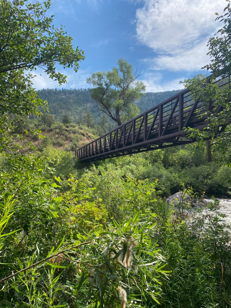
Gudy Gaskell Bridge
While ascending from the river, Sheena informed me that this was her least anticipated section of the entire hike, because it is through an exposed burn section with high temperatures and beating sun. Luckily for us, the clouds took care of the sun and we were shaded from its aggressive rays.
While taking a rest, Sheena and I both energized with a Gu. I let her know every Gu has a motivational quote on the bottom. Mine was “pain is temporary”, a go to phrase for me. Hers was “stash your trash”. While still a very good piece of advice, we both couldn’t help laughing at how appropriate it was for how she was feeling. While giggling a little too hard I experienced a pretty bad nose bleed which is right when we met Ruth (that’s not her name, but that’s what we called her because of her likeness to the character Ruth in Ozark). While trying to contain my gushing nose, we learned she is from Bellingham and is solo hiking. She had an eventful night after her sister called SAR in a panic after not receiving a Garmin check in (apparently there was a global outage? Wouldn’t know, we’re living in blissful ignorance of the real world!). After finally getting a hold of her sister the rescue attempt was aborted, but still left Ruth shaken. She contemplated getting off the trail, but we were adamant that the insecurity she may be feeling is temporary (we didn’t find it necessary to tell her to stash her trash) and at least she has someone at home checking in on her! Hopefully we see her down the trail.
After saying see you later to Ruth, we were caught in an afternoon storm. It blew in quickly and we were fully exposed. Rain, lightning, and wind encouraged us to hasten our pace but it soon died down and led to a beautiful double rainbow. Maybe we were a little too lackadaisy with our approach – the Foursome were seeking shelter while we were yelling about how much I hate Apple – that’s a story for another time.
Barely visible double rainbow
Fortunately we all survived and refilled our water at the fire station. We are so thankful for the station allowing us use of their spigot. Otherwise it would be an even longer water carry – yikes!
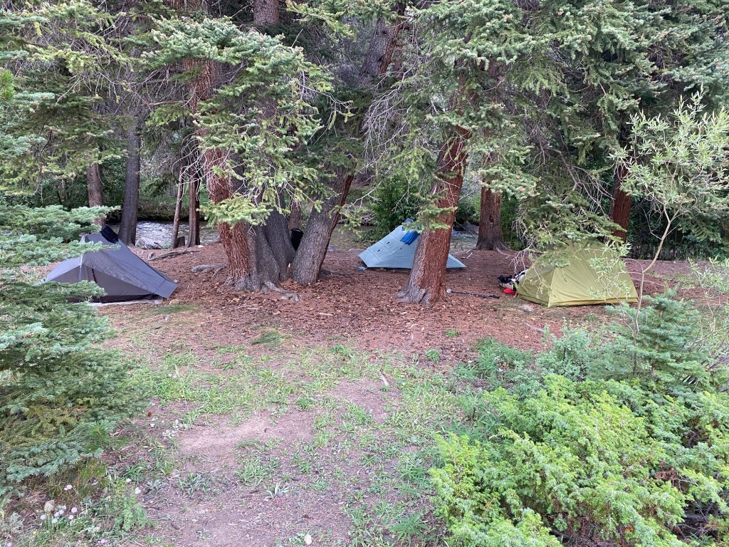
We went another mile to camp and are sharing it with a few other hikers, including the Foursome.
Day 3 July 20 13.1 miles
Wow that was the best sleep I have ever had in my tent, I’m pretty sure. And I’ve spent a lot of nights in that tent. It was so good in fact I slept through my alarm and in a panic shot up at 6am. Yes, that is sleeping in for me!
We had a later start than normal for what we anticipated to be a shorter day. But after getting to our goal by noon, we added a few more miles. I love that we’re feeling strong to push ourselves to eat more miles!
We decided to take a 2 hour break by a stream where Sheena took a dip in attempt to wash away the stink. I know it’s a futile attempt – we have to embrace the stink cause it’s not going away anytime soon! In addition to lots of mountain bikers, we ran back into Liz and met some new folks who either caught up to us or are section hiking starting a different trail heads. We haven’t seen the Foursome, we may have lost them.
While getting in the last few miles, not only did it start thundering, but we walked past a very active gun range. Thank God I left little Addie girl in the very capable hands of my parents, for she would have definitely dropped dead from all the loud noises.
While gathering water right before setting up camp for the night, we met Strawberry. After talking a bit, we realized we basically live in the same town! In fact, we were practically neighbors when I was a wee bitty thing. I never got her actual name, but wow what a small world. Maybe I’ll run into her when I get back home.
Setting up camp the storm clouds rolled in. Looks like we might be in for a rough night.
Ps no pictures because my phone ran out of storage (see previous aside about Apple). Apparently the App I use for navigation eats up storage like we’ve been eating up miles. So add that to the list of things I have to figure out! But luckily there weren’t too many picture worthy views today.
Day 4 July 21 14.1 miles
What a day. I thought I could wrap today’s events up with a pretty little bow and put it behind me, but my hands are shaking too much to make it look any better than sloppy.
It rained all night with some pretty intense thunder that reverberated through the mountains. With the drenching rain I woke up in a drenched tent. But alas, it had to be packed up… I’ll just dry it out later (famous last words).
Strawberry left super early and we went on our merry way up a steep 5 mile climb. We were serenaded by thunder the whole way, which was just a taste of what was to come.
Smiling in blissful ignorance, unaware of what’s to come
Once we started the descent, the heavens opened and we were greeted with a heavy downpour that was accented with dip n dot sized hail. It lasted briefly and we entered into a beautiful meadow just as the weather seemingly stopped. Soon that meadow turned dangerous with another strong storm blowing through. We spent the next 3 hours battling strong rain, winds, and thunder. We were drenched and eventually my hands went numb. That’s when the concern for hypothermia kicked in. We figured it was best to keep moving rather than sit and wait it out cold and soaked. And so we marched on right to camp, which is right when the storm ended.
10 minutes later everything changed and that smile was washed away
We set up our tents and ate our cold dinner, shivering the whole time. I really regretted not having my sleeping bag liner with me. But with dry clothes and a dry sleeping bag, I was able to regain my body temperature even though I couldn’t stop shaking.
During our time out in the storm we saw no one. We wondered if they sought shelter or were just as bullheaded as us. Either way, it sounds like we all survived.
The only good thing about today is our bags are that much lighter and we are that much closer to Jefferson, our first resupply stop!
Day 5 July 5; 10 miles
After a freezing night on an uneven surface rolling all over the tent wishing I had my sleeping bag liner, we woke up late in an attempt to dry out our soaked gear. It was a feeble attempt, as the sun was not cooperating. So we settled for damp gear with the plan to dry it out later. We at least were warmed up and no longer shivering.
We set out for a 10:30am departure, hours later than our norm. But we had a short day with easy elevation and light packs! But that’ll be short lived. We resupply it in Jefferson tomorrow and it’s quite bittersweet. We’ll have the opportunity to get off the trail and eat real food, but also return to the trail with heavy packs. It feels so great to not be weighed down, but alas, all good things must come to an end.
We were chased by storms all afternoon. Pretty sure yesterday traumatized us and any sign of rain or thunder has us reaching for our rain gear or playing the “thunder or airplane?” game. Luckily we evaded the storms and look to have a dry night at camp.
Praying we evade all threats of rain
We have a great camping spot and started completely alone in it. I said out loud how nice it would be to see more people, and lo and behold my prayers were answered. 7 people rolled through, 5 of whom are camping with us. Plenty of space to share!
Day 6 July 23; 10 miles
It was another wet, rainy, cold night but fueled by the knowledge that civilization and a hot meal were waiting for us in Jefferson, we packed up our wet gear in anticipation for an easy day. Jefferson is a tiny little town, but to us it’s the Emerald City. And given Sheena’s Tin Man bike trail name, she was ready to receive her heart!
Now the good views are starting!
The last few miles of the hike were breathtaking. We walked through an aspen forest with a full scale wildflower bloom. All the colors are so dainty and delicate. From pastel pink and purples to deep red indian paintbrushes to bright and happy yellows, it was like walking through a fairytale that pictures just couldn’t capture.
The tail end of the hike was riddled with a low level anxiety – we had to hitch 4 miles to get into the city. From everything I read, this was a seemingly easy task. We just couldn’t imagine exactly how easy it would be. We must’ve looked like 2 lost kids when a couple asked us “need a ride into town?” We jumped at the opportunity and hopped in with Monica and Brian, a couple who just finished a segment hike and wanted to give out some trail magic.
After getting dropped off in town and walking into the small general store, a local stopped me and said “you ain’t from around here cause you sure are confused. In this town you come in with one leg on one side of a horse and the other on the other side. Ain’t no such thing as walking with a pack!” It was a great welcome.
In the store we picked up our resupply packages and had a hot meal. Just as much as you can be hungry for food on trips like this, you are also hungry for information. Whether it’s family, friends, pets, or current events, being disconnected for almost a week can really be a mental load. Luckily, everyone is doing great! It took us 3 days to learn Biden dropped out of the 2024 election, what a year it’ll be!
Endless entertainment during our dry out
We had to dry out our wet gear outside and deal with our large resupply. We definitely have way too much food! While outside we were approached by a woman asking if we needed a ride back to the trailhead. What a fortunate day for us! Didn’t even have to attempt a hitch. We took Bear Bait (she hiked the CT last summer) and Kyle up on their offer along with thru hiker KDog, a retired postal worker who is living his retirement in thru hiking bliss.
After getting dropped off we fell upon even more trail magic! We filled up on fruit and cookies. Amy and Johnny Walker are acclimating before a thru hike in early August. They’ll be out there all week helping out hikers!
Amy (Moffit) and Johnny Walker
We hiked another 3 miles to camp completely zonked from the events of the day. Another threat of rain, but looks like we should avoid the worst of it!
KDog walking into camp
Day 7 July 24 13.5 miles
Had a poor night sleep last night due to a few brazen mice and a poor bear hang. But we woke up to unchewed packs and untouched food bags. The only good thing was the warmth the newly acquired bag liner provided – top notch!
We hit the trail early knowing we had to go up Georgia Pass, which involved a long climb with 2k’ of elevation gain. I am a sucker for passes and loved every minute of the ascent. It helped that we got some more trail magic a mile into the hike. I didn’t get his name, but the trail angel had to bail from the CT because of altitude sickness. Fortunately for us he is spending some time spreading the love with cookies, oranges, and plenty of other goodies. We would’ve stocked up if we hadn’t just resupplied the day before. Hopefully the trail magic continues further along!
As we were ascending we ran (pun intended) into a few ultramarathon runners competing in the Summit 200, a 200 mile race through Summit county. Once I’m done the trail I hope to compete in an ultra or two, likely not 200 miles but who knows, maybe I’ll return to try out this race!
When we got to the top of Georgia Pass we were greeted with beautiful views despite smoke from Canada and Oregon lending a slight obstruction to the mountains, but what we could see was spectacular. We met up with KDog and said our goodbyes, this might be the last we see of him.
We trudged along for the last 5 rocky downhill miles to camp, where our trail converged with the CDT. Can’t say that trail is on my bucket list.
Camp is quiet, some threats of rain but fingers crossed it misses us. We could use a dry night!
Day 8 July 25; 10 miles
Officially one week on the trail! To think just a week ago we were crawling up climbs with loaded packs. Well, nothing much has changed, but at least we have 7 more day’s experience!
Because the mornings are so bitter cold we decided to sleep in and get a later start to let things (mainly our hands) thaw out. We set out for an expected climb, one that kicked my butt. Mentally it was a struggle. Yesterday felt like a breeze compared to today. I think I just really like passes – they feel like an accomplishment as opposed to just incessant climbing. But surely enough, we made it to the top and had a nice downhill to enjoy.
We decided to take it easy today with a low mileage day to have a nero day tomorrow in Breck. Coming off a long and exhausting day yesterday, we took plenty of long breaks to reach our 9 mile goal. During one such break, Sheena got up slowly and said calmly, “Emilie, you have a huge cricket on your crotch”. Not wanting to look, I stared at her in panic. Her calm approach was likely to stifle the chaos that was sure to ensue. I looked down, and just like she warned, there was the biggest blackest cricket on the planet staring up at me. And all the swatting and screaming and dancing wasn’t enough to get him away from me. But persistence pays off and I managed to free myself from its death grip.
We got into camp early and prepared for our half day in Breck tomorrow by writing shopping lists and looking at all the food establishments to determine where to get the best coffee and burgers (not together, although at this point any food sounds amazing).
The camp site is beautiful with a stunning view of the valley that butts right up to Dillion reservoir, it even has a bench to sit and relax. I’m sure the sunset will be spectacular!
Ps – foursome update. Apparently now they are just a twosome. Received information just now from a woman we are sharing camp with that one of them actually broke his ankle day 1 and was hiking through it before bailing out in Bailey with his girlfriend. The other two are forging on and apparently are hot on our heels so we should be seeing them soon!
Day 9 July 26 6.5 miles
Woke up to dry tents this morning despite a little rain overnight. Happy to not have to worry about drying out wet tents in Breckinridge!
We had a slow hike into Breck with many stops. It was nice and easy because of low miles and a late check in to our air bnb. On the trail we met Mike, AKA Skyline. We talked to him for a few and said see you later because we knew we’d run into him again soon. We didn’t realize it would be so soon! On the bus into Breckinridge, we bumped back into mike! We all were looking for a place to eat and decided to get lunch at a bistro together. Mike is a recently retired IT guy who has hiked the PCT and now attempting the CT. We had a great lunch with him and hope to see him soon on the trail!
Aside from lunch, we ran errands including food resupply and laundry. But best of all, we enjoyed a shower to wash off a week’s worth of accumulated crud. You really take for granted cleanliness until you spend some time in the dirt!
We hit just over 100 miles today, a huge accomplishment. Just over 1/5 of the way there. But in order to meet time requirements, I have a feeling we’re going to need to see some higher mileage and longer days soon. The clock never stops ticking, and I’m really starting to miss everyone (and every pet) at home.
Put a lot of work into that 100 mile rock art work!
We plan of having dinner then going to bed early (in an actual bed!)for an early morning wake up to get to Copper mountain to slack pack back up to breck. It’ll feel incredible to hike with a light pack!
It is shocking to me that my last big adventure was 3 years ago. I was deep in the Tahoe wilderness questioning why I brought my poor little pup on such an ambitious trip and desperate for a plan to bail her out. Luckily, all things considered, it all worked out and Addie is back to her happy little self and the failed trip has not dampened my love for adventure. In fact, after a relatively quiet few years, that itch for adventure has returned and the only cure is another grand trip! After floating around the possibilities, I boiled it down to three options – a Northern Tier bike tour, an international thru hike of the Tour du Mont Blanc, or keep it domestic with a Colorado Trail Thru hike. My love for the great West won, and soon I found myself knee deep in the logistics of planning a nearly 500 mile trek from Denver to Durango CO.
While I always knew the Colorado Trail existed, I never took much time to look into it. While setting out for the 2022 Four Passes Loop hike, I ran into 2 Colorado Trail (CT) thru hikers in Alma. I didn’t want to bother them too much, so I asked a few brief questions. Afterwards, I did a quick google investigation and right then and there I determined eventually I would attempt to conquer the trail. Maybe I didn’t forecast this would happen 2 years from then, but no time like the present!
The CT is a (for my personal thru hike) 491 mile thru hike starting in the outskirts of Denver and ending in the San Juan mountain town of Durango. Climbing over 90K’ vertical feet with much of that being over 10K’ of elevation, it is quite the endeavor for any level of backpacker. Born in 1974 and completed in 1987, the trail originally took hikers east of the Collegiate Peaks Wilderness, but like all things, it evolved in 2012 to include an alternate route through the Collegiates, known today as the Collegiate West alternate. The trail wouldn’t be what is it today without the passion of the Colorado Trail Foundation and its devoted volunteers. A trail of this length obviously requires a lot of logisitics and planning to complete, but luckily there is no shortage of trail towns along the way who offer supplies and rest for a weary hiker!
Trip Planning
My biggest concern for taking on a trip of this magnitude initially was logistics. Luckily, I am no stranger to complicated logistics and thankfully for me, though the CT is over double the distance of the JMT, planning this hike is much less complicated.
For my trip planning, I utilized The Colorado Trail Guidebook that I purchased 3 years ago, the Colorado Trail Foundation website (truly, all the information one needs to plan a CT thru hike is in there), and various blogs/vlogs from those who have completed the trail. From that wealth of knowledge, I boiled down a rough plan for a 5 week journey. A trip this large it’s nearly impossible to plan day to day itinerary. While I was able to for the JMT (more out of logistical necessity), the stress of having a daily schedule to keep up with can be a distraction and has the potential to take away from the spontaneity the trail can bring. The major things I had to be aware of were resupply towns. Fortunately, the trail does have towns relatively close that are accessible by either a short hike off trail or easy to get hitch. With full services, I can shop in town and not have to worry about shipping a resupply box – that is, with the exception of one. And I’ll get into that shortly.
5 weeks alone on a trail can get pretty lonely, so I shot a message over to my favorite adventure buddy, Sheena, asking if she was interested in joining me. Never one to turn down an adventure (in her home state none the less!) Sheena obliged and I’m so grateful and excited I’ll have someone to bask in the beauty (and pain) with.
We’re back!
Originally I debated driving out to CO. Not wanting to risk delays or lost luggage because of recent nonsense with airlines and loving long drives, I was going to take a leisurely scenic drive out to one of the most scenic places in the country. But alas, plane tickets and a family trip the weekend before our start date nearly forced me into flying. I already shipped out my food and majority of gear out to Sheena in Leadville (shipping cost more than the plane ticket – d’oh!) and will just carryon the rest on the plane.
Trip Prep
500 miles is no joke! The longest I have completed is the JMT, and like I previously said, the CT is over double the mileage. Not wanting to haul Big Booty Judy over all the mountains Colorado has to offer, I decided that I needed some gear change. I have slowly replaced most of my old heavy gear with new ultralight gear that makes life a little easier. This old body no longer can handle a 45lb pack and anything I can do to hedge my bets at completing this trail I’ll do.
So I now have a 55L Hyperlite Mountain Gear Southwest pack, a Sea to Summit ultralight sleeping bag, finally gave in and got a Sawyer Squeeze filter, a lightweight food storage system, and decided to trade in my clunky hiking boots for trailrunners. Theoretically, when all is said and done, my gear should be weighing ~12lb not accounting for water or food. Not bad when compared to my previous set up!
Gear pic! Addie unfortunately not included.
All this new gear gave me a good excuse to get out and test it out! Thankfully, Addie is great at processing trauma and didn’t hesitate to join me on a shake out hike out in Loyalsock State Forest in PA. We did a 2 night 26(ish) mile hike through the beautiful landscape and really put the new equipment through the ringer. Outside of slow miles with a senior dog (really just my own excuse, I had a severely painful foot I hobbled through those miles with, thank God for trekking poles), some really loud owls, a loud thunderstorm, and caterpillars raining from the sky, it was a great trip to take with Addie before leaving her for so long.
Addie and me at World’s End State Park – the trail goes right through it!
The pack was amazing, carried everything perfectly and felt so light, even with 5# of dog food. The trailrunners were light and bouncy, even with what I can only imagine was a fractured foot (the pain was nearly unbearable!). And I kicked myself for not hopping on the Sawyer train earlier – what an incredible piece of equipment! It made me feel so secure and comfortable with the new replacements and ready to tackle on the mountains in CO.
Okay, so what exactly is my plan?
Heck if I know! Like I said earlier, a trip of this magnitude cannot be strictly planned out. All that is set in stone is our first day has to be longer than 7 miles due to camping restrictions, we are choosing the Collegiate West route (barring any unforeseen circumstances), and we have to get in our miles early because of afternoon storms. Having experienced monsoon season on the JMT and gone through some of the most terrifying storms above treeline in the Sierras, I would prefer to not repeat this again out in CO. From what I’ve read, everyday around 2pm you can (and should) expect a storm to roll through – so just like the JMT!
Initially I wanted to just bust out miles everyday to complete this trail quickly, as I worry about my mental ability to stick it out for 5 weeks. But that all changed when Sheena accepted my offer. Having a good friend come along and share this experience with will only add to the magic of the trail. 25 mile days only sound more appealing if doing them alone. So the plan now is to start out conservatively and start tacking on longer mileage days once our trail legs develop. All in all, I am expecting this to take 30-35 days in total, including zero days. There are also opportunities to bag some 14ers, as some of these peaks are right off the CT! While this goal is likely to change depending on how tired the trail makes me, I really want to try and climb at least Mt. Elbert, as it’s the peak that my carved wooden Welcome Bear Bert I got in Frisco is named after!
Those bittersweet zero days! I remember feeling so guilty taking them on the JMT and just itching to get back on the trail. I’m sure the same will be true for this. Right now, our resupply stops are looking like Jefferson, Breckenridge, Leadville, Twin Lakes, Salida, Lake City, and finally Silverton. We certainly don’t want to have long food carries, so any carry longer than 6 days is not ideal. Wanting to have lighter back, hot food, and potential for a rest day will certainly hasten our pace to get in the miles for a resupply or zero day!
Speaking of resupply, this is the trail food I’ll be chowing down on! Though with shopping in towns, this is bound to look different with each resupply stop.
And thus we have it. My flight is scheduled, everything is shipped out, the animals will be properly taken care of (new addition to the pirate crew, Missy the tripod cat!), and the start date is set. We will be starting the trail July 18, just one day after the 6 year anniversary of my start date for the JMT! Wish us luck and peace from the bears and thunderstorms!
Obligatory pet pic! Missy brooding in the background is the newest member of the Pirate Ship. Missing one leg, she is slowly but surely becoming a defining member of the pack.
In 2018 I was fortunate enough to hike the Four Passes Loop in the Snowmass Wilderness of Colorado with my dad and two brothers. Fresh off the John Muir Trail, I was ready to take on the challenges that climbing four passes presents. Assaulted by bad weather and left almost abandoned until the fateful flip of a coin determined we trudge along (you can read about it here https://emiliebikesandhikes.com/2021/01/03/four-passes-loop-2018/). I remember this hike being one of the most gorgeous trails I’ve ever been on, so when Sheena, Craig, and Jordan suggested hiking it this summer, of course I jumped on the opportunity!
Flashback to 2018 Four Passes Loop
Since hiking it in 2018, a lot has changed logistically to get to the trail due to the spike in popularity (thanks COVID). But I won’t bore you with the details. The most important thing is that the hike still does not require permits to hike – so the most frustrating aspect of most hikes wasn’t a factor this time around, which made my frantic 2 week preparation for the hike easy!
Having experienced a bad case of altitude sickness on the JMT, I knew I needed to acclimate in order to safely and happily climb four passes all over 12,000 feet without wanting to jump off to alleviate the headache, nausea, and weakness altitude tends to bring. I was fortunate enough to be in Colorado the same time as Aaron, who I met 2 years ago in Florida and was such a help last year during the Southern Tier in Texas. After spending some time with his mom Ronie in Loveland, we headed into the mountains to spend time with his sister and her daughters in Alma, CO. Infamous for being the highest town in the US at 10,301′, I knew there was no better place to acclimate. And imagine my delight when I realized that I rode my bike past Audrey’s house just 6 years ago (to the day!) on the transam during the 100+ mile day death march through the Rockies. Memories flooded back as I witnessed 7 different TransAmers ride past the house, either relieved from conquering Hoosier Pass or pedaling slowly up it. I experienced no altitude symptoms as I enjoyed my time in Alma. I was able to run, walk MarnDog (coolest dog West of the Mississippi), hike, play in an extremely competitive matching game tournament, explore the surrounding towns, cheer on Juniper at baseball, and just in general have a great time with everyone. Audrey, Bella, and June were absolute delights to stay with and may have planted a seed to look into that area to move sometime in the future!
Troll of Breckenridge with Aaron and the girls
Alas, the tourist fun had to come to an end and it was time to meet up with Sheena and the guys in Avon. Aaron was kind enough to take us to the trailhead bright and early Friday morning to get an early start. Envious from the beauty of just the trailhead, Aaron wished he could join us. Maybe a third trip around the loop is in my future! With Sheena fresh off a 12 hour workshift and the guys coming in late from a concert at the Red Rocks, no one was ready to take on the first day with sufficient sleep, but the mountains were calling and this was not the time to complain about being sleepy!
Day 1: 11.5 miles 3462′ elevation gain
And so we were off! With a slight drizzle we hiked 1.5 miles to Crater Lake, the official start (for us) of the loop. After a few pictures, we split up.
All smiles before the trek!
Not wanting to slow down the boys, Sheena and I stayed back to take our time. With the amount of people on this popular trail, finding campsites can be challenging. We told the boys to secure a site and, “we’ll get there when we get there”. With two passes to get over the first day, we didn’t want to feel rushed.
Heading towards Crater LakeHeading towards Maroon Pass
We took our minds off the initial climb up Maroon Pass by catching up (wow, there was a lot to catch up on!). As we climbed, memories from my first trek around the loop came flooding back, including memories of bad weather. Which was exactly what was rolling in. Knowing powerful afternoon storms are common in the mountains and being atop a pass is not where you want to be, I grew slightly anxious at the gathering clouds. But we hustled up Maroon Pass, avoiding any sign of danger. I am certain my mom’s prayers for us helped keep the monsoon at bay. In 2018, the weather prevented a good look out from Maroon Pass. This was not the case this time around. This hike was worth it if only to see that view. What absolute beauty! A valley full of angry boisterous clouds on one side, rolling hills of brilliant green on the other. We spend some time taking in the beauty, but it was getting late and the clouds were getting darker. After all, we had another pass to get over!
Atop Maroon Pass!View from the other side of the pass.
We enjoyed the descent and eventual gradual climb to Frigid Air Pass. There was beauty everywhere we looked. I remember it being stunning four years ago – but not this stunning! Wildflowers were in full bloom, accenting the vibrant green with yellows, magentas, blues, and lavenders. It was dazzling and felt like walking through a field of dreams.
Tiny patch of wildflowers.
Those dreams quickly turned to nightmares, however, as we approached the last half mile of the pass. With vivid memories of it’s harsh grade and unforgiving steepness, I didn’t sugar coat it for Sheena – this was going to suck. But, always one to impress with her tenacity and determination, an already exhausted Sheena (who had COVID just 2 weeks ago) rose to the occasion and conquered the pass like a seasoned pro. The last 100′ of the pass was ungodly steep. Not even the Grand Canyon has grades like that! We weren’t the only ones struggling. There was a train of about 15 people behind us slowly ascending the slope with various degrees of obvious outward pain. I was thankful for these people, as lightning and thunder were present in the distance I felt more secure with my decision to ascend the pass in inclement weather. At least I wasn’t the only idiot, ha! After getting to the summit and celebrating with pictures, it started to rain and we scurried down off the pass quickly to below treeline.
Frigid Air Pass Conquered!Happy to be done with that pass! (as I raise my poles in triumph with lightning in the area – doh!)
Without service, we were left to blindly find Craig and Jordan. We would yell “Craig? Jordan!?” to any pair of tents we came across. I’m sure we startled more than one unsuspecting camper retreating into their tents to shield them from the rain. After a few unsuccessful “This has gotta be them!”s, we finally found them around 7pm. They were also rightfully exhausted. So much so, in fact, that they went straight to sleep after we arrived. We scarfed down dinner and sought shelter into our tents for some much needed rest. What a long, exhausting day. But I couldn’t be more proud or feel more accomplished. We did today what took me 2 days to complete 4 years ago! Two passes done, two to go!
Camp for night 1
Day 2:8.16 miles, 2202′ elevation gain
Let me preface this with the disclaimer that my memory is extremely poor. If I don’t write it down, it will likely escape my brain. I wrote the 2018 blog post 2.5 years after the fact, based purely on memory. Then I forgot to read it before embarking on this journey. I do NOT have any memory of today’s pass being this brutal! I’ll get to that in a minute.
Today started slowly. After a long day yesterday, a long rest was necessary. I slept well enough – awoken throughout the night by gentle rain. I got out of my tent later than ever at 6:30am. The boys were experiencing altitude symptoms (which apparently they were suffering from all day yesterday as well). Fortunately, after eating and waking up, they started to feel better. We were on our way at 9:30am, a much later start than Sheena and I are used to. On our bike tours we were usually hitting the road by 7:30am! But with only one pass to conquer, 3 less miles, and my poor memory assuring Sheena today wouldn’t be tough, we weren’t concerned about the late start.
Mama Mia that’s a spicy Italian Paintbrush!
The first two miles were glorious. Mostly downhill, we stuck with the boys where in Sheena’s sleep deprived state, she told us all about the various wildflowers, including the infamous Italian Paintbrushes, or more commonly known as Indian Paintbrushes.
Marmot! One of these little buggers ate both of my trekking pole handles!
We all knew Trailrider Pass was going to be long and unpleasant, me especially, but apparently the trauma of the pass escaped my memory. Because this thing started aggressively and was relentless, like Frigid Air on steroids. 2.5 miles of steep climbs we took in stride. The boys went ahead as we trudged along slow and steady. Again, having the guys secure a campsite ahead of time decreased anxiety immensely about where we were staying the night. Tired from yesterday, it took a good while to get up the beast, including many mental health breaks. But together, Sheena and I did it. I tried distracting her with a brain teaser, which proved futile as she solved it in less than 2 minutes. Darn that brain of hers! As a further attempt of distraction, we calculated how much of a mechanical disadvantage Sheena is in compared to me. We calculated that my strides are a little shy of 30% longer than her’s just by the simple fact that I’m taller. Interesting, I’m sure the guy’s are at least 50% larger! No wonder they can charge ahead so quickly.
Last few steps of Trailrider
At the top we rested for a while, taking in the views of what looked like a tiny Snowmass Lake, our destination for the night.
Look at that view!A storm blowing across Snowmass Lake
We were excited for the descent, unsuspecting of what was to come. Going down proved itself just as treacherous as going up. From steep rocky trail to falling victim to a snow patch to transversing loose boulders that could lead to a dramatic end, getting down Trailrider Pass was no easy task.
Us slipping and sliding down the only patch of snow on the whole trail. Caught it all on video too, ha!Snowmass Lake was more stunning than I rememberedIf you zoom in real close you can see Sheena crossing the boulder field. Looks are deceiving – this was A LOT more terrifying than it probably looks.
But we did it! Eventually we found the boys around 7pm. They got there early and secured an awesome site near the lake. It was gorgeous, but like everything else, the mosquitoes took out a lot of the enjoyment! I caught the sunset, ate dinner, and am now ready for another early night turn in.
Camp night 2Snowmass Lake
Day 3: 9 miles, 1726′ elevation gain
Once again I woke up at the most inconvenient time to have my bladder request an emptying. Seeing it was only 2am, I couldn’t possibly hold it until my alarm went off, so out into the dark I went. Upon arriving back to my tent, I looked toward the lake. The mountains that towered over the trees were bathed in the moonlight, their granite faces illuminated in such a way that almost beckoned me to take a closer look. When mountains call, I must go. So with a light on in my tent to guide me back and armed with a headlamp, I made my way to the lake. But not without trouble. There are a dozen trails to the lake, and after taking the wrong one and ending up almost walking right into another hiker’s tent, I abandoned my mission and retreated back to my tent. But alas, stubborn old me told myself that my parents didn’t raise a quitter and I set back out to the lake. Second times the charm and I arrived unscathed to an absolute magnificent sight. The lake was still and the mountains towered above like silent stone kings. The stars were glittering above, dotting the night sky with pinpoints of light adding to the brilliance of the display. The magnitude of what I was seeing and the silence surrounding me was both calming and alarming at the same time. Terrified isn’t the right word, the closest feeling I can relate this to is seeing the total eclipse during total inclusion. Almost a primal fear filled my veins, but I couldn’t stop watching. I tried to take a few pictures, but none could possibly do this experience justice. I sat for a few minutes to soak it all in before stumbling back to my tent.
Pictures cannot possibly do this justice.
Not soon after I was awakened to get ready for the last day on the trail. Sheena and I both agreed it was a good idea to get up and out early to get over the final pass before afternoon. Considering I couldn’t trust my memory, for all we knew the last pass will be just as treacherous as the last two. We were on our way by 6:45am.
Shielded from the sun by the mountains and cooled by a freezing creek crossing, we headed up the beginning of Buckskin pass swiftly and efficiently. There are a ton of dogs on the trail, which made my heart ache almost as much as my legs. I miss Addie and wish she could be out here with us, but after the trauma of last year’s Tahoe excursion, I will never put her through that again. When I took out my backpack to pack it, she just about cowered in fear – I could see the trauma in her poor little eye! Besides, while most of the dogs out here are extremely well behaved, more than a few unleashed dogs posed a few problems and Addie would not put up with that. She’s in good hands at home with my parents.
That water was painfully cold
About half way up, our progress slowed only slightly as the sun appeared and heated the mountain. Fortunately, the last half of the pass proved to be more forgiving than all of the other passes. The grade lessened and Sheena and I arrived to the top together all smiles. The views atop Buckskin were stunning, arguably the best of the hike. Sweeping landscapes of all different colors and textures were a sight for sore eyes (and feet, and legs, and backs). We rewarded our aching bunions with a long break. About half an hour later we were ready to finish the hike. We looked down from where we came from and saw Craig making his way up the pass. Those boys are fast!
Buckskin Pass!And of course view from the other side!
The way down was quick and soon the boys caught up to us. We all agreed that Buckskin was the easiest of the passes and voted the favorite. The boys got ahead and Sheena and I took our time back to Maroon lake. On our way I ran into Doug, a fellow Widener PT grad! The look of confusion on his face when I yelled his name matched the confusion in my brain of, “I know you… but how and why are you here?!” He is working as a travel PT and lucked out with a Colorado placement. Talk about a small world!
DONE!
Soon we all met back up and took the shuttle and bus into Aspen, happy to take a mode of transportation other than our feet. We congratulated ourselves with shots (Sheena had to have Jameson, of course) and burgers. We were all exhausted and ready to shower and relax.
Waiting for Steve to pick us up in Aspen. Talk about hiker trash!
The Four Passes Loop is a difficult trek for experienced hikers, let alone beginners. But like riding a bike across the country for the first time, Sheena took on this challenge head on and earned the trail name “Trial by Fire”. I’m hopeful this experience didn’t traumatize her from backpacking and that I now have a new trail buddy. Cause like I told her already, if you can finish this trail, you can finish any trail.
Day 6: Big Meadow Trailhead to Talamac Lake: 21.7 miles
The first day without Addie was sad and lonely to say the least. The only person i had to talk to was boring old me. Addie was at least a captive audience. But I know she’s in good hands with Joan and Greg. I got an update that she has made herself right at home (shocker) and has become great friends with the cat.
The day off yesterday was just what Addie needed. While I ran around collecting resupplies and buying a new water cartridge, Addie relaxed and rested her weary too thick legs. She has forgiven me and returned her normal snuggling ways. Which really tugged at my heartstrings. I feel immense guilt for leaving her and I’m not certain if I’m making the right decision. If I still feel this way on the trail, I’ll just bail out I n Tahoe City, only a couple of days away.
Carson City is a lot nicer and more fun than I was expecting! It has a huge deer population that have not one ounce of fear towards humans. “They’re just vermin,” Joan told me, “And you can always tell who the tourists are because they’re always taking pictures of them!” Well Addie must stick out like a sore thumb because she was paying them all the attention. And they ate it up. They were enamored by her and even followed us a little too closely for an entire block.
This morning I said a tear felt heartbreaking goodbye to Addie and took a shuttle to the trail head. Joe, the driver, was very knowledgeable of Nevada’s past history. We drove past a just put out wild fire that started last week and quickly burnt out 700 acres. The barren charcoaled vastness was alarming and jarring. Soon I was at the trail head and started hiking at 9 AM, a much later start than normal.
Round Lake
Because I do feel so guilty leaving Addie behind, I am going to hike as many miles as I can every day, from just after sunrise to just before sunset. I mean, what else am I going to do? After today. I originally was only going to hike 16 miles, but after getting there at 4:30 PM I thought, “what’s another 5 miles?”
PCT!
The PCT joins for a portion of the TRT. I kept wondering why people were giving me weird looks when I told them I was a through hiker and I have been on the trail for five days. I totally forgot I was on the PCT. Sure, nearly 20 miles a day is pretty good, but not good enough to get to here from Mexico in five days! Ha!
With it getting late, I was ready to be done once I hit Echo Lake. I knew I was cranky when my response to a woman telling me to watch out for mosquitoes was, “you worry about yourself I’ll worry about me.” Yikes, I need a snickers. I mean, she wasn’t wrong, there are a ton of mosquitos, But I didn’t need her sage advice to realize it. I also didn’t need to get that sassy response either, looks like we both learned a lesson.
Echo Lake. There is a little general store there that I got to just as they were closing at 5pm – good timing!
Eventually I made it into Desolation Wilderness, a part of the trail I was really looking forward to as everyone raves of its beauty. I’m really happy Addie isn’t here for it. The terrain is sharp and rocky, surely injuring her delicate little feet since she refuses to wear her booties! Now let me tell you desolation did not start off and on a good foot. Between the rocks, my tired legs, my rumbling belly, bloodthirsty swarming mosquitoes, and the sun setting right in my face, I must’ve look like I just finished 60 mimosas. I was so frustrated that I’m sure I scared any bears away with my clumsy stumbling and frustrating yells. But alas, at 7 PM, I made it to the Tamarack Lake. With just enough sunlight to eat and set up camp, I’m ready to just pass out to the humming of a million mosquitos.
Today was long and I’m feeling it. My feet hurt (my aching bunions!) and my hips are sore. I’m not sure if my old body can handle this high mileage, but I’ll reassess in the morning.
Day 6: Lake Tamarack to Lake Richardson: 22.3 miles
Without having Addie in a tent with me to check on to make sure she’s warmly snuggled in her sleeping bag, I didn’t sleep the greatest despite having a very tired body. The wind kept doing weird things to my tent, making me think they were critters (God forbid a raccoon) rooting by my tent. That coupled with being really hot left me half awake half the night.
Another beautiful sunrise.
But alas, the sun rose and so did I. The mosquitoes were in full force in the morning and I couldn’t break down camp fast enough. Because they were so aggressive, I set out at 5:45 AM and couldn’t find a mosquito free place to eat breakfast until a mile in.
Aloha! Lake
I passed by more lakes today, most noteworthy being Aloha lake. It was very reminiscent of 1000 Island lake on the JMT. It drew in a crowd and was swamped with tents and campers in mosquito nets. At least I wasn’t the only one being assaulted by these bloodthirsty fiends.
After my mental breakdown climbing the pass
On my way up Dicks pass I came to the realization that I’m not enjoying myself. While my body feels fine my mind and heart just aren’t in it. Even such beautiful scenery can’t make me feel like it’s worth it to finish the trail. Sure it would be great to complete, but I actually have a lot more desire to go back home and go back to normalcy. Besides, I really miss Addie. Right after this epiphany, I ran into Blake again. He too was discouraged by the mosquitos, but he’ll be done and out of their path on Tuesday – same as me!
A marmot enjoying the view from Dick’s Pass
The rest of the day wasn’t anything special. Mainly just coming up with a plan to get out. All of this trail I’ve had exceptional service, except the day I really need it. I could do another 22 mile day and end in Tahoe City tomorrow, but I have nowhere to stay. Joan and Greg are hosting an actual cyclist and I cannot contact the warm showers host in Tahoe city. So I’ll plan on a 15 mile day tomorrow and an easy 7 mile day Tuesday into Tahoe city where I’ll pick up my resupply, head to Carson City, then head home.
Contemplating at Fontanillis Lake
This hike certainly didn’t go as planned, but I am learning a lot about failure and humility and when to throw in the towel.
Day 7: Richardson Lake to Ward Creek: 15 miles
Today started out with battling mosquitoes, again. I’m so sick and tired of them. I packed my pack as much as I could in the tent, but when a quarter sized spider joined the party, you bet I flew out of that tent and was happy to be eaten alive by mosquitoes.
The first 8 miles were nothing but mosquitoes. I couldn’t stop to rest, eat, or refill water without getting bombarded. With time, however, they magically went away and I could actually enjoy myself, well as best as I could with aching hips and throbbing feet. 44 miles in 2 days sure beat my body down!
Because it was a “short” day, I slept in (6:15am!) and took my time on the hike. I took lots of rest breaks and tried to enjoy my last full day out here.
The scenery was more or less the same with abundant wildflowers offering a dazzling display of yellows, purples, and pinks lining the trail. Apparently there was no trail maintenance during 2020 (thanks COVID!) and there are downed trees all over the trail, forcing weary hikers (such as yours truly) to get down on their hands and knees and crawl past. All with a very heavy pack. It’s amazing how a Trail 24 inches wide can have so many trees fall right on it. But honestly it’s only a minor inconvenience in the grand scheme of things.
I arrived at my camp around 4:15 PM and saw there was already a tent set up. I recognized it as a girl’s who I have been leapfrogging with all day. Though there was plenty of space for the two of us, I didn’t want to encroach. I dropped my pack and started walking down the trail to find another spot, if there even were any. I was just walking along, minding my own business when I turned a corner and BAM. There was a massive furry creature less than 10 feet from me right in the middle of the trail. It took a second for me to recognize it as a bear. It caught me so off guard I really didn’t know what I was looking at, but it stopped me dead in my tracks. Instinct made me want to run, but luckily logic kicked in. It was a young adult bear and I avoided making eye contact as I slowly backed away. Well, just as confused, it took him a second to recognize me as human. And let me tell you, that second of him analyzing me as threat or prey was terrifying. I could feel him size me up. Even though I was backing up I was still close enough where he could annihilate me in less than a second. But thankfully like most humans, this bear must’ve found me intimidating because he ran back into the woods at a full sprint. And I very swiftly returned to the site, whether that girl liked it or not.
Well, she liked it. I told her about the bear and she was glad to not be alone. In fact, she was a little bummed she didn’t see him herself. Be careful what you wish for. Vivian is 22 years old from the Bay area, but lives in Vancouver working in software. She has also done the JMT and will be doing the Colorado Trail right after the TRT (next week!). She has plans to hike the PCT next summer. Oh to be young!
HEYYYY BEAR!!!
As we were having dinner, guess who decided to join us?? THE BEAR! Vivian’s wish to see a bear was granted – on her last night on the trail nonetheless. In fact, she got to see a lot of the bear. He just kept coming closer and closer unfazed by yelling, clapping, or whistles. The only thing that got him to flinch even slightly was waving around and clashing the trekking poles together. He circled us twice and appeared to retreat into the woods from boredom. Apparently we weren’t entertaining enough to stick around, but I think our food might tempt him to come back. On edge, we finished our dinners and chitchatted a little more. Three guys coming down the trail scared us to death, thinking the bear was back. We warned them and they didn’t seem too worried by the potential of running into Mr. bear.
We put our bear canisters far away and when we came back, so did the bear, brazen little thing. I’ve never encountered such a persistent bear. Raccoon, yes. But will bears react to a smack on the nose the same way as a raccoon? Doubtful. And I didn’t want to find out. He eventually moseyed away when one of the three guys came back to tell us they were two more bears by them, only a short walk down the trail. According to one of the guys, one of the bears of was, and I quote, “the biggest F’ing bear I’ve ever seen!” Splendid. Hopefully she stays over there. I’m fine with our little guy. In fact, he’s pretty darn cute. I’m confident that though he might came back at night I think he has a healthy enough fear of us that he’ll leave us alone, at least I hope. I have little Addie to get back to, I can’t leave her an orphan!
Luckily it’s only 7 miles to Tahoe city where I’ll drop out tomorrow. So the lack of sleep I’m sure to experience won’t affect tomorrow too much. And if I wake up without food? Whatever, I can last 7 miles without eating. Good night!
Day 8: Ward Creek to Tahoe City: 7 miles
1:00am: The breaking of branches broke me out of my sleep, heart racing. Oh no. They found them. The bear canisters we so craftfully shoved into the dead, twisted branches of a fallen tree. The mangled and misshapened fortress has failed us. Maybe we’ll still have food in the morning.
1:15am: Well that was definitely the unmistakable sound of a bear canister being assaulted by a bear. At least it’s 500’ away and not over by us. Please don’t come sniffing over here!
Better the canister than my skull
At 6am I woke up and peeked out my tent. I was surprised I was able to sleep so soundly after waking up to all that bear noise. I saw one canister out in the open, not where we left it. I walked up to it and saw it was mine. But it was intact! Only suffered a few bite and claw marks. But where was Vivian’s? I couldn’t find it. And neither could she, even after a pretty significant search. It was nowhere to be found – probably displayed as a trophy in the bear’s den, proud of his accomplishment of fooling those silly humans.
Oh the irony. The bear didn’t appreciate this sticker.
I gave her some of my snacks and she was on her way. I followed shortly after, ready to get out of the bear’s territory. I swiftly completed the 7 miles because there was quite frankly nothing to look at. Unless you’re enamored by active logging operations, there was really nothing to pay attention to besides getting to Addie soon. After doing some errands in Tahoe City I was on my way to do just that! And when I did, I’ve never seen her so happy before. She jumped into my arms and I nearly started crying.
This trip, though it didn’t go as planned, was a true learning experience for me. I think this chapter of my life may be coming to an end and this summer might be my last hurrah. While I have thoroughly enjoyed taking advantage of my youth by doing many long adventures, I think I’m ready to settle down and live a more normal life with more relaxing vacations. And I think Addie might be in agreement.
Day 1: Spooner Lake Trailhead to N. Kingsbury Trailhead – 12 miles
I really couldn’t imagine a more worse case scenario than what I find myself in right now – bar a lightning storm or a wildfires near attack. Phew, bet you weren’t ready to read that! I’ll explain more later.
Let’s start this off on a happier note. Joan and Greg are seriously the kindest folks, truly. We all had a lovely dinner together with great conversation. Addie and I retired early to get the packs ready to go and had a great night’s sleep in the cottage. This morning, giddy with anticipation, we got up early and did a final once over. We were finally ready for the TRT!
Joan dropped us off at the trail head and we were on the trail at 8 AM. Beautiful blue skies and chirping birds greeted us as we ascended up through the wilderness. As usual, Addie needed about 1 mile to get used to her pack (as has been the routine since forever, despite many trial runs). But today she just didn’t seem to shake her sluggishness. I was mildly concerned, but she was keeping up, so keeping on we did.
Prancing through the wildflowers!
We had beautiful views of Lake Tahoe for the first 5 miles. The size and depth of the lake is almost frightening. But it was bustling with activities from boats to jetskis to paddle boarding. Apparently the lake is too cold to actually swim. Across the lake out to the west was a perfect view of Desolation Wilderness, shrouded in gray clouds that looked to be threatening lightning. Luckily they didn’t float over the lake to us. But we’ll be over there exploring them in a week!
Eventually, after much searching, we found the famous Tahoe Bench! Famous in so much as I’ve seen so many pictures taken on it and I really wanted a picture with Addie on it. With a prime view of Lake Tahoe and snow covered mountains peeking out in the background, is there really a more picturesque bench?!
The Bench!
While there, Addie showed the first signs of unhappiness. She would lay down at any given moment and would only start moving for a treat. I checked her feet and while still intact, they were covered in sap and one pad had a blister. What the heck!? She has never had issues with her feet before. I lubed them up with musher’s wax and put on her booties. Well if she refused to walk before, forget it now. She was more stubborn than a mule and made me take them off. I even decided then and there I will be carrying her pack. What’s another 10 pounds? Addie’s happiness is worth it.
The bench was a happening place! While lubing up her feet, a young man came up to it and we started to talk. Asking questions, it turns out that we knew of each other, in fact, we had been in communication for all last month! It was Blake from warm showers! He couldn’t host us in South Lake Tahoe because he was hiking the TRT and there he was making great time. He saw the shape Addie was in and was in agreement that bailing out might be in our future.
Blake! And one irritated dog.
So with her pack strapped to my back and her feet all jazzed up, Addie was a new dog. She had her usual pep in her step. Faker! What a good actress – or manipulator? Either way I didn’t care Addie was back!
But not for long. Soon she lagged behind and took frequent breaks. We took a one and a half hour break which barely made her better. I couldn’t tell if she was sick, exhausted, sick from altitude, being a princess, or her feet really really hurt. Didn’t matter, she wasn’t happy so I was resigned to the notion that this was a one day attempt. We tried. It didn’t work out. Oh well. As my mom so eloquently put it, “A broken heart over not finishing a hike heals much easier than a broken heart over a beloved broken dog.”
We stopped 1 mile short of North Kings trail head for camp. It was early and Addie instantly laid down as I did camp chores. We both took short naps and I woke up to a panting Addie in a very cool tent. Thinking she had to relieve herself, I let her out and she just fell into the dirt. That’s it. We’re out of here.
I packed up camp in record time and started for the bail out point, 1 mile away. Along the way, Addie perked up. What?! She was fine! I called my parents and they calmed me down. I decided to go back, camp tonight, and call Joan to pick us up in the morning. I called Joan to give her a heads up and she was more than willing to pick us up tomorrow, literally. She even offered to watch Addie so I can finish the hike solo. Wow. I was speechless. The only caveat was they were going to San Diego Wednesday through Saturday. Addie would either have to be boarded for that or I wait to head back. This is something to further discuss with Joan and Greg tomorrow.
Addie is snoozing in her bed and it finally got dark. I feel horrible that Addie isn’t enjoying this hike like past ones, but I won’t subject her to anymore if in the morning she still isn’t acting right. We have one mile to figure it out.
Day 2: North Kingsbury Trailhead to S Fork Daggett Creek – 11.5 miles
This morning could not have started better. Addie woke me up in her usual “crawl on her belly licking me awake because it’s feeding time” fashion. I love her waking me up because it not only means snuggles but it means she’s happy. It was actually litmus test for the course of this morning. If she woke up like this maybe she’s happy. If she didn’t, then it’s definitely bail time. I let her out to do her business and eat, and she pranced around barely able to contain her energy. Great!
We walked 1.5 miles to the trail head to pick up water I stashed in case of emergency. Thank God I did, I dumped out water during the frantic camp break down yesterday to offload pack weight in case I had to carry Addie. With low water sources, it wasn’t my brightest move, but I was in panic mode!
We met Mike along the way and hiked with him for a little. He is a 69-year-old retired landscaper who lives 2 1/2 hours away. He makes the trip several times a week to hike and is constantly discovering new trails to explore. He said he’ll be hiking until the day he dies. My kind of guy!!
After we said goodbye to Mike, it was 3 miles so another bail out option. We had beautiful views of Lake Tahoe along the way. It’s crazy how blue the lake is. It’s hard to tell where the sky ends and the lake begins! If it weren’t for the mountains in the background it be impossible. It would just look like one big reflection. When we got to 207 Addie was still riddled with energy. We thanked Joan for her assistance but let her know we were trekking on. There were about 100 road bikers riding 207, something I was jealous of. After driving up at Sunday, I want to ride it! It looks beyond challenging, but worth it.
View of Heavenly Resort
We soon got to Edgewater Creek, the first reliable water source since Spooner. I refilled water only to realize my filter was clogged. Crap. After 20 frustrating minutes, I procured 32 ounces. Record timing. UGh. I tried to unclog it but no dice. Luckily I have water purifying tablets if necessary.
We trudged on I mean trudged. Addie lost some energy, but kept up. Soon though, she was truly lagging. Though we’ve been taking lengthy breaks, it doesn’t seem enough. We took a two hour lunch and only had 2 1/2 miles left.
During those miles, we ran into a man with his dog bailing out. He believed his dog had altitude sickness, as they came from Santa Cruz without acclimating. The symptoms he described are similar to Addie’s, only I am pretty positive Addie isn’t suffering from altitude sickness. After he drops off the pooch he’s coming back. Maybe I’ll run into him again soon!
We got into camp after spending 45 minutes filling water, talk about frustrating. Because Addie’s temperament in the afternoons, I’m likely going to bail Thursday to South Lake Tahoe to get her off the trail. I’ll get back on and continue solo. It’s not fair to have her suffer.
Camping under ski lifts!
Day 3: S. Fork Daggett Creek to Gorgeous view of Lake Tahoe – 12.7 miles
The next couple of days, the Tahoe area is experiencing a heat wave, along with the rest of the southwest. Thank God I’m not riding the southern tier now! In an effort to beat the heat, I got up early. I intentionally say effort because Addie felt like sleeping in. Much like a stubborn teenager, I had to practically force her out of the tent. Food was the only thing that she would listen to. After refilling water (we’ve switched to the tablets – I can’t deal with that stupid filter anymore) we set out at 6:30 AM. We started with an assent that didn’t seem to stop. Along the way we entered into California! I’ve never hiked into another state, so that was a new fun experience.
California!
Our first destination was Star Lake – 5 miles away. Since Addie does best in the morning, we were able to get there quickly and take a break to enjoy the view.
Addie enjoying the view at Star Lake
Then we were off to the next checkpoint – Freel Lake trail junction. A 600 foot climb over 1.8 miles, I way underestimated how difficult it would be. Plus it was hot. Plus I was carrying 50 pounds worth of junk on my back. We took a long break when we got to the top not only because we were exhausted, but I got into talking with an Italian mountain biker. Now living in the bay area, he was bursting with Italian pride and told me 1 million different places to visit. Italy should hire him for tourisma even though he no longer lives there. It was an awesome engaging conversation, but the whole time I could only think about how badly I had to go to the bathroom. Oh the glamorous life of hiking!
The top of the arduous climb
We hiked another 3 miles and took a 2 1/2 hour break. The sun took mercy and hid behind some clouds. The temperature became a lot more manageable and Addie perked up. We hiked a little with Rose and Alex, a nice couple who is also through hiking the trail. Either Addie is faking it or she really loves to chase, but she was hauling it to keep up with them. I feel very comfortable taking her off leash at this point. She keeps me in sight at all times and is listening extremely well (if a treat is involved).
We made it to camp and have a beautiful view of Lake Tahoe, I can’t wait for the sunset and sunrise! People on Guthook raved about it and I guess people listened to the 5 star reviews. There are two guys who are also sharing this camp with us.
Addie retreated into the tent right after this picture. What isn’t pictured here: mosquitoes, thousands of mosquitoes.
As usual, I have a plan A, B, C (and all the way down to Z) For tomorrow and it all depends on how Addie is doing. Regardless, she’s only gonna hang for this first stretch. I don’t want to hurt her or make her absolutely hate me.
Day 4: Gorgeous View of Lake Tahoe to Big Meadow Trailhead – 7 miles
We woke up to an absolutely beautiful sunrise and broke down camp. Sorry to the guys we shared the site with – they are not early risers like us.
What a way to wake up!
The 7 miles to 89 were all downhill and lovely. Addie was her happy little self and did well off the leash. 89 is a bailout point and the only one until tomorrow. The whole hike I was considering what would be the best option to get Addie out. Could she handle another day out on the trail? Today was planned to be a 14.2 mile day in the heat. Is that acceptable? I decided no it isn’t. She’s done and I’m not pushing her. I looked up ubers and lyfts, and decided the best (and cheapest) option is to Lyft it to Carson City and let Addie rest. I’ll pick up my resupply from South Lake Tahoe tomorrow and get back on the trail Saturday. Joan and Greg are gracious enough to watch her. I couldn’t be luckier.
Unexpected, yes, but 100% worth it. Addie’s happiness is my priority and nothing else really matters. I feel guilty that I may have taken too long to pull her out, but now that she’s back in civilization, her tail is wagging and she’s greeting everyone with smiles.
I’m gonna miss my little trail buddy. She’s great at finishing my dinner and sharing my snacks. She forced me to slow my pace and stop to smell the roses – or the dirt or the tree or the whatever she used to try and squeeze out more of a break. But now that I don’t have to slow down for her or carry an extra 12 pounds of weight, I can complete the trail in just over a week, so I won’t be away from her for too long.
All she’s been doing is sleeping since we’ve been back. And someone is getting a bath!